Biking the Boston 'Burbs (Trails, MDC, & Towns beyond Hubway area)

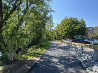
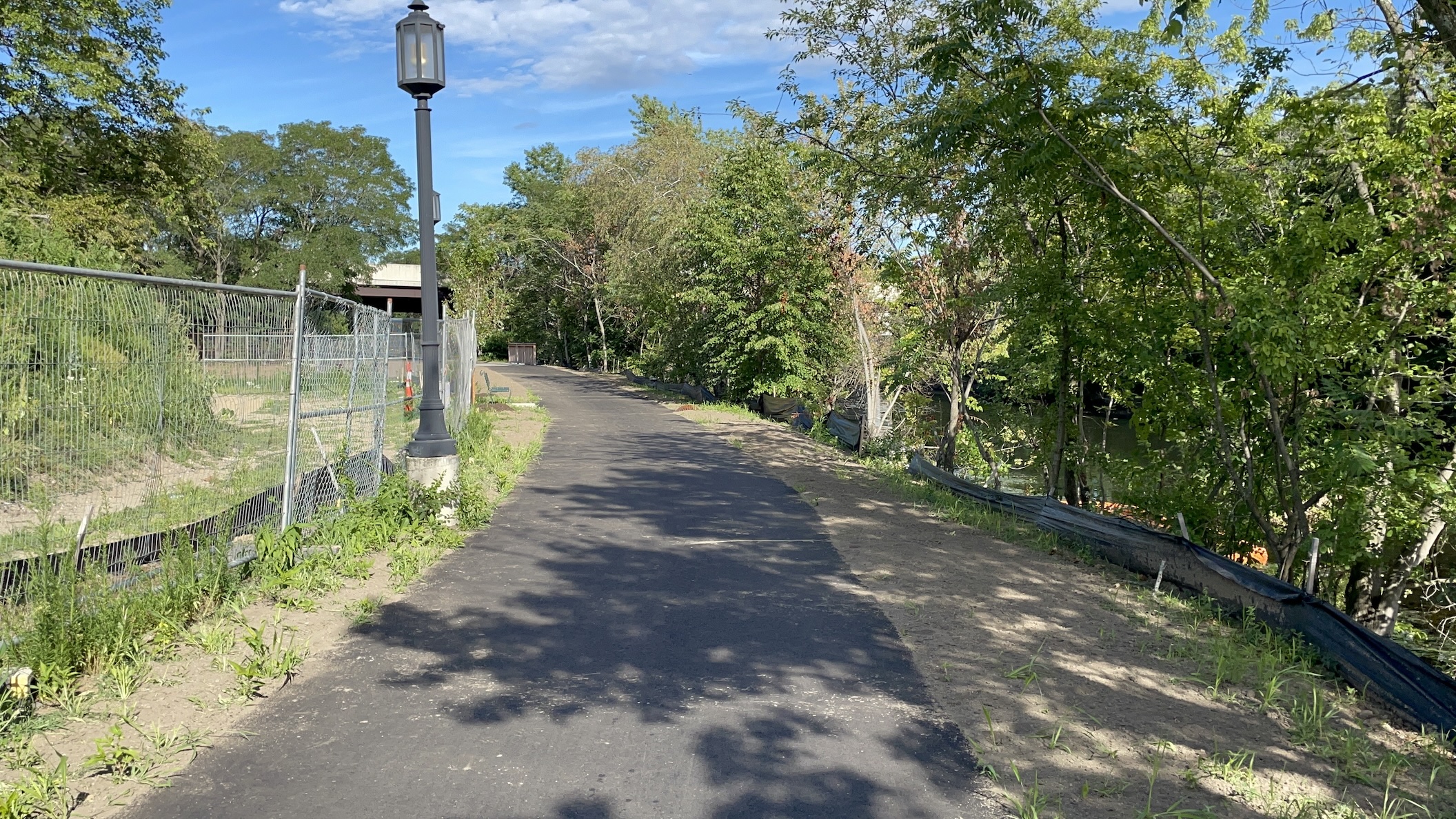
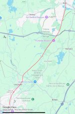
Yesterday I rode the new section of the Mass Central Rail Trail from Sudbury Station to downtown Hudson. Construction of the trail is still ongoing - no signage is installed yet and some work remains on the interfaces between the trail and road crossings and bridges.

That said it is perfectly rideable end-to-end and there were probably 300+ other people out there yesterday. Please just exercise caution around the road crossings where there is no signage for either trail or road users.

I hadn't realized how much the trail cuts through the Assabet National Wildlife Refuge. Compared with all other rail trails I've explored in the Boston-area this one feels much more natural and wild. It is also nice a shaded throughout even on a sunny July day. I look forward to the official opening soon!
 
The Clippership Connector in Medford is unofficially opened. The fences have been opened at all of the entrances and the entire length is fully ridable/walkable. Looks like they’re just finishing up some landscaping, painting crossings, and finishing a connector path to Riverside Ave.
 

Attachments

  • IMG_6421.jpeg
    IMG_6421.jpeg
    5.5 MB · Views: 117
1753206121615.png

Parts of the Mass Central Rail Trail - Wayside in Sudbury are now complete, as the final topcoat is being paved this week (the total project is not yet complete).
For example, this is a view from the completed Bridge 128 (restored for ADA accessibility) over Hop Brook, with completed fencing, a new Osprey platform, native vegetation/trees added, invasive plants removed, and with the new, final topcoat pave, surrounded by and with connections to Memorial Forest and Hop Brook Marsh.
https://masstrailtracker.com/map?segment=130

Clearly worth spending millions of dollars failing to destroy!🙄
 
I'm very excited to ride on this new section, hopefully soon. If that final missing section in Waltham could be completed (recognizing it's a tough spot, with the highway), this would become such a great piece of infrastructure. It's already really good, and now better.
 
I'm very excited to ride on this new section, hopefully soon. If that final missing section in Waltham could be completed (recognizing it's a tough spot, with the highway), this would become such a great piece of infrastructure. It's already really good, and now better.
While it stinks the real shared use path project connection(s) are basically stuck:
https://masstrailtracker.com/map?segment=256 (1265 Roadway Reconstruction Project)
https://masstrailtracker.com/map?segment=2 (Weston-Waltham Phase 2, blocked by above)

the current situation will be much better in a month or so when Weston-Waltham Phase 1 opens:
https://masstrailtracker.com/map?segment=240 (Weston-Waltham Phase 1)

After Phase 1 is done... Unofficially, the former Railroad Bridge over 128 is safe to cross now, though unimproved and not ADA accessible. It has a solid floor and high, solid walls.
The other alternative: there is a sidewalk and crosswalk/traffic light from Jones Road, along Main Street, to the main trail in Waltham.

So while it will be far from ideal... getting between Waltham and Weston/beyond will be MUCH easier in a month!
 
After Phase 1 is done... Unofficially, the former Railroad Bridge over 128 is safe to cross now, though unimproved and not ADA accessible. It has a solid floor and high, solid walls.
The other alternative: there is a sidewalk and crosswalk/traffic light from Jones Road, along Main Street, to the main trail in Waltham.
From the link you shared, it's implied that the bridge is closed at the moment for construction. Do you know if that means inaccessible, or just not formally endorsed for usage. It's been a couple years, but last time I was over there, you could cross the bridge, under the conditions you describe. If it's still that way, I consider that viable for most users, but it will definitely be great to have it completed as a fully accessible component of the trail.
 
From the link you shared, it's implied that the bridge is closed at the moment for construction. Do you know if that means inaccessible, or just not formally endorsed for usage. It's been a couple years, but last time I was over there, you could cross the bridge, under the conditions you describe. If it's still that way, I consider that viable for most users, but it will definitely be great to have it completed as a fully accessible component of the trail.
Apologies, to clarify, there are two former railroad bridges. The bridge over the Fitchburg MBTA tracks (part of Weston-Waltham Phase 1) is under construction and should complete in about a month. The Bridge over 128 (part of Weston-Waltham Phase 2) seems hopelessly stuck in planning, and is "closed", but also... people are using it right now. It has a solid floor and high, solid walls.

Or, sidewalks and crosswalks run the entire connection along Jones Road and Main/117, though they are subpar sidewalks.
 
Did the East Bay Bike Path along Narragansett Bay from Providence to Bristol yesterday. Finally seeing tangible progress on the replacement of the bike bridges over the Barrington and Palmer Rivers. The Palmer River bridge linking Barrington and Warren near the Tourister Mill already has the deck down. Will hopefully soon no longer have to use the temporary decking detour on the adjacent road bridges.

Palmer River
IMG_20250723_111946776.jpg


Barrington River - just the bridge footings
IMG_20250723_111038819.jpg
 
Did the East Bay Bike Path along Narragansett Bay from Providence to Bristol yesterday. Finally seeing tangible progress on the replacement of the bike bridges over the Barrington and Palmer Rivers. The Palmer River bridge linking Barrington and Warren near the Tourister Mill already has the deck down. Will hopefully soon no longer have to use the temporary decking detour on the adjacent road bridges.
So that Bailey bridge is intended to be permanent?
 
Does anyone know if the Bay Colony Rail Trail will eventually get paved if/when it's completed from Medfield to Needham? Or does the lease agreement with the MBTA stipulate that it can't be paved?
 
Last edited:
Does anyone know if the Bay Colony Rail Trail will eventually get paved if/when it's completed from Medfield to Needham? Or does the lease agreement with the MBTA stipulate that it can't be paved?
The big issue is if the Dover section ever gets built at all. The other sections in Medfield, Needham (and with no plan to connect, Newton) are all compacted stone dust.

Dover finally voted for a trail proposal in 2016-2017, but only with unique "exclusion zones" at the ends to make sure it was impossible to connect to the now-completed Medfield and Needham sections. The MBTA ever since refused to agree to Dover's modified lease proposal.

Dover has finally agreed to start over with a new design allowing for connections. Once the design is completed, Dover will have to vote again to approve this new design.

Last I checked, the new proposal would immediately connect to Medfield, but repairing the bridge to Needham is out of scope and would need to be an additional project, even if the Dover trail without exclusion zones was approved.


Last edited:
Per Wikpedia, there are now almost 70 rail trails in Mass., and their combined length is equivalent to the distance on I-95 from Portsmouth to Philly. As late as 1979, however, the year before the Cape Cod Rail Trail opened, there were none.

Thus, deep into the adulthood of the Baby Boomers, rail trails were still unknown--and thus presumably took some dogged, pioneering activists to relentlessly advocate for, in the face of whatever formidable opposition I imagine they faced. I assume this new documentary tells the story of their crusade:

 
Rails to Trails is a great program, but the one thing that bothers me about it is that the old railroad ROW gets locked up, unable to be converted back to rail or transit use in the future. Once a railbed is converted to a trail, forget ever running trains or BRT on it again, unless in those rare cases where the ROW is wide enough to accommodate both a trail and a transit line.
 
Rails to Trails is a great program, but the one thing that bothers me about it is that the old railroad ROW gets locked up, unable to be converted back to rail or transit use in the future. Once a railbed is converted to a trail, forget ever running trains or BRT on it again, unless in those rare cases where the ROW is wide enough to accommodate both a trail and a transit line.
The choice is almost never rails or trails though. It's usually not "do nothing" either.

Typically, the two binary options arise on the fact there's no money for rails (usually for decades or longer), while the land itself only increases in value. This creates the choices: either railbank or similarly retain in public ownership the corridor for public trail development, or, permanently abandon and sell it off for private development, destroying the rail corridor forever.

At least one of the options typically preserves the right to rail, among other advantages.
 
What is the feasibility of connecting the Nashua River Rail Trail to Clinton and the MCRT via the active CSX ROW? Has this been proposed?
 

Attachments

  • IMG_0021.jpeg
    IMG_0021.jpeg
    348.9 KB · Views: 99
What is the feasibility of connecting the Nashua River Rail Trail to Clinton and the MCRT via the active CSX ROW? Has this been proposed?
Hasn't been proposed by anyone since up to 3 years ago the line was owned by Pan Am, who were a nightmare to deal with at any level. New owner CSX would probably not want the liability associated with having that on their property, so it would be up to MassDOT to make them an offer to buy a line which has now been freshly upgraded and projects to be much more valuable in the years ahead when the lucrative intermodal lane to Maine gets better established. So it may not be an asking price the state is willing to pay so long as the passenger prospects for that line remain very minimal in the long term, but that would be the way to do it if there proves to be interest. The good news is that the freight schedules don't project to be dense enough in the long-term (CSX likes to run 'em long in length and long in distance but sparingly by-schedule over running them shorter and more frequent) to require a second track, so the space for a fence-separated trail will always be there for the deep long term.
 

Back
Top