You are using an out of date browser. It may not display this or other websites correctly.
You should upgrade or use an alternative browser.
You should upgrade or use an alternative browser.
Bill Russell Bridge | North Washington St.
- Thread starter PaulC
- Start date
- Joined
- May 25, 2006
- Messages
- 7,034
- Reaction score
- 1,875
Where is the train embankment
What?
statler
Senior Member
- Joined
- May 25, 2006
- Messages
- 7,939
- Reaction score
- 547
What?
Surely they are going to replicate this in the design, right?

Charlie_mta
Senior Member
- Joined
- Jul 15, 2006
- Messages
- 4,573
- Reaction score
- 6,509
Surely they are going to replicate this in the design, right?

I wish.
Proposition Joe
Active Member
- Joined
- Oct 24, 2012
- Messages
- 307
- Reaction score
- 3
People are trashing the gondola system because:
1.) It is a different mode of transport, with much less capacity than a train.
2.) It is a vaporware proposal being floated so that everyone can continue to ignore practical solutions that would actually require city and state money.
3.) The gondola is being proposed over a wide right of way, that's not only capable of handling transit improvements on the ground but needs to reduce its capacity for automobiles.
I don't think anyone is seriously proposing a train right of way as part of the project, people are just being nostalgic, but even so a train embankment over this bridge would still be more useful than the gondola.
- Joined
- Jan 7, 2012
- Messages
- 14,072
- Reaction score
- 22,823
stevebikes
Active Member
- Joined
- May 14, 2013
- Messages
- 277
- Reaction score
- 103
So was the underpass open, Beeline?
- Joined
- Jan 7, 2012
- Messages
- 14,072
- Reaction score
- 22,823
So was the underpass open, Beeline?
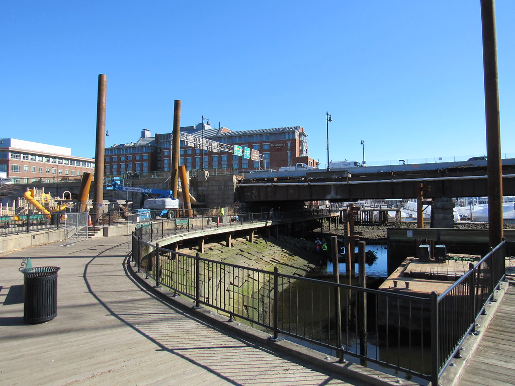
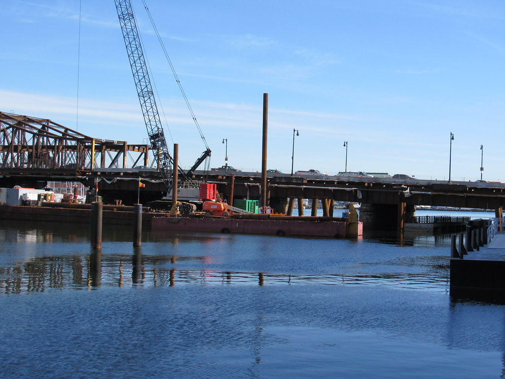
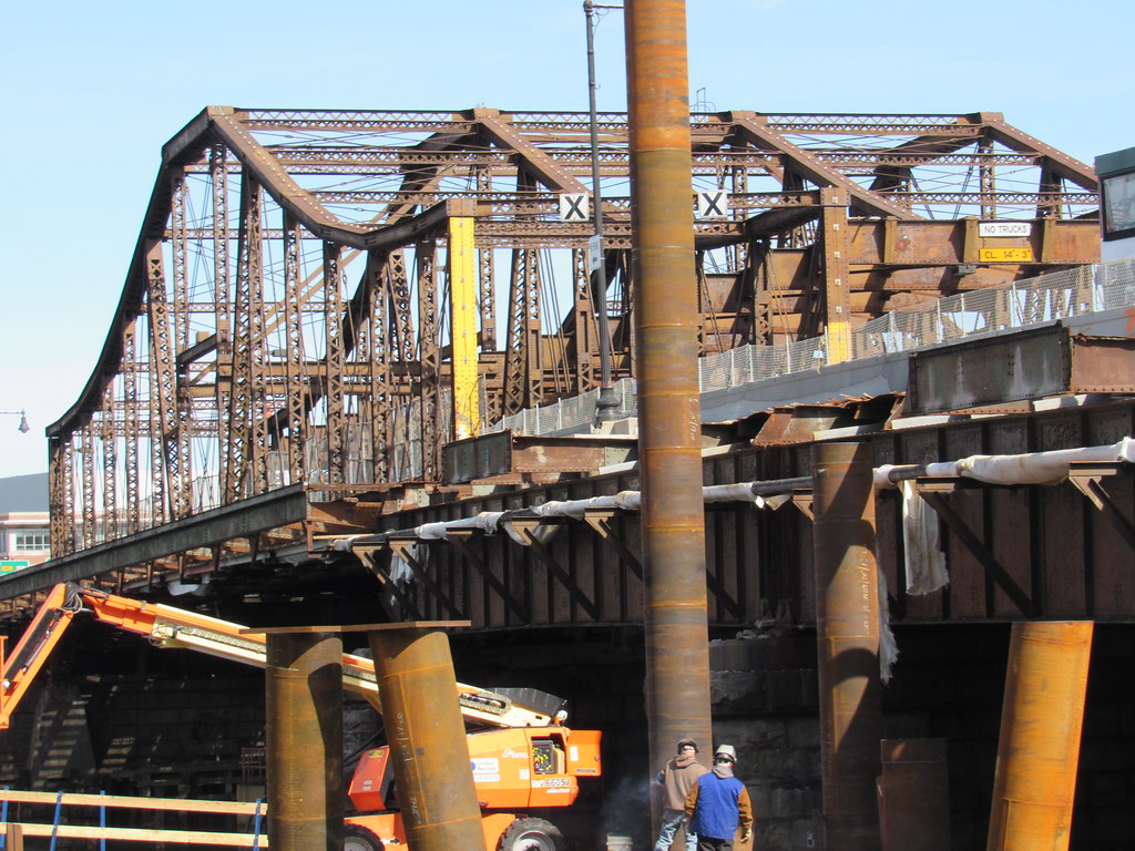
I would say no. As you can see in photo #2 they have a gate they can close at any time. The day I walked by they were swinging I beams around so I did not venture any further. The workmen were also staging equipment and materials along the walkway in support of work on the seawall waterline and barges.
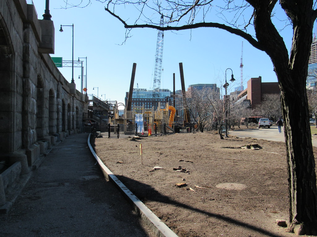
I used the roadway to get to the other side because it looks like they have also blocked off the stairs. I was surprised at how many trees they have cut down (photo #4). I assume the playground will be removed or relocated soon.
the playground is being permanently relocated towards the entrance to the locks. its a much better location for the playground.
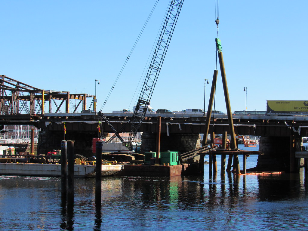
The structure being installed now in the pics will hold the temporary bridge.
the underpass on the Charlestown side is not all that important, because as Beeline did, you can cross under at Water St.
The underpass on the Boston side is not just closed, but has been removed. It is being reconstructed as part of the bridge project at a higher elevation for resiliency. This wasnt possible with the existing bridge structure when it was constructed 5(?) years ago.
The underpass on the Boston side is not just closed, but has been removed. It is being reconstructed as part of the bridge project at a higher elevation for resiliency. This wasnt possible with the existing bridge structure when it was constructed 5(?) years ago.
The problem with this is that the connection on the Boston side is THE bike connection. The only reason the Connect Historic Boston bike route disappears at Keany Sq is because it officially uses the Harborwalk to get through the area to connect Causeway St to Commercial St.
I don't see how this was allowed because there is no safe biking alternative to cross N Washington St.
Charlie_mta
Senior Member
- Joined
- Jul 15, 2006
- Messages
- 4,573
- Reaction score
- 6,509
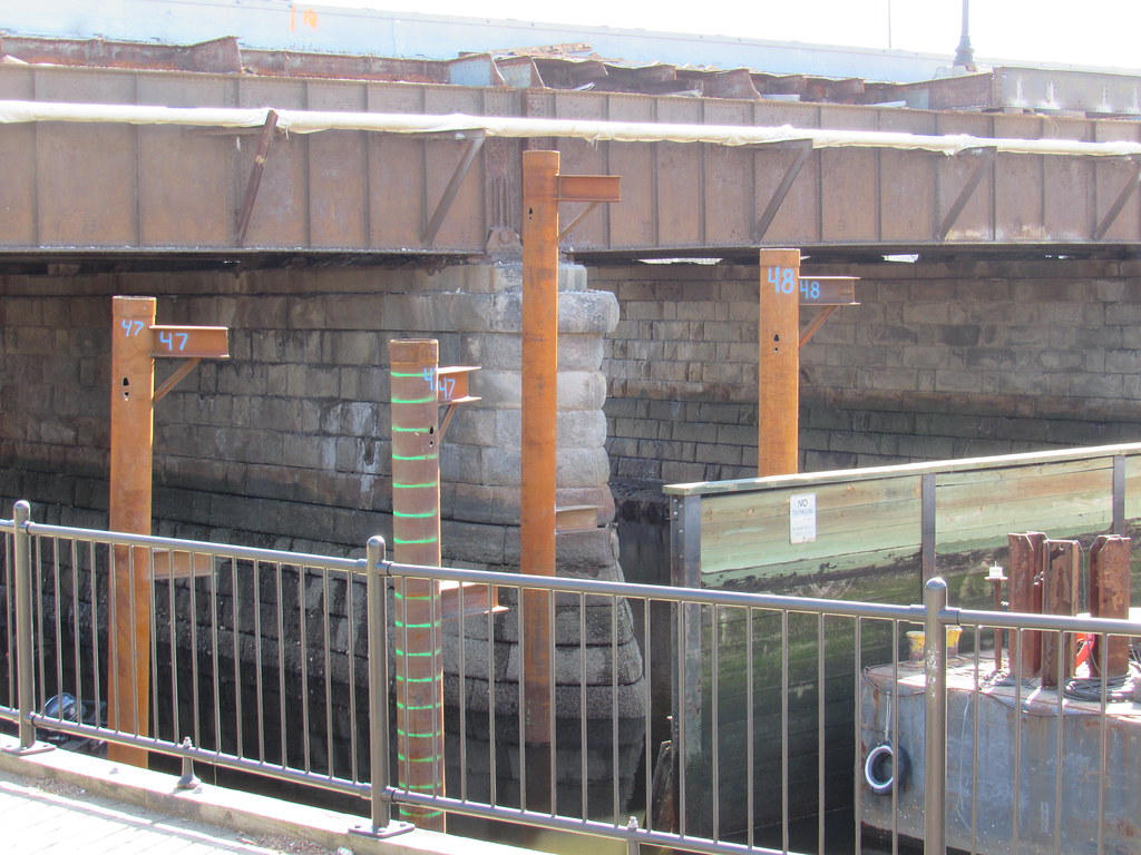
The stone masonry wall in the last photo is a beauty. I hope they at least salvage the stones when they demolish it. I did a lot of stone masonry wall design for national parks, and that structures is superb.
The problem with this is that the connection on the Boston side is THE bike connection. The only reason the Connect Historic Boston bike route disappears at Keany Sq is because it officially uses the Harborwalk to get through the area to connect Causeway St to Commercial St.
I don't see how this was allowed because there is no safe biking alternative to cross N Washington St.
what are the other options? the connection is closed during construction of a bridge that should have been replaced 20 years ago.
what are the other options? the connection is closed during construction of a bridge that should have been replaced 20 years ago.
I guess that's for the construction team to brainstorm. They're building a temporary bridge; they can and should also consider how to accommodate peds and bikes.
- Joined
- Jan 22, 2012
- Messages
- 5,078
- Reaction score
- 1,661
^ yes and on the Charlestown side of the river, it looks like under those small arches there are storage spaces. I am not sure what is inside…
If I recall correctly, I've seen snow removal equipment hiding in those arches.
Randomgear
Active Member
- Joined
- Jul 7, 2012
- Messages
- 362
- Reaction score
- 45
I don't see how this was allowed because there is no safe biking alternative to cross N Washington St.
Having been through three sets of design meetings (a BTD Causeway St design, the CHB design, and PWD North Washington Bridge design) I can tell you that vehicle LOS was the driving factor in not bringing bike lanes through Keany Sq.
The BRA, as part of their Crossroads Innitiative, developed a design for Causeway St including the Keany Sq intersection that brought on street painted bike lanes through Keany Sq.
In the BTD redesign of Causeway (maybe 2011, I can't find the drawings), Vehicle LOS was considered too important and the bike lanes just dissapeared in the last block(s) before Keany Sq.
During the CHB process, the official line from the City was that Keany Sq would be redesigned during the North Washington St Bridge project and that the CHB bike path would head down Beverly to the boardwalk and under the bridge. And yes, they crossed their fingers that the redevelopment, or at least the boarwalk, along the water would be done by the time CHB was built.
During the Boston Public Works redesign of the North Washington ST bridge, the line was that Keany Sq was beyond their scope of work.
Just keep on passing the buck City of Boston...
- Joined
- Jan 7, 2012
- Messages
- 14,072
- Reaction score
- 22,823
stevebikes
Active Member
- Joined
- May 14, 2013
- Messages
- 277
- Reaction score
- 103
I guess that's for the construction team to brainstorm. They're building a temporary bridge; they can and should also consider how to accommodate peds and bikes.
Right. "Is the design of the CHB between the skating rink and the Garden terrible?" is a separate discussion from "has the contractor/city/state done any temporary mitigation for CHB users?" The answers are very much yes and no. There's no warning that the underpass is gone until you get to it. There should, at the very least, be signs here and here warning people not to bother trying to go around Lovejoy.

