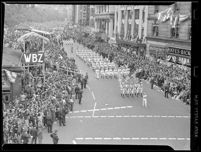
Boston in the 1960's

Yes there was discussion back in the 1960s of a third tower, which would have been located on what a portion of the site that is now Rowes Wharf. The original HT developer tried to buy the site from the BRA but by the time the 2 original Harbor Towers were up, the BRA realized that more towers on the waterfront were a bad idea (and they still think so, correctly) and instead sponsored the development of Rowes Wharf. That's why it's hilarious that anyone would think that the city's position on the Harbor Garage proposal has anything to do with a personality clash between the developer and the mayor....the BRA has been an opponent of towers on the water ever since Harbor Towers were first built in the 1970s. Hey, at least they're consistent!

The Federal Reserve, One International Place, One Financial, Two International Place, The South Station Tower, Atlantic Wharf, The Keystone Building, etc. . . . notwithstanding.
 
My dad gave me a three series of books of Boston.
1902

I am deff gonna have to scan em in now after all of these threads keep popping up : )
 
It's not much but I call it home.

I found a couple of excellent things while researching the South End Urban Renewal plans from the 1960's.

South_End_vice.png
South_End_map.png


The first image is a map of the South End circa 1962, courtesy of the Boston Redevelopment Authority. The second image is a map of the South End circa 2006, courtesy of Google.

In the 1962 map,"Shaded areas [are] considered by Cap't Mahoney (Boston Police Department) as worst areas in South End for crime and vice".

A: In the top middle area of the first map there's a big shaded blob, located between Tremont Street to the left, Albany Street to the top, Shawmut Ave to the right, and Dover (now, East Berkeley) Street to the bottom. During that time, there were multi-family homes on narrow city streets in this area. These were filled with "Houses of Prostitution" according to the Captain. In the middle of the blob, people went to "Meet the 'Girl' (or is it 'Gent'?)"

B: Diagonally from this is another blob. These were also "Houses of Prostitution" and "Derelicts". Something else, too, but I can't figure out what it says - Nilolies??

If you trace around the top border to the left you eventually come to the left side of the map. At the upper left corner, you're looking at Dartmouth Street coming in from the Back Bay where it hits Columbus Ave.

C: Right next to that you see a darkened, narrow tube running down much of Columbus Ave toward Massachusetts Ave. Toward the end, you see two dark balls to either side of the street. A block behind that is where you hit Massachusetts Ave.

This large and dark phallus goes all the way down Columbus Ave. The police department said that this area was rife with "Major Problem Bars". Not so much the side streets, perhaps, not West Canton or Braddock or Claremont Park or Wellington, but the buildings facing Columbus Ave on both sides.

D: The smaller phallus seems to be covering Tremont Street's off-streets such as Rutland Square and Concord Square and W Concord Street and Rutland Street and West Newton Street. Here, the problem was "Dope Peddling".

E: The last major crime and vice area was below this, to the other side of Massachusetts Ave, in Lower Roxbury, heading on to Dudley Square. Here, "Prostitutes to be picked up in cars - Meet in Castle Square".

So, current day, things are quite different. Based on what I've read or guessed:

A: This blob (hundreds of buildings) was torn down and became a massive public housing project known as Castle Square. It also has a second component, I believe, an elderly housing apartment complex.

B: The second, smaller blob was a series of buildings facing Dover Street (now, East Berkeley Street) and part of Shawmut Ave. It's possible it included what's now Peter's Park - for many years it was an abandoned lot (as was the lot across the street). It's possible the park came about as a result of the urban renewal plan. Several buildings on that end of Shawmut Ave were torn down while new buildings went up on empty lots.

C: The two sides of Columbus Ave going all the way down from Dartmouth Street to Massachusetts Ave shows trouble. There were plenty of problem bars on these blocks. It appears they tore all the old buildings down and replaced them with monolithic 12-story public-subsidized apartment complexes that went up every couple of streets.

D: The drug peddling on West Springfield and Worcester Street got cleaned up by opening a public school on Worcester Street and by adding public housing to W Newton Street and Rutland Street and reinvigorating the United South End Settlements organization.

E: The Girls waiting to get picked up to be driven to Castle Square I don't know about. I estimate the location to be the site of what is now the CVS (what was Liquor Land). These could have been built after residential housing was torn down or maybe it was just a place to hang out, in the taverns and clubs in that corner of the neighborhood. Much of that area is still kind of wiped out - perhaps what was ever there was just never built.

The third document is a page from the South End Urban Renewal plan discussing plans to relocate many residents of the South End - over 5,100 people will be displaced. They've revised the estimate to be below 20% of the population.

These people need to be relocated because the housing they live in is poorly-constructed and maintained and in danger of falling apart and, in many cases, are inhabited by many more people than they were built for. Many of those who will be relocated will remain somewhere in the city of Boston, just in other neighborhoods, while some may make it back into some of the newly constructed buildings, many of which will be designated as "affordable housing".

South_End_urban_renewal.png

This is fantastic. My father came to this country in 1964 and started working on the T a year later. He told me that the Tremont Street run (#49 Bus) at the time was known as The Burma Road at that time because of the war like atmosphere along the route. That police map is great material.
 
I think it's hysterical that the "high vice" shaded area on left-hand side of the map looks like a dick and balls!
 
Yeah, but the balls are tiny (vis a vis the shaft). Maybe I'm just splitting hairs (pubic) . . .
 
Last edited:
...and you wonder why we can't get any ladies on this forum!!!!!!!!!!!!!!!!!
 
Hmmm. The Tufts Digital Library has this Bostonian Society image listed as being "Newbury Street" but I don't think it is. Anyone else think this is actually 2-10 Commonwealth Avenue? Notice the building behind the brownstones - doesn't this look very much like the Ritz Carlton / Taj hotel?

newbury.jpg
 
Two photos I stole from a Boston.com photo essay on bad Boston storms.

Washington Street (Paramount in the distance)

washington_st_1960.jpg


Dewey Square (pre- One Financial or Federal Reserve buildings ...)

dewey_sq_1969.jpg
 
Look at that South Station... beautiful! And begging for air rights projects!!!

Imagine if the Fed was built over it rather than replacing those buildings? Though, that's basically impossible since someone could place a bomb under it, and there's no way in hell they'd let that possibility come up.
 
JohnAKeith - I think you are right. This is the site of the Carlton House. There was a fire on this site in 1981 or 1982. One or two firefighters died in the fire. One of the firefighters was named Paul Lentini and was based out of the firehouse on Huntington Ave. by Wentworth. There is a plaque on the station.
 
M22751257.img__1271091126_3225.jpg


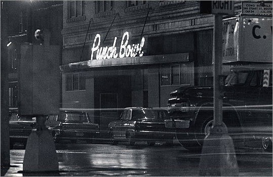
The Punch Bowl gay bar, located in Park Square, where the South Cove Plaza senior citizen development is located, today (if I've got it right).

Today


Edit: Link to Boston.com photo gallery of images from past 40 years of gay life in Boston http://www.boston.com/lifestyle/gallery/gaypride/
 
Last edited:
Thank you for the photos. That brick old folks home is one of the worst buildings in the city. Better than a gay bar, I guess. ;)
 
Whenever I see those old black and whites from the 60's, the Mad Men TV series comes to mind. There was an urban film-noire style to those times, replaced now with a colorful suburban look, which disturbs me. The before-and-after photos above are a perfect example.
 
An old thread, but....

To understand Boston in the 1950s-60s, you have to understand Boston. This was a city built not on exports, but on trade (I'm simplifying over time, here). The region didn't have raw materials to export, nor a river to carry trade from inland regions (like New York). Much of Boston's famous trading fleet went out with capital, bought trade goods, transported them to another port, sold the cargo, bought another, and then came home.

During the 19th century, as Boston's merchant fleet rose and then fell, industry built up, and the city was full of manufacturing plants. Iron and lead works, furniture making and many other industries thrived. Then, gradually, industry started moving west, to be closer to raw materials. This process started in the 19th century, and went on for many decades. By the Depression, Boston was already a shadow of its former self.

By the end of WW II, the defense jobs were gone, and Boston was a shell. And there is nothing that could have been done about it. Macro-economic forces dragged Boston down. Curley's tax policies and corruption didn't help, but the city would have been in a shit-hole regardless. Then, the great migration to the suburbs begins - again, a macro process.

The upturn of the city was not produced by urban renewal. That - again - was a macro-ecomonic thing. The build-up of 128 as a job creator, the new emphasis on education, the G.I. Bill, all had slow and incremental effects. But if the West End had never been touched, the city would have improved economically at the same rate.
 
You will love the photos on this guy's Facebook page, trust me.

https://www.facebook.com/DirtyOldBoston

Here are a couple of images I "borrowed" from there (not all from the 1960's).

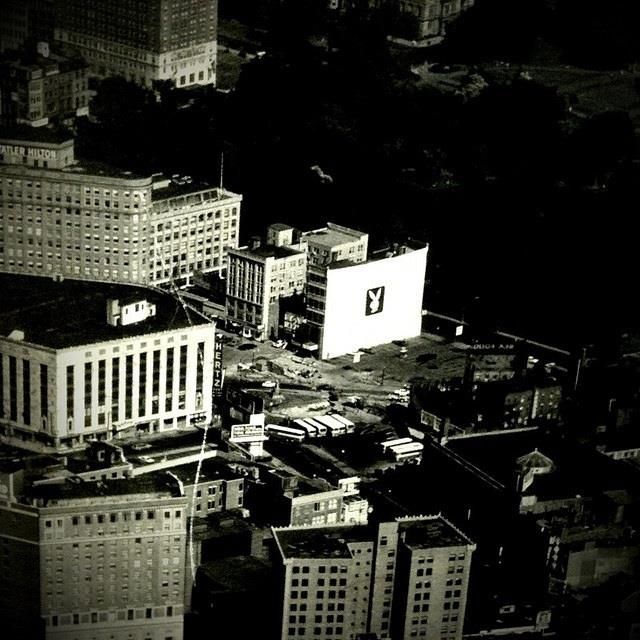
Park Square and environs ...

523673_10151072674016724_1346285021.jpg


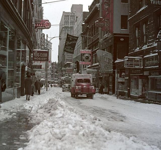
Winter Street from Tremont Street

46216_10151274953811495_449165603_n.jpg


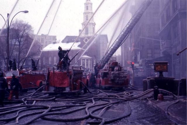
Tremont Street - department store fire (which block?)

208184_295981480517496_661820658_n.jpg


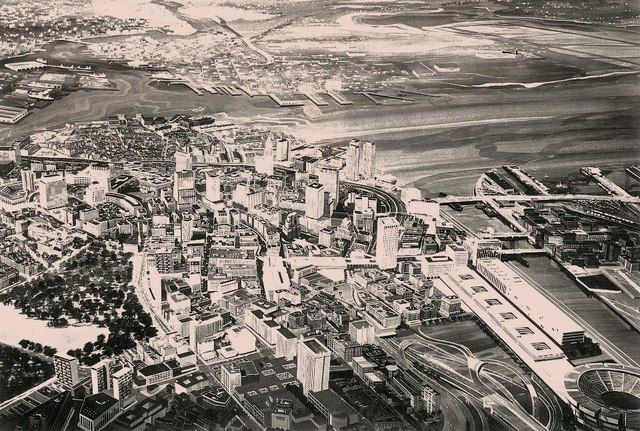
A proposal for Boston, circa 1965. (Why yes, that is a baseball stadium lower right)

22393_523033884390744_1237753422_n.jpg


Tremont at Boylston

9260_3998685533931_2137560096_n-1.jpg
 

Back
Top