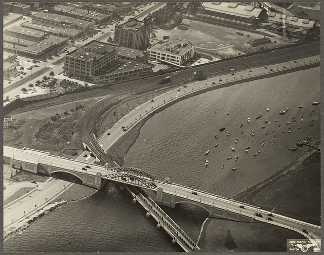
Yes, Boston's bridges are not the architectural statements they should be with the exception of the Longfellow. It is a shame that such relatively low-hanging fruit (beautiful bridges, significant fountains, etc.) that would quickly make Boston so much classier, distinctive and design-centric go ignored. .... Extending the Esplanade on the Boston side as well as creating a Cambridge riverfront sprinkled with newsstands, public boating, and coffee kiosks seems like such an obvious move that would instantly draw crowds. Plowing through the clusterf*** mess the Zakim presides over and connect the Charles to the Greenway seems like another relatively easy thing to do that would kills so many birds with one stone.
As for the comparison with Europe, I don't think US cities know what do do with riverfront--I'm hard pressed to think of any of them that really nail it (Pittsburgh being a particularly egregious offender).
Tomb -- Someone perhaps Charlie said something about learning from history:
1) Boston is already one of the most engineered cities in the world -- see for examples the book -- "Gaining Ground: A History of Landmaking in Boston" by Nancy S. Seaholes
2) the Charles in particular is entirely artificial from Watertown Dam to Boston Harbor -- see for example the book -- "Inventing the Charles River" by Karl Haglund
3) the filling of the Charles for Storrow Drive and even the expansion of the Esplanade was very contentious even involving the widdow of James Jackson Storrow of the epoymous drive --
http://www.esplanadeassociation.org/park/history.html
4) I don't think the Universities who control the Cambridge side want anything less formal than the existing boat houses and sailing pavilions -- they view the Charles as their private country side
5) This view also prevailed on the Boston side in the late 19th Century (original NIMBYs)
from
http://esplanadeassociation.org/park/documents/CLR.pdf
" In 1852 a legislative commission was established to determine the future of the Back Bay. It recommended curtailment of industrial development and established a plan for filling the area, beginning in 1857.
Streets were laid out in a grid-like pattern and over the next three decades, the area was gradually filled and developed, moving from east to west. The granite seawall adjacent to Back Street (the alley behind the Beacon Street houses) formed the northern edge of the newly created Back Bay neighborhood. While the Back Bay was primarily residential, the Beacon Hill Flat and West End waterfronts to the east were more industrial in the nineteenth century, with warehouses, docks and a network of bridges leading to East Cambridge.
The Charles River remained tidal and polluted, a source of increasing irritation to Back Bay residents, particularly at low tide. In the 1870s there were numerous proposals to turn the entire shore of the lower Charles River into an embankment with walks, trees, a bridle path and a carriageway. Many were based on European precedents, particularly the Alster Basin in Hamburg, Germany.
...Once the report was completed Eliot refined his design ideas for the lower basin. On the Boston side he envisioned a continuous seawall with “promenades and plazas - broad gravel-ways well shaded by trees afford[ing] pleasant out-of-door halls where crowds may mingle in an easy social life . . .” He also proposed “. . . concert grounds, outdoor halls, nurseries, playgrounds, gymnasia, and gardens” which could be combined so that no individual feature would take more than a small space and also “a roadway which will serve as a pleasure drive and also as an approach to the buildings on the abutting estates.”.....In 1894, a report on the Charles River was issued jointly by the Metropolitan Park Commissioners and the State Board of Health.... The report determined that the pollution of the river was indeed severe enough to endanger public health and recommended that the lower section of the river be dammed near the harbor, transforming it from a tidal estuary to a basin with a permanent water level. The report also recommended an extra row of houses north of the seawall behind the Beacon Street houses. The rationale was that the houses along the river should face the river, not turn their back to it as Beacon Street houses did. Beacon Street residents strongly opposed additional houses that would block their view of the river and eventually the proposal was dropped. Eliot was an articulate and effective spokesman for improvements to the Charles River basin but he died in 1897 before most of his ideas were implemented.....Once the concept for the Charles River dam had been established, civic activists such as James Jackson Storrow campaigned to gather support for the project. In 1903 the state legislature authorized construction of the dam and established the Charles River Basin Commission to oversee the project, which also included a strip of parkland that was 300’ wide between Longfellow Bridge and Brimmer Street and 100’ wide west of Brimmer Street. A seven acre park (where Boston Museum of Science is currently located) was also included upstream of the dam. While Charlesbank was visually a part of the Esplanade, it remained city parkland. The row of houses north of Beacon Street was deemed an auxiliary issue and was omitted from the proposal....The new parkland was created as part of the dam and conduit project, using material generated by the dredging to create new land north of the seawall. The Beacon Hill section (right below) was the widest, with up to 300’ of newly filled land. The Back Bay section (left below) was 100’ wide.....On July 1, 1910, the Charles River Basin Commission, which had been responsible for construction of the dam and associated parkland, turned the Boston parkland over to the Metropolitan Park Commission, which was to operate the dam and riverfront park.
The Cambridge riverfront remained under the jurisdiction of the Cambridge Park Commission and Charlesbank remained under the jurisdiction of the Boston Park Commission...in 1911 Guy Lowell, the architect and landscape architect for the Basin Commission, prepared planting plans for a border along the north side of the Back Street wall that included small trees such as dogwoods and hawthorns, as well as many species of flowering shrubs.... shade shelters were added because the area was hot in summer..... By 1909 the two gatehouses at the lock were in place, as was the Fens gatehouse at Charlesgate. Union Boat Club was located adjacent to Back Street. There were also two recreation buildings at Charlesbank, one for men and one for women. The Tea House (also known as the Refreshment Building) was built near Berkeley Street in 1913..... By 1912 the area was considerably more pleasant than it had been, but still far from the lively promenade that Eliot had envisioned. Back Street remained a private alley rather than a public parkway and Beacon Street residents made it clear that they preferred to have their view kept open rather than blocked by trees. Although there were boat landings, the river was not heavily used.... Shurtleff praised the Esplanade as an improvement but argued that the basin “must be made infinitely finer and more serviceable to a recreation-seeking public.... A legislative commission issued a report in 1928 that characterized the basin as “unsatisfying and disappointing . . . began with a history of the basin and a summary of three issues that were essential to the improvement of the basin. The first was improvements to the banks of the river. The second was the completion of the Charles River parkway system, with uninterrupted parkways on both sides of the Charles River from the dam to Watertown Square. Third, they recommended that the river should be made safer and more attractive for boating and water sports. Specific recommendations that pertained to the Esplanade included: Widening and Extending the Esplanade.... from Charlesbank to Charlesgate and extending the park further west to the Cottage Farm (Boston University) Bridge. Dredged material from the river was to be used to create the new parkland, which would vary from 300’ to 400’ wide east of Charlesgate and be narrower to the west. The land was to be brought down to the water’s edge and have pebbled beaches rather than a seawall. The edge was also to be gently undulating rather than straight. The new area would be covered with loam, planted with shrubs and trees, and have numerous walkways....
Playgrounds and Bathing Beaches – The park at Charlesbank was to be expanded from 9.6 to 15.4 acres and was to have a wading pool, a swimming pool and bathhouses. Although swimming was occurring in some parts of the basin, the report expressed concern about the safety of the river for swimming as overflow sewage was sometimes flowed into the river...Landing and Plaza – The report proposed a landing for boats and a decorative plaza with terraces and fountain where people could congregate and out door concerts of “high grade music” could be given....Parkways....The dual goal was to create a parkway along the river and to alleviate congestion on city streets. The proposal was to place the parkway at least 150’ from the rear of the houses and to create additional parkland on the water side that was roughly 200’ wide, double the width of the existing parkland. The commission also suggested that the parkway be depressed below grade so that it would not be visible from the rest of the Esplanade... Mrs. Storrow offered $1,000,000 towards the beautification and improvement of the Charles River Basin. The only stipulation was that the money be used in connection with legislative appropriations to carry out a comprehensive plan for the beautification and improvement of the basin with public funds. The total cost of the work was estimated at $4,250,000.... The commission strongly supported the continuous parkway but there were many opponents, including Helen Storrow, so the parkway was dropped but the legislature authorized the remainder of the basin project....Construction was ongoing through 1936, with much of the fill provided by subway construction elsewhere in Boston.....In the Back Bay section of the park, the width of the parkland had been doubled to 200’. The walkway previously located along the water’s edge was now the central path and there was a new walkway along the water’s edge. In 1934, 1,060 trees were planted between the Boston University Bridge and the Longfellow Bridge in accordance with Shurcliff’s design... the new lagoon between Exeter and Fairfield Streets. It created a quiet shallow area that was used for sailing of model boats in summer and ice skating in winter. Bridges at either end provided pedestrian access to the breakwater that formed the lagoon... overlooks at Dartmouth and Gloucester Streets on either side of the lagoon. These were rectangular plazas planted with a bosc of trees and with a classically detailed granite edged balustrade at the water’s edge and docks in the water....When the Storrow Memorial Embankment was dedicated in 1936, the parkland between the Longfellow Bridge and the Boston University Bridge had more than doubled in size....Significant changes occurred at Charlesbank as well but it remained under the jurisdiction of the Boston Park Department. Major buildings in the Esplanade by the late 1940s included the two gatehouses at Charlesbank (1908); the Fens Gatehouse at Charlesgate (1909); the Tea House near Berkley Street (built 1913, demolished 1950) the Union Boat House (moved to Boat Haven 1930s); the Recreation Building (1939, demolished 1950); the Hatch Shell (1941); and Community Boating (1941)...... In 1946 the Metropolitan District Commission was directed to prepare plans, estimates and specifications for the construction of a parkway along the Storrow Memorial Embankment from Embankment Road to Soldiers Field Road. Two years later, the Metropolitan Area Highway Plan wascompleted, with the new parkway (later named Storrow Drive) as an important component. There was strong legislative opposition to construction of a parkway along the Esplanade but ultimately the bill passed. The intent was that most of the road was to be below the grade of the Esplanade and that new parkland was to be created using the fill from the road. Ironically, the new road was named James J. Storrow Memorial Drive, which many observers felt was particularly inappropriate given the Storrow family’s history of interest in creating parkland along the Back Bay and Helen Storrow’s earlier opposition to the road.
The new highway was located immediately north of Back Street on the 100’ strip of filled land that had been created between 1907 and 1909. Near Berkeley Street a tunnel was constructed so that land did not have to be taken from the popular Music Oval. The project was massive in scale and disrupted the entire Esplanade for several years"