You are using an out of date browser. It may not display this or other websites correctly.
You should upgrade or use an alternative browser.
You should upgrade or use an alternative browser.
"Dirty Old Boston"
- Thread starter theSil
- Start date
 1990's - Boston Big Dig (9)
stick n move
Superstar
- Joined
- Oct 14, 2009
- Messages
- 13,482
- Reaction score
- 24,529
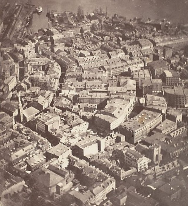
Found out today the oldest aerial photo in history is of Boston. Pretty cool!
https://mymodernmet.com/first-photograph-photography-history/
https://mymodernmet.com/first-photograph-photography-history/
Last edited:
Charlie_mta
Senior Member
- Joined
- Jul 15, 2006
- Messages
- 5,150
- Reaction score
- 7,778
Where is that? It is so different from today that it's hard for me to tie it into anything.Found outvtoday thevoldest aerial photo in history is of Boston. Pretty cool!
https://mymodernmet.com/first-photograph-photography-history/
BeyondRevenue
Active Member
- Joined
- Mar 13, 2020
- Messages
- 553
- Reaction score
- 1,157
I’m pretty sure The Great Fire of 1872 is why you’re having difficulty negotiating the streets compared to today. 80 percent of that area burned and nearly all of the remainder was ripped down and built up later. Could someone confirm that we are looking North East-ish at Old South Meeting House at the left center, with Milk Street curling up toward the water (which is now fill)?Where is that? It is so different from today that it's hard for me to tie it into anything.
Charlie_mta
Senior Member
- Joined
- Jul 15, 2006
- Messages
- 5,150
- Reaction score
- 7,778
I think you're right. Long Wharf is on the upper left, and the curve of the streets matches what's there now.I’m pretty sure The Great Fire of 1872 is why you’re having difficulty negotiating the streets compared to today. 80 percent of that area burned and nearly all of the remainder was ripped down and built up later. Could someone confirm that we are looking North East-ish at Old South Meeting House at the left center, with Milk Street curling up toward the water (which is now fill)?
BeyondRevenue
Active Member
- Joined
- Mar 13, 2020
- Messages
- 553
- Reaction score
- 1,157
I keep thinking of some mustachioed be-monocled dare-devil strapping a monstrous proto-camera to an untested balloon, rope-anchored somewhere close to where Charles St an Beacon meet, all launching with a huzzah and the throwing of topped hats, a nod to this feat of aeronautical fancy!
Java King
Active Member
- Joined
- Apr 6, 2007
- Messages
- 986
- Reaction score
- 2,053
Where is that? It is so different from today that it's hard for me to tie it into anything.
Old South Meeting House is clearly visible, and not very different than today, within far center left of the old photograph. Then you can get the context of everything else.
BeyondRevenue
Active Member
- Joined
- Mar 13, 2020
- Messages
- 553
- Reaction score
- 1,157
Better angle than mine. Having the Park Street Church in there was probably confusing.Old South Meeting House is clearly visible, and not very different than today, within far center left of the old photograph. Then you can get the context of everything else.
View attachment 26085
View attachment 26084
 Federal Reserve Bank, Boston (8) by Ron Gilbert, on Flickr
 Construction of Copley Place (1) by Ron Gilbert, on Flickr
Charlie_mta
Senior Member
- Joined
- Jul 15, 2006
- Messages
- 5,150
- Reaction score
- 7,778
atlantaden
Senior Member
- Joined
- May 31, 2006
- Messages
- 2,679
- Reaction score
- 3,344
Credit…Old School Boston
Charlie_mta
Senior Member
- Joined
- Jul 15, 2006
- Messages
- 5,150
- Reaction score
- 7,778
Love the density, love the steam locomotives at North Station. Boston was great then, and is great now.View attachment 26408
Credit…Old School Boston
1930's Dirty

1970's Dirty

1980's Dirty

1970's Dirty
1980's Dirty
Charlie_mta
Senior Member
- Joined
- Jul 15, 2006
- Messages
- 5,150
- Reaction score
- 7,778
As much as they tried to disguise the elevated Central Artery in that last photo, it still stuck out like a sore thumb. Thank God for Tip O'Neill, wheeling and dealing to get the funds to put the Central Artery under ground. Wish we had politicians like him today who could get things done.
stick n move
Superstar
- Joined
- Oct 14, 2009
- Messages
- 13,482
- Reaction score
- 24,529
Aerial of Cambridge from 1930. The Concord Turnpike (Rte 2) through the Alewife area to Lexington had not been built yet. The link to the photo for close up viewing is here.
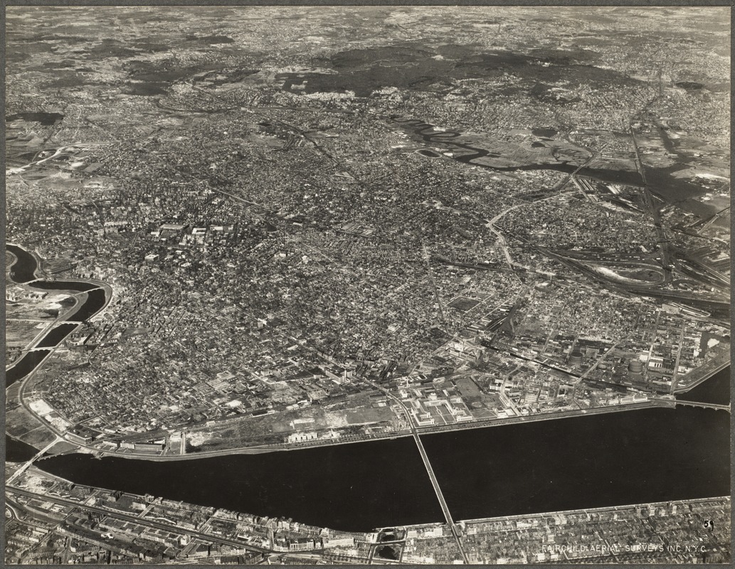
Never knew the mystic heading into medford had been straightened, and soo much. It used to be crazy squiggly!
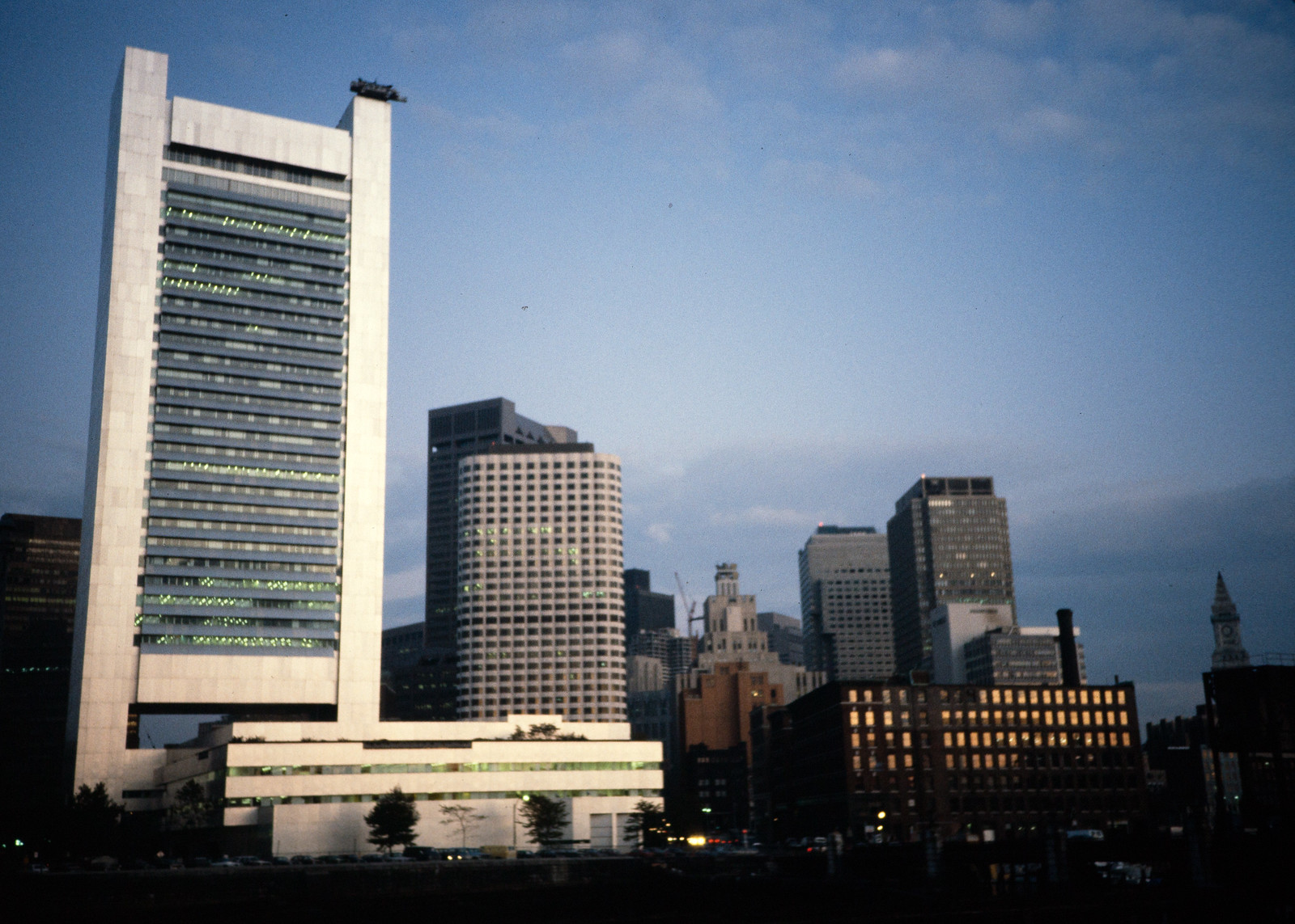
2001. Note the old State Street sign poking out from behind the Pregnant Building. One Lincoln wasn't completed until 2003.

Charlie_mta
Senior Member
- Joined
- Jul 15, 2006
- Messages
- 5,150
- Reaction score
- 7,778
Yeah, when the 1st section of I-93 was built around 1962, the Mystic River was straightened out a lot to make room for the new interchange with Mystic Valley Parkway (Rte 16 to the west). I used to ride my bike as a kid in 7th and 8th grade from North Cambridge up to there quite a bit to check out the construction work. The Medford Branch (now gone) of the B&M RR was used to haul fill to the site. I remember seeing the train car loads of fill parked on the (long gone) RR tracks just east of I-93 being constructed near Medford Square. All of those kind of experiences inspired me to become a civil engineer.Never knew the mystic heading into medford had been straightened, and soo much. It used to be crazy squiggly!
BACsop
Senior Member
- Joined
- Jun 1, 2019
- Messages
- 1,868
- Reaction score
- 7,859
2001. Note the old State Street sign poking out from behind the Pregnant Building. One Lincoln wasn't completed until 2003.
View attachment 26570
I didn't realize these two buildings were that old? Do you know when they were built?
I didn't realize these two buildings were that old? Do you know when they were built?
View attachment 26582
They started construction in 1998 and finished in 2001.