You are using an out of date browser. It may not display this or other websites correctly.
You should upgrade or use an alternative browser.
You should upgrade or use an alternative browser.
Flickr Finds & Social Media Pics
- Thread starter kz1000ps
- Start date
CDubs
Active Member
- Joined
- Sep 9, 2008
- Messages
- 180
- Reaction score
- 0
A great series of photos on the expansion of Logan in Eastie in 1973:
http://www.flickr.com/photos/usnationalarchives/sets/72157620726678645/with/3682403862/
http://www.flickr.com/photos/usnationalarchives/sets/72157620726678645/with/3682403862/
Beton Brut
Senior Member
- Joined
- May 25, 2006
- Messages
- 4,383
- Reaction score
- 354
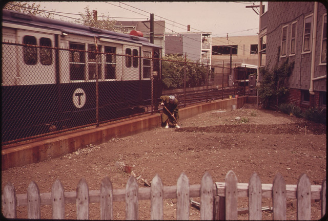
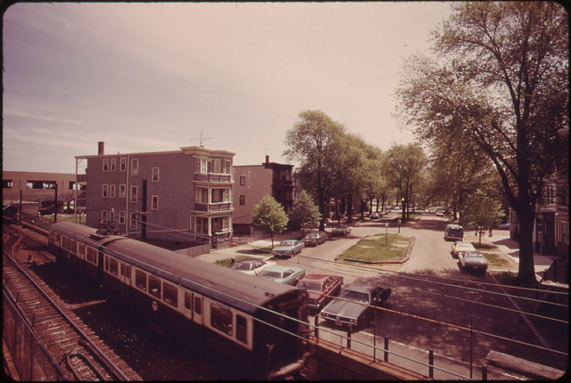
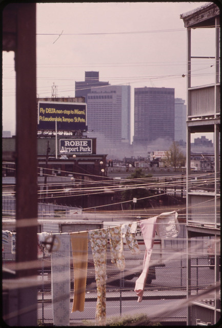
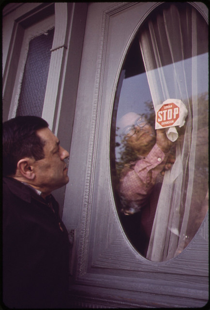
^ That's the Wood Island / Neptune Road neighborhood in East Boston, circa 1970. Photo's were taken in the immediate aftermath of the annihilation of Olmsted's Wood Island Park and environs to extend Runway 15/33. Eighteen Neptune Road was demolished by Massport last year; the three decker was the last artifact of this sad history. Some folks wanted the vacant home preserved as an museum / interpretive center, chronicling the history of the entire neighborhood. Massport had other ideas. It's likely to remain a lovely, fenced vacant lot.
Last edited:
Pierce
Active Member
- Joined
- May 29, 2008
- Messages
- 461
- Reaction score
- 1
MASSPORT is currently redeveloping it as a park in their Airport Buffer series. And last I checked (last spring during the RFP process for said park) there was one triple decker left, resided in by the last holdout, now 80ish years old.
Ron Newman
Senior Member
- Joined
- May 30, 2006
- Messages
- 8,395
- Reaction score
- 14
What, didn't they remove a park in that exact location because it was in the way of a runway expansion?
Beton Brut
Senior Member
- Joined
- May 25, 2006
- Messages
- 4,383
- Reaction score
- 354
MASSPORT is currently redeveloping it as a park in their Airport Buffer series. And last I checked there was one triple decker left, resided in by the last holdout, now 80ish years old.
The house was demolished last year. It survives only in Google StreetView (see link in my earlier post). The petition to preserve it proved ineffectual.
What, didn't they remove a park in that exact location because it was in the way of a runway expansion?
The park was roughly 500 yards east of the former site of 18 Neptune Road. It was the largest active (sports) park in the city, a few times larger than the Common. There was a swimming beach, tennis courts, baseball fields, a running track, bathhouses with lockers, and a large wooden band-shell. My former colleague Cynthia Zaitzevsky discusses Wood Island Park in detail in her excellent book on Olmsted's work in Boston.
Whatever Massport ultimately puts on the site will be cold comfort.
belmont square
Active Member
- Joined
- Jun 19, 2006
- Messages
- 365
- Reaction score
- 0
There is one triple decker left from this old neighborhood, but it sits a few doors off Neptune Road on Frankfort Street.
Beton Brut
Senior Member
- Joined
- May 25, 2006
- Messages
- 4,383
- Reaction score
- 354
I suppose that depends on how you define "easy walking distance."
Consider, some folks were stunned in this thread by the low "walk score" that East Boston received. Chez Brut is less than 200 yards form the Blue Line and even closer to a liquor store, and it only scored a 68. When you consider the history of malignant land use, in spite of density, there are parts of East Boston that are about as pleasant to traverse on foot as the Turnpike Extension.
Consider, some folks were stunned in this thread by the low "walk score" that East Boston received. Chez Brut is less than 200 yards form the Blue Line and even closer to a liquor store, and it only scored a 68. When you consider the history of malignant land use, in spite of density, there are parts of East Boston that are about as pleasant to traverse on foot as the Turnpike Extension.
Ron Newman
Senior Member
- Joined
- May 30, 2006
- Messages
- 8,395
- Reaction score
- 14
what is that building? Google Maps says that it belongs to a silversmith, which surprises me.
Beton Brut
Senior Member
- Joined
- May 25, 2006
- Messages
- 4,383
- Reaction score
- 354
I believe it was initially built as a fabrication facility for the now defunct Transitron Corporation in the 60s. Towle Silver used it into the 80s (I'm not sure if it was a warehouse or fabrication facility). It's now been subdivided for use by several airport-related businesses; the eastern end is a Planet Fitness.
belmont square
Active Member
- Joined
- Jun 19, 2006
- Messages
- 365
- Reaction score
- 0
Consider, some folks were stunned in this thread by the low "walk score" that East Boston received. Chez Brut is less than 200 yards form the Blue Line and even closer to a liquor store, and it only scored a 68.
Admittedly I'm a newcomer (7 years in Eastie) but to me the neighborhood consists of two very distinct sections--the areas between the harbor and Day Sq, and everything beyond Day Sq and Wood Island Station. The former is as walkable as any area outside of Boston Proper with relatively few scars in the built environment (Liberty Plaza and the toll plaza being the two biggest problems), and the latter consists of a series of disconnected mini-neighborhoods ranging from somewhat urban to suburban in density. If the "walk score" is an average of both of these areas, then I suppose it is defensible.
Shepard
Senior Member
- Joined
- Mar 20, 2009
- Messages
- 3,518
- Reaction score
- 69
BB, is there something distinctive about the part of the neighborhood roughly bounded by Maverick Street, Bremen Street and the airport? It strikes me as a pocket of more stately brick walkups and townhouses rather than the wooden curb-hugging buildings that I'm much more familiar with seeing in Eastie.
Beton Brut
Senior Member
- Joined
- May 25, 2006
- Messages
- 4,383
- Reaction score
- 354
...to me the neighborhood consists of two very distinct sections--the areas between the harbor and Day Sq, and everything beyond Day Sq and Wood Island Station. The former is as walkable as any area outside of Boston Proper with relatively few scars in the built environment...and the latter consists of a series of disconnected mini-neighborhoods ranging from somewhat urban to suburban in density.
True enough. I think of Eagle Hill as having two centers of gravity, depending on proximity to Central or Day Square. Maverick Square and Jeffries Point feel like a separate neighborhood, culturally and even architecturally (see below). Depending on who you talk to (and how old they are) you'll hear different things about where Orient Heights begins. Old school East Bostonians will say Byron Street, referring to the area to the south (between Day Square and Byron) as Wood Island. For newer residents, the Heights is simply the confluence of Bennington and Saratoga Streets.
BB, is there something distinctive about the part of the neighborhood roughly bounded by Maverick Street, Bremen Street and the airport?
I think the brick townhouses date from the 1870s, and were built for the rising merchant class (shipwrights, importers) in East Boston. The spartan three deckers on Chelsea, Bennington, and Breman Streets were, as you can guess, built on spec as workers' housing. Conversely, the three deckers up on Eagle Hill, as well as those that were demolished in the Neptune Road neighborhood, were among the nicest in East Boston, on par with what you'd find in Jamaica Plain or Roslindale.
The two-family home that my grandfather bought in Orient Heights in 1936 was built on spec two years earlier. Interestingly, the finishes in spec houses from even five years earlier were nicer, as they predated the Depression. You learn a lot about a house when you open up the walls to renovate.
Last edited:
BostonUrbEx
Senior Member
- Joined
- Mar 13, 2010
- Messages
- 4,346
- Reaction score
- 140
Oh wow, can we please have that burgundy back on the "Purple Line" (hate it when people call it that).
Whipped a couple F40PH's up:


---
Also, I made one based on the Caboose's paint scheme for some fun:

^ Surely to burn retinas.

BostonUrbEx
Senior Member
- Joined
- Mar 13, 2010
- Messages
- 4,346
- Reaction score
- 140
Pierce
Active Member
- Joined
- May 29, 2008
- Messages
- 461
- Reaction score
- 1
The house was demolished last year. It survives only in Google StreetView (see link in my earlier post). The petition to preserve it proved ineffectual.
Not 18 Neptune, the place around the corner on Frankfort.
Unless that guy died or Massport invaded that house is still standing and occupied. Maybe it's gone, I defer to you if you live in Orient Heights as I'm never out that way (unless I'm on or immediately over the tarmac), but it's not the place that petitions were trying to save.
Beton Brut
Senior Member
- Joined
- May 25, 2006
- Messages
- 4,383
- Reaction score
- 354
It's still there, and is apparently occupied. Maybe Tyler Durden lives there.
Edit: Drove by this evening. No lights, but lawn clipped, and the general state of the property is good. Uncertain who owns/lives there...
Edit: Drove by this evening. No lights, but lawn clipped, and the general state of the property is good. Uncertain who owns/lives there...
Last edited: