You are using an out of date browser. It may not display this or other websites correctly.
You should upgrade or use an alternative browser.
You should upgrade or use an alternative browser.
Flickr Finds & Social Media Pics
- Thread starter kz1000ps
- Start date
A couple from 1970
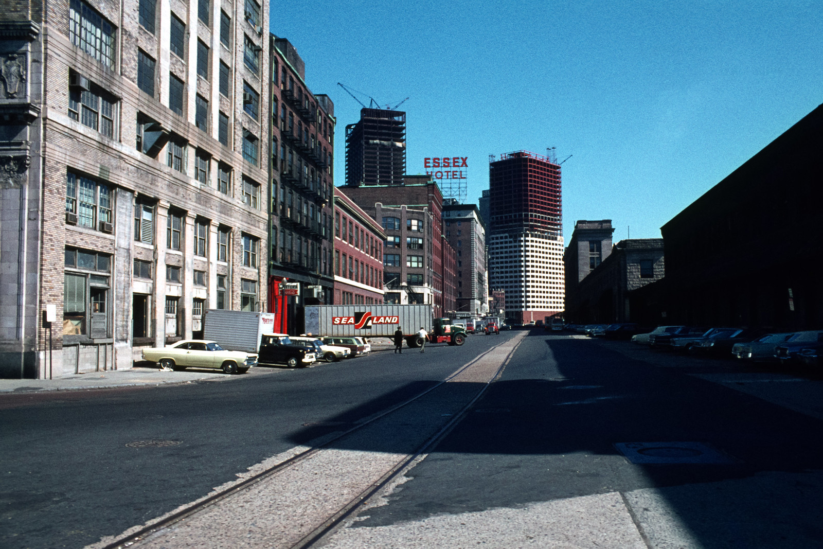 alley with railroad tracks by Essex Hotel, Boston, MA by Dave MacKenzie, on Flickr
 highway interchange, Boston by Dave MacKenzie, on Flickr
alley with railroad tracks by Essex Hotel, Boston, MA by Dave MacKenzie, on Flickrhighway interchange, Boston by Dave MacKenzie, on Flickrstick n move
Superstar
- Joined
- Oct 14, 2009
- Messages
- 13,487
- Reaction score
- 24,557
Where is that 2nd picture?
- Joined
- May 25, 2006
- Messages
- 7,064
- Reaction score
- 1,990
That's the old South Bay interchange.
Charlie_mta
Senior Member
- Joined
- Jul 15, 2006
- Messages
- 5,150
- Reaction score
- 7,778
That first one is not an alley technically, it's Atlantic Avenue next to SS.
Charlie_mta
Senior Member
- Joined
- Jul 15, 2006
- Messages
- 5,150
- Reaction score
- 7,778
Demolition for the original Central Artery.

FormFollowsBudget
Senior Member
- Joined
- Jan 15, 2015
- Messages
- 2,318
- Reaction score
- 4,106
I thought that was a photo from the 60s for a second until I realized the Sudbury's in there. That's awesome.
 Comm Ave Up
 look to the east
Last edited:
Bananarama
Active Member
- Joined
- Mar 18, 2020
- Messages
- 609
- Reaction score
- 1,262
Has there ever been any talk of developing that parking lot parcel to the west of the BU engineering building?
 V_4139
Charlie_mta
Senior Member
- Joined
- Jul 15, 2006
- Messages
- 5,150
- Reaction score
- 7,778
Great photo. That was my route everyday from Cambridge High and Latin school to Harvard Square back in the 1960s.
dhawkins
Active Member
- Joined
- Jan 25, 2014
- Messages
- 906
- Reaction score
- 3,180
Before the Pru complex and turnpike extension into Boston. Taken from the the top floor of the Lenox, corner of Boylston and Exeter streets, Huntington on the left. What happened here is basically what is happening in the seaport area now.

Blackbird
Senior Member
- Joined
- Feb 2, 2014
- Messages
- 1,246
- Reaction score
- 1,832
From 1910, looks the same as it did 110 years ago
Does it?
That is the Arlington Street Church, right? For the life of me, I can't see the break in the streetwall where Arlington continues passed Boylston to the south?
Last edited:
Does it?
That is the Arlington Street Church, right? For the life of me, I can't see the break in the streetwall where Arlington continues passed Boylston to the south?
Yes. Arlington used to stop at Boylston.
Blackbird
Senior Member
- Joined
- Feb 2, 2014
- Messages
- 1,246
- Reaction score
- 1,832
Yes. Arlington used to stop at Boylston.
So if that is the right intersection, far from "looking the same as it did 110 years ago": pretty much nothing in that photo is still there except for the church and the fencing around the Public Garden.

So if that is the right intersection, far from "looking the same as it did 110 years ago": pretty much nothing in that photo is still there except for the church and the fencing around the Public Garden.
Correct. In addition to Arlington this shows the portal where the subway trolly is seen turning into the Public Garden.
So if that is the right intersection, far from "looking the same as it did 110 years ago": pretty much nothing in that photo is still there except for the church and the fencing around the Public Garden.
I was mostly just thinking the city in general looks the same. Moreso it reminds me of areas of Marlborough Street and Comm Ave. But you're right, when I try to isolate this spot on google maps today I can't match up anything besides the church and the park. So basically, that whole block was replaced by... this?
Google Maps
Find local businesses, view maps and get driving directions in Google Maps.