General Infrastructure

Nice; discussion on aB had been started here previously (great to see this moving forward):

Thanks for linking, I was unaware of the thread.
 
... this whole area is a bag of broken glass and nails with a mystery amount of cash at the bottom (A nickel? A million bucks? Who knows?)

It has fascinated me for years. Thank you, thank you all for not shrugging your shoulders! Stlin and C-Town, you rock!

Late as I am to the thread, I just wanted to say a hearty THANK YOU to all of you who contributed details and knowledge (and speculation! and snark!) to this discussion of the areas currently used by Boston Sand and Gravel.

A friend of mine has been living in The Harvey, at 50 Hood Park Drive, for the past nine months, and so I've had many opportunities recently to aimlessly wander through the area on my bike. Every time I'm there, I'm looking at so much of the low-density land use, weird muddy lots, expanses of surface parking, and wondering how much longer it can persist. I also stand and look longingly across the railroad right of way and wonder if we'll ever be able to get some kind of pedestrian and bike connection from Hood Park to Inner Belt that would enable a safe and grade-separated Charlestown-Somerville connection, like the fancy pedestrian bridge to the south underneath the Zakim Bridge…?
 
I also stand and look longingly across the railroad right of way and wonder if we'll ever be able to get some kind of pedestrian and bike connection from Hood Park to Inner Belt that would enable a safe and grade-separated Charlestown-Somerville connection, like the fancy pedestrian bridge to the south underneath the Zakim Bridge…?
The problem I see is the physical constraint of not having enough vertical clearance beneath I-93 to bridge over the Orange Line (which runs right under the I-93 viaduct). The OL could be lowered for a short distance in an underpass to enable a ped crossing. Wouldn't be cheap but not prohibitively expensive either.
 
The problem I see is the physical constraint of not having enough vertical clearance beneath I-93 to bridge over the Orange Line (which runs right under the I-93 viaduct). The OL could be lowered for a short distance in an underpass to enable a ped crossing. Wouldn't be cheap but not prohibitively expensive either.
Right you are. It’s do-able, but don’t forget about the commuter rail tracks and the possible freight track ownership quagmire between the aforementioned Boston Sand and Gravel’s lease/own/take abutter situation. It all affects how poorly that mile has been planned in the last half-century. This is why you can’t have nice things.
 
Right you are. It’s do-able, but don’t forget about the commuter rail tracks and the possible freight track ownership quagmire between the aforementioned Boston Sand and Gravel’s lease/own/take abutter situation. It all affects how poorly that mile has been planned in the last half-century. This is why you can’t have nice things.

It's actually even worse of a problem (though not really a planning one). The Orange Line is elevated underneath the viaduct to allow the Commuter Rail (and the disused Mystic Wharf branch) to cross under. If we're already talking about clearance problems under the viaduct, it's probably fatally constrained for the length of that overpass or at least most of it. The track's leveled out again by around where the derelict Budd RDCs are parked, but that far south to get to Inner Belt would mean bridging over the Eastern/Western CR and the Lowell Line's raised embankment and even that only gets into BET's no-man's land with the back tracks there to deal with.

Regrettably difficult terrain for making life less inconvenient, but given that that was mostly industrial land (and a fair bit of it still is) and was presumably expected to be so for quite a while when the various infrastructure there was built, it's hardly surprising that there wasn't a contingency for some far-flung future possibility of those areas becoming residential and wanting better connections. (If this were Crazy Transit Pitches, I might wonder just how crazy a tunnel would be.)
 
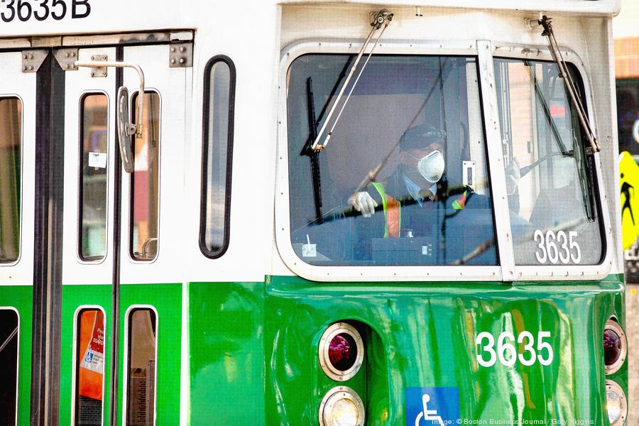
Gov. Baker Urges Quick Adoption Of New $9.7B Transportation Bill
green-line-03900xx3600-2403-0-457.jpg


“The MBTA's efforts to replace its entire Green Line trolley fleet, a statewide move toward electric vehicle adoption, and projects to make Massachusetts infrastructure more resilient in the face of climate change impact would all get a major boost under a $9.7 billion bond bill Gov. Charlie Baker rolled out Thursday…”

https://www.nbcboston.com/news/loca...tion-of-new-9-7b-transportation-bill/2671891/
That's all great, but how about the final design and construction of the Red-Blue connector?
 
I just want to make a comment about all the weird lanes they have painted over the past couple of years, turning car lanes into bus lanes, bike lanes, etc. The problem is that a lot of those lanes are now faded. If they do not commit to repainting those lines we basically have mayhem now. Nobody respects the "bus only" lanes anymore, such as the one by the science museum, because you can barely even read that it still says that! If they're going to go out of their way to turn the roads into nonsense, then they need to raise the budget for repainting that nonsense so it's clearly visible for all users of the road.

As an aside, the double light on the O'Brien Highway between Edwin Land Blvd and Museum Way is an absolute disaster because of the bus lane. Only 4-5 cars can fit between those roads at once, so you have constant backups into the intersection where they really needed to keep both lanes for cars for that short stretch. Does anybody know the timetable for returning that lane to all traffic? Even in off-peak hours that intersection has become an even bigger nightmare due to removing the 2nd lane's capacity at the double-stacked light. I could see making it buses only directly next to the museum, but that very short stretch between lights is a killer.
Isn't this bus lane being eliminated since GLX to Lechmere/Union is now open?
 
Isn't this bus lane being eliminated since GLX to Lechmere/Union is now open?
I assume it is, though there's no official confirmation.

Regardless, even before the GLX opening, some cars were already not respecting the bus lanes, partly due to how faded they are.
 
I assume it is, though there's no official confirmation.

Regardless, even before the GLX opening, some cars were already not respecting the bus lanes, partly due to how faded they are.

I mean, painted bus lanes and respect don't have a particularly good history in Boston at least (stares at the Silver Line)
 
I haven’t seen the McGrath resurfacing project discussed renecelty, but it was linked in a BBJ article today about the 15 MacGrath/Sav-Mor lab project starting this summer.

EA1DEBA0-0A8B-4F97-93BB-A683599DD62F.jpeg
9AD85B05-8E99-4B9B-A98C-8A04DF791966.jpeg
142E54D5-E608-4732-B52A-38675F7CC655.jpeg
078D5CE0-95CB-4A9F-A560-955900D5FF6D.jpeg


Hopefully the lab building will jumpstart the highway project.
 
I'm not sure if this is exactly the right thread, but I need a place to vent and maybe some of you have more information.

Last night I drove downtown as I often do to walk off the stresses of the day. There were no events at the Garden nor at Fenway so it seemed like it should be a nice and easy trip. I couldn't have been more wrong! As soon as I pulled onto the Leverett Connector I knew I was screwed, but by then it was too late.

Basically, they decided to close the entrances onto Storrow from 93 (mainly from the Leverett Connector) in order to do paving. There was not a single warning that this was happening. Frankly, there should have been 10 flashing signs within a mile of the Leverett Connector telling us to seek alternate routes, but there were 0. For nearly 80 minutes, from 9 pm to 10:20 pm, I was stuck on the Leverett ramp. It usually take me about 3 minutes and last night took 80!

When there aren't any events, I'd say a solid 85-90% of the Leverett Connector traffic is headed onto Storrow. With the onramps unexpectedly closed, we were all forced up to those stacked lights near the Science Museum. We're talking about half a dozen cars at a time, maybe a few more, every light cycle, backed up all the way to where the ramp splits off 93 (not the mention those joining in from Route 1). It was pure misery. We needed 5 times as many police directing traffic because there are too many double-stacked lights in the area, so there was no outlet and everybody was stuck. I eventually went the North Station route or I don't know how much longer it might have taken me to get through those lights.

So here are the things I want to know. Who makes these decisions to do this paving work at 9 at night (maybe started earlier) when there is still too much traffic on the road? Who is responsible for actually telling people it's going to happen? I couldn't find anything about it online when I got home. I saw 0 warnings while driving until I got stuck in the jam. Even then nothing explained what was happening, and people were still trying to get onto Storrow until they figured out they couldn't. I only knew what was happening due to the "traffic on the 3's" after I was already at the point of no return. When there are no events and no accidents, it's completely insane to expect people to just deal with an unexpected 80 minute delay at 9pm. The decision makers were either completely incompetent, or else actively sticking it to drivers. It was so bad it made me think maybe we need another outlet partway down the ramp, although I don't even know where it would/should go. I was just praying for one to appear, so I could veer off and end my nightmare.

It was without a doubt the worst experience I have ever had on the Leverett Connector. I have gotten stuck on it during rush hour, and during events, but this was another level of torture and should have been completely avoidable. 80 minutes to travel approximately 1.6 miles at offpeak hours is positively soul-crushing.
 
The most absurd thing I've ever encountered was simultaneous late-night construction on the Expressway and the Braintree branch of the Red Line. The bus shuttle from JFK/UMass to North Quincy got stuck in traffic on I-93 because of an unrelated construction project.
 

Back
Top