General MBTA Topics (Multi Modal, Budget, MassDOT)

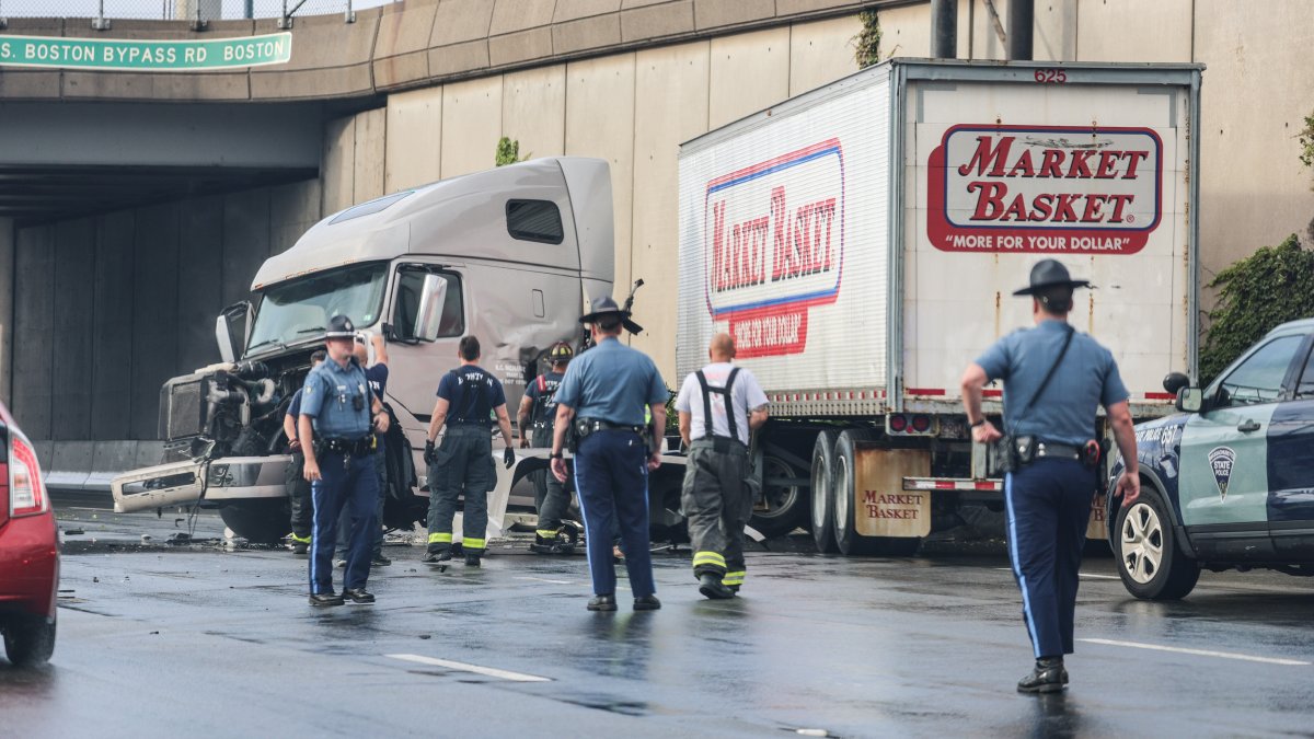
It's wild how the I-95 bridge collapse, which serves 150k cars day, was fixed in 12 days, while the Red Line which carries ~240k per day pre-pandemic is allowed to languish for months at a unusable frequency and travel speed.

One word: freight.
 
  • 106: Weekday inbound trips before 8pm will complete the loop via Forest St and Sylvan St. Currently, trips after 6:30pm use Lebanon St.
    • The BNRD has all route 106 trips serve Forest St and Sylvan St, although I'm not sure if that was because the BNRD map doesn't display alternative routes.
Minor update: Seems like this change may have possibly been in place unofficially, at least sometimes, for a while now, despite only being official when the summer schedule begins on July 2. I was there on Friday 6/23, and the two inbound 106 trips I observed both used Forest St and Sylvan St. However, two trips that I'm watching on the app today used Lebanon St inbound.
 
Last edited:
GTFS for summer 2023 (2023 Q3) is out.

As such, the MBTA frequency map I can update it again.

Weekday changes aren't shown on this map as weekday service is higher than Sunday service, and plotting rush hour routes gets complicated due to differing service schedules and midday gap.

Due to BNRD being on hold, this is an additional update. I will only be updating this map until BNRD phase 1 begins.

Map changes (based on adjustments to bare minimum Sunday service):

Frequency increase:
* Orange Line up from 80 to 106 trips (Every 15 - 20 minutes -> Every 10 - 12 minutes) (>=101 trips, >= 81 trips)

Frequency decrease:
* Blue Line down from 124 to 102 trips (10 minutes or better -> Every 10 - 12 minutes) (< 121 trips)
* SL1 down from 124 to 107 trips (10 minutes or better -> Every 10 - 12 minutes) (< 121 trips)
* 111 down from 106 to 92 trips (Every 10 - 12 minutes -> Every 12 - 15 minutes) (< 101 trips)

Routing change:
* 134 early morning and late evening extension from Medford Square to West Medford @ Winthrop St & Playstead Rd.
* Winthrop routing for route 713 shifted 1 block westwards

Due to frequency changes, there is no longer any route with more than 121 trips on Sunday, and therefore, no route with sub-10 minute frequencies or better. Only the Green Line trunk with multiple interlined branches qualifies as such. The maximum trips on a single route is 118 trips (GL E) on Sunday.

The old map is here (2023 Q2): https://archboston.com/community/th...modal-budget-massdot.971/page-422#post-452594
(pre-slow zone update 2023 Q2): https://archboston.com/community/th...modal-budget-massdot.971/page-411#post-450065
The original map is here (2023 Q1): https://archboston.com/community/th...modal-budget-massdot.971/page-399#post-445361 (No older map available, oldest map available)

1687898336864.png


Comparison now (Q3 2023) vs. Amsterdam. It would look worse if the Orange Line was kept where it was (80 trips Q2 2023).
 
Halp!

We don't have real-time bus trackers here on Cape Cod (CCRTA - https://capecodrta.org/) but I can't think of any reason why it *can't be built easily.

I'm sure they've looked into it (I hope so?) but can't seem to find anything on it.

Does anyone know if there's been work done on it? If not, any "beginner" websites I could visit to learn more about the technology?

It seems it was really easy to build third-party apps for the MBTA - do all buses have at least some form of tracker?
 
Last edited:
Halp!

We don't have real-time bus trackers here on Cape Cod (CCRTA - https://capecodrta.org/) but I can't think of any reason why it can be built easily.

I'm sure they've looked into it (I hope so?) but can't seem to find anything on it.

Does anyone know if there's been work done on it? If not, any "beginner" websites I could visit to learn more about the technology?

It seems it was really easy to build third-party apps for the MBTA - do all buses have at least some form of tracker?
The MBTA makes available an API for 3rd party developers - thats the framework and service the MBTA provides that allows a 3rd party app, website or similar service to request and receive data from the MBTA system in real time, such as vehicle position and where it's going. It's in a standardized format, and that's the data that apps like Transit and the other T trackers use to tell you where your bus is or where the new trains are, or how transit matters track slow zones. Once you have that access, building the front end to process it and display it is the easy part.

Unfortunately for your purposes, that would require the CCRTA to both have trackers on their buses - which they likely do internally - but also make that available to the public in the form of an API you can call. It doesn't look like the CCRTA provides that.
 
To go a bit deeper still, what you'd likely be looking for is an API that implements the GTFS Realtime standard. This is an industry standard format developed by Google and used by transit agencies for publishing data about trip updates, service alerts, and vehicle positions. There is also a GTFS Static standard for publishing schedules and non-changing geographical data.
 
Halp!

We don't have real-time bus trackers here on Cape Cod (CCRTA - https://capecodrta.org/) but I can't think of any reason why it can be built easily.

I'm sure they've looked into it (I hope so?) but can't seem to find anything on it.

Does anyone know if there's been work done on it? If not, any "beginner" websites I could visit to learn more about the technology?

It seems it was really easy to build third-party apps for the MBTA - do all buses have at least some form of tracker?
Until recently (not sure when), you could get real time tracking from Umo (formerly NextBus) here. An custom (not GTFS-RT) API was available, with docs here, but it looks like buses may no longer be tracking.
 
Well at least it's the track/third rail causing the fire instead of the brand new train.
 
Not quite sure what was going on yesterday: I see buses tracking now.

::sigh:: Now I see it, too. I'm very confused. And, I haven't heard back from CCRTA customer service. But, yeah, it looks as though it's live and updating. <strike>Except the "Beaches" line doesn't seem to be updating, which is probably the one most-used in town lol.</strike> ::sigh::
 
Last edited:
I couldn't find a 23 minute clip showing the entire North Quincy -> JFK slow zone, so these were the best I could find. I'm surprised that no one has recorded the whole slow zone experience on video. These clips only start halfway through the NQ - JFK stretch so it doesn't capture the whole thing.


This is just plain ridiculous!! It's almost been a year since this crap started. When with this ridiculousness stop?!!! :mad:
 
This is just plain ridiculous!! It's almost been a year since this crap started. When with this ridiculousness stop?!!! :mad:

It wasn't ridiculous enough. I decided to fetch a Youtube Sync viewer program to line this slow zone video (the only one on the internet), up with another one with a train ride in Amsterdam, side by side.

This should be infuriating enough I think. Open it or share for the maximum ridiculousness effect.

1688433598536.png
 
Last edited:
Yeah, maybe it can be helped, maybe it can't. But no wonder the MBTA hasn't asked for any fare hikes! Because the system is so screwed up that if they DID ask for any, they'd be denied any increases in fares!! They must get this system right where there would be any fare hikes, otherwise there would be so many complaints across the board!! :eek:
 

We have to implement lengthy 3mph slow zones along I93 until safety can be assured.
 

Back
Top