Green Line Extension to Medford & Union Sq

Sure, but not quite what I asked. The way I interpret the maps info is that D and E would run to Union concurrently, which we know won’t be true (at least according to published MBTA plans). I wonder if somebody just messed up, or if they’re willing to have incorrect info up on maps for a couple months until the Medford branch opens.
I would assume they are going to live with incorrect maps for a few months. Changing all the maps twice for the slightly staggered GLX launch is a huge waste of money.
 
I would assume they are going to live with incorrect maps for a few months. Changing all the maps twice for the slightly staggered GLX launch is a huge waste of money.
Not talking about physical maps, I’m talking about how the MBTA sent Apple info that states Union Square is getting both D and E trains and not just E trains until the Medford branch begins testing. Curious how this might affect routing/directions.
 
Not talking about physical maps, I’m talking about how the MBTA sent Apple info that states Union Square is getting both D and E trains and not just E trains until the Medford branch begins testing. Curious how this might affect routing/directions.

I'd wager that if a Maps app thinks there's service, it'd give directions using that info, which would be confusing to anyone relying on it. I'm curious, though, if that's just Apple's screw-up or the T's.
 
I'd wager that if a Maps app thinks there's service, it'd give directions using that info, which would be confusing to anyone relying on it. I'm curious, though, if that's just Apple's screw-up or the T's.

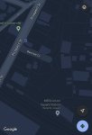
Hard to say… looking at Google Maps and it’s in an even worse state. The station is listed as a “Transportation Service” and you can’t even choose train station as an option for corrections. The default view is also incredibly out of date for the area: Still shows Bennett Ct and the old lot lines even though the satellite view is far more recent.
 

Attachments

  • C278ADD1-F0A5-4F47-890A-96C225F87C23.jpeg
    C278ADD1-F0A5-4F47-890A-96C225F87C23.jpeg
    679 KB · Views: 108
So I was bored and checked the Apple Maps app, and they've got a long way to go with regards to the Union Sq extension...
 

Attachments

  • IMG_0496.PNG
    IMG_0496.PNG
    2.9 MB · Views: 131
Lighting activated along the "gangway" to Magoun station. I'm actually wondering if this is an art installation rather than part of the station design? It looks way too creative to be government-issue. And lord help you if you've feasted on edibles when you enter this station, cause the lights bend downward as you walk down the ramp, so it looks like walking into a whale skeleton... or being clasped by an upside-down millipede.

I love it!!!
IMG_5776.jpg
IMG_5777.jpg
 
Last edited:
So I was bored and checked the Apple Maps app, and they've got a long way to go with regards to the Union Sq extension...

How very bizarre. Particularly odd since Science Park, despite being shown, is closed, while the similarly-closed old Lechmere (as well as new Lechmere and Union Square) appear not to exist at all on that map. Who programs these things?
 
Hard to say… looking at Google Maps and it’s in an even worse state. The station is listed as a “Transportation Service” and you can’t even choose train station as an option for corrections. The default view is also incredibly out of date for the area: Still shows Bennett Ct and the old lot lines even though the satellite view is far more recent.
Patience y'all, the way this works is the MBTA puts it in their GTFS feed, which is then picked up by all your various mapping and transit apps. The MBTA will have the service start date listed as Monday so most apps won't show it until next week, even then it takes a few days for most apps to take in the new feed. Reporting it to Google won't do anything, they just display the MBTAs GTFS data. (The streets around the station and pathways accessing the stations are up to the developers of the apps though)

 
Hard to say… looking at Google Maps and it’s in an even worse state. The station is listed as a “Transportation Service” and you can’t even choose train station as an option for corrections. The default view is also incredibly out of date for the area: Still shows Bennett Ct and the old lot lines even though the satellite view is far more recent.

Even that is an improvement, though. Last time I checked, Google didn't identify the station at all.
 
GLX extension to Route 16 has a preliminary design and environmental document done, but NIMBYs in West Medford are a problem for extending it past that, and of course there is no funding designated for final design and construction even just to route 16. The GLX extension to Porter is far in the future, but as you say, will get a boost if the substation project at Union Square can be built to be out of the right-of-way. The Red-Blue connector is probably the next MBTA project. as it has the backing of Mass General, and no NIMBY vetching.

Even if GLX to Rt. 16 gets built, it’ll be value engineered to the max. Once the West Medford community shot down GLX twenty years ago, the state has consistently designed GLX to Rt. 16 to preclude any extension further north. The most recent 2017 re-design further enhances this point, most notably bringing the station down to street level instead of placing it at the same elevation as the ROW viaduct over MVP and the river. See attached for a 2017 Notice of Project Change summary. Full document is within this link near webpage bottom: https://www.mass.gov/lists/glx-public-meetings-documents

Although the 2017 NPC doc didn’t include new design images, the 2015 image gives you an idea of the station location and layout. Note the community path to West Medford baked into the design. See attached image.
630A1CB9-F202-4D45-B689-2C47AE33BFF8.jpeg
B3F70A75-CCAC-434D-847C-2FCE3050FED7.jpeg
 
Lighting activated along the "gangway" to Magoun station. I'm actually wondering if this is an art installation rather than part of the station design? It looks way too creative to be government-issue. And lord help you if you've feasted on edibles when you enter this station, cause the lights bend downward as you walk down the ramp, so it looks like walking into a whale skeleton... or being clasped by an upside-down millipede.

I love it!!!View attachment 22311View attachment 22312

Yes. The lighting is the major public art for Magoun station. Since it’s solar LED, they don’t require the full station power feed to work. If you look closely under the bridge you can see the generator temporarily wired into the switchgear, while they are constructing the final electrical feed.
 
I was doing some research on the exact time of the opening of service between North Station and Union Square. On the Green Line page of the MBTA website it's indicating that the service of the green line will resume first thing Monday morning - because it says shuttle buses thru Sunday March 20th. But I also have heard about a grand opening at 11:30am on the 21st. So if one is to expect service with no shuttle or from Union, are trains starting with the first at the normal start of service around early morning?
 
I was doing some research on the exact time of the opening of service between North Station and Union Square. On the Green Line page of the MBTA website it's indicating that the service of the green line will resume first thing Monday morning - because it says shuttle buses thru Sunday March 20th. But I also have heard about a grand opening at 11:30am on the 21st. So if one is to expect service with no shuttle or from Union, are trains starting with the first at the normal start of service around early morning?

I had heard afternoon, presumably after the 11:30 ceremony.
 
I was doing some research on the exact time of the opening of service between North Station and Union Square. On the Green Line page of the MBTA website it's indicating that the service of the green line will resume first thing Monday morning - because it says shuttle buses thru Sunday March 20th. But I also have heard about a grand opening at 11:30am on the 21st. So if one is to expect service with no shuttle or from Union, are trains starting with the first at the normal start of service around early morning?
This was asked on the STEP mailing list and this was the reply:
I checked with GLX outreach people. It has been decided that regular passenger service will start on 5AM Monday so the MBTA service page is correct. Thanks for pointing this out.
 
In re GLX to Rte. 16, IIRC that the reason they didn't keep the station on the embankment was because they'd have had to take down a building, I think 222 Boston Ave, to have room to separate the tracks for the platform, and curving the entire line to the south didn't have that problem. Looking at Google Maps and MassMapper, it looks like the building is only a few feet from the ROW, but it's quite some distance from where you'd have to start the track separation (using the Magoun Square station's distance from the Lowell Street bridge as a model). Interestingly, the North Street bridge was built in 1996 with bays for four tracks.
 
The bridges over Mystic Valley Parkway and the river are the bottleneck for anything outside of Route 16. They would need to be completely rebuilt for 4 tracks.
 
The bridges over Mystic Valley Parkway and the river are the bottleneck for anything outside of Route 16. They would need to be completely rebuilt for 4 tracks.

There's likely enough room to build a 2 track bridge for the Green Line parallel to the existing 1908-built arch bridge without major modifications to the original bridge. It wouldn't necessarily be cheap, but it wouldn't be the full cost of rebuilding the existing bridge at 4 track width.
 
The bridges over Mystic Valley Parkway and the river are the bottleneck for anything outside of Route 16. They would need to be completely rebuilt for 4 tracks.

The historic Boston & Lowell river bridge is indeed wide enough for 4 tracks if the track separation was reduced to the functional minimum. You'd only need to twin up the much more recent and non-Historic Register arch over Route 16, which is no big deal. West Medford was fully studied, remember...and the bridges did not pose any great hardship in the study. The problem with West Med was the grade crossings, and the fact that pedestrian crossing traffic around the stop would've been a complete shitshow with GLX needing to stub out at the laterally cramped south end of the crossing. Grade separation is functionally required before you can go there.
 
The bridges over Mystic Valley Parkway and the river are the bottleneck for anything outside of Route 16. They would need to be completely rebuilt for 4 tracks.

Man it's crazy to me that rebuilding this relatively tiny little bridge would be a big deal. I know it absolutely would for the state of MA... but dang, it really shouldn't be that big of a deal
 
Both the MVP and Mystic River bridges would need modified. This was explicitly mentioned in the DEIR:
During the development of the 2005 Beyond Lechmere Major Investment Study/Alternatives Analysis (MIS/AA), the alternative that evaluated light rail service (Alternative 1C) included evaluating the extension of service beyond the Mystic River to West Medford. The MIS/AA’s proposed light rail alignment traveled via the Massachusetts Bay Transportation Authority’s (MBTA) Lowell Commuter Rail Line beyond the Mystic Valley Parkway/Route 16 and Mystic River to terminate at a location south of the existing West Medford Commuter Rail Station near High Street/ Route 60. This termination point was determined to have a number of operational and environmental challenges, including the crossing of an existing highway-railroad at-grade crossings and impacts on the existing historic Mystic Valley Parkway/Route 16 and the Mystic River structures.

By extending the Green Line service across the Canal Street grade crossing, this existing two-track crossing would become a four-track crossing (two Green Line tracks; two commuter rail tracks). The differing operational characteristics of the Green Line, commuter rail, and roadway would significantly raise safety concerns. In a similar situation in Los Angeles, the accident rates are significantly higher than the national average; ninety people have died on the Los Angeles County Metropolitan Transportation Authority’s 22-mile Blue Line (consisting of 100 at-grade crossings). This line has had more than 821 recorded incidents between its inception in July 1990 and July 2008. All of the at-grade crossings in Los Angeles have grade crossings gates and lights.

With the potential of having Green Line vehicles cross the roadway in each direction, safety concerns were raised at the Canal Street crossing. Additionally, extending the Green Line to West Medford would require the widening of the historic structures over the Mystic Valley Parkway/Route 16 and the Mystic River and could impact the parklands beneath the structures. If these structures were impacted, there would be an increased amount of environmental documentation and coordination that would be required, which could significantly impact the ability to meet the Project schedule of December 31, 2014 and could incur additional expenses to the Project. For these reasons, it was determined during the EENF process that a variation of the Alternative 1C from the MIS/AA was proposed with a Project terminus south of the Mystic Valley Parkway/Route 16, in the vicinity of College Avenue. The Secretary’s Certificate specifically cited that a potential terminus be evaluated in the vicinity of the Mystic Valley Parkway/Route 16.

The Mystic River bridge is only a total of 52 feet wide - 5 feet narrower than the Harvard Street bridge, which is the narrowest 4-track MBTA bridge I can find - and has very wide walls. It is doubtful that you could fit 4 tracks, including electrification and communications, on that. It was built to this width in 1906 but has never been used for more than 2 tracks, so it would likely need major reinforcement as well.

The MVP bridge is on the National Register since 2006: https://mhc-macris.net/#!/details?mhcid=SMV.906
 

Back
Top