Green Line Extension to Medford & Union Sq

Sorry if I’ve asked this before…but where/how is the Community Path connecting between East Somerville stop and right as it approaches Lechmere? Does it go underneath the tracks :

7F3CCF5E-509A-4F0C-8B4A-59080E6BC277.jpeg
1B069467-6DA1-4478-8F1E-B70AB2D7FF38.jpeg


Or does it go behind the apartment building (where there’s already a temporary path, and is somewhat awkwardly close to private patios)? Here:

FF7123AB-232D-448C-AF15-0C9FEB75DF4B.jpeg
 
I can't help but feel East Somerville got deprioritized because of proximity to Union Square and Sullivan. Like we'll be super glad to have it if there are long term disruptions to Union Square (McGrath grounding or a GLXX to Porter?) or Sullivan, but I have a hard time imagining it'll be the station of choice for anybody except those who live in the immediate vicinity.

Will be interesting to see how access evolves with the neighborhood.
I disagree. For those heading to / from Union Square along the Medford branch, East Somerville will be the de facto Union Square station. No one taking the Medford branch from Union is going to make the switch at Lechmere for a train to Union Square station when it’s an 8 minute walk from East Somerville station to the actual Union Square. Currently the 80 bus (which shadows the GLX Medford Branch route) stops underneath the Washington Street overpass for a 5 minute jaunt to actual Union Square. Don’t see why this commuting pattern to Union to / from the north would change with East Somerville station just a few hundred feet to the east of the 80 stop.
 
Sorry if I’ve asked this before…but where/how is the Community Path connecting between East Somerville stop and right as it approaches Lechmere? Does it go underneath the tracks :

Or does it go behind the apartment building (where there’s already a temporary path, and is somewhat awkwardly close to private patios)? Here:

It ducks under the GLX viaduct and connects to Morgan Avenue. It looks like there will be an off-street path on the northeast side of Morgan - it's already in place south of First Street - which connects to the North Point Park trails at Education Street.

1649443231049.png
 
The footbridge at Medford/Tufts is open. Unfortunately, it was starting to get cloudy, so I wasn't able to take full advantage of the good angle.
1649445054916.png


I really hope these bare cinderblock walls get painted someday - even plain green would be great for branding.
1649445869812.png

1649445878171.png

1649445887881.png


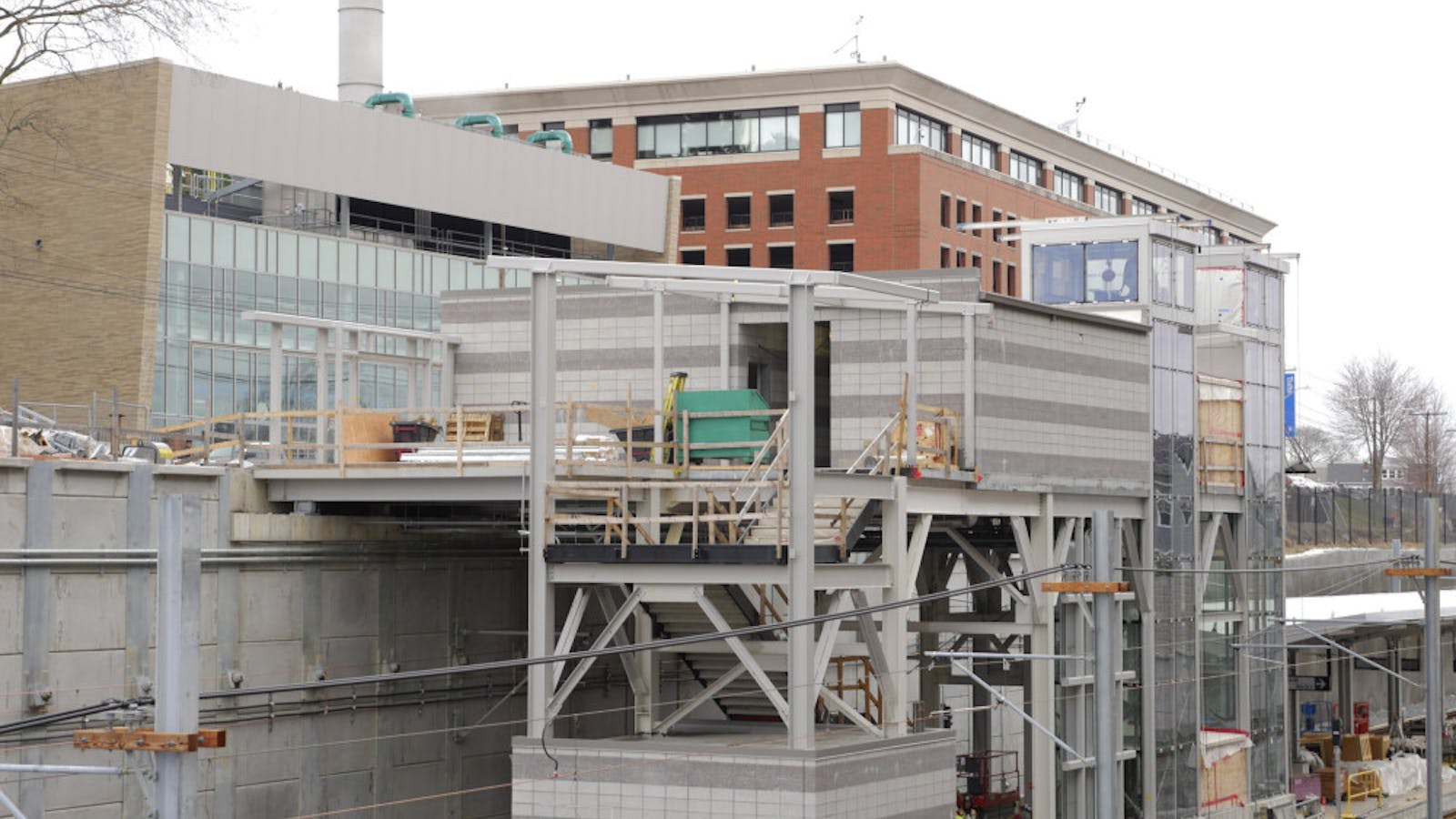
The emergency exit at Medford/Tufts is a good reminder why long ramps alone are no substitute for elevators. It has about 400 feet of ramps for 20-25 feet of vertical - a significant difference in time and energy versus a 10-second elevator ride - and probably cost just as much as an elevator. (Obviously the ramp is necessary as an emergency exit that doesn't require electricity, but it would be vastly inferior as the main entrance.)
1649447249506.png


One of these days Tufts is going to yell at me for photographing from their parking garage, but for now it's a great angle even with crappy light.
1649447609832.png


And that's that for my March 2022 GLX photos. (Save for the politicians at the opening, but those aren't very interesting shots.)
 
The footbridge at Medford/Tufts is open. Unfortunately, it was starting to get cloudy, so I wasn't able to take full advantage of the good angle.
View attachment 23243

I really hope these bare cinderblock walls get painted someday - even plain green would be great for branding.
View attachment 23244
View attachment 23245
View attachment 23246

The emergency exit at Medford/Tufts is a good reminder why long ramps alone are no substitute for elevators. It has about 400 feet of ramps for 20-25 feet of vertical - a significant difference in time and energy versus a 10-second elevator ride - and probably cost just as much as an elevator. (Obviously the ramp is necessary as an emergency exit that doesn't require electricity, but it would be vastly inferior as the main entrance.)
View attachment 23248

One of these days Tufts is going to yell at me for photographing from their parking garage, but for now it's a great angle even with crappy light.
View attachment 23249

And that's that for my March 2022 GLX photos. (Save for the politicians at the opening, but those aren't very interesting shots.)
You did well
 
(Obviously the ramp is necessary as an emergency exit that doesn't require electricity, but it would be vastly inferior as the main entrance.)
What are the laws around accessible emergency evacuation points? It’s obviously not a requirement for buildings. Is it required for transit stations? Is the T going above and beyond here, or just covering for themselves if both elevators break on the same day?
 
What are the laws around accessible emergency evacuation points? It’s obviously not a requirement for buildings. Is it required for transit stations? Is the T going above and beyond here, or just covering for themselves if both elevators break on the same day?
As far as I'm aware, not strictly. Last I saw College Ave and Magoun were supposed to have "areas of refuge" or glorified cages some distance from the station itself as an emergency exit egress location.

When did they add this ramp structure to the plan anyways? The last station plan I saw had the aforementioned safe refuge area.
 
I'd be terribly afraid to walk under here during the day, much less at night! Very little lighting there now, none at night!! They need to get some lights under there if that is to be a walkway!!! Look how dark it is there!! :eek:
Under the GLX.jpeg
 
Last edited:
I'd be terribly afraid to walk under here during the day, much less at night! Very little lighting there now, none at night!! They need to get some lights under there if that is to be a walkway!!! Look how dark it is there!! :eek: View attachment 23259
I don't think the path will be following along the underside of the GLX viaduct. It will quickly cross it and end up connecting to Morgan Ave, according to this earlier post:
It ducks under the GLX viaduct and connects to Morgan Avenue. It looks like there will be an off-street path on the northeast side of Morgan - it's already in place south of First Street - which connects to the North Point Park trails at Education Street.

View attachment 23242
 
Thank God!! Of course, I'll be on the trolley anyway, so that dark & dismal area will pass right by me!! :eek:
 
Those support poles look so height-inconsistent. I realize some of it maybe camera distortion but some, like these in the second picture below, look unnecessarily high.View attachment 23289

It's not camera distortion. The height of these poles vary wildly, and I always thought it looked weird (if not sloppy), but I always figured they knew what they were doing and had a reason for it. Anticipating settling into the ground? Waiting until the end to lop off the tops to make them even? I am very curious to hear the reasoning behind this.
 
It's not camera distortion. The height of these poles vary wildly, and I always thought it looked weird (if not sloppy), but I always figured they knew what they were doing and had a reason for it. Anticipating settling into the ground? Waiting until the end to lop off the tops to make them even? I am very curious to hear the reasoning behind this.

If differential settlement is expected to be over a foot, we have wayyy bigger problems than sloppy looking poles :).

Since l dont see baseplates, l would put money on all the piles being the same length, but with varying depths below grade. If they’re driven, makes sense to hit refusal at slightly different depths. If they’re drilled shafts, the expectation would be more or less equal depths, but not unheard of for some weird subsurface conditions to change that.
Either way, a little bizarre the tops weren’t cut off given steel prices right now. Maybe priority number 1 was to get the thing open?
 
Last edited:
Any chance some are light poles or maybe the tall poles are for the eventual electrification of the commuter rail?
 
Is it possible that I saw a green line test train going over the washington st. bridge at about 11 this morning. Only caught a glimpse of a tiny part of it from the angle I had, seemed like one heading north bound tho, I could well be wrong.
Could have been the tail end/roof of a commuter rail train I suppose.
 
I did see the outbound signals showing a red near Central St this weekend. However, the OCS is not fully wired in that area yet.
 
Rode the extension the other day for the first time. Thoughts:
  1. The slow zone ends right at the viaduct. The cars really scoot as soon as they exit it and start to approach Lechmere.
  2. The outbound flying junction is quite loud and screechy. Combined with the slow speed and the stop at the end makes outbound much more unpleasant than inbound.
  3. The long walk to the platforms at Union Square isn't actually that bad. What's worse was trying to figure out which of the two trains that were parked I should go on. Had to herd a bunch of people onto the right one once I realized that only one of the trains had its inbound-end drivers seat ready.
  4. The building at the end of the platform makes me nervous about a Porter extension. The elevator is offset, and so would be basically useless to an extended Green Line. They'd have to rebuild most of the non-platform parts of the station from scratch.
  5. Geeze the new buildings going up nearby are tall.
  6. Probably related to the Haymarket closure, but I believe the drivers were using batons for signalling. Our driver (inbound) at Science Park got passed a baton and handed one off to an attendant. Same attendant had a cone with a flag sticking out of it that they put out afterwards.
  7. Almost all of the riders got on and off at Union Square, not Lechmere. This was late at night, so probably not indicative of peak ridership, but makes me excited that the new station is actually serving people.
 
good observations.
Rode it for the first time yesterday
Wasn't bothered by the walk to the platform in union.
Thought Leechmere looked well.
Ridiculously slow over the viaduct.
All in all really quick from Union to North Station.
The ticket thing was baffling tho.
I got a validated or verified ticket inbound but outbound from north station I just tapped my card? Is it really two different payment methods depending on direction or did I screw up?
The helper at Union mentioned that we needed to show the receipt to the driver on boarding, the driver looked baffled when we tried that.
Not familiar with the green line but why cant there just be tap fair gates till the new system comes in?

The fare gates were value-engineered out. They cost money, and the only reason this is getting built is that corners were cut. There are some stations where they will absolutely make more sense to have than the current system, but we'll see if anything ever happens.

Ultimately it shouldn't matter, as AFC 2.0 (the new fare system) should obviate the need for validators (or replace them with new validators that work more simply?). My understanding is that, at least until Harmarket reopened, nobody cared about your validation ticket because nobody was checking. I wouldn't be surprised if that continues for a while, but eventually they'll probably start checking.
 

Back
Top