Green Line Reconfiguration

I found in the link below from a North-South Rail Link study the image below which shows the location of the underground Silverline line tunnel (MBTA South Boston Piers Transitway) as it ends under Atlantic Avenue. I do not know if it shows a fairly accurate depiction of the tunnel or is more diagrammatic. As discussed in earlier posts the Silverline Phase 3 was going to turn down Essex, but this plan seems to indicate it could be possible to slip under the train tracks going into South Station and then head towards Marginal Street or portal out on Atlantic Avenue with LRT connecting to the Greenline (Gold line:). This could be done as part of the proposed South Station expansion into the USPS location.

https://www.mass.gov/doc/chapter-5/download

Further below is a photo I have found of the Silverline turn around under Atlantic Ave.
View attachment 46521View attachment 46523
I believe this has been reviewed in multiple other threads (I cannot find the reference), the Silver Line cannot go any further south at this point. There is too much Big Dig tunnel work under Atlantic and Surface to navigate across. And under the tracks means navigated through the maze of foundation work for the South Station Bus Terminal. Not happening.
 
I found in the link below from a North-South Rail Link study the image below which shows the location of the underground Silverline line tunnel (MBTA South Boston Piers Transitway) as it ends under Atlantic Avenue. I do not know if it shows a fairly accurate depiction of the tunnel or is more diagrammatic. As discussed in earlier posts the Silverline Phase 3 was going to turn down Essex, but this plan seems to indicate it could be possible to slip under the train tracks going into South Station and then head towards Marginal Street or portal out on Atlantic Avenue with LRT connecting to the Greenline (Gold line:). This could be done as part of the proposed South Station expansion into the USPS location.

https://www.mass.gov/doc/chapter-5/download

Further below is a photo I have found of the Silverline turn around under Atlantic Ave.
View attachment 46521View attachment 46523
@F-Line to Dudley mentioned in multiple threads that the loop under Atlantic can't be extended further as the vertical space is constrained by the I-93 tunnel:

silverlinetunnel.jpg


The loop's under Atlantic, but the dead-endedness of the stub is because of the orientation of the I-93 tunnels as they rise to the South Bay portal. They infringe on the SL tunnel's level as you advance down Atlantic.

The corner of Atlantic/Essex is where the wall is notched for the hook-in for the unbuilt SL Phase III. Essex is utility cleanroomed by the Big Dig to Surface Rd. for a tunnel (from somewhere) to be built, as that's the only feasible entrypoint. But there's no actual tunnel under there today.


Yes...on the bus loop end of the tunnel on Atlantic it pinches out of spatial room by tunnels above/below for any continuation from that direction. The Phase III hook-in point exists on the corner of Atlantic & Essex as a wall notch, with the junction trajectory basically spanning the middle of the intersection pavement plus the front steps to Two Financial Center (i.e. a pretty wide-angle junction for BRT/LRT). The Atlantic-South block of Essex facing Two Financial and South-Surface Rd. blocks were clean-gutted during the Big Dig for building the CA/T vent stacks and associated underground physical plant and was cleanroomed with SL III in mind. Transition from Big Dig nuke zone to Old Boston street is at the Kingston St. corner opposite the Radian & State St. HQ.

So any trajectory of any kind into SS & Transitway will follow Essex between Atlantic & Chinatown Park next to the Radian...slipping underneath I-93 @ Surface Rd. From the point of clearing the last I-93 wall it's then choose-your-adventure...but this block is the one and only set-aside insertion point into the Transitway because the Loop area further down Atlantic is squeezed off by criscrossing tunnels.


Now...to answer Van's question, the problem with going deeper under Essex west of the Radian is that there is hardly enough incline room to matter after you've thread needle on a totally fixed trajectory between Atlantic & Chinatown Park. Chinatown OL Station with its blowout underpinning costs is only 800 ft. west of there, and that's near the point of max street width pinch. The inclines already had to be of performance-killing variety to slip under the 1908 OL tunnel in only 800 ft. of run-up space, and were already unsuccessful at avoiding building foundation mitigation despite dropping as quickly/steeply as the mode would allow. Mode-switch to LRT and maybe it's not so lethal a performance hit at the same grades...but it'll still be suckily slow from what a sustained descent that must be to clear the OL tunnel, and still scrape the same hull on building foundation mitigation. If you try to steepen the incline some more for LRT's max grades, then maybe you can inoculate more building foundations, but at cost of the performance hit being so absolutely shitty and the constrained upstairs/downstairs transfer to Orange being such a P.I.T.A. that the tunnel won't be able to run representative headways. GL-Chinatown will be a dwell-killer.

At only 500 ft. west of Chinatown, the tunnel still keeps dropping to hit Boylston Under in a deep cavern. On BRT the deep cavern was completely untenable via the performance hit, and because you were now booting every passenger off the buses to loop making the sojurn upstairs to the GL level truly painful. You couldn't go deeper given that ALL from Atlantic was on a thread-the-needle trajectory set by criscrossing Big Dig tunnels, Orange Line tunnel, and max descent between them. Boylston was simply too close to drop down any more...and dropping down as much as they could possibly drop down already failed to ameliorate the blowout underpinning costs of the GL level + Common archeology. They already tried to go most of the way to Arlington with the Charles St. South portal approach underpinning GL, but while that proved feasible the Design was already fucked by Chinatown + Boylston where the depth could not be changed.

So, no...simply going deeper isn't an option from where any Essex trajectory must start. It's not enough running room. As before, Essex corridor ITSELF is the point of failure. It's no-go anywhere up that street because of the way insertion angles are set in stone by the thread-around other tunnels.
 
@F-Line to Dudley mentioned in multiple threads that the loop under Atlantic can't be extended further as the vertical space is constrained by the I-93 tunnel:
Yes, that is true. It was discussed a lot on here a few years ago. Unfortunately the I-93 keeps climbing up near Kneeland Street, so that south of the SL Loop there's not much vertical space from the roof of the I-93 tunnel to the street level.
 
Potentially stupid question, but how farfetched would it be to shut down some streets to traffic in order to connect the GL to the Transitway via the surface?

I know that the running consensus here is to connect the Huntington subway, not the Boylston subway, to the Transitway. But let's suspend that just for a moment, and try to achieve the original SL Phase III goal of connecting Boylston to the Seaport. We know that tunneling Boylston->Essex->Transitway is infeasible. So, instesd, what if we shut down the easternmost segment of Boylston St (east of the GL station) and all of Essex St to auto traffic? Then, perhaps a GL branch from Boylston could rise eastward up through a new portal, and run along Essex St, before descending through another new portal underneath the cleanroomed easternmost portion of Essex St, connecting to the Transitway at SS.

I have a feeling that this particular idea would be a non-starter given the combination of logistical difficulty of 4 grade crossings (Washinton, Harrison, Kingsron, Lincoln), political difficulty of excluding traffic from streets, expense of the new portals, and the fact that it doesn't solve central subway congestion. But I do wonder, in general, whether converting surface streets into transit+pedestrian corridors, is in the cards at all for the next few decades of development in Boston. Is certainly seems like it'd cost way less than tunneling under 400 year old streets.
I think this could potentially be applied even better to a Huntington Ave Subway route. What if the portals were instead at Atlantic Ave @ East St and Stuart @ Warrenton St, with median running between them and connecting to a subway under Stuart St to meet the Huntington Ave Subway? Both streets would (Well, frankly the already do) need a road diet, but I don't think you would even need to eliminate any street parking for it.
 
I think this could potentially be applied even better to a Huntington Ave Subway route. What if the portals were instead at Atlantic Ave @ East St and Stuart @ Warrenton St, with median running between them and connecting to a subway under Stuart St to meet the Huntington Ave Subway? Both streets would (Well, frankly the already do) need a road diet, but I don't think you would even need to eliminate any street parking for it.
Riffing off of that, could the initial build just be center-running BRT, with the busses turning around at/near Back Bay in lieu of hooking into the Huntington GL? The Nubian-bound SLs could also be merged into the network. You could imagine something like this:

* SL0 is Back Bay to (City Point?)
* SL1 is Back Bay to Airport
* SL2 is Nubian to Design Center
* SL3 is Nubian to Chelsea

I know that the Nubian->Seaport connections are not ideal. The end goal would still be the full GL reconfig. But this might be an fairly easy-to-swallow Phase I, in that the only massive cost would be the Atlantic St @ E St portal into the Transitway.

(EDIT: Re-reading Ratmeister's proposal, I realize the center bus lanes would terminate near Boylston, not Back Bay. Still, with that, you can imagine either connecting the SL1/2/3 to SL4/5, or just extending SL1/2/3 to Boylston.)
 
Last edited:
Potentially stupid question, but how farfetched would it be to shut down some streets to traffic in order to connect the GL to the Transitway via the surface?

I know that the running consensus here is to connect the Huntington subway, not the Boylston subway, to the Transitway. But let's suspend that just for a moment, and try to achieve the original SL Phase III goal of connecting Boylston to the Seaport. We know that tunneling Boylston->Essex->Transitway is infeasible. So, instesd, what if we shut down the easternmost segment of Boylston St (east of the GL station) and all of Essex St to auto traffic? Then, perhaps a GL branch from Boylston could rise eastward up through a new portal, and run along Essex St, before descending through another new portal underneath the cleanroomed easternmost portion of Essex St, connecting to the Transitway at SS.

I have a feeling that this particular idea would be a non-starter given the combination of logistical difficulty of 4 grade crossings (Washinton, Harrison, Kingsron, Lincoln), political difficulty of excluding traffic from streets, expense of the new portals, and the fact that it doesn't solve central subway congestion. But I do wonder, in general, whether converting surface streets into transit+pedestrian corridors, is in the cards at all for the next few decades of development in Boston. Is certainly seems like it'd cost way less than tunneling under 400 year old streets.
In general, the idea of converting surface streets into transitways is something I've definitely thought about (see here). I'm not sure I've specifically considered an Essex transitway, but it does seem worth thinking through!

Frequencies: in some crayon maps, only 1 Green Line (Kenmore) branch is sent to the Seaport (usually the C). For that level of service, I think frequencies would not be as much of a problem (a train every 6 minutes in each direction). My Gold Line proposal, however, assumes much higher frequencies -- ideally up to 30 tph, or a train every two minutes. At those frequencies, with those grade crossings, I think you would either have auto traffic building up through light cycles that keep getting preempted for trains, or you'll get trains piling up for the same reason.

Closing Essex: in general, I tend not to care that much about the traffic impacts of closing streets. But I think Essex unfortunately needs to be looked at more carefully. Due to the construction of Downtown Crossing, the closure of Beach St at the Chinatown Gate, and the spaghetti of highway ramps, Essex is actually one of only a very small number of east-west crossings:

1704653913859.png


From the Old South Meeting House (southern end of State station) to the Mass Pike are a paucity of cross-streets.
  • Kneeland (both directions)
  • Essex (eastbound)
  • Bedford St to Ave de Lafayette (westbound)
  • Ave de Layfette to Chauncy St to Summer St or Arch St (eastbound)
Closing Essex would reduce those even further, and require the Chauncy St route to be accessed in an even more roundabout fashion:

1704654196930-png.46591


Probably most traffic would end up going down Stuart + Kneeland, and it's not like those streets are low-traffic now.

So, even I have to admit that closing Essex to private traffic probably isn't feasible.

Portal: setting all that aside, the lowest-impact way to add a portal would probably actually to reuse some of the infrastructure left over from the Public Garden Incline. The original portal is long gone and pointed in the wrong direction anyway, but the extant tracks still diverge in the subway, creating a bit more space to add something new. The portal would probably surface near the intersection of Charles St & Boylston St... which then means that you have another block of Boylston street-running to figure out.

Remember: a large problem with the Silver Line Phase III Essex tunnel wasn't the tunnel itself but how the tunnel would have to interface with the surrounding existing infrastructure. Putting the new portal east of Boylston station would almost certainly entail digging underneath and having to underpin this ancient subway station. At the very least, reusing the area around the Public Garden Incline would minimize the impact on the existing Green Line pieces.
I think this could potentially be applied even better to a Huntington Ave Subway route. What if the portals were instead at Atlantic Ave @ East St and Stuart @ Warrenton St, with median running between them and connecting to a subway under Stuart St to meet the Huntington Ave Subway? Both streets would (Well, frankly the already do) need a road diet, but I don't think you would even need to eliminate any street parking for it.
I have the same concerns about frequency here; it's also a lot of traffic lights to go through. My vague recollection also is that the Silver Line tunnel can't be (easily) accessed via a tunnel under Atlantic; my understanding (though I don't remember the details why) is that you basically have to do the hook-in at the intersection of Essex & Surface Rd. (EDIT: literally was explained in here yesterday, lmao)
Riffing off of that, could the initial build just be center-running BRT, with the busses turning around at/near Back Bay in lieu of hooking into the Huntington GL? The Nubian-bound SLs could also be merged into the network. You could imagine something like this:

* SL0 is Back Bay to (City Point?)
* SL1 is Back Bay to Airport
* SL2 is Nubian to Design Center
* SL3 is Nubian to Chelsea

I know that the Nubian->Seaport connections are not ideal. The end goal would still be the full GL reconfig. But this might be an fairly easy-to-swallow Phase I, in that the only massive cost would be the Atlantic St @ E St portal into the Transitway.

(EDIT: Re-reading Ratmeister's proposal, I realize the center bus lanes would terminate near Boylston, not Back Bay. Still, with that, you can imagine either connecting the SL1/2/3 to SL4/5, or just extending SL1/2/3 to Boylston.)
This is actually very similar to some of the service patterns suggested in the Silver Line Phase III EIS from 2005.

1704655367697.png


Silver Line Phase III 2005 EIS Service Patterns.png


I think bus lanes along Stuart/Kneeland between Back Bay and South Station (and even continuing on to Summer Street) is a great idea, and I also think it doesn't really achieve most of the objectives of the GLR/Gold Line concept. (Need to run but am happy to elaborate on that if desired.)
 

Attachments

  • 1704654196930.png
    1704654196930.png
    538.9 KB · Views: 235
Last edited:
Possibly dumb question: Can someone ELI5 on the engineering challenges of underpinning an old (say 100+ years old) subway tunnel and/or station, like Boylston, Chinatown and Kendall, versus a more recent one like Tufts Medical Center and World Trade Center?
 
Possibly dumb question: Can someone ELI5 on the engineering challenges of underpinning an old (say 100+ years old) subway tunnel and/or station, like Boylston, Chinatown and Kendall, versus a more recent one like Tufts Medical Center and World Trade Center?
It's not necessarily the age, it's the complexity. What SL Phase III was trying to attempt under Boylston and Chinatown was maximally complex. The Chinatown station was going to be a tri-level affair, with stacked BRT platforms and maximal climbing grades crammed underneath an already labyrinthine Orange Line setup. Boylston Under was going to deep-cavern a station in the middle of a tight BRT turning loop underneath the 2 track levels of the current GL approaches, and excavate a section of Boston Common to do so. Both blew out their cost projections hilariously because of the extreme complexity of what they were trying to do.

You'd have to look at each potential underpin on a case-by-case basis of course, but if you're simply doing something conventional in nature like underpinning at a clean angle of a station that's not an architectural mess to begin with...it's almost impossible to do as badly on cost scoring as SL Phase III did.
 
My vague recollection also is that the Silver Line tunnel can't be (easily) accessed via a tunnel under Atlantic; my understanding (though I don't remember the details why) is that you basically have to do the hook-in at the intersection of Essex & Surface Rd. (EDIT: literally was explained in here yesterday, lmao)
oops, missed that. Wasn't totally sure where in the tunnel sandwich the transitway is. Anyways, if you put the portal at Surface Rd @ Beach St (Or elsewhere along Essex St or Surface Rd) the proposal isn't really affected much.
I have the same concerns about frequency here; it's also a lot of traffic lights to go through.
It's definitely not perfect. If I had to propose a way to get the number of lights down to a minimum:
  • Break Tremont St, only right turns on/off, no cross traffic.
  • Pedestrianize Washington St north of Kneeland/Stuart, then run the light rail on the north side of Kneeland/Stuart so it is unaffected by the intersection
  • Break Harrison Ave, Tyler St, and Hudson Streets
  • Do the same trick on Surface Rd as with Kneeland, run the tracks along the western side of Surface Rd so they are unaffected by the intersection
And then GL traffic would never need to stop. That being said, a couple of these, Tremont St and Harrison Ave come to mind, I suspect would be more controversial to implement, and could bring the number of lights up to 1-2. It's still a lot better than 5 though.
 
Possibly dumb question: Can someone ELI5 on the engineering challenges of underpinning an old (say 100+ years old) subway tunnel and/or station, like Boylston, Chinatown and Kendall, versus a more recent one like Tufts Medical Center and World Trade Center?
(...are we proposing tunneling under Tufts Medical or WTC?)

~~~

Shifting topics briefly, and returning to something that was raised in passing in Crazy Transit Pitches some weeks ago...

(EDIT: I have been talked out of this idea, see replies below.)

I'm pretty sure the core Green Line system can't handle 3-car Type 10s. Boylston itself is a huge limiting factor, as its platform length may not even handle 2-car trains without moving fare gates, and the platforms can't be extended in either direction. There are old posts on this forum about it, but I can't find them now.
That still leaves the (Admittedly not great) option of just, not stopping at Boylston, but this could create problems with overcrowding Park St.
Per pages 220-221 here, Boylston is likely constrained to 250' eastbound (northbound) and 300' westbound (southbound). The Type 10 consists will be 114 feet long, so a three-car train would be 342 feet. No way that'll work for the northbound track (unless the third car literally only opens its first door), and it's not much better on the southbound side either.

There are going to be other weird things about Boylston too. Even if a way can be found to make it accessible, it's still going to lack an in-station exchange between the two platforms; the station is not unique in this regard (see Copley), but it stings more here because of the value of "inbound-outbound" transfers, e.g. a passenger coming from Nubian wanting to go to Hynes Convention Center.

In many ways, Boylston will increasingly become "A Tale of Two Trolleys" (sorry, I couldn't help myself), or perhaps more properly, "A Tale of A Trolley and A Train"; on the inner tracks will continue to run the boutique subway-surface lines from Allston, Brighton, and Brookline, while the outer tracks will feature increasingly modern light rail services that will be faster, more reliable, and higher capacity.

Boylston is also (by far) the lowest ridership stop in the Central Subway:

1704659708489.png


(You could consolidate Boylston with any station other than Park St, North Station, and Copley, and the combined total still wouldn't exceed those top two.)

So... why not have Gold Line trains run express through Boylston? The station would still be served by Kenmore trains on the inner tracks, and the only existing OSRs that would be disrupted would be those from the D and E Lines. (Assuming an even distribution of that 5,265, that would be about 2,600 riders -- comparable to some of the lowest-ridership [gated] stations on the network, including Green St, Shawmut, and Savin Hill.)

And those D & E riders would have an easy transfer at Back Bay to Orange Line service to Chinatown, or would have the option of walking from Park St or Bay Village, both which of cover almost all of Boylston's 10-min walkshed...:

1704660280961.png


...and do okay (though not great) on the 5-min walksheds:

1704660390266.png


Having Gold Line trains skip Boylston would have systemwide benefits:
  • Remove the most significant barrier to 3-car super(hyper?)trains for use across the network, increasing capacity by 50% everywhere from Needham to Medford, Back Bay to Seaport
  • Speed journeys between Back Bay and Downtown, providing a faster alternative to and decreasing crowding on the Orange Line
  • Reallocate funds that would need to be spent on Boylston to other parts of the system (e.g. lengthening other platforms), where the same dollars can be spent to stronger effect
 
Last edited:
The Silverline transitway bus turnaround floor is essentially the I 93 North tunnel roof. As I 93 begins to portal up headed south, a transitway extension would also need to follow it to the surface. Therefore, a Silverline tunnel cannot continue south of Beach Street, but it should be feasible to portal up on Atlantic. A portal on Atlantic could be tough with traffic and South Station vehicular drop offs, but if that could be managed, I think a portal is possible.

In this 2016 post (below) F-line notes that it would be operationally dangerous to keep the bus turnaround loop under Atlantic Ave and a Greenline portal on Atlantic. He noted a portal is possible but the bus loop would need to be removed (and he felt that was not realistic).
http://archboston.com/community/threads/crazy-transit-pitches.3664/post-254062

With the bus loop removed the Silverline could continue out of the portal to Back Bay Station on Stuart and Columbus Ave as described earlier this weekend. This creates Chelsea (and Everett?) to Back Bay and Airport to Back Bay via Seaport Connections.

A Greenline connection from North Station to the Seaport via South station could be achieved by adding a Greenline portal on Stuart Street connected to Tremont Street tunnel. Light rail from the Atlantic portal could also turn down Harrison / Washington Street to Nubian SQ.

Screenshot 2024-01-07 214547.jpg
 
but it stings more here because of the value of "inbound-outbound" transfers, e.g. a passenger coming from Nubian wanting to go to Hynes Convention Center.
That's true, but skipping this would also mean all North Station-Nubian or Medford-Nubian passengers have to transfer at Park St now. Given that Boylston is the least used central subway station, perhaps that should be viewed as an opportunity to have a higher quality transfer at a less busy station. Park St is already insanely busy and adding even more Gov Center & North - Copley & West transfers could be quite bad. From there you would be looking at a full Park St rebuild and then costs are really going to skyrocket.

But I think this ultimately gets at the question of: Is this even a worthwhile goal? Is Medford/Newton/Needham/Seaport traffic really enough to justify platform lengthening across the network? As I mentioned previously 5 minute headways with 2-car Type 10s already quadruples capacity on the Washington St route, for example. Would the extra 50% bump:
  1. Justify the costs
  2. Make sense to put towards the GL in the first place? There's plenty of platforms that would need to be lengthened at pretty significant cost. Given that an orbital route would take load off radial routes, would that money be better spent as a nice down payment on a new orbital line?
 
The Silverline transitway bus turnaround floor is essentially the I 93 North tunnel roof. As I 93 begins to portal up headed south, a transitway extension would also need to follow it to the surface. Therefore, a Silverline tunnel cannot continue south of Beach Street, but it should be feasible to portal up on Atlantic. A portal on Atlantic could be tough with traffic and South Station vehicular drop offs, but if that could be managed, I think a portal is possible.

In this 2016 post (below) F-line notes that it would be operationally dangerous to keep the bus turnaround loop under Atlantic Ave and a Greenline portal on Atlantic. He noted a portal is possible but the bus loop would need to be removed (and he felt that was not realistic).
http://archboston.com/community/threads/crazy-transit-pitches.3664/post-254062

With the bus loop removed the Silverline could continue out of the portal to Back Bay Station on Stuart and Columbus Ave as described earlier this weekend. This creates Chelsea (and Everett?) to Back Bay and Airport to Back Bay via Seaport Connections.

A Greenline connection from North Station to the Seaport via South station could be achieved by adding a Greenline portal on Stuart Street connected to Tremont Street tunnel. Light rail from the Atlantic portal could also turn down Harrison / Washington Street to Nubian SQ.

View attachment 46610
The thought of running some kind of transit service along Kneeland is certainly interesting. (I'll also add that, should transit lanes be implemented, they'll also greatly help the 501 and 504 buses - which run much more frequently than you may expect, achieving 15-min "T" route standards at peak.)

But where I'm getting lost in the conversation is: What's the purpose of considering alternative surface connectors between Transitway and the Green Line (current or reconfigured) in the first place?
  1. As a "Phase 1" solution for a BV-Seaport connector before we figure out a more permanent build?
  2. As a permanent BV-Seaport connector to avoid engineering challenges for a tunnel (such as this issue with Hudson St)?
  3. Or, as a curiosity of knowing whether it's feasible for no particular reason?
I think @kdmc's original intention is leaning towards (3). @TheRatmeister's comment seems to be leaning towards (1), but could also be (3) - hard to tell. Whereas your idea can probably be interpreted as any of the three.

As for your specific proposal, my main concern would be the intersection between Tremont St and Stuart St. Tremont St likely has no room for a flying junction, so most likely you'll end up with a flat junction. I'm also not sure about the utility of a Park-Seaport wraparound service: the main reason it has gradually fallen out of favor on this forum is that, while it has some benefits in reducing 3SRs, the circuitous route reduces its utility to a point where it gets outweighed by the benefits of going further west to Back Bay. While using Stuart-Kneeland instead of Marginal-Hudson reduces route length, its travel time will likely be the same due to street-running.
 
But where I'm getting lost in the conversation is: What's the purpose of considering alternative surface connectors between Transitway and the Green Line (current or reconfigured) in the first place?
  1. As a "Phase 1" solution for a BV-Seaport connector before we figure out a more permanent build?
  2. As a permanent BV-Seaport connector to avoid engineering challenges for a tunnel (such as this issue with Hudson St)?
  3. Or, as a curiosity of knowing whether it's feasible for no particular reason?
I would classify it as either (1) or (2), depending on how much of an engineering mess Marginal-Hudson would potentially be, and given the absolute mess of ramps, tunnels, and narrow streets you'd need to navigate I think there's plenty of room for a proper kerfuffle there. The western section of Stuart especially is hardly what I'd consider "wide" but compared to Hudson it might as well be a boulevard.

Obviously it's not like this route has it's challenges. A junction with the Tremont St Subway would likely be more difficult and like you said may have to be a flat junction, which is not ideal. I don't think it would necessarily be catastrophic, more similar to the C/D junction at Kenmore than the Copley Junction but still not great. Obviously you're now adding surface next-to-street running as well to a seaport branch, which could reduce reliability, although again I don't think it would be catastrophic, just less than ideal.

I would say that's really the theme here: A full tunnel is obviously preferable, but the nature of the area could make that disproportionately expensive or even (practically, if not literally) impossible and as such a less ambitious alternative should also be considered.
 
Last edited:
(...are we proposing tunneling under Tufts Medical or WTC?)
No, I was just using them as the first examples of "not ancient" tunneled stations that came to my mind. (Davis may have been be a better example than TMC.) But... Shhhhh

Per pages 220-221 here, Boylston is likely constrained to 250' eastbound (northbound) and 300' westbound (southbound). The Type 10 consists will be 114 feet long, so a three-car train would be 342 feet. No way that'll work for the northbound track (unless the third car literally only opens its first door), and it's not much better on the southbound side either.

Feasibility of running 3-car Type 10s anywhere in the system?

This actually brings up a question I have always been unsure of. Not just limited to Boylston, but systemwide.

With each Type 10 car being 114 ft long, the needs for 1, 2, and 3-car Type 10s are: 114, 228 and 342. The question is that, according to the GLX design specs (summarized by @The EGE here):
  • The stations are explicitly designed for easy conversion for Type 10 LRVs: " Design shall support the vertical relocation of platforms to 14” above Top of Rail (TOR) for future level boarding with the Project and Existing System equipment. " All platforms are built at 225' but designed for future extension to 300' (except Lechmere, which is being built at 300')
This is on Page 309 of the first document in the comment. @The EGE himself also treated 300' platforms as a goal in his own proposals, possibly because of this.

225' makes sense for 2-car Type 10s. But why stop at 300'? This seems like a weird standard to me: it's too long for a 2-car Type 10, and not long enough for a 3-car Type 10. But then I tried to measure Lechmere's platform length, and - guess what - it's actually built at around 350' long, enough for 3 cars!
1704687093468.png


From the paper that @Riverside sent, stations west of Arlington (inclusive) are 300-350' long, while Science Park is 240' and also difficult to extend. The paper did not mention Park St to Haymarket.

I am very confused by the situation here. What is the 300' intended for? If the GLX stations are only provisioned for 300' and not 342', how easily extendable are the platforms to 342', and does this rule out running 3-car trains? Most importantly, are there any plans to run 3-car Type 10s or not?

Regardless:

Skipping Boylston or not

So... why not have Gold Line trains run express through Boylston? The station would still be served by Kenmore trains on the inner tracks, and the only existing OSRs that would be disrupted would be those from the D and E Lines. (Assuming an even distribution of that 5,265, that would be about 2,600 riders -- comparable to some of the lowest-ridership [gated] stations on the network, including Green St, Shawmut, and Savin Hill.)

And those D & E riders would have an easy transfer at Back Bay to Orange Line service to Chinatown, or would have the option of walking from Park St or Bay Village, both which of cover almost all of Boylston's 10-min walkshed...:

View attachment 46604

...and do okay (though not great) on the 5-min walksheds:

View attachment 46605

Having Gold Line trains skip Boylston would have systemwide benefits:
  • Remove the most significant barrier to 3-car super(hyper?)trains for use across the network, increasing capacity by 50% everywhere from Needham to Medford, Back Bay to Seaport
  • Speed journeys between Back Bay and Downtown, providing a faster alternative to and decreasing crowding on the Orange Line
  • Reallocate funds that would need to be spent on Boylston to other parts of the system (e.g. lengthening other platforms), where the same dollars can be spent to stronger effect
While the ridership statistics did give me a curious idea of consolidating Boylston and Arlington into an in-between station at the site of the former portal between Arlington St and Charles St (provisioned for Post Office Sq), as for closing Boylston itself, I agree with @TheRatmeister's conclusions: Ironically, while consolidating Boylston may have value in today's Green Line, it likely becomes much less desirable in a full GLR world.

With B and C cut back to Park St, the transfer possibilities actually increase at Boylston and Park St: In addition to transfers to the Red Line (don't forget additional passengers from Nubian), now they will also need to handle transfers between the Kenmore system (my Lime, your Green) and the Bay Village system (my Green/Gold, your Gold). Opposite-direction transfers have to go to Park St regardless, but Boylston can help alleviate same-directions transfers, which I feel will be more common than opposite transfers - particularly from A/B/C to Government Center, North Station*, etc.

If Boylston is the only bottleneck to full 342' platforms on the entire GLR system, it would be more understandable. But as it is, that may not be the case: Science Park will be another bottleneck, and possibly a bunch of other stations need modifications too.
 
If Boylston is the only bottleneck to full 342' platforms on the entire GLR system, it would be more understandable. But as it is, that may not be the case: Science Park will be another bottleneck, and possibly a bunch of other stations need modifications too.
From a super quick overview it seems like some other problem points would/could be:
  • Science Park, as you said
  • Haymarket
  • Gov Center NB
  • Prudential
  • Symphony
  • Riverside
  • Reservoir
  • Medford/Tufts
Plus some smaller works for the other GLX stations and some other D branch stops like Newton Centre for example.
 
The thought of running some kind of transit service along Kneeland is certainly interesting. (I'll also add that, should transit lanes be implemented, they'll also greatly help the 501 and 504 buses - which run much more frequently than you may expect, achieving 15-min "T" route standards at peak.)

But where I'm getting lost in the conversation is: What's the purpose of considering alternative surface connectors between Transitway and the Green Line (current or reconfigured) in the first place?
  1. As a "Phase 1" solution for a BV-Seaport connector before we figure out a more permanent build?
  2. As a permanent BV-Seaport connector to avoid engineering challenges for a tunnel (such as this issue with Hudson St)?
  3. Or, as a curiosity of knowing whether it's feasible for no particular reason?
I think @kdmc's original intention is leaning towards (3). @TheRatmeister's comment seems to be leaning towards (1), but could also be (3) - hard to tell. Whereas your idea can probably be interpreted as any of the three.

As for your specific proposal, my main concern would be the intersection between Tremont St and Stuart St. Tremont St likely has no room for a flying junction, so most likely you'll end up with a flat junction. I'm also not sure about the utility of a Park-Seaport wraparound service: the main reason it has gradually fallen out of favor on this forum is that, while it has some benefits in reducing 3SRs, the circuitous route reduces its utility to a point where it gets outweighed by the benefits of going further west to Back Bay. While using Stuart-Kneeland instead of Marginal-Hudson reduces route length, its travel time will likely be the same due to street-running.
Yeah I phrased my comment as curiosity (3) because I had low confidence in its value, but seeing that there is some interest, I would say that: surface connectors are an end-state (2) only if Boston is able to adopt an Amsterdam-like attitude towards autos eventually pedestrianize enough midtown streets such that these grade crossings wouldn't significantly impact the GLR system. Otherwise, surface connectors are just a phase-1 build (1).
 
Demand for 3-car Type 10s on the GLR, assuming it's feasible?
But I think this ultimately gets at the question of: Is this even a worthwhile goal? Is Medford/Newton/Needham/Seaport traffic really enough to justify platform lengthening across the network? As I mentioned previously 5 minute headways with 2-car Type 10s already quadruples capacity on the Washington St route, for example. Would the extra 50% bump:
  1. Justify the costs
  2. Make sense to put towards the GL in the first place? There's plenty of platforms that would need to be lengthened at pretty significant cost. Given that an orbital route would take load off radial routes, would that money be better spent as a nice down payment on a new orbital line?
If we assume feasibility is not a question, I actually feel there will almost certainly be demand for 3-car Type 10s on the core GLR routes: my 
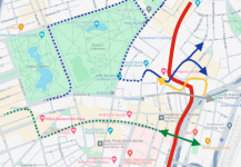
Green (North Station-LMA) and Magenta (Seaport-South Station-LMA) Lines. (I will use these two colors to exclusively refer to these two trunks.)

First of all, a small but notable distinction: From the MBTA Green Line study slides (which may be summarizing the paper above), a single Type 10 car (388 passengers crush load) "only" has equal capacity as two Type 7/8/9s (Type 7s have 269 crush load per car, Type 8s have 199, both have policy capacity 101, source). Running two-car Type 10s only doubles your capacity from today, not "quadruples" them.

The point of Green and Magenta are not only to serve Medford, Newton, Needham, etc. They serve some of the most major destinations in both the downtown core and slightly further out: North Station, South Station (Financial District), Back Bay, Seaport, and LMA.

Job numbers, using US Census OnTheMap: (Bolded are served by Green and Magenta lines)
  • DTX/Financial District/Chinatown (roughly bounded by Tremont St, Stuart/Kneeland St, the waters and State St): 122,453
  • Back Bay (between Arlington St and Mass Ave): 69,052
  • Seaport: 40,013
  • Kendall (roughly bounded by Charles St, Windsor St, Mass Ave and the river): 61,048
    • Some offices on the western edge of this region may be closer to Central than Kendall
  • LMA (cutoff slightly south of Francis St): 60,615
  • Harvard, not counting in Allston (roughly bounded by Ash St, the river, Flagg St, Putman Ave, Ware St, Francis Ave, and Mellen St): 25,270
    • Almost entirely from Harvard University itself (so I'd guess it counts the Allston campus too)
GLR really does connect the most major employment centers - it has bidirectional demand, not limited to residents along the line. Seaport and LMA are the obvious ones, but Back Bay also deserves a big mention. For this reason, I'm actually more concerned about Magenta than Green.
  • The South Station - Back Bay link is too valuable. For anyone from southside Red, Fairmount and Old Colony, Magenta is the easiest way to get to Back Bay. And in an NSRL world, Magenta (SS) may even have an advantage over Green/Orange (NS) for northside riders that are not paired with one of the Back Bay CR lines (there will be a lot of them, because Fairmount). No ring route can help with that (aside from my Mini Ring).
  • To LMA, same as above. In fact, a northside OL rider will probably find it more convenient to do an Orange-Green transfer at North Station than anything else. (Especially if the ring route winds through Harvard and Allston.)
  • Seaport should be obvious.
  • Even for D/E residents going to downtown offices, Magenta at South Station may offer a shorter walk than Green.
And none of these are solely job destinations, either. Back Bay will get its share of Copley, Newbury and Prudential shoppers. So does Seaport with its many shops and restaurants. The hospitals at LMA not only draw employees, but also patients. Downtown Boston, in addition to recreational and tourism activities, will always serve as a transfer hub for anyone who can't be helped by a circumferential line.

I want to reiterate that last point: Regardless of how good your circumferential route(s) are, there are simply many travel patterns for which radial lines are needed. As @Riverside described here, people coming from opposite ends of downtown (including commuter rail) are highly likely to find a downtown transfer the shortest and/or with fewest transfers. Yes, circumferential routes will take some pressure off existing radial subways, but I highly doubt most people will be using them to cross more than 1 or 2 radial lines.

Plus, the target audience of these routes may not even contribute to peak loads on radial lines (including Green and Magenta-equivalents) today in the first place - someone going from RL north to LMA may transfer to the 47 at Central, or just bike/drive. Subway expansions (Green and Magenta included) will also have induced demands. Then there's also the question of when you expect the Urban Ring to be built, and whether it comes before or after NSRL (NSRL without a full Urban Ring(s) will obviously dump huge loads on GLR).

Even the residential areas that GLR serves likely deserve high capacity. The D branch today already has high ridership, GLX crosses through Somerville which is one of the densest cities in metro Boston, and the Union Sq branch has long-term potential to be extended all the way to places like Watertown and Waltham.

Today's Green Line already serves as a main spine of the network, even though it wasn't intended to and doesn't have the infrastructure to cope with it. The same will be true for the reconfigured Green and Magenta lines, except they are intended to be main spines - so let's try to ensure they have the infrastructure for it.
 
I would classify it as either (1) or (2), depending on how much of an engineering mess Marginal-Hudson would potentially be, and given the absolute mess of ramps, tunnels, and narrow streets you'd need to navigate I think there's plenty of room for a proper kerfuffle there. The western section of Stuart especially is hardly what I'd consider "wide" but compared to Hudson it might as well be a boulevard.

Obviously it's not like this route has it's challenges. A junction with the Tremont St Subway would likely be more difficult and like you said may have to be a flat junction, which is not ideal. I don't think it would necessarily be catastrophic, more similar to the C/D junction at Kenmore than the Copley Junction but still not great. Obviously you're now adding surface next-to-street running as well to a seaport branch, which could reduce reliability, although again I don't think it would be catastrophic, just less than ideal.

I would say that's really the theme here: A full tunnel is obviously preferable, but the nature of the area could make that disproportionately expensive or even (practically, if not literally) impossible and as such a less ambitious alternative should also be considered.
Despite the potential issues of Hudson St near One Greenway, I remain relatively optimistic. In the worst case, it's just 1000 ft of tunneling that potentially can't be cut-and-covered - that's very short. Such short tunnels also potentiate the use of the Sequential Excavation Method (SEM) which is usually cheaper than TBM, but even if a full TBM is used, it's still short. Once you get north of Kneeland St and especially Chinatown Gate, F-Line has developed more detailed proposals for how you can tunnel under the park (which stays west of the Big Dig) to the Essex St hook-in.

If we're really aiming for (2), the flat junction is actually a very significant deal and almost destroys the whole premise of GLR:
  • Capacity: It forces interlining of the Magenta (Huntington-Seaport) and Gold (Nubian-Tremont) lines in my map.
  • Reliability: A potential 3-way flat junction. Enough said.
  • Frequency: I imagined 3-min baseline frequencies on each of Green, Magenta and Gold lines (6 min per letter). I don't think a street-running route downtown can handle 3-min headways.
I think there are ways to turn this into a flying junction, but the first and third points still stand.

There are other places where a very short street-running section can be cost-effective - most notably Grand Junction - but the characteristics of GJ and Kneeland St are very different.
 

Back
Top