Greenway Residential Building | 55 India Street | Downtown

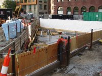
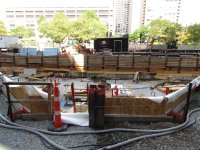
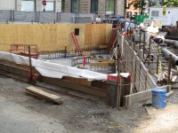
-Very weird to have this not labelled as under construction on bostonplans and a notice of project alteration was just approved.


“PROPOSED CHANGES TO THE APPROVED PROJECT

The Proponent now seeks to further update the Project by altering the layout of
the third floor as shown on the floor plans attached hereto, which alterations
include the following: (1) reducing the total number of Artist Live/Work Units from
five (5) Artist Live/Work Units to four (4) Artist Live/Work Units; (2) providing in lieu
of the additional Artist Live/Work Unit a $425,000.00 off-site IDP Contribution; and
(3) and adding an amenities space in the location of what was originally
designated as the fifth unit (collectively, the “Revised Project.” The total gross floor
area, height, dimensions and building design remain consistent with the
description of the Project previously approved and described in the development
plan.

The Proponent seeks to update the IDP commitment associated with the
approved Project to reflect the proposed changes. The July 13, 2021 AHA will be
amended, and an Affordable Housing Contribution Agreement (the “AHCA”) will be
entered into with respect to the off-site contribution.

UPDATED INCLUSIONARY DEVELOPMENT COMMITMENTBOARD APPROVED 23

Although the Revised Project is zoning compliant, the Current Developer plans to
honor the Original Proponent’s commitment to conform to the Inclusionary
Development Policy, as amended through September 27, 2007, effective October
3, 2007 (the “2007 IDP”). The 2007 IDP requires the creation of an amount of
income-restricted housing units equal to fifteen percent (15%) of the market-rate
housing units included in the Revised Project
The Proponent now commits to four (4) on-site income-restricted artist live/work
homeownership units (the “IDP Units”), and in place of the fifth previously agreed
upon IDP Unit, the Proponent will make a $425,000.00 monetary IDP contribution.
Two (2) units will be made available to households with incomes not more than
80% of the Area Median Income (“AMI”), as published by the BPDA and based
upon data from the United States Department of Housing and Urban
Development (“HUD”), and two (2) units will be made available to households with
incomes more than 80% of AMI but not more than 100% AMI.”

 
As of 8/30/25.
 

Attachments

  • IMG_9321.JPG
    IMG_9321.JPG
    5.5 MB · Views: 223
  • IMG_9324.JPG
    IMG_9324.JPG
    6.4 MB · Views: 223
  • IMG_9328.JPG
    IMG_9328.JPG
    6.2 MB · Views: 226
Its pretty crazy but this is the last empty lot on this side of the greenway besides the new one that was just created by demolishing govt ctr garage. Theres the dock square garage that is still in planning to be rebuilt, but thats about it. Been a LONG time coming. I feel like there should be some type of celebration or at least a champagne pop. Ironically the north end side is now the worst offender with multiple smaller empty lots and one massive one. Time to refocus on that side and get those filled in now! The ball keeps rolling.
 
They had a few good ideas presented in a couple different studies throughout the years on how to cover much of the ramps and stitch those parcels better into the overall greenway. Not sure why nothing more was ever done after that though. It just faded away and hasnt been brought up again in a while.
 
They had a few good ideas presented in a couple different studies throughout the years on how to cover much of the ramps and stitch those parcels better into the overall greenway. Not sure why nothing more was ever done after that though. It just faded away and hasnt been brought up again in a while.
All the over ramp projects (museums, winter gardens, etc.,) all were pricing out at 3-4 X what anyone was willing to pay. Simply far more complex construction than building equivalent facilities on terra firma. And the developers were all non-profits, so not able to foot the enormous bill. MassDOT expected the developers to all foot the entire bill as though they were just selling land. Neither the City nor the State have demonstrated a willingness to expend public funds to grease the skids on healing highway wounds.
 
All the over ramp projects (museums, winter gardens, etc.,) all were pricing out at 3-4 X what anyone was willing to pay. Simply far more complex construction than building equivalent facilities on terra firma. And the developers were all non-profits, so not able to foot the enormous bill. MassDOT expected the developers to all foot the entire bill as though they were just selling land. Neither the City nor the State have demonstrated a willingness to expend public funds to grease the skids on healing highway wounds.

Those ones werent the ones I was talking about, that was the original plan for the greenway. Later on there were some studies done showing how you could build more contiguous park space over the ramps by partially covering certain spots. None of the links work anymore, but I can find a couple images on google images. It was stuff like this.

This is one example for the ramps in front of govt center. It shows how by covering certain parts of the ramps you can add more green space but more importantly create a new path connecting the bottom part to the small patch of green at the top right. They had examples like this for each ramp parcel.

Ramp-Parcel-6_existing.jpg

100314parcel6003.jpg
 
Those ones werent the ones I was talking about, that was the original plan for the greenway. Later on there were some studies done showing how you could build more contiguous park space over the ramps by partially covering certain spots. None of the links work anymore, but I can find a couple images on google images. It was stuff like this. This is one example for the ramps in front of govt center.

Ramp-Parcel-6_existing.jpg

100314parcel6003.jpg
I was not aware of the further planning. Was that a serious effort, or just a student charette or something?
 
I believe they just asked for a couple studies of what could be done but it never really went further than that.
 
Later on there were some studies done showing how you could build more contiguous park space over the ramps by partially covering certain spots.

This is one example for the ramps in front of govt center. It shows how by covering certain parts of the ramps you can add more green space but more importantly create a new path connecting the bottom part to the small patch of green at the top right. They had examples like this for each ramp parcel.
It would be great if some of the ramps get covered to create more park space. It would be expensive, but it would also help stitch the greenway together, connecting the new North Meadow on the Greenway park with the rest of the Greenway.
 
Last edited:
It hasn't progressed, since 2015 but at the time it was a proper BRA/MassDOT planning effort, and it still has a MassDOT project listing.

This is a very old BRA link, but it still works - it should be one of the last public presentations from Jan 2015 - Im not sure the march meeting happened. Fair warning, Its a hefty pdf file.
Awesome thank you so much! Thats exactly what I was looking for.

Its much better when you can see the versions without the red highlighting.

Parcel 6
IMG_4157.png

IMG_4153.png


Parcel 12
IMG_4155.png

IMG_4156.png


It would be great if some of the ramps get covered to create more park space. It would be expensive, but it would also help stitch the greenway together, connecting the new North Meadow on the Greenway park with the rest of the Greenway.
That overlay in that link for the new pocket park is the best one Ive ever seen! Ive never seen it done this way where you can see all the streets and features on both of them like that. They did it to show the new pocket park is in what used to be a pond, but it really shows you where everything else was too, amazing. Definitely saving this!

IMG_4158.png
 
Last edited:
That overlay in that link for the new pocket park is the best one Ive ever seen! Ive never seen it done this way where you can see all the streets and features on both of them like that. They did it to show the new pocket park is in what used to be a pond, but it really shows you where everything else was too, amazing. Definitely saving this!

View attachment 67667


Mild derailment... if we're going to squeeze in pocket parks, I hope we're actually using the largest extent possible to de-pave the urban environment where we can. That new park is a brutal offender of leaving 4 lanes of traffic that are severely underutilized for a pedestrian hub. It's miserable to walk on this corner across so many lanes, with no discernable need for the highway design. Similar to those wide on-ramps in - highway design doesn't belong in urban centers.
1760456892701.png
 
Mild derailment... if we're going to squeeze in pocket parks, I hope we're actually using the largest extent possible to de-pave the urban environment where we can. That new park is a brutal offender of leaving 4 lanes of traffic that are severely underutilized for a pedestrian hub. It's miserable to walk on this corner across so many lanes, with no discernable need for the highway design. Similar to those wide on-ramps in - highway design doesn't belong in urban centers.
View attachment 67719
They could've easily blocked off that piece of Beverly St, and expanded the park. No driveways or garage doors are along that section. I suspect they left the street in for the parking spots it provides to the adjacent businesses
 
It’s quite the odd pocket park, I agree. There isn’t an opportunity to actually utilize it for anything. A small cafe with chairs would have been a better use here.
 
This park was on my typical grocery route when I lived in the north end. It opened not long before I ended up moving out of the neighborhood but I enjoyed walking through it when I did. Even though it's pretty small it made the walk much more pleasant IMO.
 

Back
Top