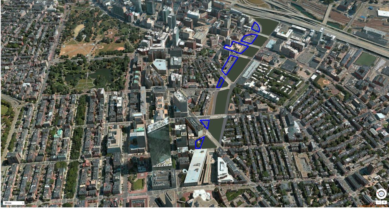
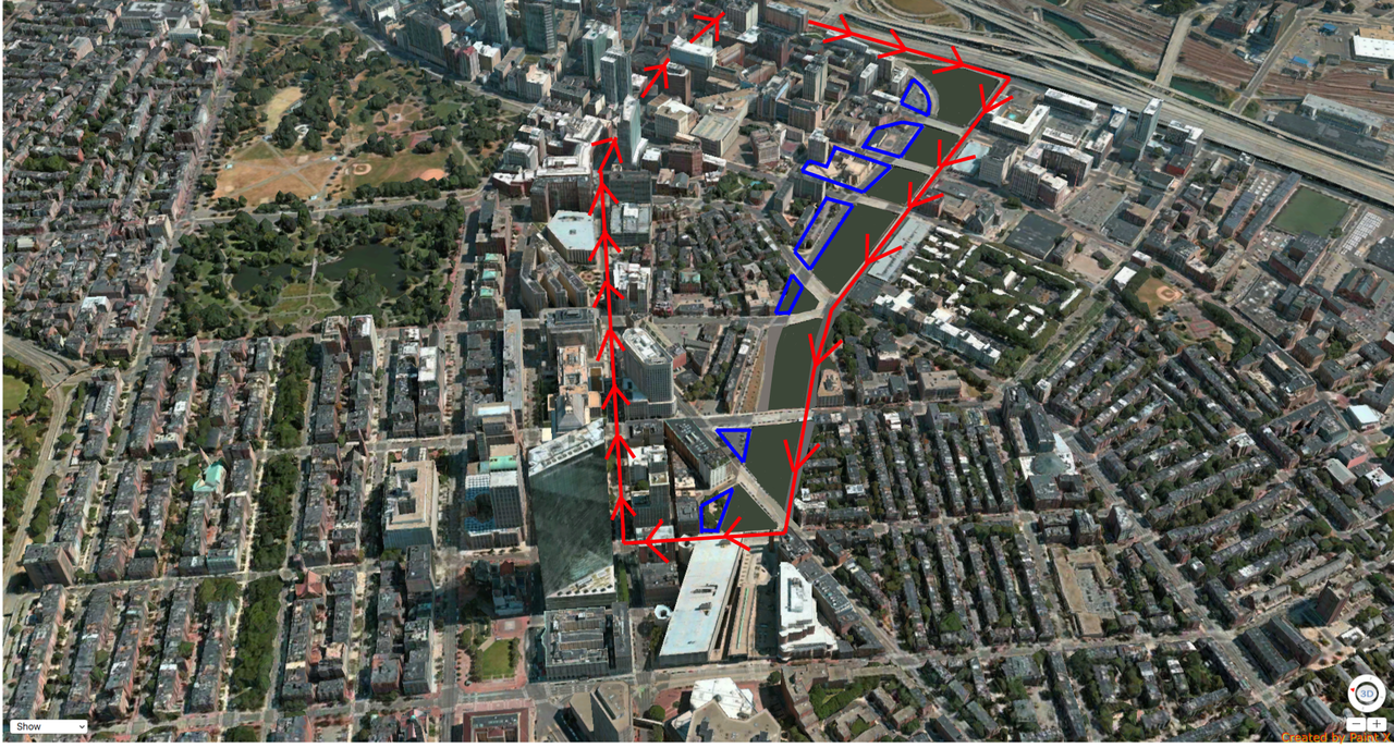
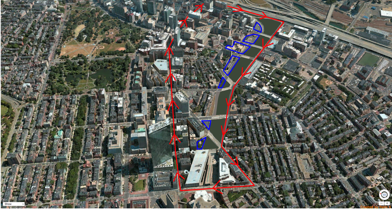
Lyrik Back Bay | 1001 Boylston Street (Parcel 12) | Back Bay

I'm a little befuddled by the over-the-top reaction here as well. Y'all have stood on a highway overpass before, right? It doesn't matter how many trees or granite benches they put in, this is going to be a loud, windy spot overlooking a bleak grey expanse. The goal should be to hide the pike, not pretend it's the Grand Canal.

Have you hung out at Portal Park near the garden? It's none of the things you describe. And it's not as large or as thoughtfully executed as what's rendered for Parcel 12 which has various levels, has retail on two sides, and appears to be deeper.
 
Have you hung out at Portal Park near the garden? It's none of the things you describe. And it's not as large or as thoughtfully executed as what's rendered for Parcel 12 which has various levels, has retail on two sides, and appears to be deeper.

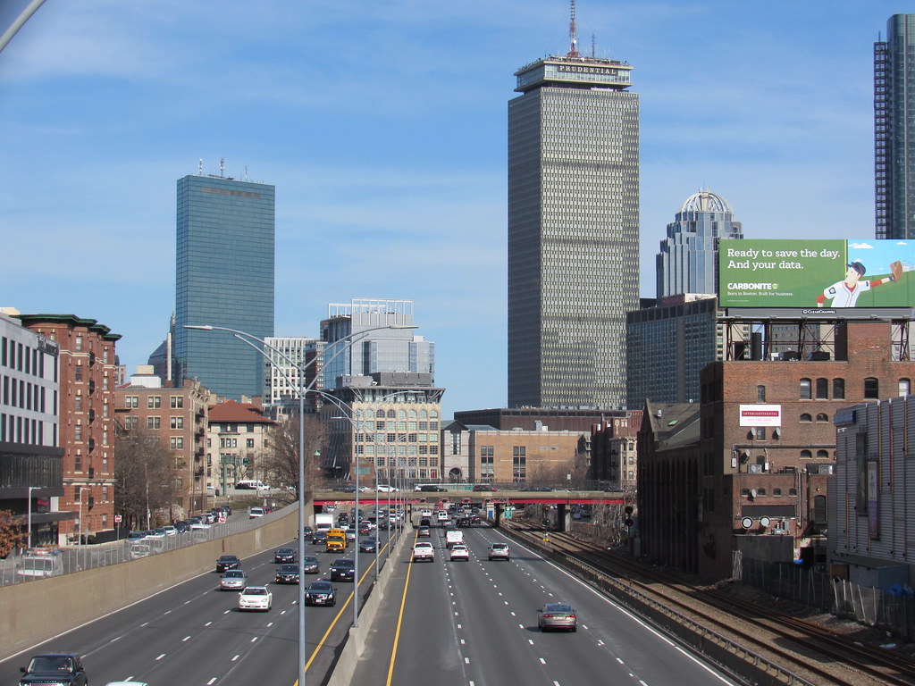
Yeah, the one-floor retail podium and glass wall over the Pike will help to keep the wind and noise back from the Parcel 12 plaza.

Also, to Lrfox's point, the current Google street view of Portal Park shows 40+ people (who look to be mostly construction workers presumably from the Hub on Causeway site next door) sitting in the park eating lunch. Once the building next door is finished those construction workers will likely be replaced with office workers. That's good usage! Especially considering that the layout of Portal Park is far from ideal...
 
Sorry for the sidetrack, but are there still nightclubs on Landsdowne Street? I am dating myself, I know.

If the Alley is now gone, too where does everyone go party?
 
I always wonder when they turn a bridge into a regular street by building up to it how do they maintain or replace them? Chicago has tons of roads that are really bridges it seems tough to do maintenance on these.
 
I'm into this idea, provided we don't repeat the mistakes of the greenway: we don't need continuous roads on both sides of the park, and we don't need the surface streets to directly track the turnpike below (this would undermine the 'knitting together' of decking).

Herald OR Marginal, flatten the Bowker, connect Newbury St. across a new Charlesgate, probably one more crossing and some re-work at BU where those long low buildings are on Cummington Mall and boom you're done.

If we undertook something like this, Boston would have among the most beautiful connected park systems of any city in the world.

Agreed. Spending billions just to put surface roads over the highway is so dumb. The Greenway would be so much better if there weren't streets on both sides and other streets cutting through the park every block. Drivers have taken enough money and land in this city and state. Time to start designing Boston for people, not cars.
 
Agreed. Spending billions just to put surface roads over the highway is so dumb. The Greenway would be so much better if there weren't streets on both sides and other streets cutting through the park every block. Drivers have taken enough money and land in this city and state. Time to start designing Boston for people, not cars.

That works only if you don't plan on lining any of that park with buildings. Those buildings would logically need access from somewhere.
 
Agreed. Spending billions just to put surface roads over the highway is so dumb. The Greenway would be so much better if there weren't streets on both sides and other streets cutting through the park every block. Drivers have taken enough money and land in this city and state. Time to start designing Boston for people, not cars.

I think you're missing the point a bit. What's being proposed is a surface street down the center of the Pike decking to replace both Herald and Marginal, with new developments on either side of the street grounded on at least some terra firma (much of which would be the former Herald and Marginal streets).
 
I think you're missing the point a bit. What's being proposed is a surface street down the center of the Pike decking to replace both Herald and Marginal, with new developments on either side of the street grounded on at least some terra firma (much of which would be the former Herald and Marginal streets).

Exactly, plus tapping into some undeveloped adjacent parcels, surface parking lots and underdeveloped parking structures. There is a lot of underutilized terra firma there if the two streets can run over the pike.
 
Sorry for the sidetrack, but are there still nightclubs on Landsdowne Street? I am dating myself, I know.

If the Alley is now gone, too where does everyone go party?

There are bars but not clubs per se, though they're the kind of bar that has a lot of dancing. You have Cask on one end which has a pretty large dance floor in the back, then the House of Blues at the midblock, and then on the eastern end Lansdowne and the other bars do get pretty rowdy.

I'm holding out hope that there will be more bars and clubs along lower Boylston St. when it's fully built out. There's still the Star Market and parking lot, the gas stations, and Tasty Burger lots to redevelop. I think it'd be the perfect stretch to inject some nightlife.
 
This would be the easiest solution to decking this stretch of the pike. Stuart st is already the road that heads downtown, Herald st would continue the loop from downtown back to Copley, you could either keep Herald where it is or extend it up a couple streets as shown, there doesn't need to be a second road as Stuart st is used to go back downtown.

Marginal st along with the lots next to it are used as the developable land because they are on terra firma. The decking that goes over the pike would only have a park and walking path on it, no roads or buildings go over the pike with this model.

If we wanted to use this route as a park this would be the best model. If the numbers make sense later on and developers can build over the pike then they can do that instead. I think is important to have this on the table though, so if there is not going to be development over this stretch of the pike we can still do this so were not always left with the gash. As the simplest solution it makes the most sense because it uses an existing road (Herald), the decking over the pike is only used for the park no buildings or roads are built over the pike, and the old Marginal st and empty lots are combined for development.


Then obviously you could keep going down Columbus or across Dartmouth or any other number of options, it opens up a much better flow of traffic for getting between downtown and back bay/copley vs what we have for options today when driving.
 
Last edited:
An easier solution would be to reverse the traffic flow on Stuart. Boylston turns into Essex and provides flow from Back Bay through Downtown to South Station. Kneeland/Stuart flows in both directions up to Charles, until it pushes everyone traveling west onto Charles and from which they need to turn onto Park Plaza/St. James. If the objective was to provide for additional flow out of downtown, then the city simply has to change the flow on Stuart to flow west -- which would then bring traffic from Downtown to the Pru at Huntington.
 
Yea. This was in regards to a surface street and park above the pike if its decked. Those buildings in ink block need Herald st because they front it, so that can just be used as the surface road. Reversing Stuart can work, but making Boylston a 2 way street can also. Maybe making Boylston 2 way along with using Herald would be the best plan. I shared a globe piece a while ago about how 2 way streets make city streets safer and we had talked about which streets in Boston should be 2 way. I think that could definitely help also.
 
Yea. This was in regards to a surface street and park above the pike if its decked. Those buildings in ink block need Herald st because they front it, so that can just be used as the surface road. Reversing Stuart can work, but making Boylston a 2 way street can also. Maybe making Boylston 2 way along with using Herald would be the best plan. I shared a globe piece a while ago about how 2 way streets make city streets safer and we had talked about which streets in Boston should be 2 way. I think that could definitely help also.

I don't think any of the Ink Block buildings are dependent on Herald Street. Ink 1 and 2 have access from Harrison. New tower under review for the Albany corner will have access from Albany, I believe. Herald side just has windows.
 
Didn't we have this conversation like 2 years ago?
 
Theres been a few times. I think its coming back up because air rights projects are finally moving forward for the first time in... forever. But yea it is heading off topic.
 
I meant to post this earlier in the week (2 April). Saw cores being drilled at the western entrance to the I-90 Prudential tunnel.

Hopefully someone is decking soon.

2_i90_pru_cores_2_apr_2019.jpg


1_i90_pru_cores_2_apr_2019.jpg
 
Last edited:
I love this. Only two small changes:

-Bus shelter needs to be bigger
-Absolutely no vehicle loading on Mass Ave in front of the bus stop. That only invites illegal parking in the bus stop. Should all be on the side street
 
Any of you ever go to the BCDC weekly meetings? This project is on the docket tonight.
 
Insomnia last night had me realizing I have never seen a full map of all of the air rights parcels drawn out. After a bit of sleuthing I found this 2000 document from when they drewout all of the parecls and numbered them. the first full map denoting each parcel is on pg 14 followed by breakdowns of each section starting on pg 23.

I figured some others on this form would be interested in this.

http://www.nabbonline.com/files/Turnpike_Air_Rights_Civic_Vision.pdf
 

Back
Top