Massachusetts Turnpike/I-90 (Current Projects, Conceptual Improvements, & Long Term)

themissinglink

Active Member
Joined
Jan 13, 2018
Messages
839
Reaction score
2,623
I'm starting this new thread about the Mass Pike since there isn't a dedicated thread for the Pike itself. We've got a thread for the Allston project, but this thread is more of a catch-all thread for all things Pike-related, whether it's an ongoing project, a long-discussed concept, a significant traffic incident, or your own idea(s) for improvements. The Pike is more than important enough and gets discussed enough on aB to warrant its own dedicated thread, IMO.

A recent project to minorly improve Exit 41 in Westfield was completed earlier this month. The project added a new right-turn signal and new pavement markings.
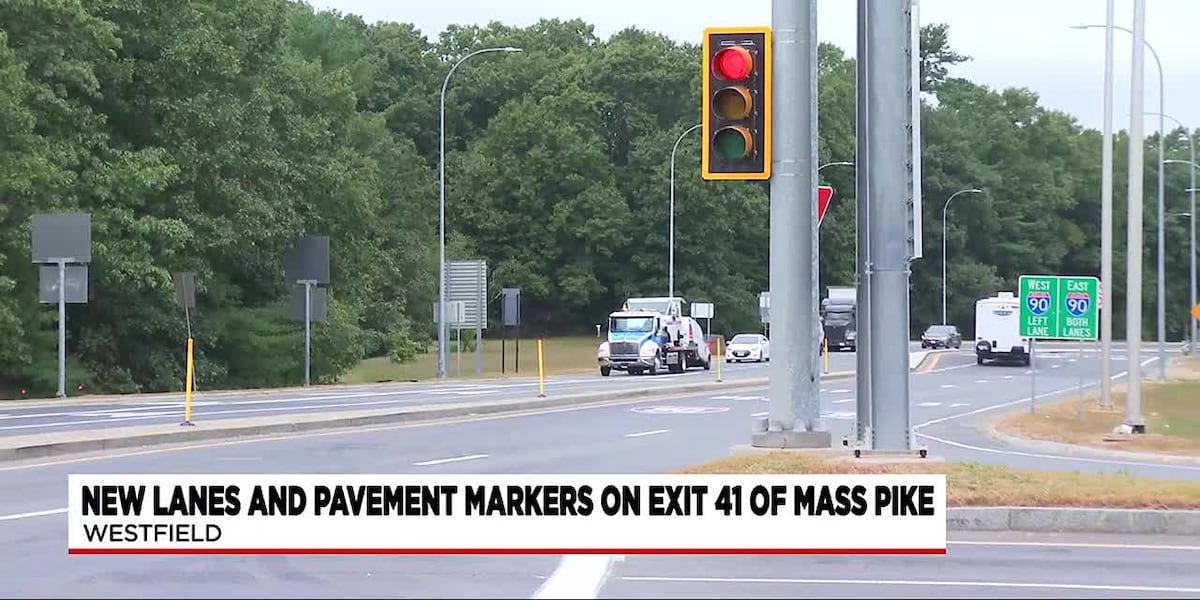
A study completed in 2021 for the City of Westfield explored more significant and intensive modifications to exit 41. However, the improvements outlined in the study were not part of this project and it's unclear if they are still being considered.
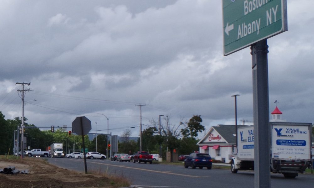
One of the improvements that was looked at in the study was a potential new onramp from Westfield Industrial Park Road to I-90 eastbound. This new ramp would provide access to I-90E from the industrial park without funneling traffic (and especially trucks) through the US-202/MA-10 & Friendly's Way signalized intersection.
onramp.JPG


Reconfiguring the intersection with Arch Road or even outright relocating Arch Road was examined in the study.

arch road 1.JPG

arch road 2.JPG


Another proposal from the study is a rotary/roundabout that would replace the signalized intersection at US-202/MA-10 & Friendly's Way. I could see this somewhat improving the current traffic situation, although it would probably be a nightmare for pedestrians and cyclists (but the current setup isn't much better).
rotary.JPG
 
Last edited:
Yesterday afternoon, there was a large oil spill on North Elm Street in Westfield, shutting down both Exit 41 and US-202/MA-10 for hours. The oil spill caused major traffic chaos and congestion in the surrounding area, as drivers attempted to find an alternate route. The exit ramps as well as North Elm Street did not reopen until after midnight.
 
They've got to get rid of the signalized intersection at the I-291 exit. That's got to be the single worst-configured Pike interchange out there.
Agreed, I'm surprised that it's persisted this long. Do you know if there have ever been any proposals for replacing the intersection with a full interchange?
 
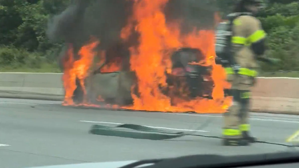
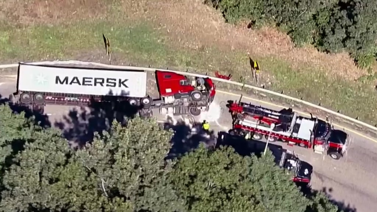
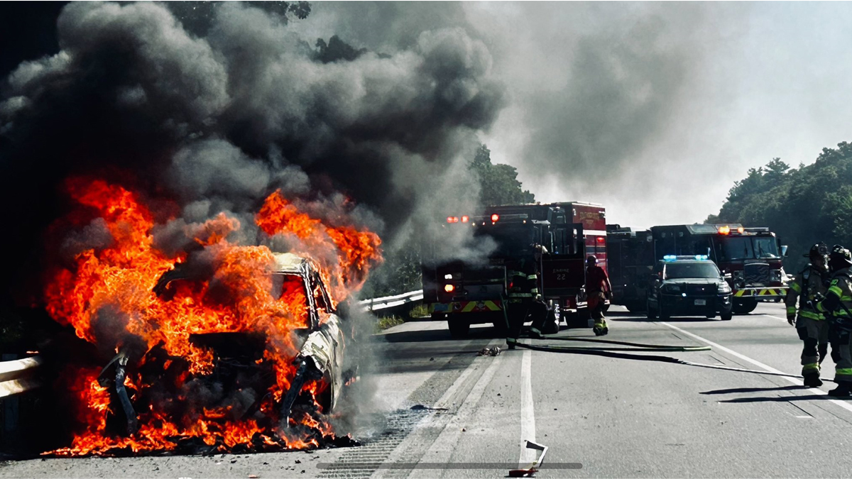
There's been a lot of destruction and drama on the Pike in the last few months. I know there's almost always insanity like this occurring on the Pike, but it's still crazy that there's so much destruction and danger in such a short period of time.
 
Last edited:
There's been a lot of destruction and drama on the Pike in the last few months. I know there's almost always insanity like this occurring on the Pike, but it's still crazy that there's so much destruction and danger in such a short period of time.
That's pretty horrific seeing those all lined up like that. But is this really any different than usual? This looks like the normal background rate of death and destruction. This ought to be considered intolerable, and we should shift people away from the most dangerous possible mode of transportation.

Also, if you think the Pike is bad, Massachusetts is basically the safest state to drive in. Cars are 3-4 times deadlier in Mississippi or South Carolina. And that's just counting deaths, and not all the other crashes, maimings, injuries, flipped trucks, chemicals spills, and fires.
 
That's pretty horrific seeing those all lined up like that. But is this really any different than usual?
I doubt it, as I pretty regularly see crazy stories like these about the Pike. But in the past couple of months, it seems like there have been considerably more incidents on the Pike than usual.

Either way, I can't wait until the East-West rail improvements between Worcester and Springfield are done, even though it will only be a few round trips per day. There needs to be some alternative to traveling between Eastern and Western Mass other than the Pike and Route 2.
 
An infill station on the Worcester Line in Millbury would be great, and it's too bad that a station there never came to fruition after it was seriously considered in the '90s. A station in Millbury would improve transit access to people living in Millbury, Shrewsbury, Grafton, Auburn, and some neighborhoods in Worcester. It would also provide easy access to/from the Pike, as Exit 91 is less than a mile from the station site. The Pike badly needs better access to the Framingham/Worcester line, and a station in Millbury would solve that problem for the most part. It's been a long time since a station in Millbury was last considered, I hope the MBTA looks into re-studying it sometime soon.

This is how Millbury station was depicted in the March 1996 Worcester Commuter Rail Extension FEIR:
Millbury 1.JPG
Millbury 2.JPG
 
Last edited:
An infill station on the Worcester Line in Millbury would be great, and it's too bad that a station there never came to fruition after it was seriously considered in the '90s. A station in Millbury would improve transit access to people living in Millbury, Shrewsbury, Grafton, Auburn, and some neighborhoods in Worcester. It would also provide easy access to/from the Pike, as Exit 91 is less than a mile from the station site. The Pike badly needs better access to the Framingham/Worcester line, and a station in Millbury would solve that problem for the most part. It's been a long time since a station in Millbury was last considered, I hope the MBTA looks into re-studying it sometime soon.

This is how Millbury station was depicted in the March 1996 Worcester Commuter Rail Extension FEIR:
View attachment 56307View attachment 56308
Man I wish that would have existed when I was taking the CR into Boston. It would be closer to where I live in Grafton than Grafton Station itself. I'd want to see a bridge over to 122 to the south, however. The 20/122 interchange can be a bit of a nightmare.
 
There's been a lot of destruction and drama on the Pike in the last few months. I know there's almost always insanity like this occurring on the Pike, but it's still crazy that there's so much destruction and danger in such a short period of time.
The Pike used to be heavily patrolled and was a likely spot to get pulled over for speeding. I don't see that anymore. It seems enforcement has declined. Anecdotal, but sharing in case others have their own.
 
The Pike used to be heavily patrolled and was a likely spot to get pulled over for speeding. I don't see that anymore. It seems enforcement has declined. Anecdotal, but sharing in case others have their own.
I didn't use the Pike much, but between ~2021-2023 when I was last driving in MA (Mostly on Rt 2 or 495) I don't remember seeing basically any staties doing speed enforcement on highways, maybe a single digit number of times at most over 2-3 years.
 
I'd like to see MassDOT add more and brighter lighting around all exits and interchanges. It can be a bit tough in some spots because there lacks any sort of lighting.
 
The location of that proposed Millbury station’s parking is now a solar power project. Not an insurmountable problem, since the panels could be relocated to canopies over the parking.
 
I didn't use the Pike much, but between ~2021-2023 when I was last driving in MA (Mostly on Rt 2 or 495) I don't remember seeing basically any staties doing speed enforcement on highways, maybe a single digit number of times at most over 2-3 years.
I drive The Pike fairly regularly between Boston and Worcester and while you'll occasionally see a MSP on the side I rarely see them pulling people over. They mostly seem to put MSP out there as a "we still exist speed check". Tap your brakes and then accelerate once you're past. They also generally sit in a handful of very well known spots.

Also the rise of GPS maps and Waze and Google Maps tracking where speed traps are seen has sort of taken away the surprise element that made these things cost effective.
 
The Mass Pike Extension needs one or more westbound off-ramps and eastbound on-ramps on the segment between the Central Artery and the Allston-Brighton exit. As most of you are aware, the Pike extension in this stretch was only designed to have eastbound off-ramps and westbound on-ramps. Presumably this was done to funnel workers in and out of Boston from Metrowest, most notably the Prudential Center complex that inspired the extension of the Pike east from 128 into downtown Boston.

There have been two studies done in the past 30 years to consider westbound off / eastbound on locations. According to the Massachusetts Turnpike Boston Ramps and Bowker Overpass Study done in 2015, legislation was authorized in 1995 that directed the Massachusetts Turnpike Authority (now folded into the Massachusetts Department of Transportation [MassDOT]), the Boston Transportation Department (BTD), and the Boston Redevelopment Authority (BRA) to conduct a joint study to provide an eastbound on-ramp and/or a westbound off-ramp on the Massachusetts Turnpike Extension between Chinatown and the Fenway area. The result of this legislation was the Boston Extension Ramps Feasibility Study, which was released in 1997. The purpose of this study was to determine the feasibility of adding an additional ramp or ramps to the Massachusetts Turnpike Extension in order to provide improved access between the Back Bay and Logan Airport and the emerging commercial area in the Seaport District.

The eight alternatives identified in the 1997 study:

Alternative 1 – Arlington Street Eastbound On-Ramp - The Arlington Street on-ramp alignment would begin at the Arlington Street/Tremont Street intersection, parallel Herald Street, and merge with the Boston Extension of the Massachusetts Turnpike just west of the South Bay interchange.

Alternative 2 – Westbound Off-Ramp at Harrison Avenue/Marginal Road - A proposed Central Artery/Tunnel Project ramp would provide egress from the Massachusetts Turnpike westbound to the Harrison Avenue/Marginal Road intersection in Chinatown.

Alternative 3 – Berkeley Street Westbound Off-Ramp - The Berkeley Street off-ramp alignment would begin in the vicinity of the South Bay interchange and terminate at Berkeley Street just south of Cortes Street. This alignment would require closure of the existing Arlington Street westbound on-ramp.

Alternative 4 – Stuart Street Westbound Off-Ramp - The Stuart Street off-ramp alignment would begin in the vicinity of the South Bay interchange and terminate at Stuart Street in the vicinity of the John Hancock Air Rights Garage at Trinity Place (a small intersecting street). This alignment would require the closure of two existing Boston Extension ramps: the Arlington Street westbound on-ramp and the Clarendon Street westbound on-ramp.

Alternative 5 – Boylston Street Eastbound On-Ramp - The Boylston Street on-ramp alignment would begin at the Bowker Overpass and would merge with the Boston Extension just west of the existing Massachusetts Avenue overpass.

Alternative 6 – Brookline Avenue Eastbound On-Ramp - The Brookline Avenue on-ramp alignment would begin at the existing Brookline Avenue overpass in the Kenmore Square area, run parallel to Lansdowne Street, and merge with the Boston Extension.

Alternative 7 – Newbury Street Westbound Off-Ramp - The Newbury Street off-ramp would begin in the vicinity of the Massachusetts Avenue overpass, run parallel to Newbury Street, and terminate at Commonwealth Avenue at the Bowker Overpass. This alignment would require closure of the existing Massachusetts Avenue westbound on-ramp.

Alternative 8 – Brookline Avenue Westbound Off-Ramp - The Brookline Avenue off-ramp alignment would begin in the vicinity of the Bowker Overpass, run parallel to (and possibly within the right of way of) Newbury Street, and terminate at Brookline Avenue just south of Kenmore Square. This alignment would possibly require closure of the existing Massachusetts Avenue westbound on-ramp.

The 2015 study then explored further Alternatives 3, 4, 5, and 8 from the 1997 study in greater detail. The main goals from the 2015 study related to the Pike ramp alternatives that were developed through previous study efforts and the associated public process:
• Reduce traffic within the study area on the arterials and local streets.
• Improve highway connections between Back Bay and crucial locations to the east, including but not limited to the Seaport District and Logan Airport.
• Improve regional highway connections to the LMA without having an impact on local roads.

Unfortunately the 2015 study concluded there was no single alternative that is recommended for further study or implementation. There were no alternatives that met the study’s goals and objectives. The estimated construction cost of the alternatives could not be justified, since no one alternative for the Back Bay Ramps satisfies the goals of the study.

Given the explosion of development in the Seaport since this study was conducted in 2015, I think these conclusions reached should be revisited. Further, most traffic is funneled through Storrow Drive to make the westbound off/eastbound on connections currently omitted from the Mass Pike, or vehicles need to take the convoluted “U-turn” ramp at the Allston-Brighton exit to exit into Back Bay. This causes unnecessary congestion and delay onto a Storrow Drive roadway that is already beyond capacity.
 
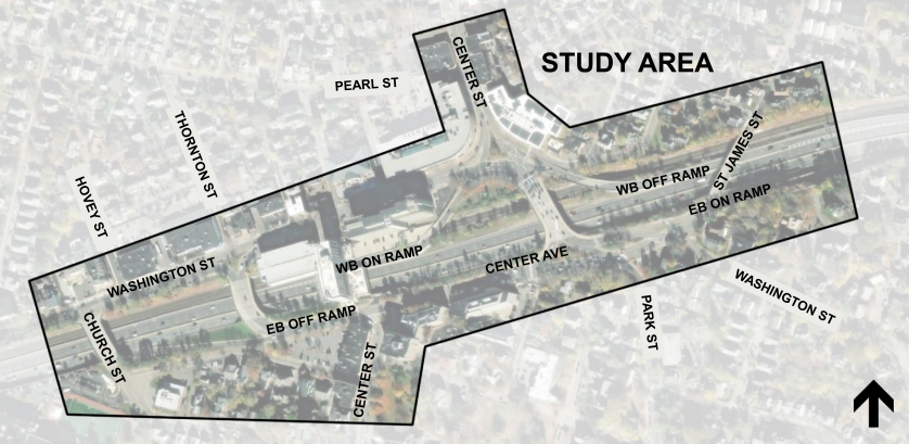
These changes are primarily focused on safety concerns and involve an upgrade to one traffic signal and the addition of another, quite different signal operations, a marked change in the use of lanes via different pavement markings, and new signage in and around the Newton Corner circle.
 

Back
Top