nicanbot
Active Member
- Joined
- Jun 18, 2019
- Messages
- 176
- Reaction score
- 245
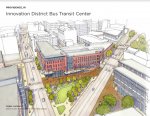
Not sure if a "public spaces" thread would be better to host the KP makeover and projects like this, but in any event wanted to put this project out there...
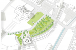
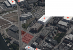
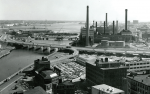
Recently released proposals would transform Crook Point Bridge into pedestrian pathway, park. RIDOC put it on the docket to demolish and there was some "backlash" so the city issued a call for proposals to repurpose it using the 6 million demolition cost. I think some of these are pretty neat. Would be great to be able to walk across.
Here is some more detail on each: City of Providence Crook Point Bascule Bridge - City of Providence (providenceri.gov)
Last edited:
")