Equilibria
Senior Member
- Joined
- May 6, 2007
- Messages
- 7,229
- Reaction score
- 8,759
LOI: https://bpda.app.box.com/s/k791htojhi8zgz16cda5xekrejuy3nmq
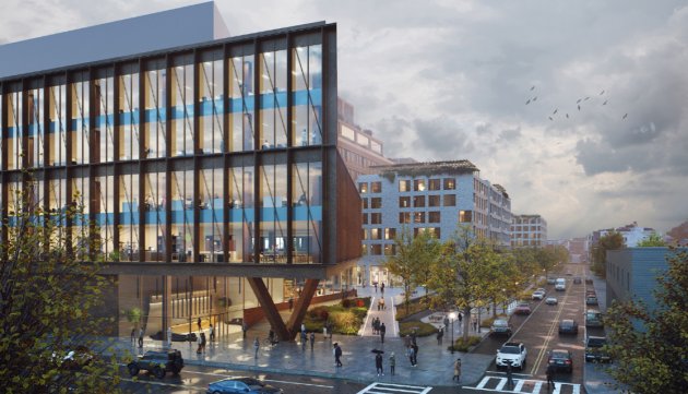
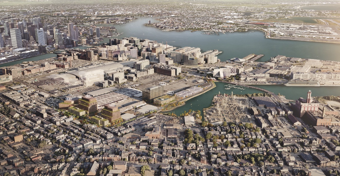
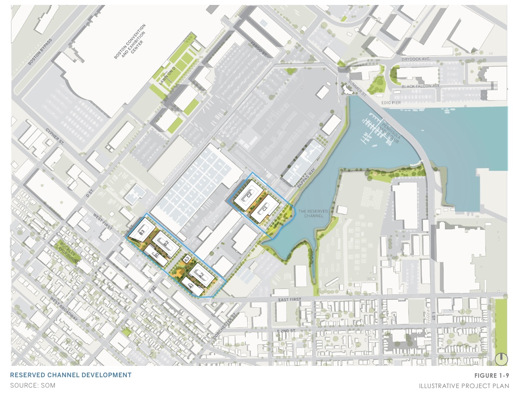
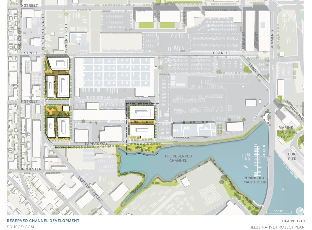
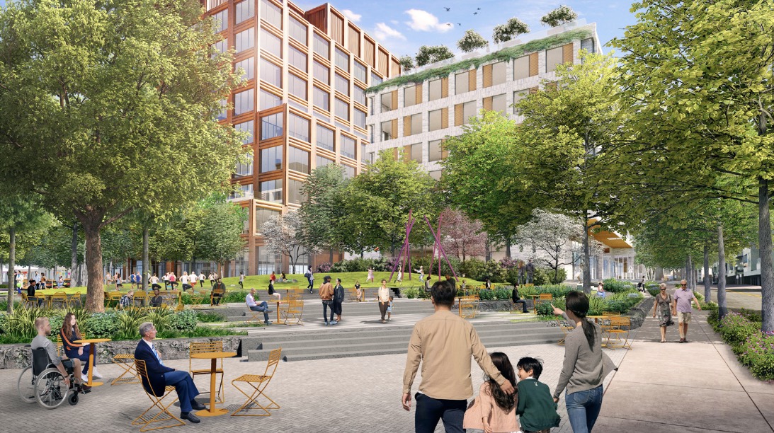
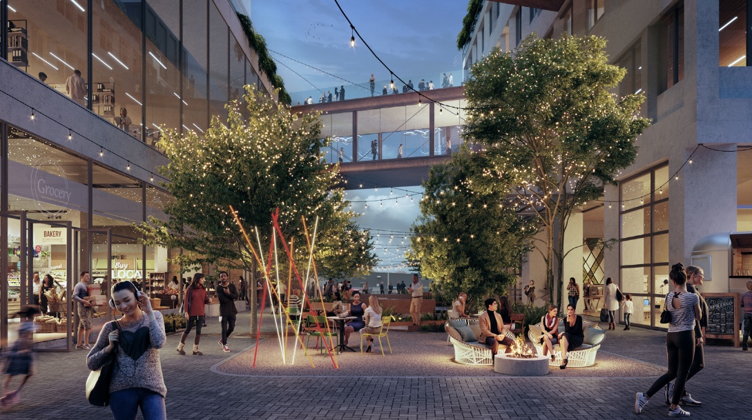
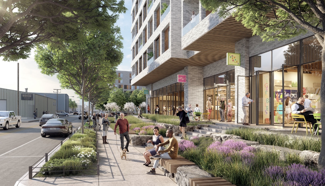
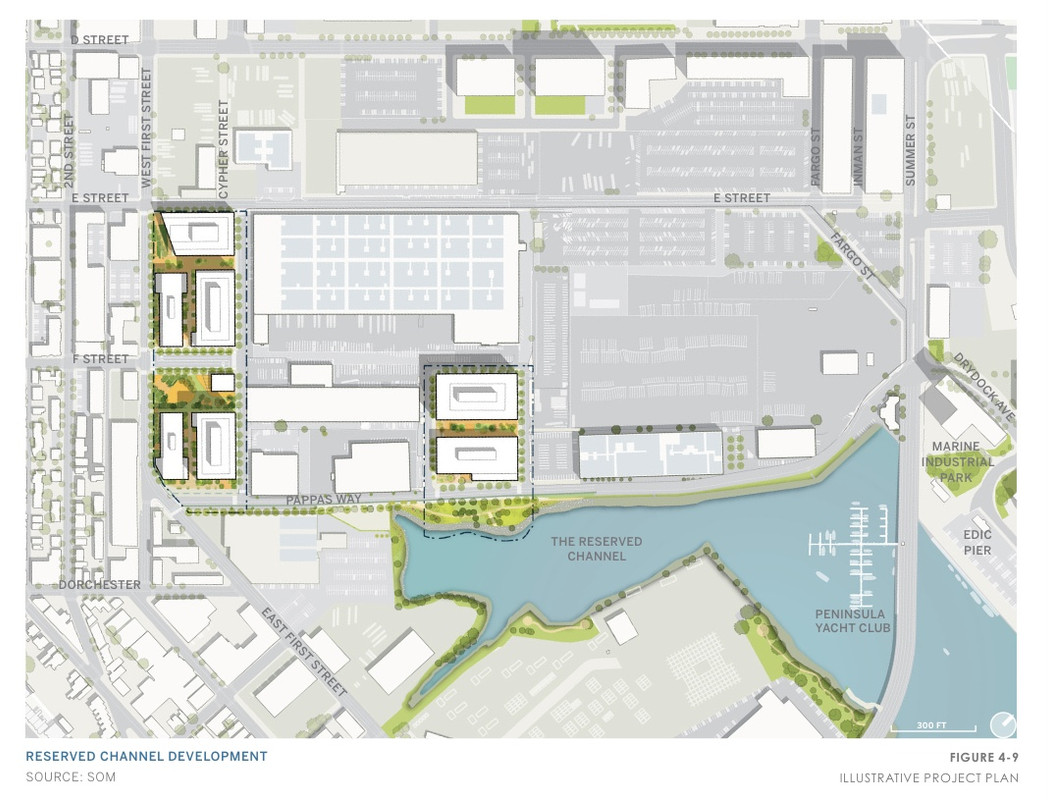
I can't find documentation for any of the charettes that would presumably have some models/sketches (and even when LOIs include a map the BPDA never includes it for download), but the 1.7 million square feet in 7 buildings would be placed somewhere along 1st, Pappas, Cypher, and E. Obviously 1.7MSF is a lot, and they're going to run up against two major potential obstacles: Massport may be looking to include some of this land in the swap with USPS that would allow MassDOT to build SSX, and MassDOT and Massport are currently collaborating to connect Cypher to E to improve the truck route from the South Boston Haul Road to Conley Terminal. They're building that to insulate truck traffic from development, so I can't imagine MassDOT would be exicted that a developer wants to drop a ton of jobs and housing right on it from the moment it opens.
Also, given the experience of the 776 Summer development down the street, I assume this would see a big size reduction through negotiations with the neighborhood, but let's see what they propose in the PNF.