Worcester Infill and Developments

Wow that Mt Carmel church was beautiful. So sad that buildings like these are lost forever. Poland and Germany are painstakingly rebuilding old buildings/neighborhoods that were destroyed in ww2 building by building, meanwhile in 2023 were still demolishing buildings like this and refuse to rebuild penn station.
It was beautiful. So was Notre Dame. Both are sadly now gone and their sites will eventually have mundane nondescript residential buildings. Doesn't seem like a good trade off architecturally.
 
I found the building replacing the notre dame church:


salemsquare.jpg


163 units, grocery store, commercial space, and restaurant.

https://www.wbjournal.com/article/t...artments-grocery-store-for-downtown-worcester

Its a better use of the space. The architecture is crap though. Wish we could have good architecture and good uses.
 

The architecture is every mid-size city Sheraton or Hilton built between 1995-2005. But just the grocery store is worth it. And guess what, they saved Notre Dame's Bell somewhere and will display it (!)
 
It was beautiful. So was Notre Dame. Both are sadly now gone and their sites will eventually have mundane nondescript residential buildings. Doesn't seem like a good trade off architecturally.

It's a good trade off functionally. And Mt Carmel itself might have been a nice structure from the outside but the rest of the lot was cracked up pavement and shoddy support buildings. We don't need poorly attended churches. We need renewal and housing and vibrancy
 
It's a good trade off functionally. And Mt Carmel itself might have been a nice structure from the outside but the rest of the lot was cracked up pavement and shoddy support buildings. We don't need poorly attended churches. We need renewal and housing and vibrancy


Make no mistake. It is clear throughout the city that Worcester far prefers utility and function over beauty and form when it comes to building.
 
Make no mistake. It is clear throughout the city that Worcester far prefers utility and function over beauty and form when it comes to building.

Very subjective, I much prefer some of the modern architecture than some of the alternatives, though a few are definitely ugly like 145 front st
 
Not sure where to post this, but here are some pics of the Worcester common/city square area of the city during Thanksgiving. The area was a little dead but has come a longgggg way since my WPI days. As @New England Born & Raised called out, utility/function over beauty was definitely at play here. For what it's worth, it was clean, seemed modern and walkability has improved IMO:
 

Attachments

  • 20231123_091142.jpg
    20231123_091142.jpg
    4.5 MB · Views: 71
  • 20231123_091147.jpg
    20231123_091147.jpg
    6.1 MB · Views: 67
  • 20231123_091203.jpg
    20231123_091203.jpg
    6.9 MB · Views: 71
  • 20231123_091211.jpg
    20231123_091211.jpg
    6.9 MB · Views: 76
Last edited:
Building permit for this one was approved in October so I expect to see some movement soon

 
No new development, but something for the wish list. I live in northern Worcester and if I want to bike or run to downtown I have the option to risk my life on Lincoln street or on Millbrook street and then on Groove Street. All are bike and pedestrian hostile.

There’s a patch of green between the P&W cargo train tracks leading north and I-290 with entry behind the Gateway Park parking garage on Graden Street close to WPI and at Cresent Street on the other side of I-290 in the Brittan Square area.

I don’t know who owns the land, but you can enter either direction freely and there is no signage. Lately there was a sizable homeless encampment on the northern end of this urban trail.

I think this area lends itself perfectly to become a dedicated paved bike path and an urban park. It allows you to cross I-290 via a tunnel.


bike path.png
FullSizeRender.jpeg
FullSizeRender.jpeg
FullSizeRender.jpeg
FullSizeRender.jpeg
FullSizeRender.jpeg
FullSizeRender.jpeg
FullSizeRender.jpeg
FullSizeRender.jpeg
FullSizeRender.jpeg
 
No new development, but something for the wish list. I live in northern Worcester and if I want to bike or run to downtown I have the option to risk my life on Lincoln street or on Millbrook street and then on Groove Street. All are bike and pedestrian hostile.

There’s a patch of green between the P&W cargo train tracks leading north and I-290 with entry behind the Gateway Park parking garage on Graden Street close to WPI and at Cresent Street on the other side of I-290 in the Brittan Square area.

I don’t know who owns the land, but you can enter either direction freely and there is no signage. Lately there was a sizable homeless encampment on the northern end of this urban trail.

I think this area lends itself perfectly to become a dedicated paved bike path and an urban park. It allows you to cross I-290 via a tunnel.


View attachment 46537View attachment 46538View attachment 46539View attachment 46540View attachment 46541View attachment 46542View attachment 46543View attachment 46544View attachment 46545View attachment 46546
That's the Barbers Freight Yard, owned by CSX and last used by Guilford/Pan Am in the early 1990's. It's zoned as a rail yard, and is a land hold for CSX in case they or P&W need expansion yard space in the Worcester area. I kind of doubt they're interested in greening it up, since it's their only land holding in Eastern MA that can be usefully used as an expansion rail yard and environmentally remediating it for other uses is going to be a costly proposition after a century of rail yard use seeping god knows what into the soil there.
 
No new development, but something for the wish list. I live in northern Worcester and if I want to bike or run to downtown I have the option to risk my life on Lincoln street or on Millbrook street and then on Groove Street. All are bike and pedestrian hostile.

There’s a patch of green between the P&W cargo train tracks leading north and I-290 with entry behind the Gateway Park parking garage on Graden Street close to WPI and at Cresent Street on the other side of I-290 in the Brittan Square area.

I don’t know who owns the land, but you can enter either direction freely and there is no signage. Lately there was a sizable homeless encampment on the northern end of this urban trail.

I think this area lends itself perfectly to become a dedicated paved bike path and an urban park. It allows you to cross I-290 via a tunnel.

Pro tip: take horizontal pictures.
 
Very interesting... I've always wondered about that strip of land. It's been a no man's land for as long as I remember. Also I had no clue there was an underpass over there near the 190/290 split.

That area has changed a lot. I remember when Ziffs was still nearby.
 
That's the Barbers Freight Yard, owned by CSX and last used by Guilford/Pan Am in the early 1990's. It's zoned as a rail yard, and is a land hold for CSX in case they or P&W need expansion yard space in the Worcester area. I kind of doubt they're interested in greening it up, since it's their only land holding in Eastern MA that can be usefully used as an expansion rail yard and environmentally remediating it for other uses is going to be a costly proposition after a century of rail yard use seeping god knows what into the soil there.
Thanks, I figured it was either owned by a rail company or maybe MassDot. Even more surprising that it’s so openly accessible
 
Also I had no clue there was an underpass over there near the 190/290 split.
The underpass was a freight siding to a cluster of yard-attached customers on the opposite side of 290. You can still see some tracks embedded in the backlots pavement on Crescent St.

The yard used to be very large, fanning out across the footprint of 290 in Historic Aerials' 1960 view. It was the primary interchange yard between the Boston & Maine and the two other railroads, NYNH&H (present-day P&W) and Boston & Albany in the city. B&M slowly consolidated its yards in the 60's and 70's, moving a lot of Barbers/Worcester functions to Ayer and Gardner, until it was whittled down to just a few long tracks next to the mainline. When Pan Am took over 40 years ago they downsized it even further to just a staging spot for locals, and finally closed it for good in the early-90's. Even though P&W owns the mainline through there the yard is still Pan Am/CSX property with them holding traffic and reactivation rights in it. It's not likely today that they'd have any use for reanimating it because CSX is trying to restructure Pan Am territory as "run longer trains faster and farther", but they are crunched for yard space on the ex-PAR territory because of lots of stupid land-dump decisions PAR has made in the last 40 years so they see it as a strategic hold if space gets untenable in Ayer and/or Lawrence.

Even more surprising that it’s so openly accessible
Pan Am didn't give a crap about site security, especially after they sold the mainline tracks through there to P&W back in the 80's. So it's been pretty much a free-for-all site going on decades. I don't know if CSX would be concerned enough about liability at this point to put up any fencing (it would certainly be ultra-low on their list of post-acquisition priorities), but corporately they tend not to be as negligent about restricted site access as PAR was.
 
Last edited:
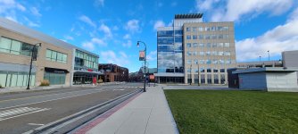
I was driving on RT 190 and noticed that most of the buildings on the North side of Saint Gobain's campus are actively being razed.

The only article I found was: https://www.telegram.com/story/busi...emolition-site-to-be-redeveloped/71933866007/


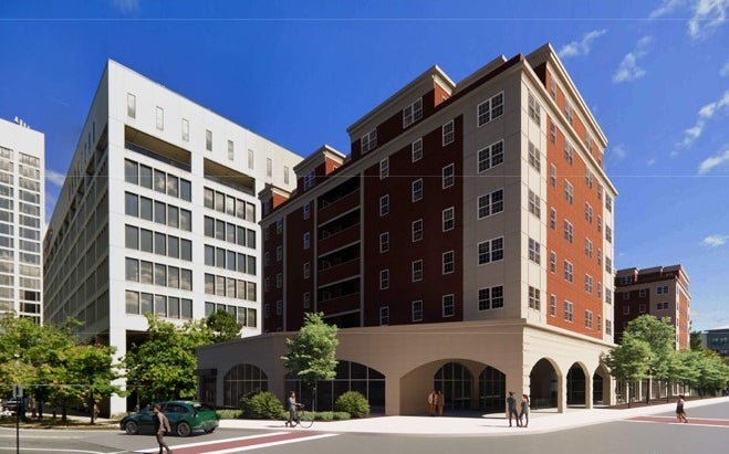
WORCESTER – If you’re driving along Interstate 190 and glance at the Saint-Gobain industrial campus in the Greendale section of the city, you may notice that some of the long-standing factory buildings that used to be the home of the old Norton Co. are being demolished.

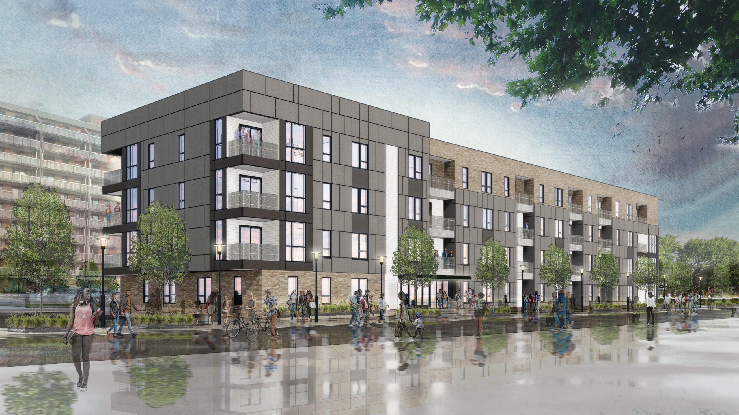
Not only are the buildings being leveled, the demolition project is also part of the largest brownfield reclamation project ever in Massachusetts and quite possibly New England, according to Worcester Business Development Corp. President Craig L. Blais.

“Right now, just for the reclamation, just for the cleanup and the demolition and all the infrastructure, we’re over $50 million just to get this site ready,” Blais said. “And then this would be upward of $500 million once it’s all redeveloped. So this is a big deal.”

The wheels of progress are rapidly turning at the spot of the city’s 138-year-old abrasives manufacturing giant and former longtime home of Norton Co., which was acquired by Saint-Gobain in 1990.

As for the land, Saint-Gobain donated the parcels to the WBDC, plus Saint-Gobain gave the WBDC a $12 million check toward the cleanup effort, Blais said.

... remainder of the article can be read online. Very interesting and HUGE potential for Worcester.
 
Very interesting... I've always wondered about that strip of land. It's been a no man's land for as long as I remember. Also I had no clue there was an underpass over there near the 190/290 split.

That area has changed a lot. I remember when Ziffs was still nearby.


I like it. A Ziff's Paperworld mention.
 

Back
Top