MBTA Red Line / Blue Line Connector

Red-Blue connector was first proposed in 1924. This would have been a tunnel extension of the Blue Line under Cambridge Street to end at an underground station at Charles Street, similar to what is being proposed today. The 1924 Globe article is at https://www.newspapers.com/clip/57692766/the-boston-globe/

Interesting article, they propose extending the Red Line tunnel from Cambridge under Charles st ! I'm pretty sure if I am reading this right the 2.5 million estimate is only the station itself not any tunnel work on either line.
 
Interesting article, they propose extending the Red Line tunnel from Cambridge under Charles st ! I'm pretty sure if I am reading this right the 2.5 million estimate is only the station itself not any tunnel work on either line.
BERY never proposed an underground station for the Red Line at Charles Street. The Red Line station at Charles Street was proposed to be elevated, just as it is today. When the Longfellow Bridge over the Charles River was constructed, it included a ramp at its east end for the Red Line to be elevated over Charles Street. To be totally accurate, the Longfellow Bridge ramp was built originally to accommodate an elevated rail line that would have continued along and above Cambridge Street and then into the old Pleasant Street portal into the East Boston (Blue Line) tunnel, but that plan was scrubbed in favor of the Red Line tunnel route under Beacon Hill to Park Street.
 
BERY never proposed an underground station for the Red Line at Charles Street. The Red Line station at Charles Street was proposed to be elevated, just as it is today.

OK major embarrassment on my part, I took the part of the article that said "the incline in Cambridge could be removed" as saying the "Red Line" incline at the Cambridge side of the Longfellow could be removed when in fact they were referring to the "Blue Line" incline on Cambridge St in Boston near Joy St removed in 1954. Sorry.
 
OK major embarrassment on my part, I took the part of the article that said "the incline in Cambridge could be removed" as saying the "Red Line" incline at the Cambridge side of the Longfellow could be removed when in fact they were referring to the "Blue Line" incline on Cambridge St in Boston near Joy St removed in 1954. Sorry.
No problem, and I apologize if I came across too harsh on that. The whole corridor has an interesting history. Originally the Longfellow Bridge was to carry an extension of (what is now) the Blue Line all the way to Harvard Square via an elevated route on Main St and Mass Ave in Cambridge (although on a map I've seen, some of the elevated route would have followed side streets in some places between Central and Harvard Square). But some parties in Cambridge objected to an elevated structure in Cambridge, and wanted a tunnel instead. About the same time, somehow the decision was made to route the new transit line into a tunnel under Beacon Hill to Park Street instead of being elevated along Cambridge Street to the Joy Street portal. I think they made the right choice, but it is an interesting "alternative history" scenario if the decision had gone the other way.
 
About the same time, somehow the decision was made to route the new transit line into a tunnel under Beacon Hill to Park Street instead of being elevated along Cambridge Street to the Joy Street portal.

I've always been fascinated by how that portal was constructed through the bottom of those buildings on Phillips and Grove streets with people still in them. The photo documentation of construction has been well preserved at the historic new england.org website. https://www.historicnewengland.org/explore/collections-access/capobject/?refd=PC017.01.03.01.0350 Cool pictures to look at on a rainy day.
 
If nothing else, the renders the Globe / Boston.com got via FOIA of a proposed station layout and design are pretty cool, and, if you believe them, confirm the demise of Bowdoin. Thankfully, nothing about the design looks to impign upon any further extension past MGH.

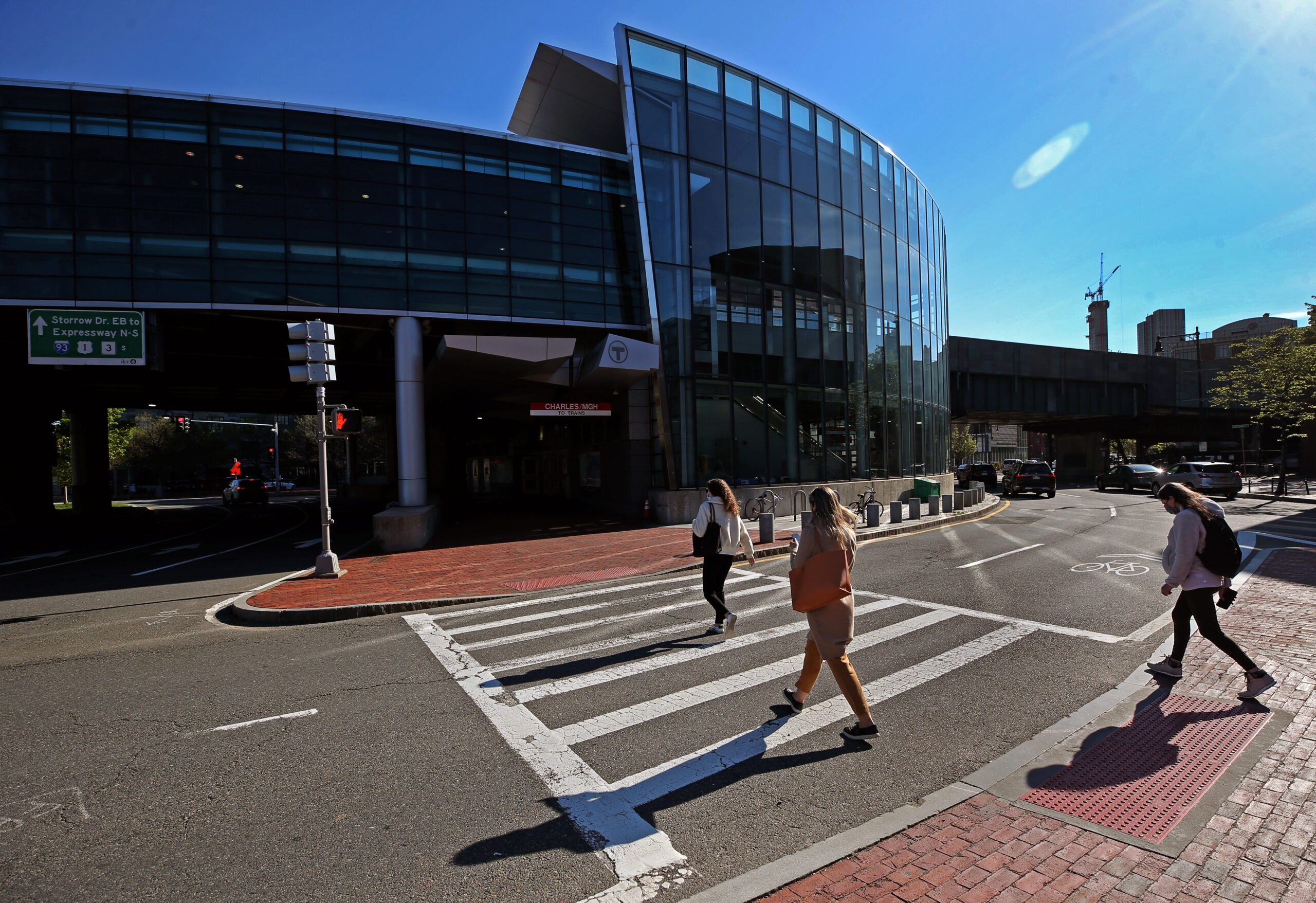
(Also, while we build this... Can we do *something* about that Storrow offramp/Charles St/ Longfellow / Cambridge St clusterf**k?)


Last edited:
1622174147422.png
1622174154921.png


1622174163187.png

MGH Entrance
 
If nothing else, the renders the Globe / Boston.com got via FOIA of a proposed station layout and design are pretty cool, and, if you believe them, confirm the demise of Bowdoin. Thankfully, nothing about the design looks to impign upon any further extension past MGH.

As a regular Bowdoin user, I say good riddance. The Bowdoin-Gov't Center-State stretch is just a waste (3 stations over the span of about 1/4 mile). I'd happily swap Bowdoin for a new stop at MGH as anything between MGH and Gov't Center is still easily accessible from either. Transfers can necessitate the close proximity of some stations (Gov't Center - State, DTX-State, Park-DTX, etc.), but without a major transfer Bowdoin is pointless in a world where the Blue terminates at MGH.
 
The rendering looks like the tunnel slopes down into the platforms, and they're pretty deep. There's inconsistency from render to render about whether there's usable space above the platforms or whether its an open cavern a la Alewife. Logically you'd have a deeper station for a mezzanine, but that level on the MGH end is a bit below Cambridge Street. The MGH diagram suggests that there's a basement level driveway above it, maybe?

Also the interior renders from the MGH end should show a wider mezzanine and stairs coming down from the other side of Cambridge Street, right? Maybe the implication of the curved wall with the straight wall behind it is that they'd bust that out at some later point? I feel like 10 years of lead time is enough to figure out SE access.

But hey, it's great to see renders at all.
 
That design has a couple of problems. The biggest one is that it would establish a 3-phase traffic signal (plus an additional phase for at-grade pedestrian crossings) on Storrow Drive itself, creating major traffic problems and pedestrian conflicts there. Also both directions of Storrow Drive would go through only one portal under the Longfellow Bridge, reducing the vertical clearance quite a bit along the outside lanes of Storrow. It would be a very shallow passageway for those lanes. You could mitigate that by lowering Storrow in a boat section through that passageway under the Longfellow but I don't see that in the renders.
51208816711_89a34d5670_o.jpg

I like my proposal because it preserves grade separation of Sorrow Drive through the area, manages vehicular and pedestrian traffic better, and has better vertical clearance on Storrow under Longfellow Bridge.
51209022340_b3852e9a59_o.jpg

I think your plan might have a fatal flaw in the east bound lane. It's shifted south into a non-existent archway and the bridge slopes down pretty aggressively there. Let a lone the new pedestrian bridge structure landing right in that pathway :/

LONGFELLOW.JPG


Would need to be a tunnel at that point. So digging out the existing roadway a bit to get headroom for two lanes seems like small potatoes in comparison. I also like that kind of consolidation of lanes instead of sprawling out through two arches (it's nice that yours at least accomplishes a similar goal there with the opened up north archway).

The intersection spaghetti is an improvement though. That proposal drew out some pretty park and pedestrian node there, but we all know it's probably be crazy dangerous (and a traffic nightmare, as much as I dream of a de-highway'd Storrow with several intersections and at grade pedestrian crossings...).
 
Last edited:
The rendering looks like the tunnel slopes down into the platforms, and they're pretty deep. There's inconsistency from render to render about whether there's usable space above the platforms or whether its an open cavern a la Alewife. Logically you'd have a deeper station for a mezzanine, but that level on the MGH end is a bit below Cambridge Street. The MGH diagram suggests that there's a basement level driveway above it, maybe?

Also the interior renders from the MGH end should show a wider mezzanine and stairs coming down from the other side of Cambridge Street, right? Maybe the implication of the curved wall with the straight wall behind it is that they'd bust that out at some later point? I feel like 10 years of lead time is enough to figure out SE access.

But hey, it's great to see renders at all.

Yeah, there are a few instances in the render where I got confused reading between the different images. It's definitely a crude proof of concept/feasibility study (sketchup model?) from the MBTA, feeling pressure from MGH wanting to put in a headhouse, and making sure that their headhouse could be incorporated into the design and not be a huge waste of money in the first place.

Though if it is getting into the specifics, I feel the curved wall and straight wall behind it might imply mechanical/staff spaces, if it's not lazy drafting. There are quite a few subway stations where there are curved walls masking a straight/rectilinear wall, which I imagine/can't confirm is much easier for excavation/structural support in subsurface construction. I'm also wondering how the escalator/stairs are going to interface with the street and existing headhouse. What they have drawn is quite an awkward (yet likely the most practical/straightforward) integration.
 
I think your plan might have a fatal flaw in the east bound lane. It's shifted south into a non-existent archway and the bridge slopes down pretty aggressively there. Let a lone the new pedestrian bridge structure landing right in that pathway :/
Would need to be a tunnel at that point. So digging out the existing roadway a bit to get headroom for two lanes seems like small potatoes in comparison. I also like that kind of consolidation of lanes instead of sprawling out through two arches (it's nice that yours at least accomplishes a similar goal there with the opened up north archway).
Thanks for the great feedback. I've revised my idea and posted it in the Crazy Highway Pitches at http://archboston.com/community/threads/crazy-highway-pitches.5916/post-401409 .
 
That connector rendering got me like

View attachment 13412

THIS.

It’s a sad indictment on the way things work in this state that this hasnt been built. You mean to tell me there isn’t money in the state budget to pay for this? Give me a break.

It should be built and the ugly green siding on the bridge heading into the RL station be changed as well.

I’m curious if there will be an indoor direct connection to the red line upstairs as there would be to the blue line.

As noted previously it’s important the design does not make future extensions impossible.
 

Back
Top