Thought that property was all raised above like it is where it meets the street. Guess I was way off.They might have to take a sidewalk/path from the adjacent condo complex to make the new outbound side platform fit, but yes it's fully feasible.
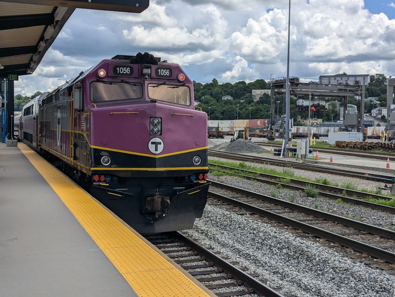
The Senate’s plan would funnel $670 million toward transportation, including $370 million for the cash-strapped MBTA. That includes $200 million to replenish the agency’s budget reserve and $100 million for training, according to a summary released by Senate leaders.
The House sought far more for the beleaguered agency. In its version of the bill lawmakers passed last month, the chamber dedicated nearly $800 million to the MBTA alone, most of which — $700 million — was tabbed for the agency’s reserve and deficiency funds.
Construction began in February 2020 and was estimated to conclude in 2023. More than five years later, the MBTA has updated its timeline to indicate that the train tracks will be shifted to their final location in early summer 2025, the new accessible platforms will come into service in late summer, and the project will be completed in early fall.
[...]
Instead of using weekend shutdowns, tasks were done overnight, which helped cut busing costs but extended the construction schedule. Keeping the station open to riders throughout the project also limited productivity.
Progress was also slowed by more specific issues, including a 2021 storm in Texas that knocked out the factory producing fiber-reinforced polymer–a modern material replacing concrete and rebar–for the station’s platforms.
Splitting the details of the ROW into two followup comments due to the character limit:
Parcels Satellite Reasonable maximum (with simple parcel purchases, parking eliminations, etc.) Prospect St - Webster Ave
(will need widening regardless)50 ft 42 ft arbitrary Webster Ave - Washington St 50-66 ft 49-66 ft 48 ft or less Washington St - Dane St 47-54 ft 37-57 ft 46 ft at the turn, 55 ft west of the turn Dane St - Park St 45-54 ft 50-56 ft 50 ft Park St - Kent St 52-81 ft 50-75 ft 70-80 ft for the most part, 50 ft or 74 ft to the west Kent St - Lowell St 52-59 ft with parcel purchase, 45-50 ft without 49-59 ft 49 ft Lowell St - Beacon St 47-70 ft 47-50 ft 47 ft to the east, 60 ft to the west Beacon St - before Porter CR 55 ft 50 ft 50 ft
- Prospect St - Webster Ave:
- Parcel: 50 ft
- This includes the Eversource substation, which will need to be dismantled in order to extend the existing GLX tracks
- Satellite: 42 ft
- Webster Ave - Washington St:
- Parcel: 50-66 ft
- Immediately west of Webster Ave, thanks to a short elongated MBTA-owned parcel, you get 66 ft
- The parcel ends around the 15 Webster Ave building, which is also where residential houses to the south start having backyards and parking immediately bordering the tracks (23-41 Clark St)
- 50 ft during this entire section, from 23 Clark St to Washington St
- Satellite: 49-66 ft
- Mostly agree with parcen boundaries (accounting for the MBTA parcel)
- The pinch point is at 15 Webster Ave / 23 Clark St, with 49 ft between track boundaries
- Reasonable maximum: 48 ft or less
- Before Washington St, you're maxed out at 50 ft without disruptions
- However, the real pinch point is where you need to cross Washington St. There's only 48 ft of width between the two diagonal buildings
- Accounting for safety margins would reduce it even further
- Washington St - Dane St:
- Parcel: 47-54 ft
- 45 ft at the curve just west of Washington St
- West of the curve, narrows from 48 ft (just beyond the curve) to 47 ft right at the Market Basket building
- Measurements include an elongated parcel owned by the City of Somerville
- The narrowing happens mostly to the north (Market Basket), where the parcel's shape is irregular
- West of Market Basket, immediately widens to 54 ft
- Satellite: 37-57 ft
- 37 ft just west of Washington St, which also accounts for crossing the building north of Washington St
- Widens to 45-52 ft between the curve and Market Basket; more lenient than parcel measurements
- West of Market Basket, 57 ft station-to-station
- Reasonable maximum: 46 ft at the turn, 55 ft west of the turn
- The section immediately west of Washington St involves a triangular parking lot owned by the City of Somerville, which can be modified with ease; but the "48 ft or less" pinch point crossing Washington St still applies
- But then you run into housing on both ends (299 Washington St and 22R Lake St), with 46 ft in-between unless you take over people's backyards
- Once you complete the turn, there are a few building-to-building pinch points:
- 55 ft between 40 Lake St and 321 Washington St
- 58 ft between 28 Dane St and 321 Washington St
- Dane St - Park St:
- Parcel: 45-54 ft
- Changes east to west from 54 ft (Dane St bridge) - 45 ft (the smoodi building) - 54 ft - 45 ft (Park St bridge)
- Satellite: 50-56 ft
- Largely agrees with parcel measurements, but with more leeway
- Two pinch points:
- 50 ft between the smoodi building and 23-27 Village St (houses)
- 51 ft between 40 Park St and 44 Park St, building to building
- Reasonable maximum: 50 ft
- See two pinch points above
- Park St - Kent St:
- Parcel: 52-81 ft
- Most of this block has MBTA parcel, but the western end near Kent St does not; the calculations below include the MBTA parcel
- 65 ft at the west end of Park St bridge, but widens to 81 ft near the midpoint of Conway Field
- The Conway Field parcel is irregular, creating a 70 ft pinch point through the western half of it
- West of Conway Field, narrows from 70 ft to 68 ft until where the MBTA-owned parcel ends
- The last stretch is affected by parking lots for Kent Street Apartments, narrowing the ROW to 52 ft
- Satellite: 50-75 ft
- Largely following parcel measurements, accounting for trees etc
- Reasonable maximum: 70-80 ft for the most part, 50 ft or 74 ft to the west
- 70 ft east of Kent St Apartments is easy; 80 ft possible by fully utilizing the MBTA parcel
- Without purchasing part of Kent St Apartments' parking lots, the western part approaching Kent St is maxed out at 50 ft
- If you get rid of about 13 parking lots there, gets you 74 ft building-to-driveway
They'd punch through the fill and retaining wall on the northerly side of the Prospect St. bridge with a reinforced double-arch, then move the abutting Eversource equipment back 10-15 feet. Webster Ave. bridge is a question mark for the overall width, but the GLX tracks would be back on-alignment from the station turnout by that point. The station would not have to be rebuilt, but the entrances would have to be converted to up-and-over instead of at grade.View attachment 62712
Apologies for the poor quality of this photo through the fencing.
I can’t quite see how they can squeeze the GL tracks through this area, unless they rebuild Union Square station. If you look closely, the GL tracks are pointing the wrong direction.
The current Eversource substation rebuild is allegedly provisioned to not block a GLX to Porter based on commitments made in community meetings. Not sure if that means they’re not further encroaching on the ROW or if the new substation will be pulled back a few feet.They'd punch through the fill and retaining wall on the northerly side of the Prospect St. bridge with a reinforced double-arch, then move the abutting Eversource equipment back 10-15 feet. Webster Ave. bridge is a question mark for the overall width, but the GLX tracks would be back on-alignment from the station turnout by that point. The station would not have to be rebuilt, but the entrances would have to be converted to up-and-over instead of at grade.
The current Eversource substation rebuild is allegedly provisioned to not block a GLX to Porter based on commitments made in community meetings. Not sure if that means they’re not further encroaching on the ROW or if the new substation will be pulled back a few feet.
If your point is that it's a shame it won't be preserved, I don't think I agree. I highly doubt anything substantial from 1928 is left on the car, and by now it's probably more a hodgepodge of spare parts and scrap than anything historical. It's historical relevance is little more than a fun bit of trivia.The high bid is by someone named “Halifaxhustlers”… That inspires confidence.
Senators rejected an amendment from Minority Leader Bruce Tarr that would have required the MBTA to, within the next year, craft and submit a "comprehensive plan" to achieve a state of good repair, then update the roadmap annually for at least five years.
The T in 2023 estimated it would cost $24.5 billion to fix all of its assets that at the time were not in a state of good repair.
The Senate tackled the majority of the 317 amendments to the bill with a pair of bundles, which rejected or adopted dozens of changes to the bill at once with a single unrecorded voice vote.
The "yes" mega-bundle added language calling on the MBTA to study expanding the commuter rail to Buzzards Bay and extending the Orange Line to Roslindale Village.
Is this the same amount that’s in the graph above?![]()
Mass. Senate passes $1.3B spending bill, declines to tweak MBTA housing law
The Massachusetts Senate on Thursday avoided making any changes to the controversial MBTA Communities Act while advancing a $1.3 billion spending bill packed with one-time investments in education and transportation.www.wbjournal.com
If it's just a +1 the Needham ROW is tri-track width from Forest Hills to Rozzie, so the Needham Line would be singled with OLX taking the other two berths. You'd probably need to install a passing siding on Commuter Rail between some of the other stops to offset the loss of the double-track near Forest Hills, but it'll all fit. The platforms probably wouldn't be side-by-sided (after all, OLX swallowing the whole joint out to West Roxbury is the eventual end goal), but you could easily fit a single side CR platform behind the municipal lot and Citizens Bank.Is this the same amount that’s in the graph above?
Also, how are the going to cram 2+ platforms at Roslindale with an OLX? They proposed it in Focus40, so there is clearly some way, but I. just don’t see it. I also don’t see a way to fit 4 tracks through most of that section, unless they will single track the Needham line.
Axing the 77 back from Arlington Heights to Arlington Center would also be very useful in the event RLX to Arlington Heights is built. It's unnecessarily redundent to have the 77 to duplicate service between Arlington Heights and Arlington Center if the Red Line runs between the two places.Great! In my opinion, OLX to Rozzie should be the second heavy rail rapid transit expansion priority after BLX to Charles.
Personally, I’d love to see an intermediate stop at South St (I imagine being called “Arboretum”) at the very least studied. I see a value in being able to dramatically pair back bus service on Washington St even more than a +1 would facilitate and in having a premier transit access to Roslindale’s half of Boston’s best park (with a new path to access that station), even if it would be the lowest ridership stop on the Orange Line.