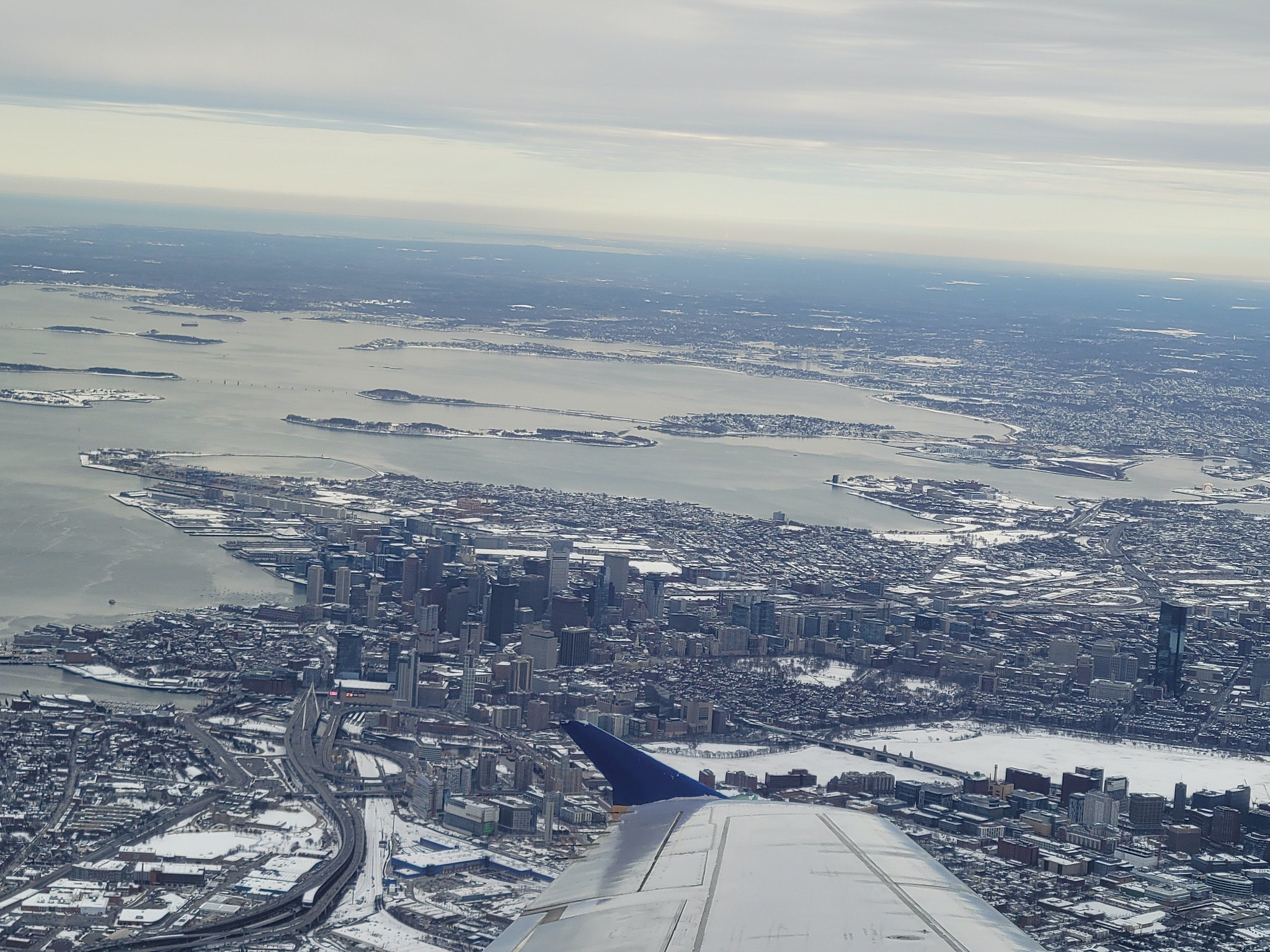
Aerials

This view is SO different today (Chinatown/Bay Village on the left, Ink Block on the right) that it took me an embarrassing amount of time to figure out what I was looking at. 😲

+1. It took me a long time too. The only moment of some recognition came when I looked at the top left and upper center to see what looks like the Seaport and then the (much longer) South Station at the curve left. What really throws me is the elongated Fort Point Channel (dry detritus channel) in the upper right - - looks like a narrow lane of empty swampy fields. I had heard that the Channel used to be much longer.
 
+1. It took me a long time too. The only moment of some recognition came when I looked at the top left and upper center to see what looks like the Seaport and then the (much longer) South Station at the curve left. What really throws me is the elongated Fort Point Channel (dry detritus channel) in the upper right - - looks like a narrow lane of empty swampy fields. I had heard that the Channel used to be much longer.

The Pine Street Inn Tower in the upper right was what made it click for me!
 
Here's roughly the same view today via Google Earth:
1611611244070.png
 
I really wish they had not Urban Renewaled the New York Streets area, or much of Chinatown... or built I-93 or I-90 for that matter...
In a parallel universe I see a Boston in which transit was a lot further developed, highways were not built, areas were not bulldozed from "Urban Renewal" projects, and density was preserved and enhanced. Those old neighborhoods had great "bones" and just needed some TLC, not obliteration. What replaced them looks empty and soulless.
 
I really wish they had not Urban Renewaled the New York Streets area, or much of Chinatown... or built I-93 or I-90 for that matter...

I really wish Adam and Eve hadn't been kicked out of Eden. But here we are.
 
Eventually the Mass Pike will be decked, and the empty areas in the old urban renewal areas filled in with, hopefully, active street walls and a pedestrian oriented street life. It will take several decades but I think the trend is strong for it to happen.
 
Eventually the Mass Pike will be decked, and the empty areas in the old urban renewal areas filled in with, hopefully, active street walls and a pedestrian oriented street life. It will take several decades but I think the trend is strong for it to happen.

Harrison is coming along nicely. The toughest nut to crack in that area I imagine will be the Castle Square apartments. Very anti-urban complex, but I don’t know how the city could get it to change.
 
The toughest nut to crack in that area I imagine will be the Castle Square apartments. Very anti-urban complex,

Is it though? The inside of Castle Square is very insulated, but the periphery on Tremont is solid. It's not the most inviting facade but its activated with the small commercial retail. Not sure how much needs to be done... its basically an enclave neighborhood like Bay Village IMO.
 
Is it though? The inside of Castle Square is very insulated, but the periphery on Tremont is solid. It's not the most inviting facade but its activated with the small commercial retail. Not sure how much needs to be done... its basically an enclave neighborhood like Bay Village IMO.

If the Tremont side could be replicated on E Berkeley, Herald, and Shawmut, I’d be super pleased with it. Though even with good retail, it likely comes no where near replacing the residential units that were leveled to build it. There’s a lot of surface parking in the interior.
 

Back
Top