Biking in Boston

Will turnover on the Boston City Council change the balance on bike issues?

Does the Boston City Council have enough power that it matters when there's a change?

I am not asking this sarcastically to criticize your question, I'm asking from relative ignorance.

I've been here long enough to know the Boston Council is weak as compared to the Mayor, but I've heard the relative weakness described at different levels. All the way up to some folks asserting the Council is effectively useless at any policy guidance or real governance of any sort; that it's really just a constituent service body. I have to admit I've never found the time to figure out if it's really that weak a body by law, or if it's just weak because the individuals have been weak.
 
I'm equally ignorant, frankly, so I'm going to double down and ask if anything changed in Cambridge's elections, too.
 
Any word on the South Bank Bridge status? It would've been nice to have it timed with all the West End/Garden/Causeway St work going on...good option for circumventing all the construction.
 
I'm equally ignorant, frankly, so I'm going to double down and ask if anything changed in Cambridge's elections, too.

http://cambridge.wickedlocal.com/article/20151104/NEWS/151108232

Small change - Dennis Benzan is out and Jan Devereux is in. I think for biking the new Councillor should be fine, though she occasionally made pro-parking comments.

For densification she is somewhat less than fine, but maybe not terrible. She's from the most suburban corner of West Cambridge and likes to talk a lot about "open spaces." I have a feeling her ideas for open spaces aren't going to be a great fit at Volpe or elsewhere.
 
Maverick does have some variety of bike cage, but it's not the more secure Pedal and Park branded type.

640px-Maverick_station_secondary_entrance_and_vent%2C_August_2015.JPG

FWIW, no actual bike cage in maverick. The glass building on the left keeps the rain off the escalator down to the platform. There is a bike rack next to it, but it's not enclosed.

Close to my heart because I had a great bike stolen from that rack last year.
 
Will turnover on the Boston City Council change the balance on bike issues?

There isn’t much that the Boston council does when it comes to bike infrastructure. Ayana Pressley held a bike safety hearing after that cyclist was killed at Mass and Beacon, but mostly they just respond to various bike infra proposed in their districts. Some positively, others negatively, such as when Linehan helped to kill the bike lanes on Broadway in South Boston. Generally it’s the executive branch that’s doing the planning and the implementation, or not as we’ve seen over the past two construction seasons. But now that Menino is dead and Freedman is in Seattle (where they just voted to spend more than > $10M/ yr on bicycle projects) it seems like momentum on city-led bicycle projects has more or less stopped.
Any word on the South Bank Bridge status? It would've been nice to have it timed with all the West End/Garden/Causeway St work going on...good option for circumventing all the construction.

I haven't seen anything on that recently. There's been a bit more attention to a bridge over the Charles in the area, but that too is looking a little dead, especially considering that the Charlestown Bridge replacement plan includes protected bike lanes.

Even so I think that a crossing at North Point Park and then a South Bank Bridge would be warranted in order to provide a clear shot into Boston for cyclists coming off of the Somerville Community Path and the Grand Junction Path. This would be just west of the commuter rail bridge.
 
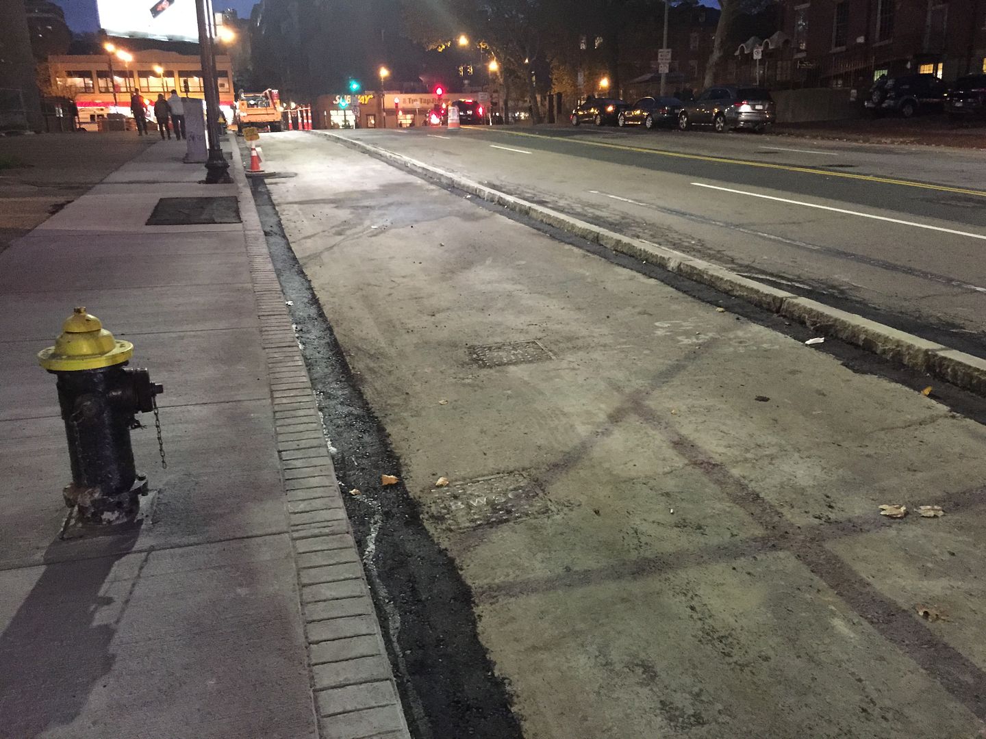
Separated bike lane taking shape on Staniford Street:

D1181E79-DEC5-48B5-8A5C-45D7801EFF67_zpssranuufw.jpg
 
As a pedestrian, I liked the median there. Its hard to cross that street mid-block (at the cross-walk) the whole way. The bike lane is probably more useful though.
 
As a pedestrian, I liked the median there. Its hard to cross that street mid-block (at the cross-walk) the whole way. The bike lane is probably more useful though.

Agreed. I cross it multiple times daily and it's still not too hard to do without the median. But I liked the safety net it provided. The bike lanes are an improvement though.
 
The article says that this is the eastern-most section from the 2011 concept depicted below, being the round-dotted "Idea A" alongside the MBTA, and being built from Short Street (the tiny segment that spans the gap as Idea A and Idea B diverge at their western edge) eastward to Constitution Beach. The eastern edge of Massport's section ended at Short Street (a logical connection/stopping point). Can anyone say what the final terminus/connection at Constitution Beach will look like?

GREENWAY%20CONCEPTS%20PLAN_4-7-2011.jpg

They’re building rail-with-trail ending in the Constitution Beach parking lot (idea a in the map), @ $750k according to the BRA's bid page.

I rode by on Sunday to take a look at construction progress but couldn't get close enough to see anything. The gates to the Greenway were locked at the Lovell and Frankfort intersection as well as where Lovell street curves to the southeast of Wood Island Station, presumably and hopefully to keep people out of the construction site.

---

Some of you should be interested in this: Boston is looking for people to join the next two years of the Boston Bikes Advisory Group: http://www.bostonbikes.org/bbag
 
Took me a while to get this done, and longer still to post it here, but I put together an annotated version of the DCR/Toole Designs presentation on Improving Arborway Bike Facilities from earlier in the Fall here - more detailed images and revised designs from the february presentations. The project area was amde smaller (nothing in Phase 1 from Center Street to South Street along the Arboretum now). For bikers, the paths on the Carriage Roads are (for now) paint only, but those carriage roads are now reversed-direction, local traffic-only streets...

Improving Arborway Bike Facilities screen grabs and write-up at my ArborwayMatters blog

Some of you might have seen this in the Casey Overpass thread...
 
Cambridge and the DCR have the 25% plans and a presentation for the next phase of the Watertown/Cambridge Greenway out. They own the whole right of way already, so the project is just finishing the designs, clearing out the old rails, doing some drainage work and then slapping down 12 feet of multiuse path. It's going to run from where the Greenway currently ends at Arlington Street to the point where the Fresh Pond Parkway path turns into a two-way separated bike lane in the Fresh Pond parking lot. The goal is to be under construction at this point next year. Pretty simple project but should be nice when it's put in.
 
Cambridge and the DCR have the 25% plans and a presentation for the next phase of the Watertown/Cambridge Greenway out. They own the whole right of way already, so the project is just finishing the designs, clearing out the old rails, doing some drainage work and then slapping down 12 feet of multiuse path. It's going to run from where the Greenway currently ends at Arlington Street to the point where the Fresh Pond Parkway path turns into a two-way separated bike lane in the Fresh Pond parking lot. The goal is to be under construction at this point next year. Pretty simple project but should be nice when it's put in.

This is a game changer for Watertown! Much like Arlington, Watertown is a very bus-reliant community with no rail transportation. Much like Arlington, its proximity to Cambridge fuels investment. Now, like Arlington, it will have a multi-use trail direct connection to Cambridge that will be heavily utilized.
 
Cambridge and the DCR have the 25% plans and a presentation for the next phase of the Watertown/Cambridge Greenway out. They own the whole right of way already, so the project is just finishing the designs, clearing out the old rails, doing some drainage work and then slapping down 12 feet of multiuse path. It's going to run from where the Greenway currently ends at Arlington Street to the point where the Fresh Pond Parkway path turns into a two-way separated bike lane in the Fresh Pond parking lot. The goal is to be under construction at this point next year. Pretty simple project but should be nice when it's put in.

Watertown was already slated to expedite the Arlington St.-Grove St. segment soon after the first segment opened to get the big Tufts Healthcare facility served with the path. It was also the furthest at the time they could go because of how long it took the Surface Transportation Board to process the abandonment (Newly Weds Foods, the last customer, was opposing it to try to wring more money out of its contract cancellation with Pan Am). Once DCR was able to buy the rest up they postponed the Grove leg to fully sync their plans with Cambridge at a bit better economy of scale.


Fresh Pond's my regular walking route, and re: the 25% design I seriously doubt the trail head is going to snake under the Waterworks driveway overpass because of the absolutely horrendous drainage issues there. Literally the only trackwork that was done in the last 30 years was replacing the constant washouts in that cut, and you can see today that the brand spanking new track panels they put in in '05-06 have already had all their rock ballast washed out and are just sitting on top of the dirt. The soil there is Jell-o consistency mush for a whole week after the rest of the Huron hillsides have dried out from a soaking rain or snowmelt. It's really awful, and not an easy solve with the reservoir right there and the water table throwing all manner of additional complications into the mix at finding a fix.

What they're most likely to do it simply dump it onto the south/Huron side reservoir path right at the ROW's closest approach from the woods, then maybe pave that lone sandy segment of reservoir path to link the rest. And leave the whole parkway-facing side as-is with the current path setup, except for fixing the missing sidewalk chunk at the driveway entrance. At bare minimum that's going to have to be the interim solution for several years because they don't have nearly enough money to tackle the drainage issues in the cut without delaying the project a few more years. And there's absolutely no reason to delay the project any longer with the property ownership properly squared and all other parts from the city line @ Mt. Auburn St. to the hook-in to the south-side reservoir path being fast and easy construction.


I cannot state more emphatically what a HUGE boon this is going to be. Arsenal might as well be out in Worcester for how utter shit every form of access is from North Cambridge to the Charles. It pisses me off every time I have to hop in the car to pick up something at Home Depot, because it's either that or the mortal terror of a walk on the Greenough Blvd. "sidewalk". Wait till they figure out the last link around the parkway + Fitchburg Line to Alewife. This thing is gonna be Minuteman II on all-day utilization. I've totally got ants-in-the-pants waiting for them to get this thing opened already. North Cantabrigians will never know how they lived without it.
 
Cambridge and the DCR have the 25% plans and a presentation for the next phase of the Watertown/Cambridge Greenway out. They own the whole right of way already, so the project is just finishing the designs, clearing out the old rails, doing some drainage work and then slapping down 12 feet of multiuse path. It's going to run from where the Greenway currently ends at Arlington Street to the point where the Fresh Pond Parkway path turns into a two-way separated bike lane in the Fresh Pond parking lot. The goal is to be under construction at this point next year. Pretty simple project but should be nice when it's put in.

What a horrible presentation. The north arrow was incorrect on all the slides and the street names were so screened that I legit had no idea where I was looking.
 
Pics from a walk on the H2O Greenway about 3 hours ago. . .

Stone trail marker, found at each trail entrance. This one is on the Arsenal St. spur behind the Best Buy driveway. Shows the complete trail connections on one side, a DCR logo and Greenway logo on the other side. Extremely well-done. You can tell they're setting this up as a 'premier' trail for eventual mega utilization, given what it connects to at both ends.
11lrgy1.jpg


Looking towards the School St. trail head.
2mo2hxe.jpg


Preserved bit of RR legacy. This is the switch stand for the spur that went to the Arsenal complex.
vwqxsk.jpg


Patent stamps on the switch stand (yes, that's an "1897" at top).
2mg0374.jpg


Looking towards Arlington St. Any Crazy Transit Pitch'ers will be relieved to know that this ROW is so freaking wide from the Waterworks to School St. now that it's been de-gunked and re-landscaped that LRT-with-trail would be a piece of cake in some future generation, if the town can successfully patch together the lapsed property lines from School St. to the Square.
ddkh34.jpg


Arlington St. trail head (the taggers have already defaced the DCR stone marker).
2ahi7p0.jpg


Across Arlington St. on the next path segment-to-be to Grove St./Tufts Health. Impenetrable giant wall of brush in the distance.
jsyem8.jpg
 
I walked this new proposed section a year ago, here's shots continuing to the north starting at Arlington Street intersection.

Looking back at the intersection with Arlington Street, probably the trickiest one in this new section. It's a five-way intersection with a really long light cycle, I'm betting they're going to do some sort of two-stage crossing for path users.
diKkEtl.jpg


An encroaching driveway by the Tufts facility.
VlUpSbQ.jpg


Quite a few locals are already using the corridor for trail running, you can see some signs of use here by the intersection with Cottage Street. I saw a couple trail runners, a couple dog walkers and plenty of tagging.
xM0sZOE.jpg


The section right by Fresh Pond could be any of the rural rail trails:
sm3p3Pk.jpg
 
Last edited:
Boston’s vision zero action plan is out, but not getting much coverage with all the MBTA drama today. It looks really promising for all road users, and it's fantastic to see some momentum starting up again after what sometimes feels like a lost year. Here are my notes from r/bikeboston on some near-term implications for cycling:

Work they plan to do in 2016:

  • Build ten miles of “high priority” projects from the bicycle network plan.
  • Write a five-year rolling action plan for implementing “high quality” bike infrastructure. I’m assuming this is going to be a list of what and when they want to build the infrastructure already listed in the bike plan.
  • Some sort of fix for Mass Ave from Melnea Cass to the bridge. This could be huge!
  • Some sort of fix at the big Codman Square intersection, also a little bit of Talbot Ave extending out to where that kid was killed.
  • Neighborhood scale traffic calming between JP and Franklin Park, and also near Codman Square.
  • “Rapid Implementation” projects in dangerous points. This should be similar to what they did at Mass/Beacon after that researcher got right hooked by a semi. Hopefully more proactive, they’ve had the data on where the dangerous points are since at least 2013.
  • Various enforcement and education campaigns. Free lights and helmets, reaching out to vulnerable communities, direct enforcement to the dangerous intersections etc. etc.
Ongoing:

  • Create a process for neighborhoods to request traffic calming from the city.
  • Investigate speed and red light enforcement cameras. Currently in Massachusetts there is no laws in effect banning or allowing them but they have the potential to tame our traffic. Less busy, expensive and racist compared to a human cop, so great!
  • Identify locations to install physically protected intersections, a concept that wasn’t really around in the US when Boston did the bike plan.
Link to the plan, which includes more details and a crash map: http://www.visionzeroboston.org/
 
  • Build ten miles of “high priority” projects from the bicycle network plan.
  • Write a five-year rolling action plan for implementing “high quality” bike infrastructure. I’m assuming this is going to be a list of what and when they want to build the infrastructure already listed in the bike plan.
  • Some sort of fix for Mass Ave from Melnea Cass to the bridge. This could be huge!
  • Some sort of fix at the big Codman Square intersection, also a little bit of Talbot Ave extending out to where that kid was killed.
  • Neighborhood scale traffic calming between JP and Franklin Park, and also near Codman Square.
  • “Rapid Implementation” projects in dangerous points. This should be similar to what they did at Mass/Beacon after that researcher got right hooked by a semi. Hopefully more proactive, they’ve had the data on where the dangerous points are since at least 2013
  • Identify locations to install physically protected intersections, a concept that wasn’t really around in the US when Boston did the bike plan.
Link to the plan, which includes more details and a crash map: http://www.visionzeroboston.org/

I'm not too sure what "high priority" means but I'm hoping they will go beyond painted bike lanes.

The 5 year rolling plan could be awesome if they follow through with it. In my opinion, Boston should finish the current 5 year plan from Boston Bikes before launching another one.

The Mass ave fix could be huge if they do it right like the part of Comm ave. Hopefully they go big with it.

The traffic calming and protected intersections are both awesome and great to see.


Overall this looks like a continuation of what they are doing. Hopefully this means an increased pace.
 
Ongoing:

  • Create a process for neighborhoods to request traffic calming from the city.
They *still* haven't done this? I was part of the group known as the Hyde Square Traffic Calming Coalition in Jamaica Plain that successfully lobbied to get speed humps and other traffic calming measures installed in our neighborhood **IN 1999**. We even won the Golden Shoe award from WalkBoston.

BTD and the Mayor's Office promised then that they would put a process in place.

They never specified a date, so I guess 15 years later is better than never.
 

Back
Top