Biking in Boston

Are there plans to paint it red or green? Painting it would help. Black asphalt level with a sidewalk that is inadequately wide just doesn't work. I should have been clearer instead of just harping on the grade.

And yeah, why place it on the inside? Cars | Bikes | Ped Sidewalk | Property is a pretty typical arrangement. Why are they swapping bikes & ped?
 
It's sufficient to separate people and bikes with color or texture of the pavement

That's a nice sentiment but the green bike pavement standard that has been adopted in the US makes this very difficult. No one uses green asphalt, and all that green paint is a maintenance nightmare. It may be time to abandon green altogether.

There are also ADA issues with texture changes. Brookline tried a rougher macadam surface on the walkways around Leverett Pond years ago but it didn't catch on (though I liked it). You can see a remnant of it here: https://goo.gl/maps/r6rXFFmnxy22

Elemenoh -- in many places in Europe the standard is red for bikes -- that can be done easily by dying concrete; although red aggregate in asphalt is used sometime for a more maroonish color

It's rare in Europe to see the bikes further from the street than the pedestrians --one the example that I can think of is where there are places with a bus loading area right adjacent to the street edge followed by a bike lane and then the regular sidewalk inboard further. That configuration has a pedestrian crossing imposed on the bike path near where the bus stops.

Of course there is the exotic [and surprisingly reversed order of the paths with different colors and surfaces]
z20752015Q,Swiecaca-sciezka-rowerowa-wyprodukowana-w-laborato.jpg

this bike path in Poland absorbs solar energy which energizes the material to glow blue for up to 10 hours
 
Last edited:
Jeremy Clarkson:
"Grown adults have taken to riding around the city on children's toys. I think they're called 'bicycles' – is that the right word?"

Fuck him.
 
Last edited:
Jeremy Clarkson:
"Grown adults have taken to riding around the city on children's toys. I think they're called 'bicycles' – is that the right word?"

troll
trōl
verb
gerund or present participle: trolling
1.
informal
make a deliberately offensive or provocative online posting with the aim of upsetting someone or eliciting an angry response from them.


Please don't be that guy. You don't need to participate in this thread if you don't have anything constructive to add.
 
Cambridge is going to install two short stretches of flex-post separated bike lane this month. One will be next to parking in Central Square and one without parking at Harvard Law:

CynRL-UXAAAm5EQ.jpg


Nothing particularly innovative or impactful, but if this winter test helps them get past not-invented-here syndrome and learn how to do snow removal then go for it. I think the idea is that they gain experience here before installing the Cambridge Street separated bike lanes between Harvard and Inman in the spring.
 
I think the idea is that they gain experience here before installing the Cambridge Street separated bike lanes between Harvard and Inman in the spring.

That's happening? Is there any more info about this? Are there going to be protected intersections, bike signals, real barriers?
 
That's happening? Is there any more info about this? Are there going to be protected intersections, bike signals, real barriers?

Yeah, the city presented on it last month. It's a quick build project meant to be installed in the spring so almost certainly no protected intersections, hard curbing, or bike signals. The Streetmix cross-sections below are the only designs that I have seen, and they show flex-posts on one side and parking-protected on the other.

3f5aFLM.png


tfWIgTU.png


YIpX0LG.png


5lPyBDG.png


nC1Xg6A.png
 
I was going to point you here...
https://goo.gl/maps/vrNEdLtSQfP2

But holy crap, it looks like it was fixed! Replaced with a single ball.

Not here though.
https://goo.gl/maps/iQH2jebvhjP2

The difference was that the side street didn't have walk signals. Pedestrians did not have a signal telling them it was safe to cross, so there were no conflicting signals.

there arent pedestrian signal heads there (to cross Babcock) either.
that still amazes me. countless signalized intersections that do not have signal heads, and not just in quieter locations (as shown by Comm/Babcock).

In the early 80s the City removed most of the pedestrian signals on side streets to conserve electricity (as silly as it sounds). It wasn't just in Boston, but across the country. They have restored most over the years, but some are still gone.

Fair enough... but, as stated, green balls = arrows there since its a T intersection. There are definitely a few intersections that actually use arrows. Boston has the most archaic and poorly designed signals I've ever seen...hell, it was only a few years ago that we did away with the solid red with yellow blinker.

Signals are designed using federal criteria and that criteria allows this at T-intersections. It's a convention in use nationwide. Whether it's pedestrian friendly or not is another question.
 
The difference was that the side street didn't have walk signals. Pedestrians did not have a signal telling them it was safe to cross, so there were no conflicting signals.
.

At one point can a pedestrian cross?
 
If you are a bike commuter or anyone who rides a bike as "street transportation", please add the Ride Report app to your smartphone so we can crowdsource data on how well our grid is working for bikes:

https://ride.report

5 days with the app and:
1) Battery life is not affected noticeably by it
2) It is smart at detecting car, bus, or bike trips (but needs to "learn" the Boston network)
3) When it gets to critical mass, it will be a sweet crowdsourced way to answer the question "where do people ride" and "where is riding good"
 
I posted a list of upcoming bike infrastructure projects early in 2016, and updated it a couple times over the year. We've now passed most of the traditional end of construction season markers, so time to take stock.
Here's a list of what opened this year, what seems like it still might open, big projects that started construction this year, and projects that seem to have been delayed or canceled. I'll pull together the suburban projects for the other bike thread but didn't track those very closely. Let me know what I missed!

New or improved infrastructure that opened in 2016

• Bike path and two-way bike lane to nowhere on Harvard's South Campus drive (Or did this open in 2015? Will be extended as Harvard develops their Allston properties.)

• Mostly repaved Boston-side Paul Dudley White bike path from Allston through to the Longfellow, a new boardwalk under the BU Bridge, and some work at the Arsenal Street bridge

• Final segment of the East Boston Greenway path from Wood Island to Constitution Beach (Opened on 5/26, with a big Hubway expansion into Eastie a few months later)

• Greenough Boulevard path and bike lanes (Opened in June but was largely complete at the start of the year.)

• First block of the Grand Junction path through Kendall Square (Opened on 6/9)

• New Memorial Drive path from the BU boathouse to the Longfellow Bridge (More or less finished in October, likely some landscaping work in 2017)

• Union Square improvements: Medford/Somerville intersection rebuilt, Washington Street underpass rebuilt, buffered bike lane added to Somerville Ave, priority lanes and bike lanes added to McGrath frontage roads.

• Beacon Street (Brookline) double buffered bike lane (It was supposed to be a 6-month summer pilot, but delayed by MassDOT and wasn't striped until 11/14.)

• Staniford Street Connect Historic Boston cycle track (Opened late on 11/18, rest of Connect Historic Boston is also delayed)

• Vision Zero Mass Ave improvements in Boston (Sriping finished and some flex posts installed by mid-November, more work planned in 2017.)

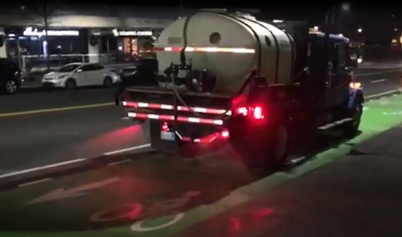
• Misc. Boston projects: Old Colony buffered bike lanes (DCR), separated bike lane on Beacon from Mass to Charlesgate, new posts on existing Congress Street bike lane, bike lane on Washington Street by Ennerking, bike lanes on Cambridge Street past City Hall

• Misc. Cambridge projects: Cambridgepark separated bike lane, Inman green paint and left turn ban, Several West Cambridge bike lanes and priority lanes, separated Kendall contraflow, two-way path on Fulkerson, Alewife path repair (MBTA), New Street bike lanes+intersection improvement

• Misc. Somerville projects: Neighborways through Spring Hill, Highland bike lane and box in Davis, Summer Street climbing lane swap, partially complete Beacon Street separated bike lane


Infrastructure that seems like it still has a chance to open in 2016

• Demonstration separated bike lanes in Cambridge (About a block of separated bike lane each in Central and Harvard Squares, installation in December.)

• Signalized Route 9 Crossing of the Emerald Necklace + new Emerald Necklace paths (Paths and signals are installed, but signals aren't active as of late October)

• Codman Square and Norfolk Avenue Vision Zero traffic calming and bike lanes (Some streets striped, traffic calming work MIA?)


Projects that were supposed to open this year, but were delayed

• Downtown Connect Historic Boston cycle tracks (Staniford street segment open, but work still underway on Causeway and Commercial. Was first billed as opening in summer 2016)

• Interim improvements at the PDW path crossing of River Street and a sidepath to Cambridge Street buffered bike lane (Work was underway towards a summer 2016 completion date, but ran into drainage problems and work was undone.)

• Arborway/Forest Hills cycle tracks and link to Southwest Corridor (Entire project is a year behind schedule due to T station delays, paths won't be usable until 2017. Initial date was 9/30/16)

• Constitution Road cycle track (Part of Connect Historic Boston with a summer 2016 opening date, but start delayed to 2017. A two-way bike lane that will connect to this was striped through the Navy Yard.)

• Neponset River Greenway multiuse path from Mattapan to Milton (Delayed from summer 2016 opening to spring 2017 opening.)


Big construction projects that began work this year, but won't open until later:

• Beacon Street (Somerville) separated bike lanes (Southbound separated bike lane now open in an incomplete form, project should be fully open by the end of 2017 with some work through 2018.)

• Cedar Street (Somerville) buffered bike lane (Part of a big water project, work underway Summer 2016-Summer 2017)

• New Charles Circle to Esplanade bike/ped bridge (Under construction now, lots of concrete already poured. Old bridge will stay open until new bridge is finished.)

• Commonwealth Avenue separated bike lanes (Delayed start. Ceremonial groundbreaking on 10/28/16 for a 2019 opening)

• Audubon Circle project (Beacon and Park intersection being rebuilt, will include bike lanes on all approaches. 2017 opening?)

• Huron Avenue buffered bike lanes (Part of a big water project with paving on 12/6. Cambridge city council pushed to make this separated but city staff don't want to change it. 2017 opening)


Ongoing projects that started construction before 2016, are still under construction, but aren't opening until 2017 or later:

• Conley Terminal Path along First Street (Path looks complete but lots of work is left on the rest of the project that will probably keep it closed. Fall 2017 opening.)

• Binney Street separated bike lanes (Westbound is complete and open, eastbound lane is complete but serving as a temporary sidewalk until building construction is finished.)

• Central Square (East Boston) (Square and approaches all being rebuilt, will include bike lanes.)


Planning and advocacy efforts that wrapped up

• State legislative push (All bills failed this session.)

• Keeping the Western Avenue in Boston protected bike lanes open (Parking protection was removed, but cones were added instead.)

• Keeping the D Street bike lanes in the Seaport from being removed by Indycar (Indycar cancelled so lane wasn't modified.)

• Reactive Cambridge bicycle safety improvements (City council agreed to several improvements and demonstrations)

• Keeping the Somerville Community Path extension in the GLX plan (Path survived GLX redesign process in diminished state.)

• Keeping separated bike lanes in the new North Washington Bridge plan
 
^Scipio, I always enjoy your updates and this is an excellent recap. Many thanks!

I saw that Wood Island bike path from the Blue Line (the one time I took it this summer; my program does an annual thing at Singing Beach and a friend and I take the Blue to Wonderland and bike from there) -- there were a lot of people using it, it looked great.

Disappointed at the Neponset delay but seems like slowly but surely a lot of positive things are happening around the city.
 
• Keeping the Western Avenue in Boston protected bike lanes open (Parking protection was removed, but cones were added instead.)

Whats this?
 
Whats this?

There was an old parking-protected bike lane on Western Ave, but the parking was removed to make way for construction jersey barriers where the bike lane used to be. Later the bike lane was reinstalled with cones for separation, signifying that the city still intends to keep a protected bike lane here. I don't ride that part of Western Ave that often but the cones were still up the last time I went by a few months ago.

^Scipio, I didn't see the two project the Town of Arlington has going (1=Minuteman@Mass Ave, 2=Mystic St bike lanes) so I added them in the Biking in the Burbs thread.

Thanks, I'll write up a suburban list tonight.

^Scipio, I always enjoy your updates and this is an excellent recap. Many thanks!
Glad you liked it!
 
At one point can a pedestrian cross?

A pedestrian always has the right of way at an intersection as long as there are no signals with a don't walk indication. The past 20-30 years have been all about over-signalization which has led to diminished common sense and courtesy. No one cares to understand the law like people did in the past, they want to have their hand held through every intersection. "Safety". Instead of cautiously going through an intersection, it's "out of my way, I have a green light!!".

Let's remember that the signals at Packard's Corner are only a few decades old and it's always been a busy huge intersection.
 
That's awesome, I was expecting all of the new bike paths to become snow banks this winter.
 
Not everyone loves them, but a definite benefit of two-way bike lanes is being able to treat (/plow/sweep) them with "standard" vehicles. Hope this continues!
 

Back
Top