Biking in Boston

Not sure if this has been mentioned, but there are new dedicated bike lanes that I noticed on Cummins Highway between Mattapan Square and Harvard St (right before the cemetery). Plastic jersey barriors were used, although it all seems a bit haphazard (with the lanes seemingly closed off at points, and I have already seen cars just ignore and park at the exits/entrances). Also, like the painted bike lanes on Adams St, they seem to... basically go no where and just end/dump you out.
Yes, these are temporary and intended to help convince local users that the road diet won't negatively impact throughput or parking. The ultimate plan is curb protected bike lanes, along with several pro-pedestrian changes. I agree that there is a connectivity problem, but I think the last bit on each end (from Harvard St. to American Legion, and approaching Blue Hill Ave.) are dependent on final decisions regarding the other two corridors, both of which are going to get significant bike upgrades. Ultimately, it should all hook together for a safe and seamless network.
 
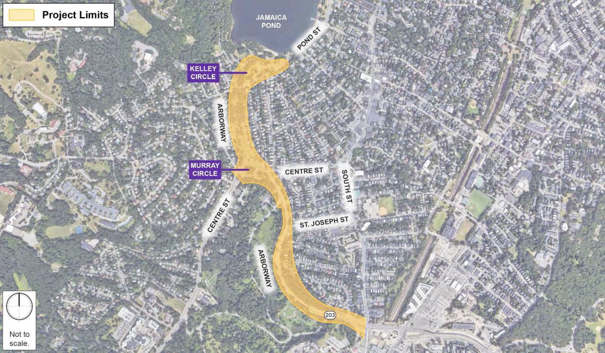
Streetsblog has some good images illustrating their story on the addition of bike lanes to the Arborway
 
Streetsblog has some good images illustrating their story on the addition of bike lanes to the Arborway
I forget the story, but a number of years ago when they put in the existing bike lanes, they installed all the bike and arrow symbols, but then came back and ground them all out... The bike lanes remained, but I think they were supposed to be officially "shoulders".
 
This is great! This stretch has always felt like a pseudo high-way/park-way.
The length between Francis and Pond still seems like an unfortunate sidewalk-bike hybrid path. They've been doing some repaving there which I guess will make is smoother though.
 
Last edited:
3 days in a row now I've watched the MBTA kick a passenger off of an empty red line train around 9:15am because bikes aren't allowed before 10am still. Why weren't these rules amended for the duration of the emergency/ridership crater?

Why are we stopping trains to enforce this?
 
3 days in a row now I've watched the MBTA kick a passenger off of an empty red line train around 9:15am because bikes aren't allowed before 10am still. Why weren't these rules amended for the duration of the emergency/ridership crater?

Why are we stopping trains to enforce this?
No idea if it helps, but I just tweeted @MBTA about this... fingers crossed.
 
As of today, Washington Street has reopened though it does not look like it's in its final condition.

PXL_20200924_220353820.jpg
 
This is the one in Union Square looking towards the Somerville Ave intersection.

Thanks. I only usually get one evening (maybe 2 evenings) a week to post. So i'm catching up on this. Definitely planning to take a walk this evening to shop at Target which means taking another look at what's going on here.
 
Does anyone know why all of the bike lanes around the Common have been taken down?
Almost no trace of them anymore. All the parking and lanes are back. Boylston is back to 2 way past Charles st too...
 
Does anyone know why all of the bike lanes around the Common have been taken down?
Almost no trace of them anymore. All the parking and lanes are back. Boylston is back to 2 way past Charles st too...
They were taken down for the protests last weekend and never came back unfortunately. Perhaps they'll bring them back in permanent form this time given those are the first on the list for transition to permanent
 
I think that the climate also factored in with the wind and rain event midweek, also.
 
I had a conversation with a city planner this week to discuss the connect downtown project - https://storymaps.arcgis.com/stories/0913a156b1a7409eb69687cf268d076e.

In the first phase (as already shared), they are focusing on making the protected bike lanes around the Common permanent. This means flex posts and mostly 1 way bike lanes. One stretch that they are looking at making 2 way is the Boylston stretch. They are not making 2 way bike lines near Charles/Beacon due to the geometry of the intersection

Phase 2 is where things could get exciting. They stressed that nothing is final, but they are considering moving some of the auto lanes on Charles to bike lanes (Longfellow to Boylston). They are even considering moving curbs and making real protected bike lanes rather than flexposts. Additionally, two way bike lanes around the common/public garden will be considered. When the scope of the project is considered, paired with the State Street project and the existing network, Boston could one day have a pretty kick ass downtown for biking (assuming they don't mess this up too badly)

I recommend others sign up for the 15 minute zoom call. The more people we have telling them to go bold, the better


It makes so much sense!

It is inevitable that cities will move to ban individually owned cars which require on-street parking (replaced by dial up autopilot pods). THINK of it - - doing away with on-street parking opens up space for wider bike lanes and wider sidewalks for pedestrians. Just envision the liveliness of cities where more people can live more densely. This inevitability is going to happen - the only questions is whether it happens by 2030 or 2040.
 
Union Square Somerville - Somerville Ave Streetscape changes

You can get a sense of how they are changing the middle of the square by adding these cycle tracks. I can only hope that the city continues to develop according to the Union Square neighborhood plan.

PXL_20201006_214235481.jpg
 
Having a crossing like that so close to the signal is interesting. Ive worked on many projects where "we cant do that"
 
Having a crossing like that so close to the signal is interesting. Ive worked on many projects where "we cant do that"
This might partly be a trick of perspective?
Google Maps says it is 300 ft from this mid-block crosswalk to Prospect St (shown) and also 300' in the other direction to the stop line for Webster.
[I used to bike commute daily along the length of Somerville Ave (Medford to Lechmere) and I don't recall that this xwalk was a source of undue surprise or friction]

When people say a crosswalk is "too close" what is the standard they're using for "far apart enough?"

Also, I'm thinking/wondering if part of what lets you closely space a midblock crosswalk is a municipal "25 mph default" or just raw pedestrian volumes?
 
For people who only consider automobile thru-put, a raised intersection and flashing pedestrian crossing between two intersections that are 600 feet apart is blasphemy. Fortunately Somerville city planners are no longer part of that cult.
 

Back
Top