Biking in Boston

That's really not true in this case; this is not a situation where we're talking about local, intercity transportation; to suggest that traffic on the 1/4-mile-long Charles River Dam Road, which is used mainly to connect to major arteries in and out of the city, is going to get better by adding a bike lane is not rational.

I'm not saying traffic will get better. In fact, I'm even saying we shouldn't care whether vehicle traffic gets better—it's the wrong metric and has been for the last 60 years. We should care that more people can travel through the road.

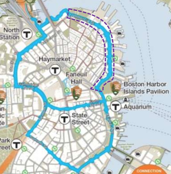
Because, in fact, this is local intercity transportation. Getting from much of Cambridge to North Station is around 2 miles, but the bridge is horrifying to bike across and turns away potential riders. Same with the North End, or much of downtown—this is a direct route for biking, and making it safer will make it a better option for more people instead of taking an Uber, a convoluted public transit trip, or not making the trip at all.

There are many reasons to support bike infrastructure. We have a crisis of social isolation and sedentary behavior in this country, leading to unprecedented levels of metabolic disease and mental health conditions. That should be reason enough. If it's not, then understand that this area is, whether you like it or not, used by bikes, and it's incredibly unsafe; it is necessary to do something, now, to protect them. You don't have to buy into the bike revolution culture to accept this fact.

I agree, but I don't think there's actually a conflict between our arguments like you're implying.

The tones on this debate could, as usual, be moderated a bit. It doesn't have to be a war.

Someone who prioritizes driving in and out of the city over living in the city posted with caps and exclamation points, without an effort to imagine how much better this will be for residents of these actual cities.

And, if the city/people really care enough to sink the money in, they could build a cycle boardwalk over the water to connect Nashua Street Park to points north in the future.

We have the space to move people more efficiently and healthily already – we just need politicians to be willing to make the changes necessary. Kudos to MassDOT for their continued conversation with the bicycle and urban communities to make this street safer for all road users.
 
What I will say is that it enrages me that the lines separating the lanes are practically invisible for about 200 yards next to the museum. It's incredibly unsafe to have 3 lanes of traffic without lines (it has the same issue further back by the underpass at Cambridge Street). However, the solution is to REPAINT THE DAMN LINES not remove an entire lane!

I drive this stretch reasonably often (a few times a month at peak times) and I agree about the lines. It's really confusing and adds to the clusterf**k it can sometimes be.

Frankly, there seems to be a good deal of wasted space by the Science Museum where they should be able to have the bike lane kind of going along with the MoS driveway and not have to steal a lane of traffic from the O'Brien HIGHWAY. I almost never even see bikes on this section of road so we are catering to very few people at the expense of allowing more cars to get OUT of the city faster. What's next, a bike lane on 93?

I don't disagree it would be nice to have a separated bike path in front of MoS but I'm certain that's more of logistical problem than removing a lane of the O'Brien. I'd also offer that you don't see a lot of bikers there because it's deadly in its current form. I bike and this is the most direct route between home and work for me. I'd never go this way because it's deadly. I'll go this way if there's a bike lane. You'll see a lot more with the proper infrastructure. It's one of the biggest issues with biking here, the infrastructure is so fragmented, there's little to encourage anyone but the most committed riders. As it is, I don't ride in bad weather, and I avoid busy roads or roads without good lanes/paths.

Except this street is not about transporting people in the city. It's about getting people the heck out of the city!

I'd change that to cars, not people. It's about getting cars into/out of the city. It can still be plenty effective if it's reduced by that lane. Traffic isn't going to get astronomically worse with one fewer lane. Just like it wouldn't be worse if you turned the McGrath into a more human friendly surface boulevard.
 
34f34f, not all of what I was saying was directed at you. There was some other semi-inflammatory stuff by others I was referring to.

You obviously are pro-bike so I assumed you agree with all the other reasons to support bike infrastructure improvements (that was also directed at others, not you). We are basically on the same page. But, I do think it's important to be careful about citing evidence and studies... in many cases, there's no evidence even needed. This stretch needed bike safety, regardless of whether you are socio-culturally pro- or anti-bike. On the other hand, whatever your cultural/political leanings toward cars and highways is, this roadway is a critical connector not just for travelers between Cambridge and Boston, but also between many other points... so, if you're going from the Galleria to North Station, it's faster and more efficient by bike, but that ignores the fact that this road fulfills many purposes, specifically, that it's a key arterial (again, a fact that may or may not be palatable to one's personal bent). Arguments on whether a road is more efficient when used by cars or bikes has much more relevance when thinking about smaller stretches of local-use-only roads.
 
Putting a bike lane on the MOS driveway was evaluated, and discarded:
(1) The grades are too steep to meet engineering standards
(2) The MOS doesn't want it there
(3) It doesn't go the full length of Charles River Dam Road

It's definitely a better end product to have it buffered/flex posted in the roadway for the sake of continuity and ease of use, but on the flip side, I know of no engineering standards related to the pitch of a bike lane, and the driveway isn't a driveway, it's actually a carriage road owned by DCR.

One of the big reasons why this won't effect vehicular traffic throughput is because it doesn't change the capacity (number of lanes) at any of the intersections. It just takes a lane in between. There is less queuing capacity in the general vicinity, but the same number of cars are making it through the intersections.
 
The plan for the replacement commuter rail drawbridges includes a bike/pedestrian crossing. Once that's built (whenever that actually happens), there will be an off-street connection from downtown Boston to North Point and the Somerville Community Path. In order to avoid the dam, yesterday I rode across the North Washington St Bridge and then over the North Bank Bridge to North Point Blvd and that was much nicer (even the NWSB, which has no bike lanes but the right lane is pretty wide).
 
34f34f, not all of what I was saying was directed at you. There was some other semi-inflammatory stuff by others I was referring to.

You obviously are pro-bike so I assumed you agree with all the other reasons to support bike infrastructure improvements (that was also directed at others, not you). We are basically on the same page. But, I do think it's important to be careful about citing evidence and studies... in many cases, there's no evidence even needed. This stretch needed bike safety, regardless of whether you are socio-culturally pro- or anti-bike. On the other hand, whatever your cultural/political leanings toward cars and highways is, this roadway is a critical connector not just for travelers between Cambridge and Boston, but also between many other points... so, if you're going from the Galleria to North Station, it's faster and more efficient by bike, but that ignores the fact that this road fulfills many purposes, specifically, that it's a key arterial (again, a fact that may or may not be palatable to one's personal bent). Arguments on whether a road is more efficient when used by cars or bikes has much more relevance when thinking about smaller stretches of local-use-only roads.

Sure thing—and thank you for the thoughtful response. It's important for all of us to keep multiple uses and different users in mind.
 
Found the actual 5/1/19 striping plan: https://www.mass.gov/files/documents/2019/05/07/dot-hwy_CRDR_20190501_roll_plan.pdf

And presentation: https://www.mass.gov/files/documents/2019/05/07/dot-hwy_CRDR_20190501_mtg_presentation.pdf

That resolves most of my concerns raised by the way the project was described in the article.

I do believe the outbound Land Blvd intersection may need to be tweaked with which lanes go where (perhaps a left + straight, rather than straight only for the 2nd lane), but I think the 4 lanes is workable.

It doesn't look like it loses too much, which is a relief. It does look like the confusion problem remains at the Museum Way intersection, as the lanes shift but there aren't any dotted lines making sure drivers know this! (as an aside, there's a similar but even worse problem when entering Kenmore via Beacon Street, heading West)

Hopefully this tinker doesn't result in the traffic Armageddon that I was expecting before I viewed the diagram.
 
It's that condescending attitude that only contributes to the animosity between bicyclists and motorists.

Nope, its the "fuck you Ive got mine" attitude of people who have access to 99% of the roadway network and throw a hissy fit at the idea of 1% being allocated to another use. Thats what creates animosity.
 
I would like to see the painting and striping to include green paint in the bike lane including through (alongside) the cross-hatched boxes
 
Is there any push going on to build a cycletrack down the Rose Kennedy Greenway? The existing bike lanes on Atlantic Ave/Cross St are OK, but a cycletrack would make it much less hairy to get north-south along the corridor. (I use the Commercial St cycletrack around the North End, even though it's a detour, because it's so much more pleasant than fighting downtown traffic.)
 
Is there any push going on to build a cycletrack down the Rose Kennedy Greenway? The existing bike lanes on Atlantic Ave/Cross St are OK, but a cycletrack would make it much less hairy to get north-south along the corridor. (I use the Commercial St cycletrack around the North End, even though it's a detour, because it's so much more pleasant than fighting downtown traffic.)

I doubt it... there isn't any space for it. Also, for the portion you are bypassing on Commercial Street, there isn't much "greenway" - it's all exit ramps and then developed lots. I usually ride, illegally, on the greenway itself... slowly.
 
Is there any push going on to build a cycletrack down the Rose Kennedy Greenway? The existing bike lanes on Atlantic Ave/Cross St are OK, but a cycletrack would make it much less hairy to get north-south along the corridor. (I use the Commercial St cycletrack around the North End, even though it's a detour, because it's so much more pleasant than fighting downtown traffic.)

I'd much rather see them limit traffic on Atlantic Ave/Cross St/Surface Rd, maybe a complete streets redesign of them. The noise and speeds of cars down those roads make the Greenway quite unpleasant to sit and relax in
 
I'd much rather see them limit traffic on Atlantic Ave/Cross St/Surface Rd, maybe a complete streets redesign of them. The noise and speeds of cars down those roads make the Greenway quite unpleasant to sit and relax in

Exactly. The Greenway serves a non transportation purpose. The roads on either side of it are over built, especially when you consider they are located directly above an Interstate Highway. Road diet on the surface, add a cycle track there, but leave the Greenway intact as is.
 
I'd like to see a better bike tie-in between the Harborwalk and the Connect Historic Boston trail (perimeter of North End).
 
Exactly. The Greenway serves a non transportation purpose. The roads on either side of it are over built, especially when you consider they are located directly above an Interstate Highway. Road diet on the surface, add a cycle track there, but leave the Greenway intact as is.

The surface roads are only overbuild in some sections. There are two conditions that completely slam the surface roads (and make it hard to lane drop):

Near where they feed the O'Neill Tunnel entrances/exits.

Where tour buses stop (park) effectively an informal lane drop.

Road dieting has to take into account these conditions.
 
Is there any push going on to build a cycletrack down the Rose Kennedy Greenway? The existing bike lanes on Atlantic Ave/Cross St are OK, but a cycletrack would make it much less hairy to get north-south along the corridor. (I use the Commercial St cycletrack around the North End, even though it's a detour, because it's so much more pleasant than fighting downtown traffic.)

The originally-promised Connect Historic Boston cycle track was meant to be a figure eight, including Atlantic Ave:

NorthEndWaterfront-2013-12-20-at-1.01.13-PM.jpg
 
Some work finally being done on the South Bay Harbor Trail (the ugliest part of it, anyway, still no sign of bike lanes on the 4th St./Broadway bridges):

JHLVvzjyS94jt-iINzyHDcppIDK1d4xHxEyWY4iEE3HlfSM3d1TuD08xQBs1y3qUr4V1Hy_mTAMRHt3CoL8MELfVfyum10X-aVlCpEyNv8EtSDKPsH3jhCKOmxcjYLJ2Up2WKRYdLjybJ41xoQZWqBBDL-Pk35ePbjWPAP5jZF2Sw8qsjOVwvwYoA5-mw4f_Q14pXJ08KV9GqQ63W1Sdx-Bci0wWzFPlf3X1cJXGJHjw-QJ0rGt_ymieqq8Ova_8Q2hdsdUtA12N0NBJwt45wFbix42jVrbvVFaL2SzVSG8P8qMTi0En1SOM3l1h0Kiimolx0u6vIgyl-ihRp4LZJ8R5PdE63exa127wvN6TzK5-l8HNvxKgg-uun6C2WTRYu5iqsfLm1dYf73zRyvmnA7JKp7PAkAWSsC-xx7aJ3PaoB5coM7KhlX6XfSJfXO77NKPBpYRsPQVNyMJ5IuOVCLyuLkMUThVTmKrn8SnWnnKc3720XOCXZIHX1CjR4L-SfPxlS16YTmUedtpE5kqLo6VNQqyzbSsILMRo-vVMFM2CllfRVP2kL74Ca8lYbGM_NB-r_7DVaD-6YfUMQe2Xxq50qEHQoZabFWM1mb8bIe1OefOfa5PgS43urI-WaIS5DZJthVFcq4D5jvYQdS73FO4og4iKQZXdP66-rMdTdWccfHd0vUpz1tb699cE4e5qL_NQRzvtUly8vQ_02qz_27MoRQ=w900-h675-no
 
@stevebikes, thanks for posting the picture, I am very excited to see that this is finally happening. Pending completion, what is your preferred non-trail way to rid from Melnea Cass through the area. It's kind of hard to figure out from looking at Google, and my sense it that if I'm not careful, I might suddenly find myself dumped out on to a section of bike unfriendly roadway if I try riding from the Ruggles area to the seaport section of the harbor walk.
 
In my experience, the best way is:


I am generally outspoken against riding on the sidewalk, and think that, absent separated infrastructure, us cyclists should generally be vehicular cyclists. Here is an exception though. The roads are a death trap of highways. The "sidewalks" and "sidepaths" are supposedly part of the Bay Harbor Trail, fairly wide at parts, with long blocks, and not a ton of pedestrians (outside of Methadone Mile). Plus many of the quasi-highways are one-way going the wrong way. So, for those reasons, this is one of my rare stretches where I recommend opting for the pedestrian infrastructure rather than the auto-centric roads.
 

Back
Top