You are using an out of date browser. It may not display this or other websites correctly.
You should upgrade or use an alternative browser.
You should upgrade or use an alternative browser.
Brookline Infill and Small Developments
- Thread starter kz1000ps
- Start date
Equilibria
Senior Member
- Joined
- May 6, 2007
- Messages
- 7,229
- Reaction score
- 8,759
It's interesting that the building is named "The Calvin at Coolidge Corner", when not only is this business district actually JFK Crossing, but JFK Crossing was also the project's name when it was first proposed.
And Coolidge Corner isn't named after Calvin Coolidge:
Getting to Know Your Neighborhood: Coolidge Corner
A guide to eating, shopping, and just hanging out in one of Brookline’s hubs
And no, the area was not named after President Calvin Coolidge, but for 19th-century local businessman David S. Coolidge, whose grocery and general store was on the site of the S.S. Pierce Building. At the time, it was the only commercial business in North Brookline.
RandomWalk
Senior Member
- Joined
- Feb 2, 2014
- Messages
- 3,793
- Reaction score
- 6,817
Maybe its naming rights were sold to Calvin Klein…
BronsonShore
Active Member
- Joined
- Feb 13, 2014
- Messages
- 520
- Reaction score
- 1,645
It's interesting that the building is named "The Calvin at Coolidge Corner", when not only is this business district actually JFK Crossing, but JFK Crossing was also the project's name when it was first proposed.
I have never heard a human being refer to this part of Brookline as "JFK Crossing" in my entire life. It's Coolidge Corner.
Yes. I grew up in Brookline and lived on Coolidge St. The whole stretch is Coolidge Corner to anyone who’s local and anyone who’s non local, for that matter. If you wanna get specific, a lot of people will say “the Jewish part of Coolidge”, although the local Jewish business presence has been dwindling over the years down there…I have never heard a human being refer to this part of Brookline as "JFK Crossing" in my entire life. It's Coolidge Corner.
I despise and detest google, which is probably single handedly responsible for the horseshit fake neighborhood names that you see when you hover close over any local map… because companies pay google, and real estate companies push fake names of fake neighborhoods. There’s no such thing, outside of a realtors office, as JFK Crossing, Emerson Gardens, High Street Hill (uh, it’s Pill Hill, dipshit), Coolidge Corner South Side (also just Coolidge), Central Village (wtf?!) etc in Brookline. Just like nobody who isn’t addicted to maps and nerdiness has any clue what you mean by Sumner Hill, Pondside, Brookside, Hillside, Parkside, or Jamaica Hills (another total wtf) in JP. Or “Centre South” in West Rox… etc etc etc. Unlike Ms. Cleo’s cards, the maps these days DO lie.
It's not a Google thing or a realtor thing. The Town designated it as such and promotes that name. JFK Crossing | Brookline, MA - Official Website (brooklinema.gov)I have never heard a human being refer to this part of Brookline as "JFK Crossing" in my entire life. It's Coolidge Corner.
There is also a sign in Coolidge that's been there for over a decade: https://goo.gl/maps/QcqjuoLAXfC4kMZH9
It may not have existed for decades, but it appears to very much be in use today.
Brad Plaid
Senior Member
- Joined
- Jan 17, 2013
- Messages
- 1,310
- Reaction score
- 1,559
Looking at sm89's link I checked what was demolished for the 2Life housing. This was a significant teardown and must have gotten some serious pushback.

Equilibria
Senior Member
- Joined
- May 6, 2007
- Messages
- 7,229
- Reaction score
- 8,759
Looking at sm89's link I checked what was demolished for the 2Life housing. This was a significant teardown and must have gotten some serious pushback.
I don't think it got any pushback. It's KI's social hall and they didn't need it anymore. The synagogue proper is far more architecturally significant than that addition.
It’s a chamber of commerce thing which = town + business + realtor.It's not a Google thing or a realtor thing. The Town designated it as such and promotes that name. JFK Crossing | Brookline, MA - Official Website (brooklinema.gov)
There is also a sign in Coolidge that's been there for over a decade: https://goo.gl/maps/QcqjuoLAXfC4kMZH9
It may not have existed for decades, but it appears to very much be in use today.
Signs don’t mean anything. Nobody who knows anything calls Rozzie Sq “Roslindale Village” and ditto for “Allston Village” for that matter… signs notwithstanding.
BronsonShore
Active Member
- Joined
- Feb 13, 2014
- Messages
- 520
- Reaction score
- 1,645
It’s a chamber of commerce thing which = town + business + realtor.
Signs don’t mean anything. Nobody who knows anything calls Rozzie Sq “Roslindale Village” and ditto for “Allston Village” for that matter… signs notwithstanding.
Right. Signs - or even municipal governments themselves - don’t give a neighborhood its name. People do. That’s why we don’t have a thread called “South Boston Waterfront General Discussion.”
I actually would advocate for that concept applying to much more of the neighborhoods… We live in an era of very top down enforced definitions, based on consensus usually of specialty groups… it was not always this way… Even things we take for granted like spelling and words had much more regional variation until quite recently… I think language is a living thing, and it needs room to grow, breathe, and be flexible… Rigidly imposed limits only represent death, not life…Right. Signs - or even municipal governments themselves - don’t give a neighborhood its name. People do. That’s why we don’t have a thread called “South Boston Waterfront General Discussion.”
guitarguynboston
Active Member
- Joined
- Dec 11, 2009
- Messages
- 258
- Reaction score
- 320
Love the different materials look.
iamdjmichael
Active Member
- Joined
- Aug 4, 2014
- Messages
- 166
- Reaction score
- 131
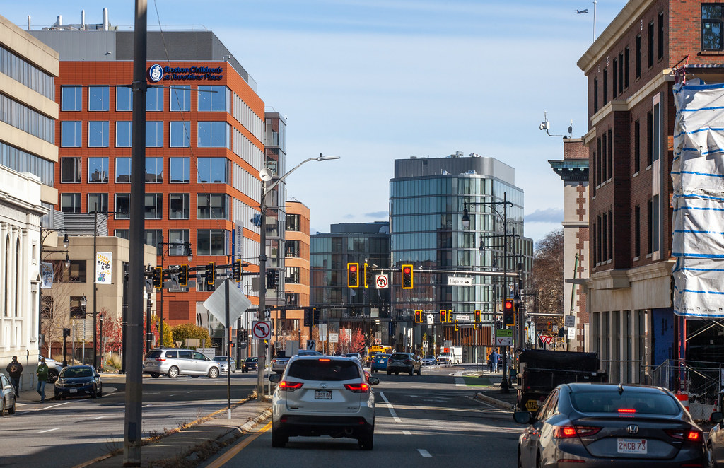
Having just driven it last night, this reminds me of a (much shorter) downtown Brooklyn as seen coming off the Manhattan bridgeRoute 9 looking significantly more built up these days
Plen-T-Pak
Active Member
- Joined
- Jul 23, 2007
- Messages
- 253
- Reaction score
- 490
Back around 2005-2006, I was part of the community planning sessions, facilitated by Von Grossman & Company, for "Gateway East", as this section of route 9 was referred to at the time. It seemed roughly half of the participants wanted this stretch to become an urban, mixed use corridor while the other half wanted it to essentially remain the same with pocket parks wherever they could fit them. One participant actually wrangled enough time to present an entire power point presentation on her vision, which was to remove the concrete pedestrian bridge (anyone remember that eyesore?) and replace it with another pedestrian bridge for the purpose of planting lots of flowers on it, similar to the rail bridge in Shelburne Falls. Fortunately the more practical ideas prevailed and it's nice to see the progress years later. I'd like to see more of this type of development all the way up to Cypress St, and it will happen in time, I'm sure.
Anyway, one great idea that came out of those meetings, which has since been built, was the realignment of the Walnut St "jug handle", behind the fire station, to Pearl St. This created a 4 way intersection with lights and crosswalks approximately was where the old pedestrian bridge was removed. Gretchen Von Grossman had a concept sketch that showed a building on the newly created parcel, within the extended jug handle, to illustrate how a street wall could be reestablished to undo the damage of the urban removal of the 1950s. Predictably the idea to put a building there was met with yawns and, last I noticed, it seems it will be a parking lot for the foreseeable future. Ah well.
Anyway, one great idea that came out of those meetings, which has since been built, was the realignment of the Walnut St "jug handle", behind the fire station, to Pearl St. This created a 4 way intersection with lights and crosswalks approximately was where the old pedestrian bridge was removed. Gretchen Von Grossman had a concept sketch that showed a building on the newly created parcel, within the extended jug handle, to illustrate how a street wall could be reestablished to undo the damage of the urban removal of the 1950s. Predictably the idea to put a building there was met with yawns and, last I noticed, it seems it will be a parking lot for the foreseeable future. Ah well.
Last edited:
I hate to say it, but the old bank building just doesn't fit the modern scheme of roads. It worked long ago when Wash/Boylston hadn't been urban reneweled to death and there was surrounding life on the streets, but now the bank building is just a cold dead killer to the feeling of that area. People will never allow it since it's a pretty old building but I think the entire area would get a lot of new life if they demo'ed it and built something with street level retail.Route 9 looking significantly more built up these days
dhawkins
Active Member
- Joined
- Jan 25, 2014
- Messages
- 906
- Reaction score
- 3,180
I hate to say it, but the old bank building just doesn't fit the modern scheme of roads. It worked long ago when Wash/Boylston hadn't been urban reneweled to death and there was surrounding life on the streets, but now the bank building is just a cold dead killer to the feeling of that area. People will never allow it since it's a pretty old building but I think the entire area would get a lot of new life if they demo'ed it and built something with street level retail.
I never liked that stretch of Boylston Street / RT9 buildings and always thought if the bank was demolished it would improve the intersection and hopefully set a precedent to continue demo Westerly to be replaced with new buildings with proper set-backs for a hwy. When the Suites Hotel was built I thought the Bank's days were numbered. Now with a beautiful interior restoration by NETA, I think that place will remain for a long time. It's bitter sweet because that interior is amazing.
Plen-T-Pak
Active Member
- Joined
- Jul 23, 2007
- Messages
- 253
- Reaction score
- 490
Strongly disagree. It is popular retail and it fills that odd corner perfectly, and it's a gorgeous building that works well as a gateway marker. Not sure what it's killing since everything sort of stops at rt9 anyway, and it's not because of the dispensary.I hate to say it, but the old bank building just doesn't fit the modern scheme of roads. It worked long ago when Wash/Boylston hadn't been urban reneweled to death and there was surrounding life on the streets, but now the bank building is just a cold dead killer to the feeling of that area. People will never allow it since it's a pretty old building but I think the entire area would get a lot of new life if they demo'ed it and built something with street level retail.
Why would you want to turn this stretch into a highway? Setbacks aren't possible due to train tracks and Walnut St., so you'd basically have to obliterate everything just to delay the transition from major regional surface artery to local road by a few blocks? I always thought the intersection with Cypress is where you officially enter the city and the highway zone ends. That intersection is a vital pedestrian connection and a highway isn't compatible. This corridor should be built up like the Fenway section of Boylston, which shares a lot more in common with this stretch other than the street name.I never liked that stretch of Boylston Street / RT9 buildings and always thought if the bank was demolished it would improve the intersection and hopefully set a precedent to continue demo Westerly to be replaced with new buildings with proper set-backs for a hwy. When the Suites Hotel was built I thought the Bank's days were numbered. Now with a beautiful interior restoration by NETA, I think that place will remain for a long time. It's bitter sweet because that interior is amazing.
View attachment 20187
Not every beautiful old building fits. The fire station serves as plenty of gateway for that area. Tear down the bank, build something with multiple smaller retail fronts and housing above, you get a more engaging streetwall on Boylston and also Washington. Do the same across Wash with the Wash side of the Art School concrete monstrosity and you've knitted back together what was lost in urban renewal.Strongly disagree. It is popular retail and it fills that odd corner perfectly, and it's a gorgeous building that works well as a gateway marker. Not sure what it's killing since everything sort of stops at rt9 anyway, and it's not because of the dispensary.
Why would you want to turn this stretch into a highway? Setbacks aren't possible due to train tracks and Walnut St., so you'd basically have to obliterate everything just to delay the transition from major regional surface artery to local road by a few blocks? I always thought the intersection with Cypress is where you officially enter the city and the highway zone ends. That intersection is a vital pedestrian connection and a highway isn't compatible. This corridor should be built up like the Fenway section of Boylston, which shares a lot more in common with this stretch other than the street name.
Plen-T-Pak
Active Member
- Joined
- Jul 23, 2007
- Messages
- 253
- Reaction score
- 490
I dig it. I'd rather start with the Art Institute.Not every beautiful old building fits. The fire station serves as plenty of gateway for that area. Tear down the bank, build something with multiple smaller retail fronts and housing above, you get a more engaging streetwall on Boylston and also Washington. Do the same across Wash with the Wash side of the Art School concrete monstrosity and you've knitted back together what was lost in urban renewal.
I get what you're saying about the bank, but I can imagine something like what you describe along the back wall of the building that could bridge the gap between Washington and Boylston. As an example, I had in mind this corner, where there's plenty of activity around this dead streetwall, but I've never thought to myself that the building needs to go. In fact I've never thought anything about it other than it being a handsome building that adds a sense of identity to the area.