Seeing the soil removed, makes me wonder if any of those sites are contaminated from some 19th-century textile mill or has that area been rail yards for the past 150 years?
Czervik -- Originally most of the area in question was a tidal swamp with lots islands at low tide and a few highland points sticking out all of the time [e.g. Lechemere Point where the Brits landed in 2 if by Sea]
Later after some filling -- there was an era prior to the Rail era [beginning about 1840] when there was the Middlesex Canal*1 which ultimately carried narrow boats to/from Lowell to / from Boston -- part of that trip used the Millers River [now in a conduit for much of its path]
Circa the rail era -- The Millers Creek or Millers River also had a Glassworks and a Sugar Refinery in the general area of NorthPoint where Cambeidge Somerville and Charlestown [Boston] come together
Mostly though its was very extensive Rail Yards and also the multi-track main line of the Grand Junction Railroad connecting the area where the Turnpike exit in Alston / Brighton is today with East Boston at Jeffries Point via a looping path through Cambridge, Charlestown, Chelsea and East Boston
see for example
On and Along the Grand Junction Railroad
[source of many of the illustrations]
Grand Junction Railroad tracks across Massachusetts Avenue in Cambridge, in the center of the MIT campus. Note railroad crossing signal.
www.bostonstreetcars.com
So its quite possible that nearly anything might be in the soil
Maps, etc.
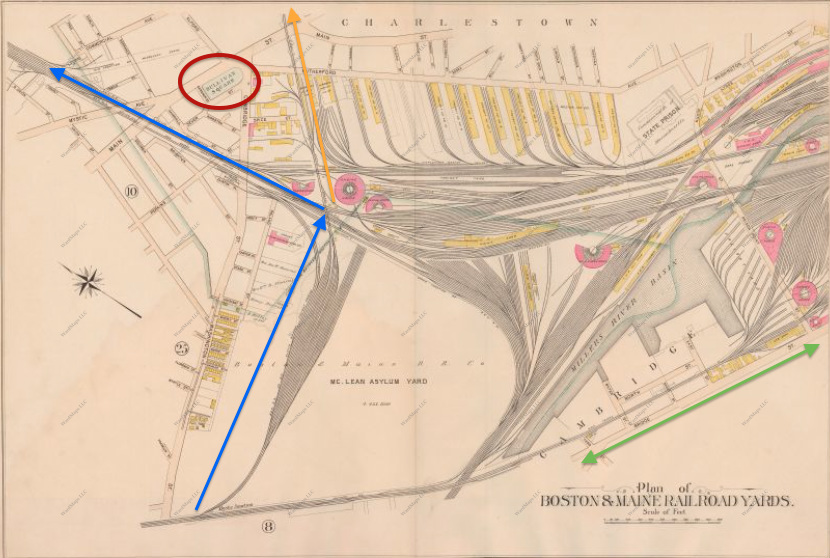
Route of the Grand Junction Railroad through Cambridge, Somerville, Charlestown, Chelsea and East Boston. [superimposed on modern map]
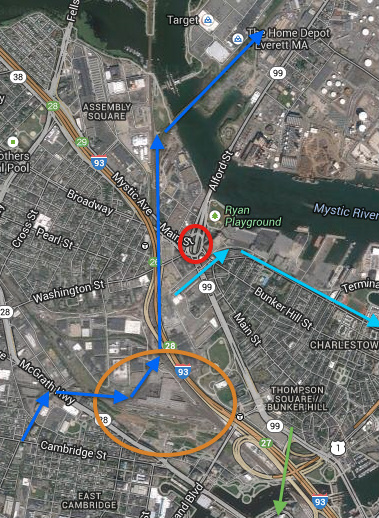
Path of the Grand Junction Railroad, shown with dark blue arrows, through the rail yard at NorthPoint, circled in orange, shown on a Google Map. The light blue arrows show an alternate spur of the Boston and Maine Railroad that runs to Boston Autoport. The green arrow points to North Station for orientation purposes
MAP OF THE CITY OF CAMBRIDGE MIDDLESEX COUNTY, MASSACHUSETTS BY H.F. WALLING, Civil Engineer. , Boston, 1854.
*1
Before the Erie Canal was a gleam in anyone's eye, the Middlesex Canal proved what a canal could do. Remnants still exist between the Merrimack and Boston.
www.newenglandhistoricalsociety.com
The Middlesex Canal, New England’s Incredible Ditch
The Middlesex Canal, now largely forgotten, was a 27-mile waterway that drove the industrialization of the Merrimack Valley for 50 years starting in 1803. The canal ran from Chelmsford (now Lowell) to Charlestown (now Boston), transforming small agricultural villages into manufacturing towns, even cities. And it cemented Boston’s position as the commercial hub of New England.
The Middlesex Canal inspired more canal building throughout the young nation. It also created America’s first generation of civil engineers who kept on building. They built the dry docks at the Boston Navy Yard and in Norfolk, Va., the Boston and Lowell Railroad, the Union Canal in Pennsylvania, the Erie Canal in New York and the Back Bay mill dam in Boston – to name just a few.
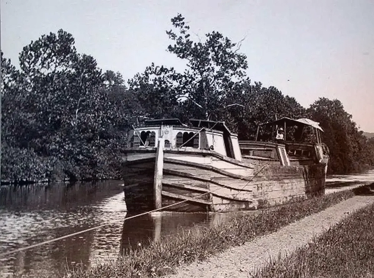
The canal allowed an exponential increase in the amount of product taken to market. A wagon and a team of oxen could haul about three tons. But a canal barge could haul 30 tons.
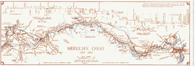
The Middlesex Canal 1793-1853
The 27 mile long Middlesex Canal connected Boston to the Merrimack River at Lowell. Freight and passengers were carried up and down the canal from 1803 to 1853 when it was superseded by the Boston & Lowell Railroad. The canal played an important role in the development of the region north of Boston as far as Concord, New Hampshire.
Statistics and Interesting Facts
Length: 27 1/4 miles
30 1/2 ft. wide at the water line, 20 ft. wide at the bottom, and 3 1/2 ft. deep
20 locks, 8 aqueducts, 48 bridges
Source of water: Concord River (auxiliary source: Horn Pond)
Route followed generally pre-glacial course of Merrimack River
Speed limit: passenger boats 4 mph, freight barges 2 1/2 mph, and rafts 1 1/2 mph
Surveyors: Samuel Thompson of Woburn; William Weston of England
On June 22, 1793 John Hancock, then Governor of Massachusetts, approved and signed a handwritten parchment document measuring nearly two by three feet, "incorporating James Sullivan, Esquire & others by the name and stile of 'The Proprietors of the Middlesex Canal' . . . for the purpose of cutting a Canal from the waters of Merrimack River into the waters of Medford River."
On that same date Samuel Phillips for the Senate, and William Tudor for the House of Representatives, noted on the bill that it had been "passed to be Enacted" by those legislative bodies comprising the General Court of Massachusetts.
Such was the official beginning of the Middlesex Canal, which for fifty years provided safe, economical water transportation between Charlestown and Middlesex Village in what is now Lowell, and linked Boston Harbor with the Merrimack River. With that stream and its canals, continuous water passage was possible from Boston, the capital of Massachusetts, to Concord, the capital of New Hampshire.
Twenty-seven and one-quarter miles in length, with twenty locks and eight aqueducts, the Middlesex Canal was hailed as a triumph of engineering for its day. Albert Gallatin in 1808 called it "the greatest work of the kind which has been completed in the United States."
 IMG_4493
 Parcel G
 IMG_4483
 IMG_4494
 IMG_4496
 IMG_4501


 IMG_7307
 IMG_7305
 IMG_7310
 IMG_7296
 IMG_7313
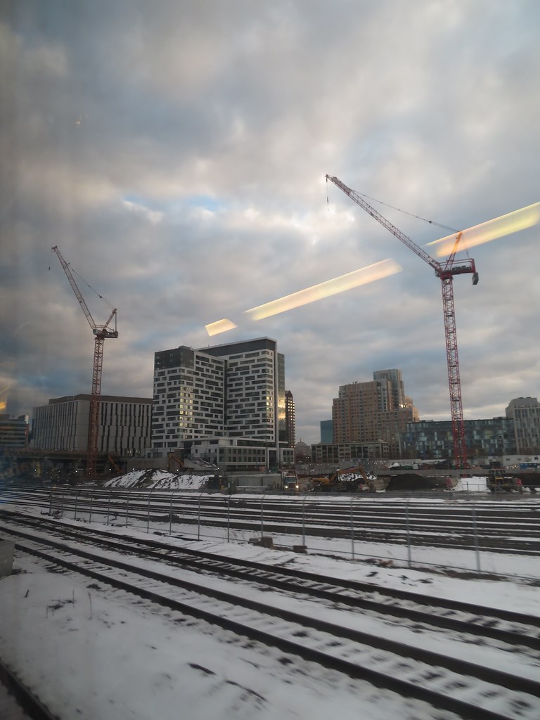 IMG_8051
 IMG_8050