Picking up on something started in the
Red-Blue connector thread.
From the R-B thread:
IF the Red-Blue connector project encompassed the Red-Blue connection at/under Charles/MGH AND then the Blue Line continued under the river to Kendall, it would seem it would be quite useful to create a 3-line mega station near the center of Kendall Square. Ideally Red, Blue, and the Grand Junction LRV lines would all intersect to support commuting to/from Kendall, one of the areas of greater Boston where in-person work is most likely to continue due to all the Kendall labs. An advantage of Blue all the way to Kendall (even though it will likely already run to Charles/MGH in the near future) is that there's demand for to/from Logan Airport travel from Kendall. This would enable a zero-transfer ride to Logan from Kendall (among other advantages).
Anyway, we run into geography issues since the intersection of Grand Junction, Red, and Blue wouldn't be close enough to each other at Kendall (particularly GJ being too far west)...unless...
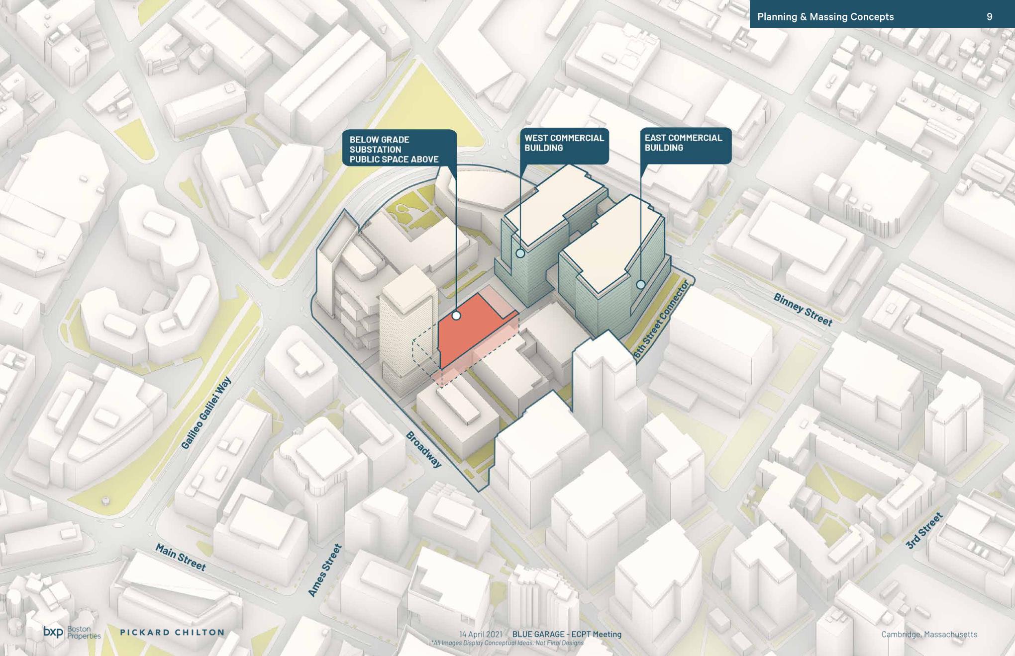
The huge MIT Volpe project is going to be digging out the multi-acre side just north of the heart of Kendall square. A giant underground garage bathtub with slurry walls, etc., is already planned. What if the Blue line tunneled under the Charles just north of the Longfellow and then proceeded under the Broad Canal to the Volpe site, terminating in/under the new Volpe bathtub. There would be space for a small storage yard, etc., under there. Then, underground walkways could be provided to both the legacy Kendall RL station as well as to the intersection of the GJ (only about 900 feet away from edge of Volpe parcel to the Broadway/GJ intersection). We could create a large underground plaza connecting Red, Blue, and Grand Junction at Kendall. It could include people movers to help span the large distances.
This would also help with the fact that the Broadway/Main/Third intersection is currently a cars-pedestrian shitshow with no obvious way to improve it without going underground.
It would seem that we'd rarely have the opportunity to create such a large/underground plaza/station in a dense urban area as we will soon have with the Volpe construction.