stick n move
Superstar
- Joined
- Oct 14, 2009
- Messages
- 13,664
- Reaction score
- 25,271
Yea thats the recent plan for the rotary replacement. I cant remember where it was posted but its on this forum somewhere.
Regarding the road infrastructure, they need to remove the onramp from Columbia into 93 south and exit from 93 north to Columbia. Traffic coming on 93 north can get off at Morrissey Blvd. Create a new onramp at Freeport Street to 93 south (remove the existing small onramp) and widen 93 south by 1 full travel lane for a half mile here so people can safely merge onto 93 south. For a portion of this .50 widening, there's already an existing emergency turnout area and it abuts parking lots. I would also widen 93 north by one full travel lane from the existing Freeport street exit to Morrissey exit to allow people to safely exit 93.
This, coupled with a redesign of the rotary, would go a long way to improving the pedestrian and bike setup around JFK/UMass.
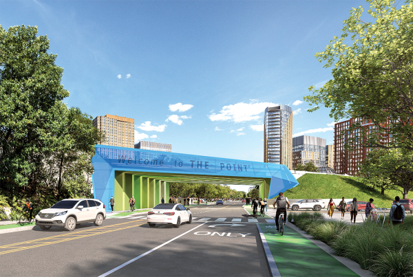

The Point would be the perfect name, even having its own cartoon:I wonder if this program with be changed to The Point. Sounds like a fitting name!!!")
Growing up, we called harbor point "da point" (The Point). So there is somewhat of a precedent.The Point would be the perfect name, even having its own cartoon
The Point would be the perfect name, even having its own cartoon:

 www.bostonglobe.com
JFK/UMass?Whoa, another huge flood-prone neighborhood with no mass transit connection.
JFK/UMass?
Even if you walk across the expressways to get to JFK/Umass, there’s no mass transit connection there.JFK/UMass?
Let's try a different take:But again, even if you make across the expressways alive there’s no mass transit there. So what good does it do anyone?