Elevated Rail: Boston and Beyond

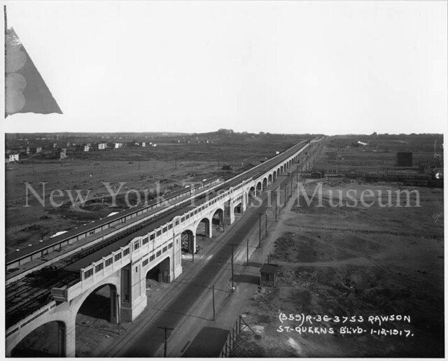
Well ideally for space the tracks would stack vertically with inbound and outbound on the same side but with an offset in section. Though this would require significant inclines approaching and departing stations. This configuration would share the same number of elevators and stairs as a central platform, but with station footprint width exchanged for height.
 
For Comm Ave, I don't see why station width would be an issue. If you shifted the track so it has between the travel lanes (like it is up until Packard's Corner and then is again after Warren Street) there would be plenty of width for a center platform. Just take the width of the current median, plus the width of the 2 platforms each stop has now. Wouldn't the resulting platform be plenty wide enough?
 
If we're talking about Green Line light rail, on certain corridors such as Blue Hill Ave the alignment can also probably curve off the street into an otherwise empty parcel for an El station.

If we're talking about heavy rail, El stations become more obtrusive if only because they are so much longer. For example, the idea of a Mass Ave Red Line El has been proposed from Central down to Fairmount Line, or JFK/Umass, etc. But, consider that an El station by Hynes would likely stretch all the way from Comm Ave to Boylston - a rather hefty intrusion. LR, by contrast, can have El stations which are much less weighty affairs.
 
Speaking of an El. and the Fairmont line, what would people think of an elevated HRRT above the FRA compliant tracks? Everyone agrees that the Indigo line would be better as rapid transit, but the option isn't available due to the corridor needing to serve occasional freight and Amtrak trains. So why not build right above it? Does such an arrangement exist anywhere?
 
Speaking of an El. and the Fairmont line, what would people think of an elevated HRRT above the FRA compliant tracks? Everyone agrees that the Indigo line would be better as rapid transit, but the option isn't available due to the corridor needing to serve occasional freight and Amtrak trains. So why not build right above it? Does such an arrangement exist anywhere?

Henry -- it used to -- the old Atlantic Ave. El ran above a regular freight rail line that serviced piers and industry in the North End --such as the infamous Molasses Tank which exploded in the Great Molasses Flood of 1919
 
Speaking of an El. and the Fairmont line, what would people think of an elevated HRRT above the FRA compliant tracks? Everyone agrees that the Indigo line would be better as rapid transit, but the option isn't available due to the corridor needing to serve occasional freight and Amtrak trains. So why not build right above it? Does such an arrangement exist anywhere?

I don't know if there's a good way to do that on most of the line. However, south of Blue Hill Ave. it used to be almost entirely 4-track because of tons of ex-freight sidings and much longer lead tracks into Readville Yard. It would be possible someday in the distant future to bring the Red Line down there from Ashmont along the Mattapan Line, then plow the 1000 ft. between the Square and the Fairmount Line to continue on to Fairmount, Readville, Westwood/128, or fork at Readville to Dedham Ctr. along the well-preserved abandoned ROW. We'll be on CBTC signal system by then with those 2-3 minute downtown headways that'll easily swallow all the extra branch traffic.

It's not likely the Mattapan Line can stay a tiny remote trolley outpost forever. At some point once you start exiling Bredas there the maintenance needs for modern low-floor cars get to be a real bother for that tiny open-air yard shed and it gets to be too much a P.I.T.A. to constantly truck cars back to Riverside for repair. So figure it's got at most 3decades and an intermediate upgrade to pantographs (cheap at this point because all the prelim weight and power draw upgrade work is either done or scheduled by FY16) to run out the lifespans of a few members of the current Green Line LRV fleet. Then they'll have to make the inevitable call on whether to go for it on heavy rail with just the high-ridership Central Ave. and Mattapan stops or build a full-service trolley carhouse to keep the current setup. The latter's not going to be too good a value for a fleet that'll never exceed 10-12 cars, so 40 years of punting that dilemma has to end eventually.

Get to Mattapan on a Red Line trainset and then it becomes worth studying whether drilling a scant 3 blocks of cut-and-cover tunnel under 4-lanes-wide Cummins Hwy. is worth doing in the future. Or if snaking on the surface on the Neponset reservation next to Truman Pkwy. is a decent prospect. You'd be talking many years after getting to Mattapan, but the short gap and the available expansion space on the Fairmount starts to beckon it. I think that's a lot easier and higher ROI than doing some graft-on to the narrower Fairmount ROW north of Mattapan where the RR is multipurpose enough to have to stay. That area would be closely served by the 28X proposal out to the general Columbia Rd. area and the Urban Ring around Uphams Corner, so why not cut out the BRT middleman and stick a trolley out of Dudley on a B-line type reservation down Blue Hill Ave. RL via Mattapan's the only way Westwood Station's got a shot at any true rapid transit link beyond high-frequency commuter rail, and a full-headway Fairmount station would allow them to close Hyde Park commuter rail station 3 blocks away when the NEC's too congested to use that as a regular stop.


Decades upon decades out of predictable schedule range but Mattapan/RL and Dudley/GL are two pretty straightforward jumping-off points with quite reasonable engineering pain threshold for getting there.
 
F-Line if you're going to the above decades and decades out -- then why not develop a light / heavy / CR rail connection to the Blue Hills Reservation.

Given how much went into the development and preservation of the Reservation -- I always wondered why it was so underutilized -- I've been hiking on nice summer or early autumn weekends and seen only a handful of hikers along the ridge-line

The Blue Hills Reservation is impressively large ( the largest conservation land within a major metropolitan area ) and pleasant area with varied terrain: some parts are secluded and near wilderness, some points of view are spectacular -- but the whole is difficult to access from downtown -- with better connectivity it could be the Boston version of the Bois Bologne in Paris
 
F-Line if you're going to the above decades and decades out -- then why not develop a light / heavy / CR rail connection to the Blue Hills Reservation.

Yah...very doable. The Cummins Hwy. tunnel option sets up a convergence at Blue Hill station for the heavy rail, the 28X trolley, and the CR at one superstation. Blue Hill CR is supposed to be offset a little on the block between Cummins and BH Ave. So say you kind of had the CR station and the RL station offset from each other stretching that block and the trolley terminal upstairs sort of spanning the middle. Another reason it's not totally necessary to make the entire Fairmount line rapid transit, because in addition to flanking it with more feasible Red and trolley that superstation convergence invites a whole lot more bus coverage on that whole swath of the district. Especially the empty quarter in Milton that's precisely the gap you want to see filled.

The 240 out of Central Ave. and 245 out of Mattapan are the only ones that go the Reservation's way now, and both would be a ton more accessible if those stations became became real Red Line stops.
 
Here are my designs for a Packard's Corner - Kenmore Green Line El, with a multi-use path underneath. I haven't figured out how to design the stations yet without disrupting the path.

commaveel1.jpg


commaveel2.jpg


commaveel3.jpg


Somewhat counter-intuitively I think this kind of El would open up Comm Ave better than the current streetcar which has a pedestrian-blocking fence through most of its center.
 
Reminds me of the Queens Blvd Viaduct.

800px-Qns_blvd_39st_jeh.JPG


Although when this was built Queens looked like this:
4920659604_e7d7cea824_z.jpg
 
Here are my designs for a Packard's Corner - Kenmore Green Line El, with a multi-use path underneath. I haven't figured out how to design the stations yet without disrupting the path.


commaveel2.jpg


Somewhat counter-intuitively I think this kind of El would open up Comm Ave better than the current streetcar which has a pedestrian-blocking fence through most of its center.

If I didn't know better -- I'd interpret that image as depicting a Monorail on Comm Ave.
 
Last edited:
Seems a bit bulky maybe?

I'd love to see something like the elevated Metro lines in Paris:

(Click for more)
 
Somewhat counter-intuitively I think this kind of El would open up Comm Ave better than the current streetcar which has a pedestrian-blocking fence through most of its center.

I think that fence is necessary to prevent pedestrians from crossing 6 lanes of comm ave traffic.
 
They make nice single-pier structures that visually look a lot narrower than that and block out less sun. You can do some really unobtrusive, less El-looking things with that type of construction.

Seattle:
3570728577_f55b3ed138.jpg
 
if boston ever builds new elevated railways they will have to be single pier. The memory of the wasteland under the central artery will not be going away anytime soon.
 
Seattle has created some very light and graceful elevated structures for their light rail line. This one has two tracks on it. I could see this for Comm Ave:

seattlelightrail.jpg
 
Seattle has created some very light and graceful elevated structures for their light rail line. This one has two tracks on it. I could see this for Comm Ave:

seattlelightrail.jpg

That's the same prefab concrete section construction that's all the rage on highway ramps these days. Like snapping together Lego blocks. Attractive and easier to maintain than steelwork, and costs scale well when you have to do a lot of it. China just built an HSR line though impossible mountain terrain using that construction for the umpteen viaducts it had to build over gorges. It was almost done on a dare to the rest of the world to see how fast they could construct a line from scratch through the most inhospitable geography.

It's too bad elevated highways have poisoned the well for new above-street structures for generations in this country. You can build an awful lot of route miles of really fast total grade separation for a whole lot less money than tunneling and a whole lot less compromises than grade crossings or mixed traffic. Using design that casts an ultra-slim sun shadow like that Seattle pic.
 
OK. So we know it's possible to build elevated that looks good. What would it take (dollar wise) to do Comm. Ave. from from Kenmore to at least Harvard if not all the way to BC as an elevated track? By what factor is it less expensive than tunneling?
 
OK. So we know it's possible to build elevated that looks good. What would it take (dollar wise) to do Comm. Ave. from from Kenmore to at least Harvard if not all the way to BC as an elevated track? By what factor is it less expensive than tunneling?

BC may not be a good comparison because the reservation has been an uninterrupted trolley line for 120 years and doesn't have a whole lot in the way of buried utilities. It's also very far away from any building abutments, and is on easier-to-manage soil than bedrock or landfill found elsewhere. It's definitely not cheaper, but it's probably more practical to cut-and-cover tunnel on that particular route out to Packard's Corner. Up the hill...that is probably not conducive to digging because of the grades and bedrock. BERy long ago planned to take the subway beyond Kenmore as it saw rapid transit conversion in the subway's future. But it wanted to take the subway straight up Brighton Ave. on the A-line route.


It's the utilities and building mitigation that add sticker shock to urban tunneling. That's what totally undid Silver Line Phase III. Not only were they tunneling under narrow Chinatown streets under the densest web of utility spaghetti in the city, but they were trying to do it with a bus tunnel on wider footprint than rail. Utilities, building mitigation, historical mitigation to the burial ground on the Common...that was extra billions right there. They learned the hard way those streets can't support a dig. Whereas they'd have better luck re-mounting SLIII using the existing abandoned trolley tunnel, then crossing under the Pike land cleared of utilities within the last 50 years and hanging a left under the always-uninterrupted NEC to get to South Station in a clean dig.


Prefab El would work nice on the Washington St. median to undo the mistake of blowing up the old El. No way the utility relocation would ever allow a subway dig under there. It would work decent on routes that have partial reservation space and partially no, like the southern half of the Urban Ring which has nice and wide Melnea Cass but some tough squeezes elsewhere and utterly unbuildable tunneling in the T's own insane Phase III plan. Maximize the options. Tunnels are great for pre-cleared space or "decking" under an existing rail ROW, modern Els are great when open heart street surgery in urban density is too tough. Both have their applications, and both could be used to good effect in Boston on real projects like the UR where Green-under-Comm can feed the two halves of it, and that southern UR that doesn't follow any RR ROW's can be pieced together with enough El and reservation-running to make a contiguous Phase III circuit. Seattle has less of a choice on what it can feasibly do because Cascades bedrock is not real cut-and-cover tunnel friendly like scoopable river silt or glacial debris.


Still think we got many decades to get over our aesthetic allergy to overhead structures before the latter's a serious option for the public. Old Central Artery traumas die hard. I almost wonder if everyone with memories of that hulking eyesore has to be dead or too elderly to remember before it's safe to say the "E" word in Boston again.
 
Keep in mind the reason we have a subway at all is because people flipped out over elevated tracks on Tremont St and in Cambridge back in the 1890s. The other elevated lines only got built because they went through less desnly populated/less politically connected areas.
 

Back
Top