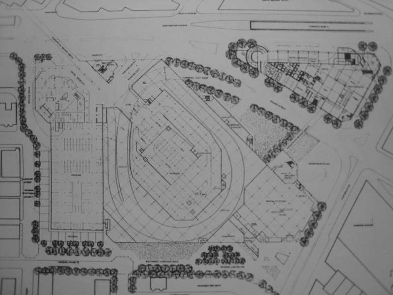
Evolution of the Prudential Center: 1954-1989

kz1000ps

Senior Member
Joined
May 28, 2006
Messages
8,827
Reaction score
10,331
I've gather these pictures from the Copley Square branch of the public library over time, and I figure I may as well share them with you. Some of the pictures I've posted before, but chances are they were taken with the ol' cell cam, whereas all of these are done with my PowerShot.

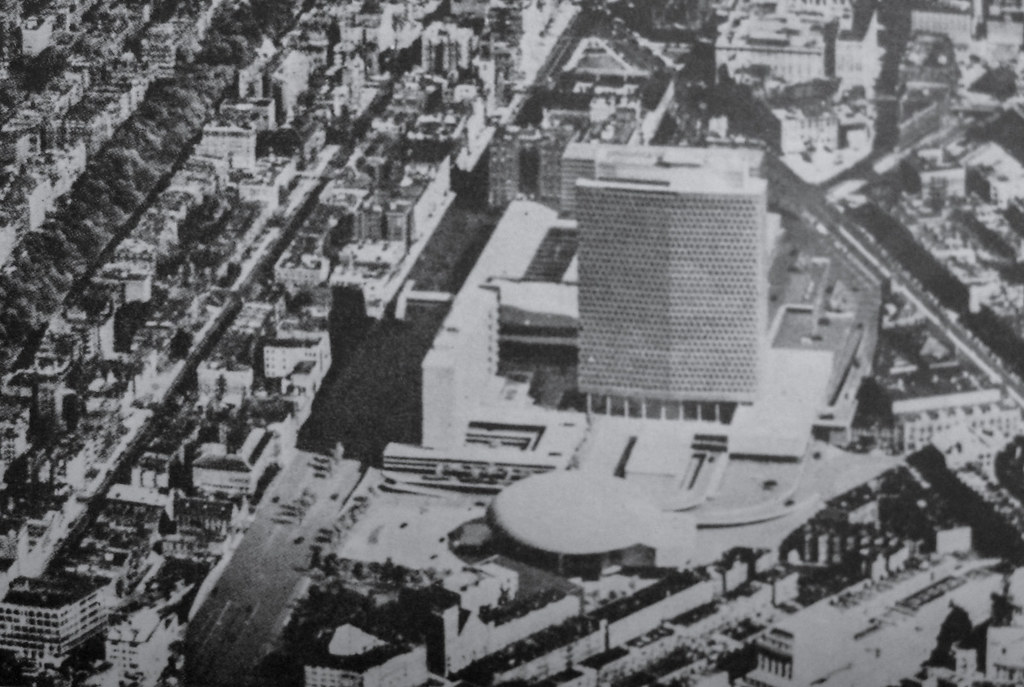
The earliest version of the Pru, taken from the cover of the "Taxi News Digest," October '54 edition:
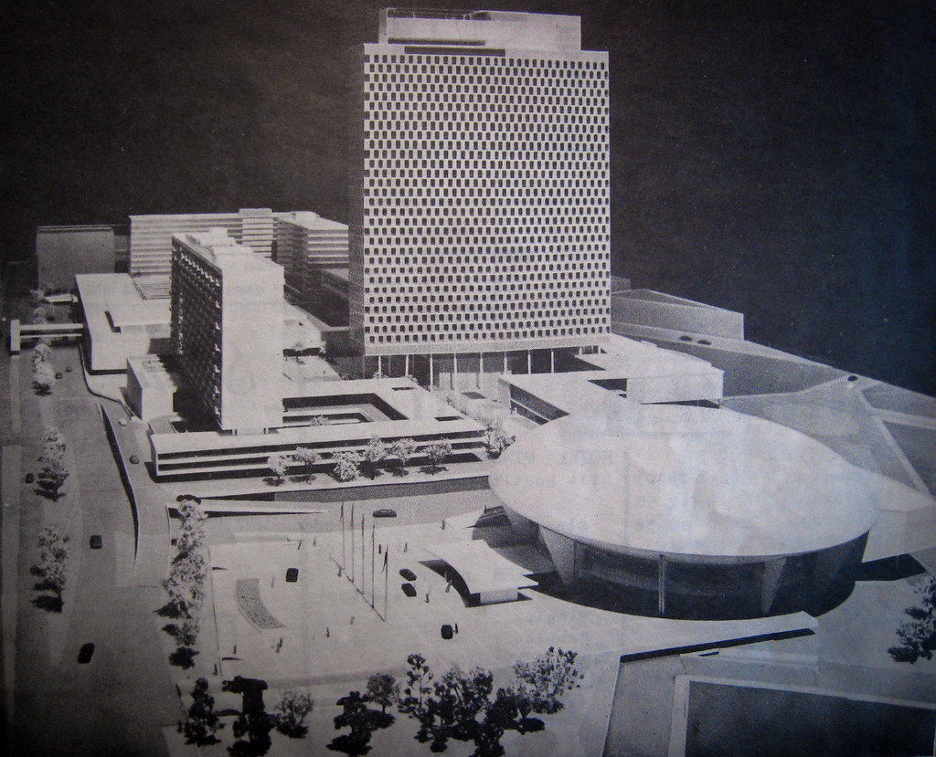
26285359251_282f5f2c46_b.jpg


26351588325_46b41dc614_b.jpg


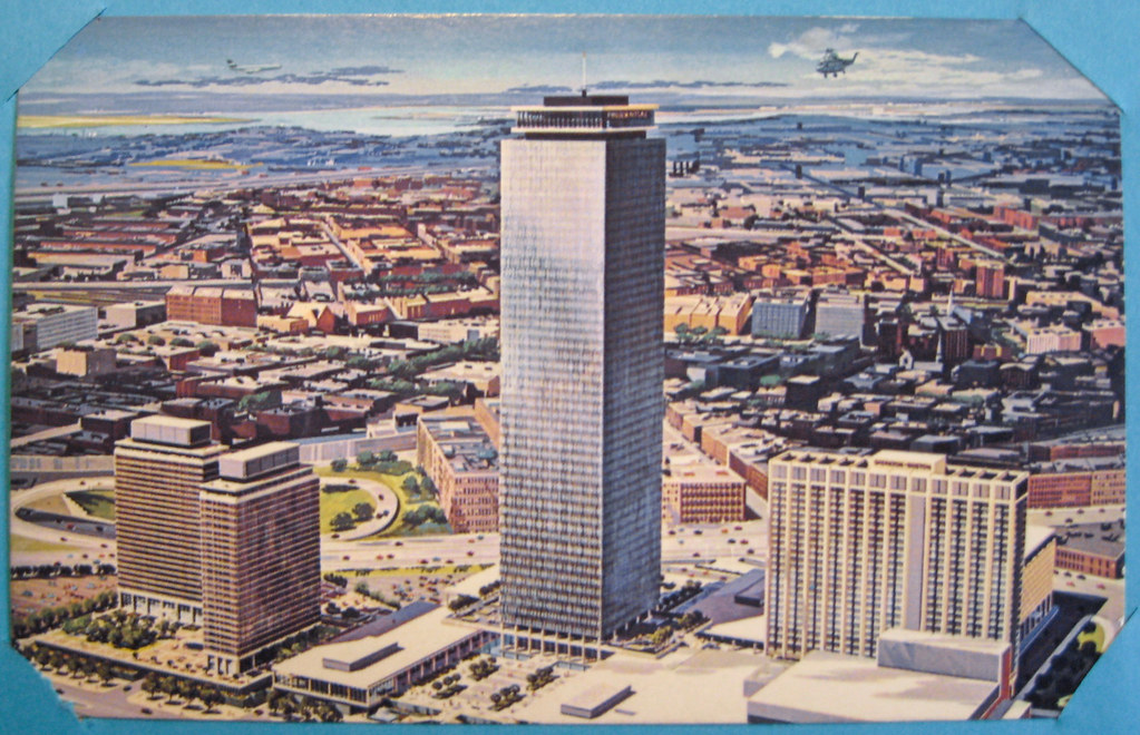
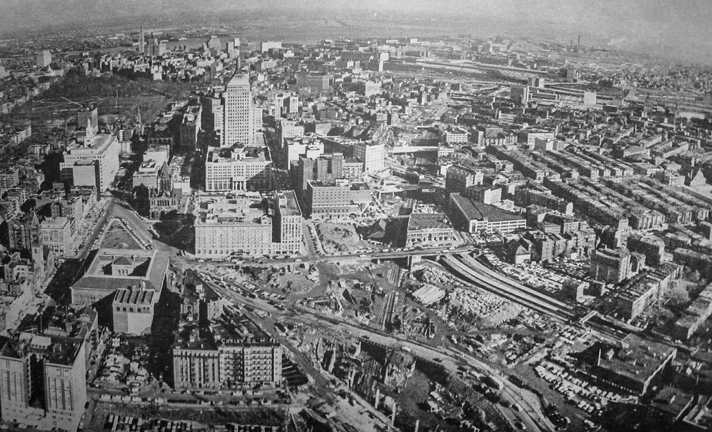
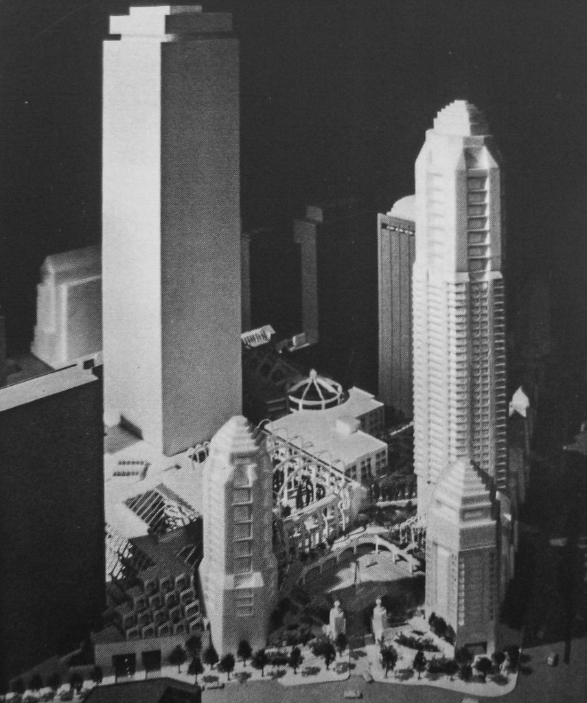
1959, the Pru has assumed its basic final form, with many residential towers envisioned:
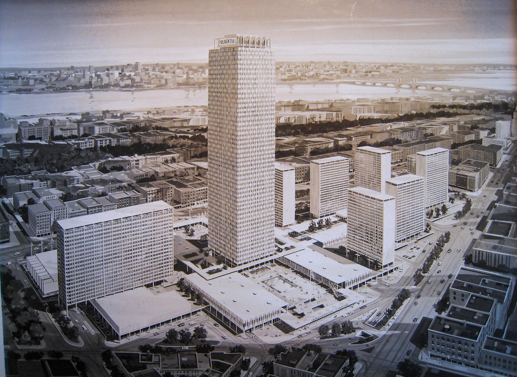
26351590335_72eb9d9dec_b.jpg


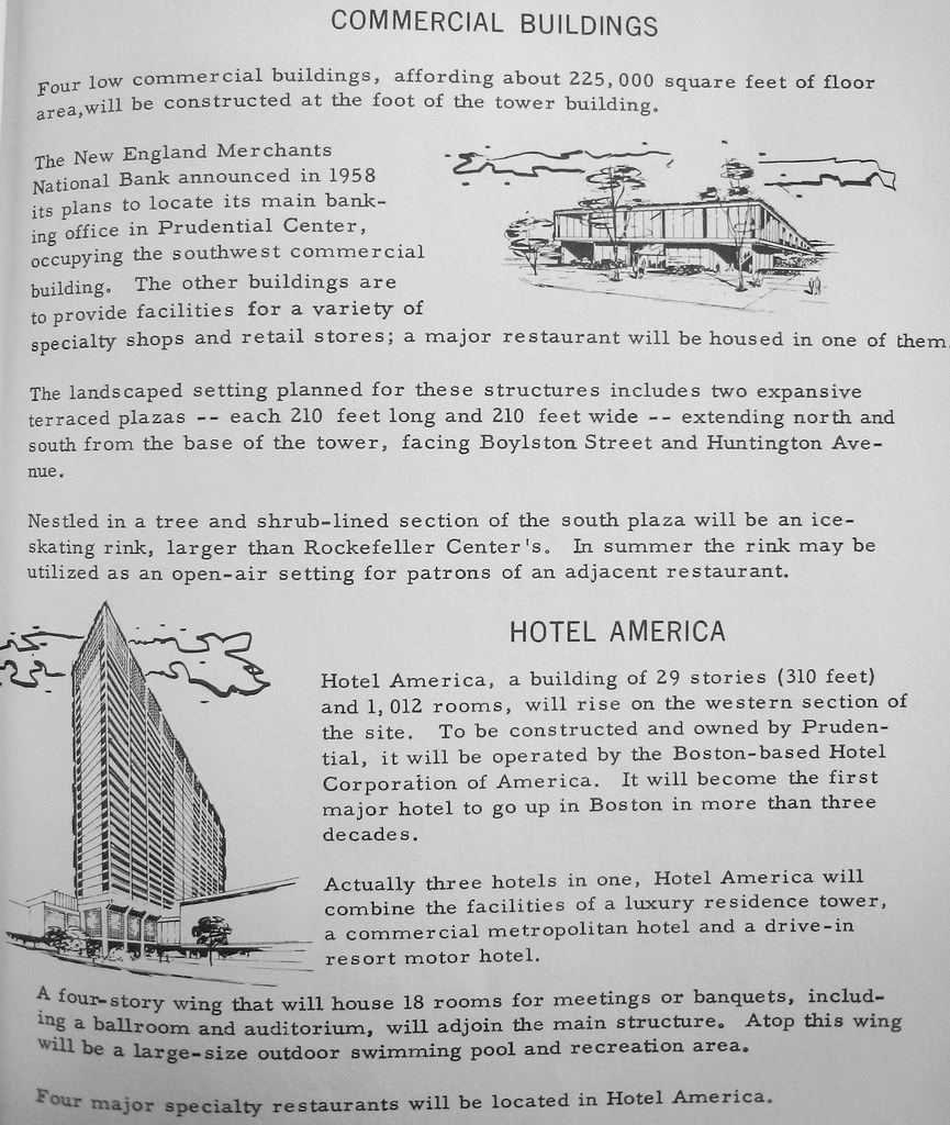
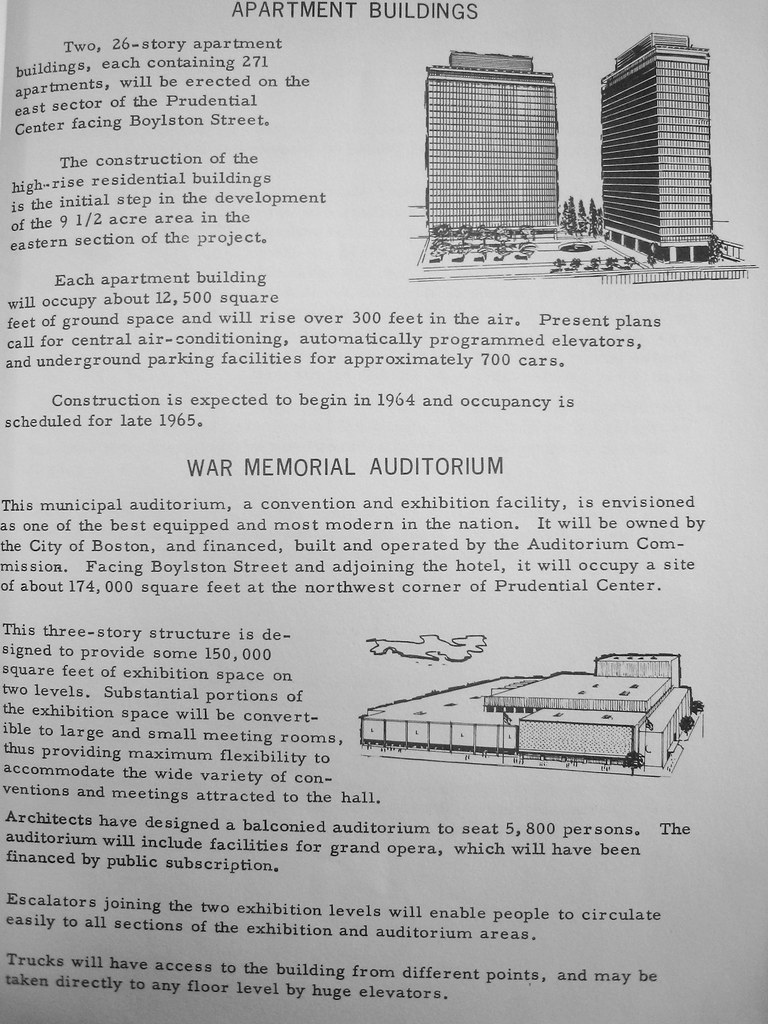
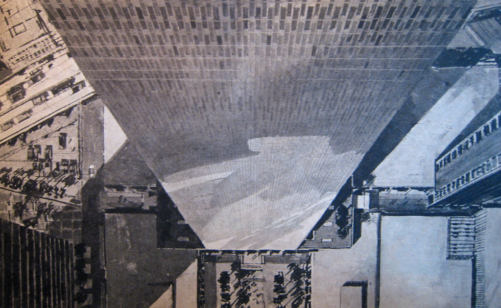
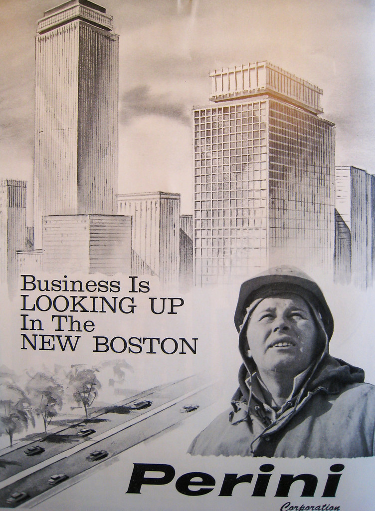
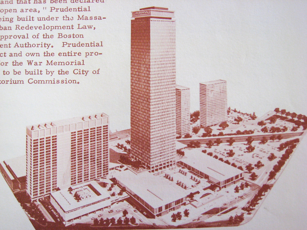
A couple years later, and the plan's been pared down to its first phase:
26259191142_b11acb92d3_b.jpg


26259190532_f314b0d146_b.jpg


26351590525_d1ff92849f_b.jpg


26325638806_b28e1837c4_b.jpg


26259196432_34768c3eaa_b.jpg


26259196042_c447aca840_b.jpg


26285360581_76f5476f16_b.jpg


26325632586_2ff4a8947c_b.jpg


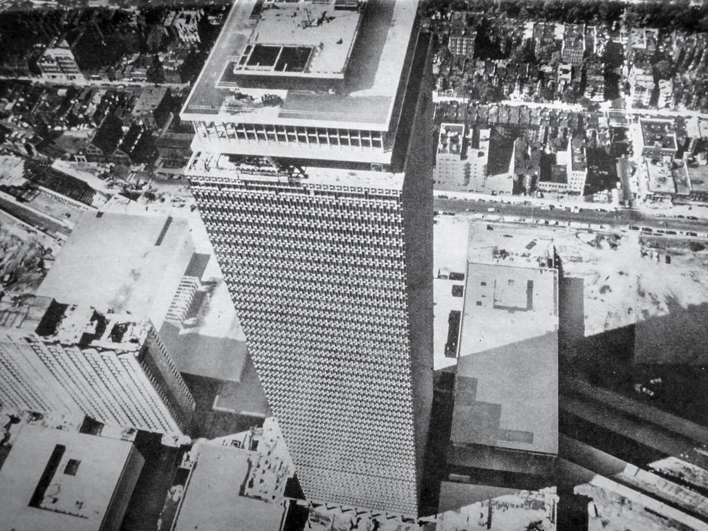
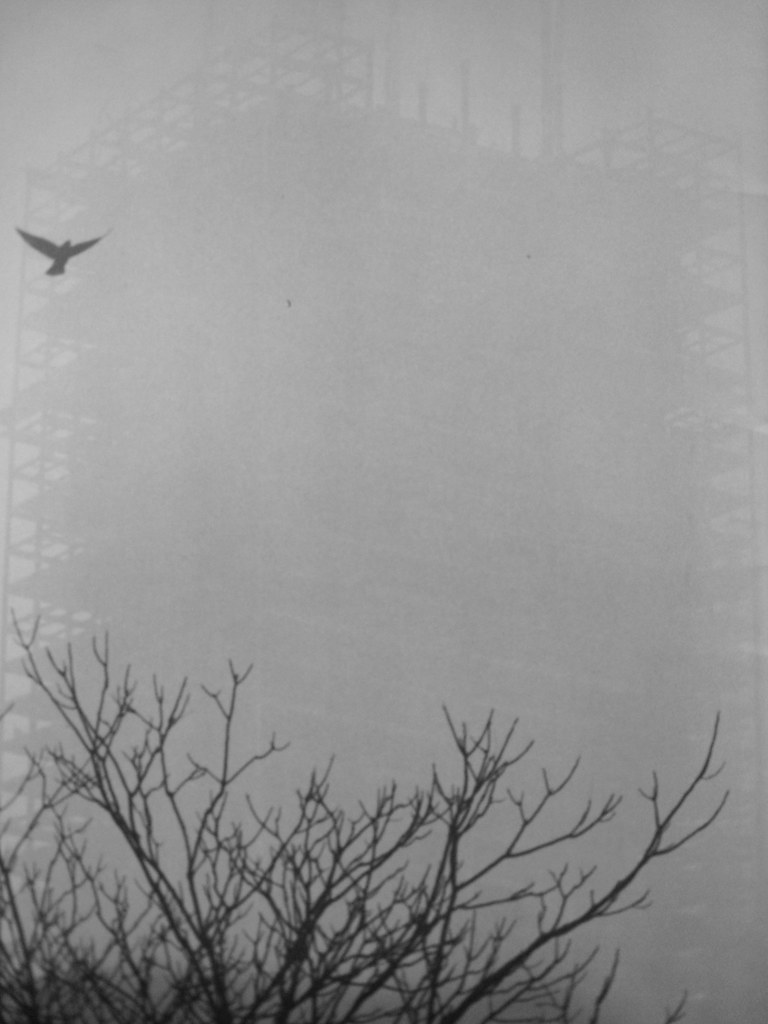
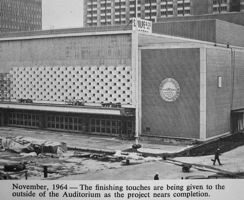
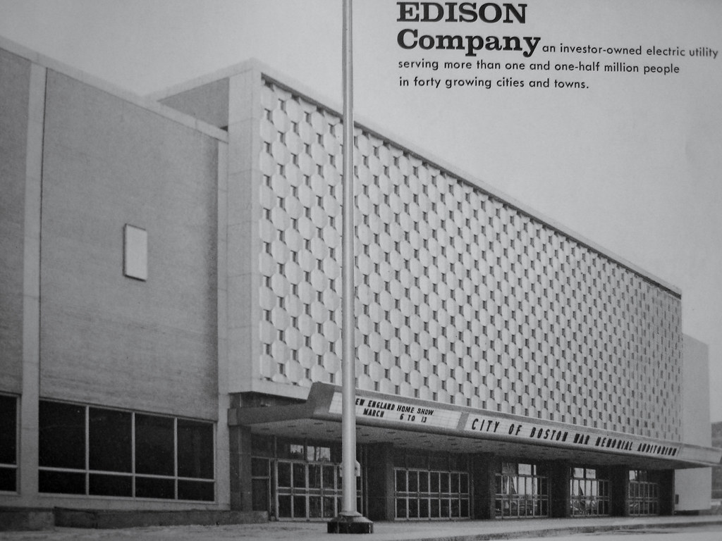
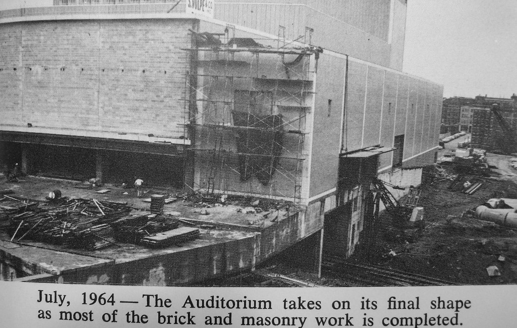
Auditorium under construction:
25746724014_2b83d50913_b.jpg


26325637406_49f687c5af_b.jpg


26351588925_3476e384be_b.jpg


26259195742_3d73ce6a14_b.jpg


img2217qt8.jpg


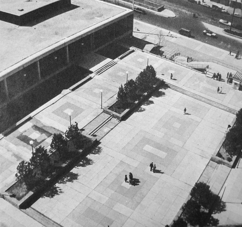
The barren plaza:

26325632936_4673c9d801_b.jpg


26078727080_9cd0da6481_b.jpg


Circa 1968:

img1912jw4.jpg


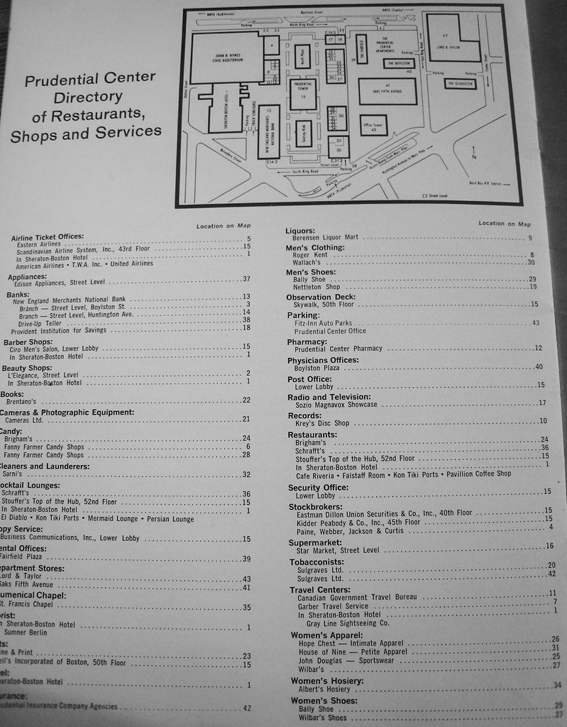
And the tenant directory from the same period:
26351584165_26ded05d93_b.jpg


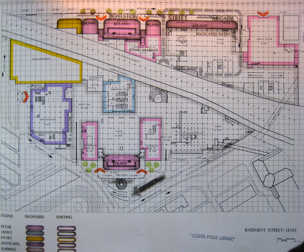
Now let's fast forward to 1981. A firm is hired to start identifying ways to make better use of their space:
26325631926_ce22eb6738_b.jpg


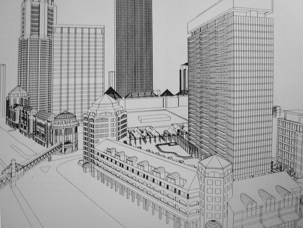
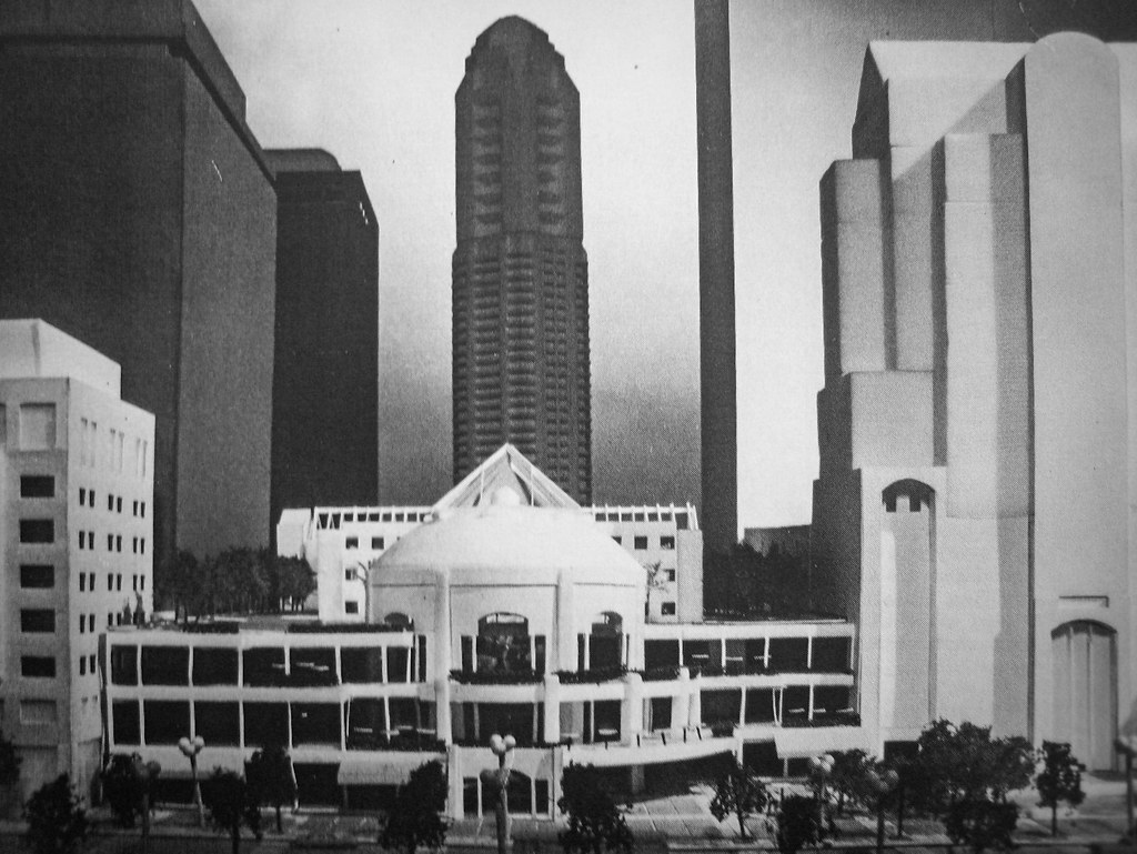
By 1985 a Master Plan had been completed, which is where the next several images come from:
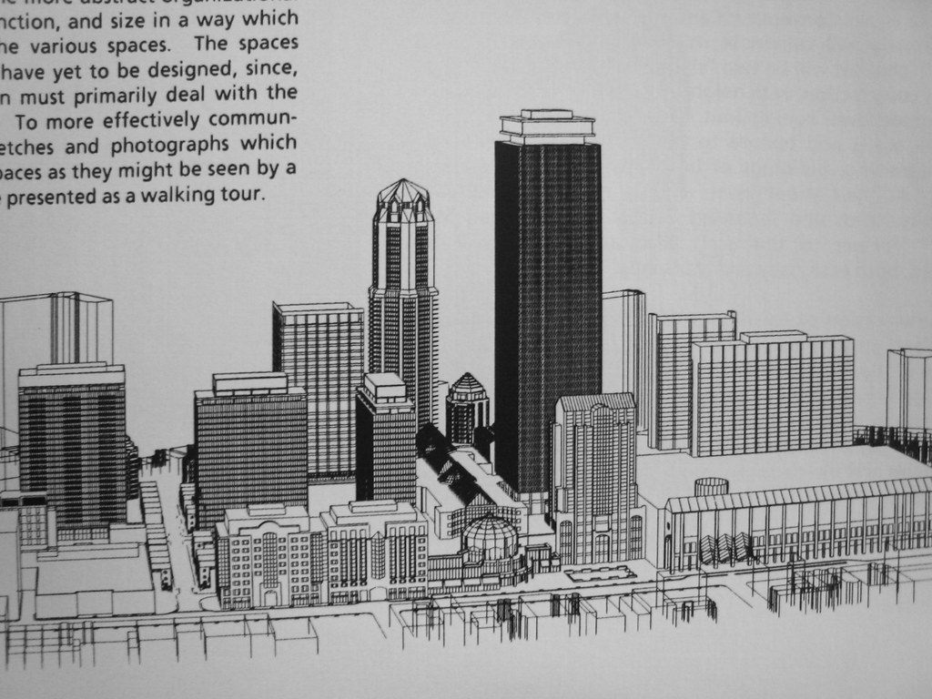
26351587165_48c02a4d6f_b.jpg


26285356851_d6a5794600_b.jpg


26285352511_e89e0df558_b.jpg


25746728494_74a16f03da_b.jpg


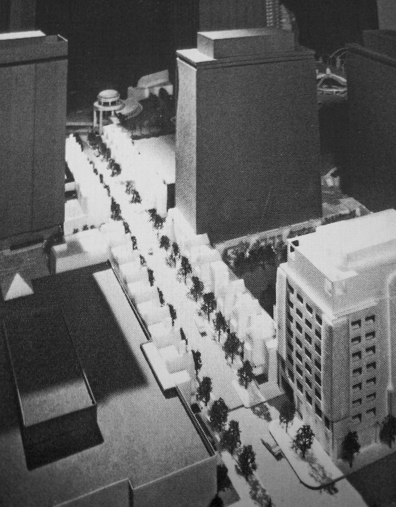
Perhaps the most intriguing idea from this plan: East Ring Road was to have townhouses built on them. The road would have been scaled down to "carriage" size, and other underutilized plaza/empty space would have created the rest of land needed for them:
26325634796_b179ed3b24_b.jpg


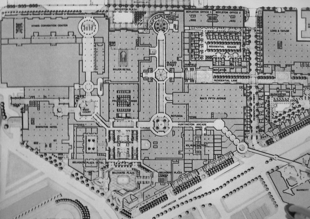
Also note that there is a "residential square" proposed off of East Ring Road:
26078726360_b4c5bd29c8_b.jpg


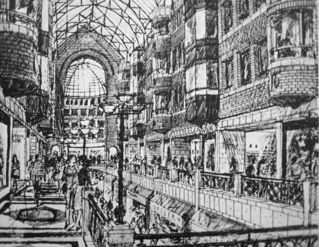
The MP proposed building up the main mall area a la Copley Place, although in place of the Drumpf-like brass and pink marble, this would have had a more typical Boston flavor to it:
25746727754_dac18928b1_b.jpg


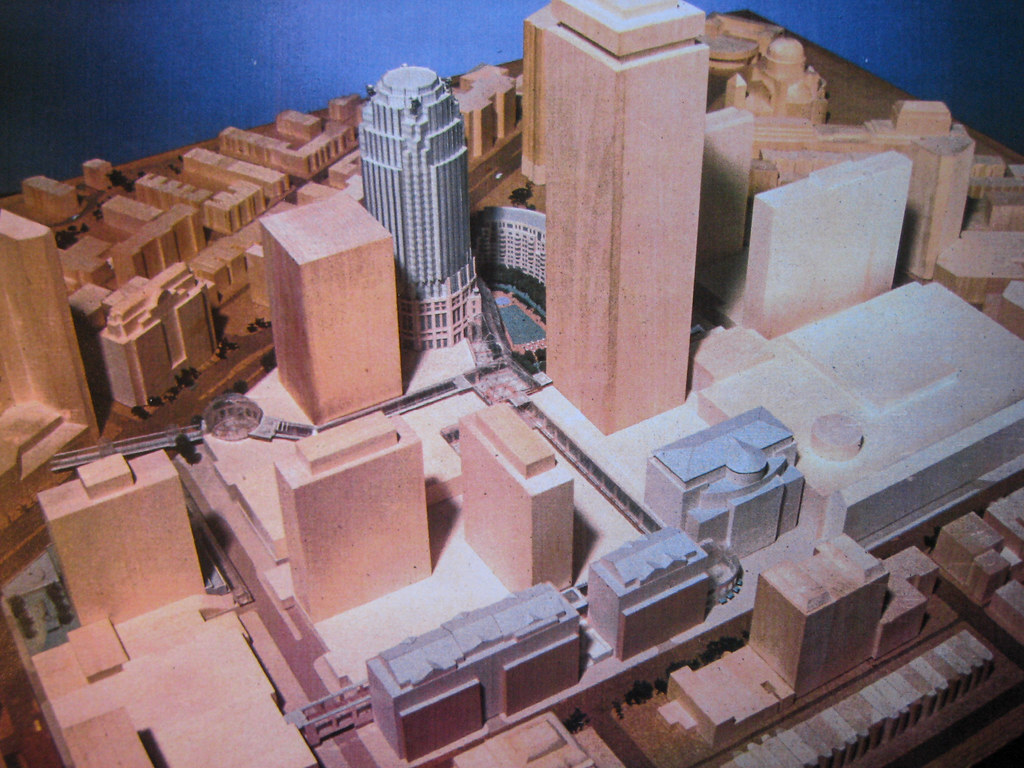
And then by 1989, two years after the so called PruPAC had been formed, the plans assumed the shape that they still have today:
26325634036_15a4626b38_b.jpg


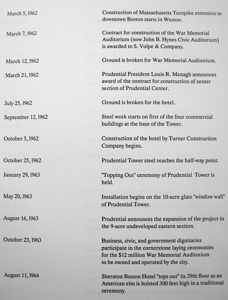
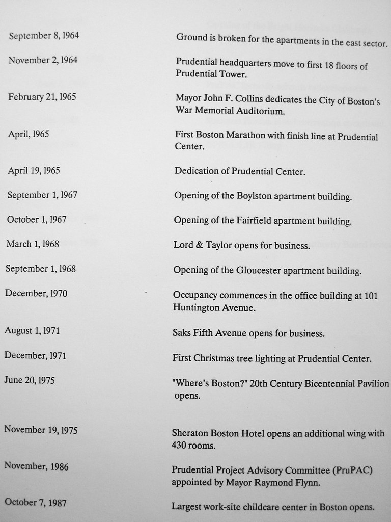
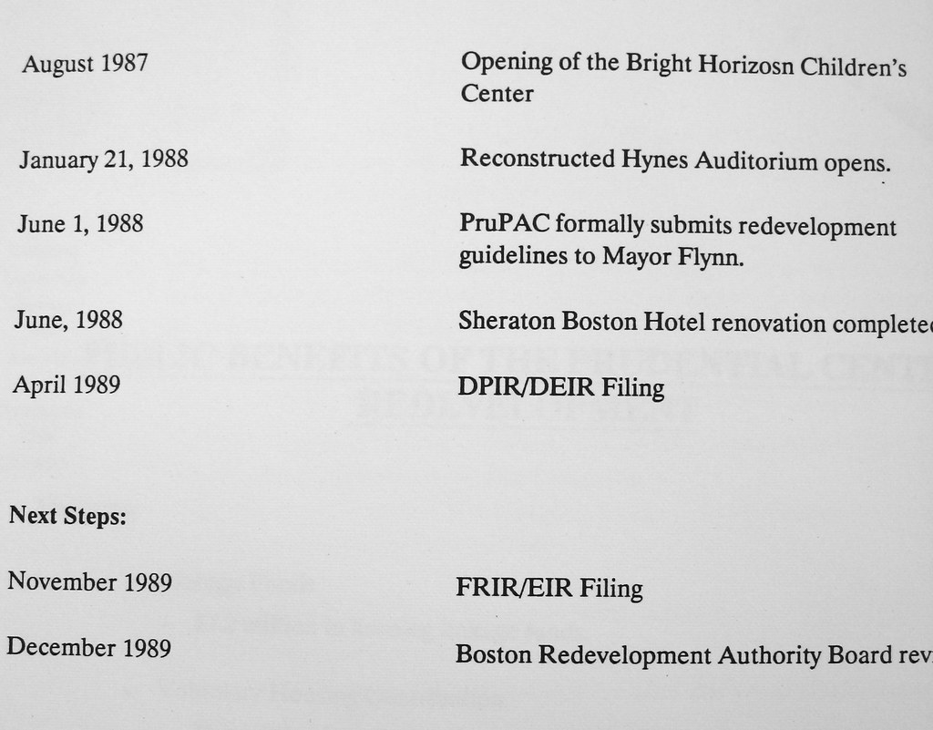
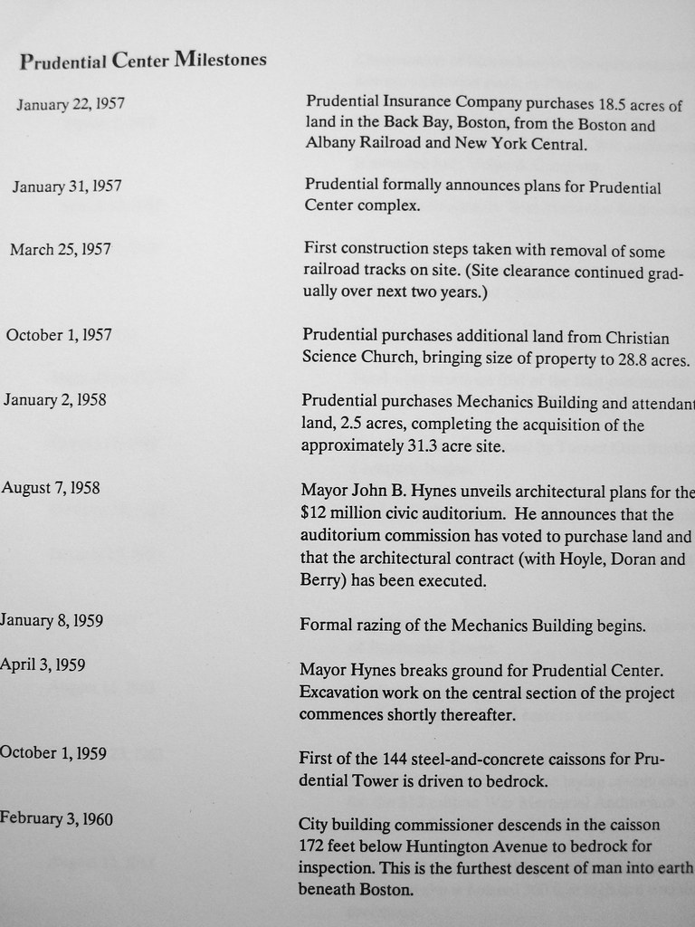
LASTLY, here is a timeline of "Prudential Center Milestones"
26078724670_f229b8c0ec_b.jpg


26259190152_a7e6344d73_b.jpg


25748833223_9307dc88b0_b.jpg


26351584985_10a270464a_b.jpg


OK, that's it. Hope you enjoyed!
 
Last edited:
Awesome post! I love stuff like this. That idea for row houses along the East Ring Road is pretty cool. It's also nice to see a plan for development that has largely been completed the way it was set out to be.

Edit: The first picture looks like the Empire State Plaza a little bit. Ahead of its time?
 
Very nice work pulling that together!

question -- when I was fairly young i vaguely remember coming in to Boston and walking around the shops at the base of the tower. my limited memory says where the mall is now was open to the air -- at least in parts.

if i'm right about that, when did it get closed in?

i also remember going to a music store in the mall when i was in college -- probably 1988/89 at that time i think everything was glassed in. the escellators down to the street were there. but it was a smaller floor plan, very plain, and not as busy as it typically is now.

anyway, nice post.
 
The non-enclosed shopping area was a terrible place, because the wind just whipped through it. Turning it into a mall greatly improved the entire Pru.
 
wind problems

When the Pru opened there was a small bridge over a pool of water leading from the shopping arcade to the tower. (Are they still there?) The high winds caused the water to spray on people crossing these walk ways. The Pru then put up the glass enclosures. Problem solved? No, pigeons caught in the wind from the tower would smash against the glass. Not a pretty sight for the tenants. They next installed green netting to stop this and this was the way it remained till the recent rebuild.


btw - great post
 
Cool, thanks for posting this. The original renderings for 111 Huntington look terrible! I'm glad that thing was never built.
 
Great posting kz! I too remember when the center was first built and going to my first auto show at the Hynes in 1964. The open malls were indeed windy, but I was fascinated by the stairs leading to open walkways above the malls and ringing around the Pru tower. They were soon closed off the the public though. The glass enclosures helped a bit, but it was always bitterly cold in the winter, and there weren't enough retail shops to make it a "destination." One of the few original features of the center is Donald DeLue's sculpture on the Boylston St. side. He did a similar figure for the New York Worlds Fair in the 60s. He is one of the great 20th C. American sculptures from the school of Paul Manship ("Prometheus" fountain at Rockefeller Center) and other mid-century modern artists. The Child's Gallery on Newbury St. features a number of his maquettes in the front window. I hope a fitting setting will be found for the sculpture when the area in front of the tower is infilled. All in all, I think the ongoing development of this site has been on of the success stories of Boston, even though the interior mall format tends to remove people from the actual sights and sounds of the city streets. My only regret is that water fountains intended to be bubbling in the newest "bamboo garden" section were filled in for plant materials.
 
When I first got here in the 1970s, a guidebook referred to the Pru complex as "antisocial" and "isolated" and said there was "no reason to go there". Wish I still had a copy of this book, whatever it was.
 
I like the tower that was proposed at the entrance of the Prudential on the Boylston Street side. I hope they would build something like that there and another taller tower over the Hynes Convention Center.
 
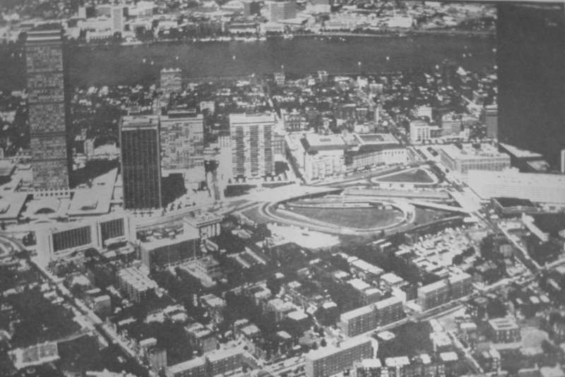
The 4th picture from the top shows an above ground highway ramp. Was that built and then covered with Copley Place? It appears so in Google Maps, but I don't know if the map is accurate.

copleyrampgw4.png
 
I remember going to the old Pru a few times in the 1980s and early 1990s (there was a Brigham's approximately where Legal Sea Foods is now). I have vague memories of it, are there any interior pictures of it prior to its 1993 renovation out there?
 
TheBostonian said:
The 4th picture from the top shows an above ground highway ramp. Was that built and then covered with Copley Place?

To echo Ron, yes. here's a photo from 1977:

img2500au3.jpg


And the ground level floor plan for Copley Place clearly shows how the parking was arranged in and around the existing ramps:

img2512dm6.jpg


** Look for a proper thread on Copley Place, and perhaps some more stuff on the Pru, in the somewhat-near future.
 
Quite a fascinating look at how modernist urban planning tried to overturn all the "rules" of city design that had accumulated over the centuries. Street walls replaced by plazas, mixed use replaced by single-use, density replaced by openess, small blocks replaced by megablocks... We've spent the last 30 years realizing why the old rules had come to be in the first place and trying to put back together what modernism had torn asunder.
 
After seeing the 1980's vintage renderings for the Pru center rebuild, I'm happy they weren't implemented. The 80's architecture envisioned is full of castle-like turrets and little sloped roofs scattered everywhere. That 80's architectural genre was an overdone, ornate and ugly reaction to the minimalist modernism of the 50's and 60's.

Thankfully the 1980's plan wasn't built. Sometimes procrastination is a good thing.
 
Joe_Schmoe said:
Street walls replaced by plazas, mixed use replaced by single-use, density replaced by openess, small blocks replaced by megablocks...

To be fair, the original Prudential replaced mostly railroad yards, not "density" or "street walls" or "small blocks". And it was mixed-use: some offices, some apartments, some shopping, an auditorium, a hotel. Originally had an ice rink, too.
 
Compared to Government Center, at least the Pru Center is gradually developing a more dense, urban fabric in both its interior spaces and along its exterior boundary. A street wall is gradually being developed along Boylston Street. Pru Center is filling in, unlike Government Center with its City Hall Plaza, a vast uninviting empty space with no real prospect of being filled in. The City could take a cue from the Pru Center on how to fill in Government Center.
 
Well lookie there....according to the 1985 master plan, 888 Boylston is shown as being over 300'.

There goes NABB and PruPac's story about this site from the dawn of time never contemplated to be over 180' (?).
 
To be fair, the original Prudential replaced mostly railroad yards, not "density" or "street walls" or "small blocks". And it was mixed-use: some offices, some apartments, some shopping, an auditorium, a hotel. Originally had an ice rink, too.
That may be, but what Joe_Schmoe says is still true.
 

Back
Top