kz1000ps
Senior Member
- Joined
- May 28, 2006
- Messages
- 9,186
- Reaction score
- 13,715
I've gather these pictures from the Copley Square branch of the public library over time, and I figure I may as well share them with you. Some of the pictures I've posted before, but chances are they were taken with the ol' cell cam, whereas all of these are done with my PowerShot.
The earliest version of the Pru, taken from the cover of the "Taxi News Digest," October '54 edition:
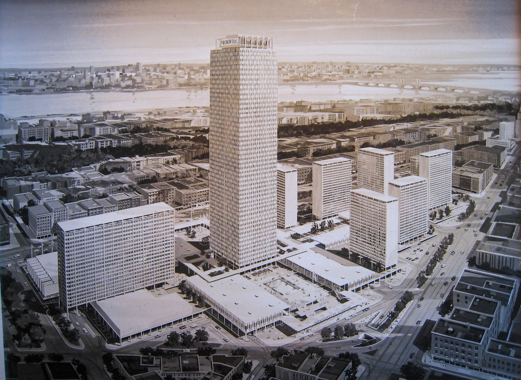
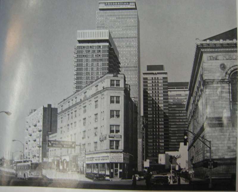
1959, the Pru has assumed its basic final form, with many residential towers envisioned:
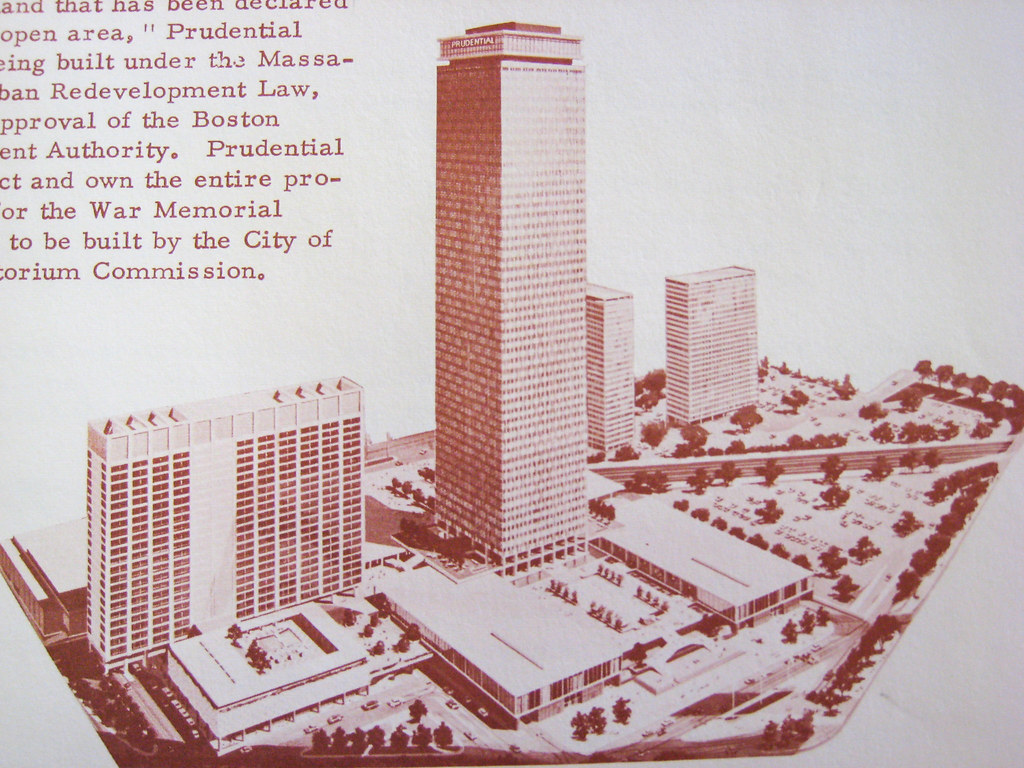
A couple years later, and the plan's been pared down to its first phase:

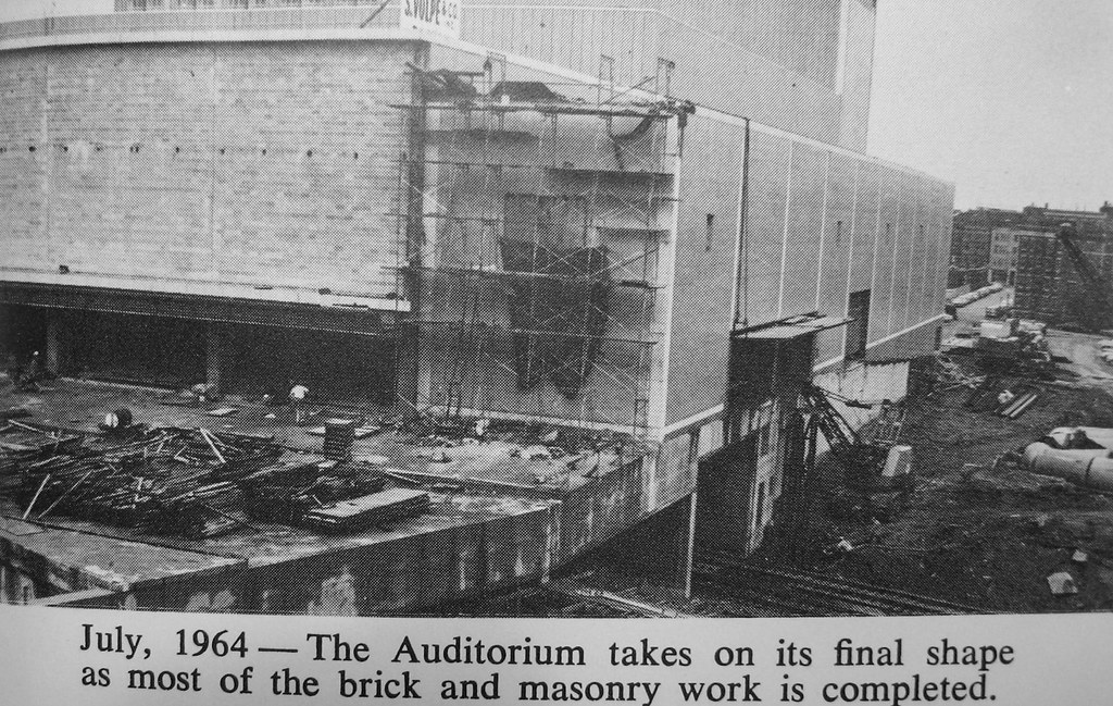
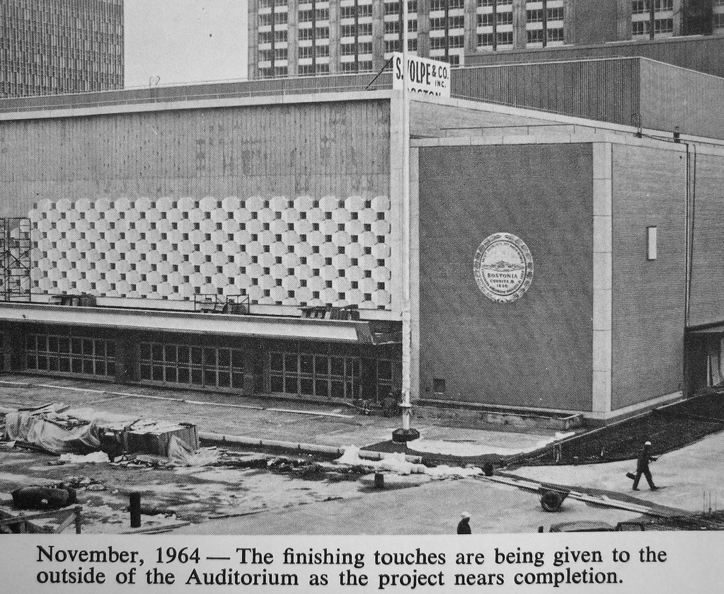
Auditorium under construction:
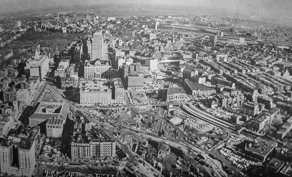
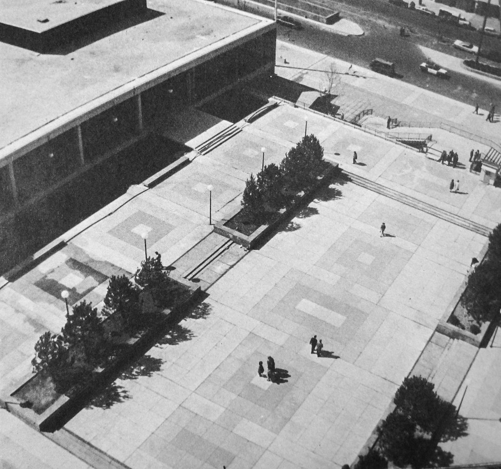
The barren plaza:
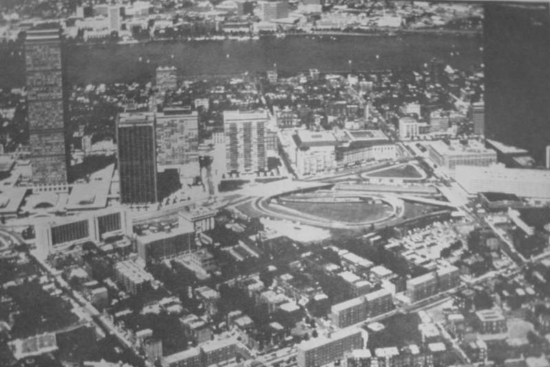
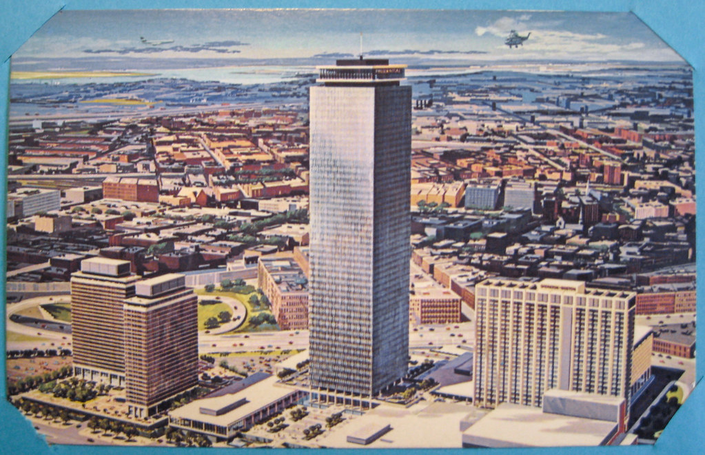
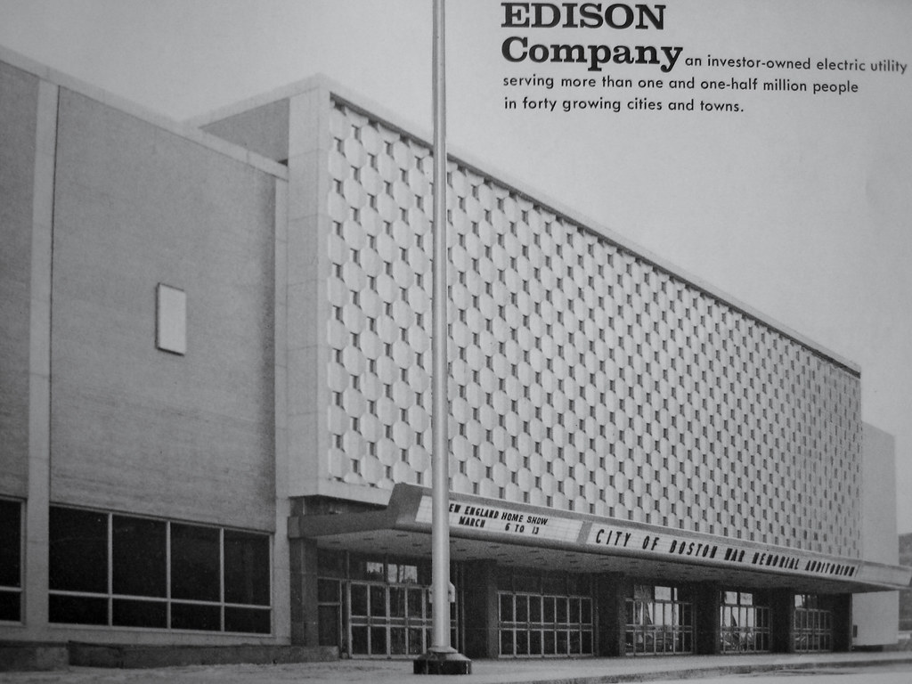
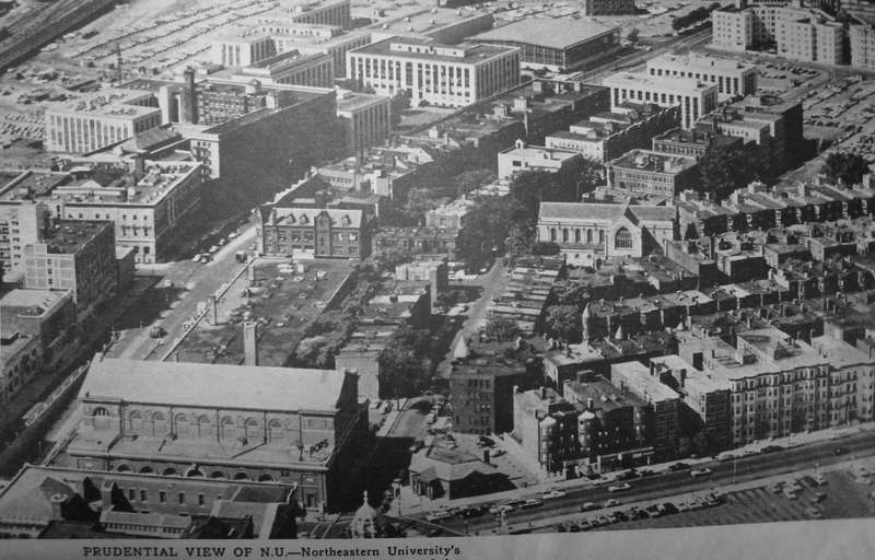
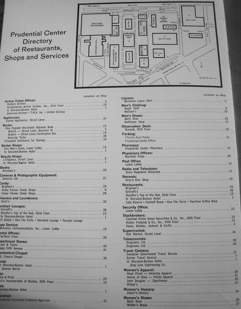
Circa 1968:
And the tenant directory from the same period:
Now let's fast forward to 1981. A firm is hired to start identifying ways to make better use of their space:
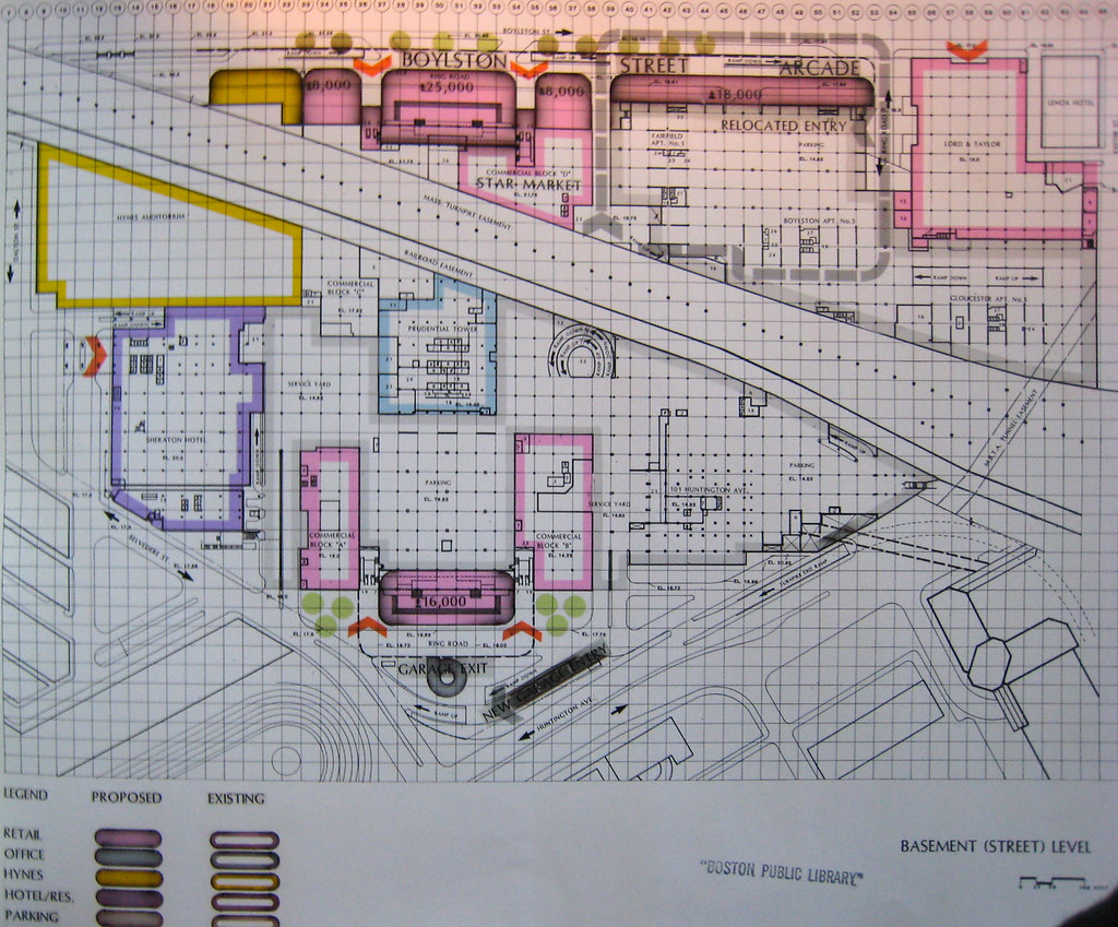
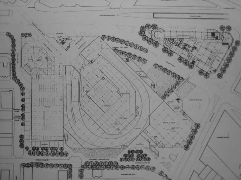
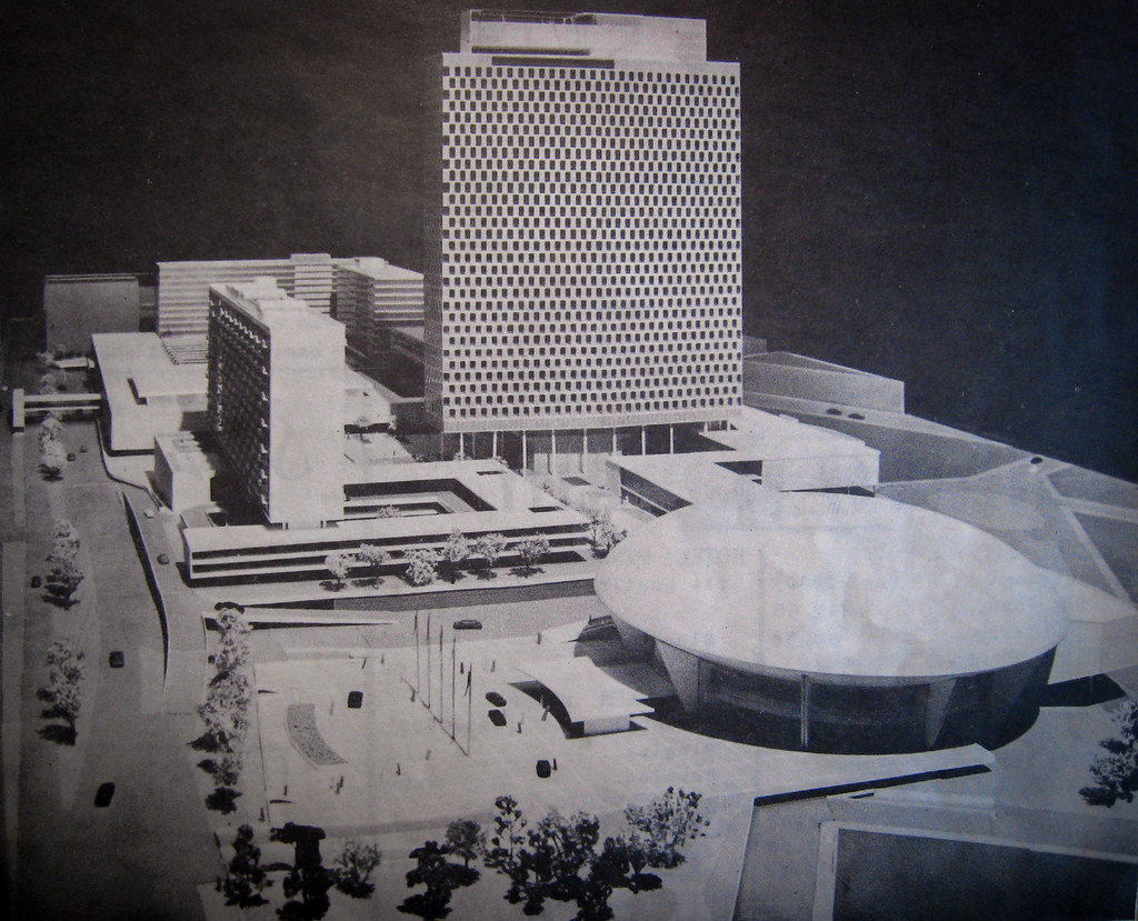
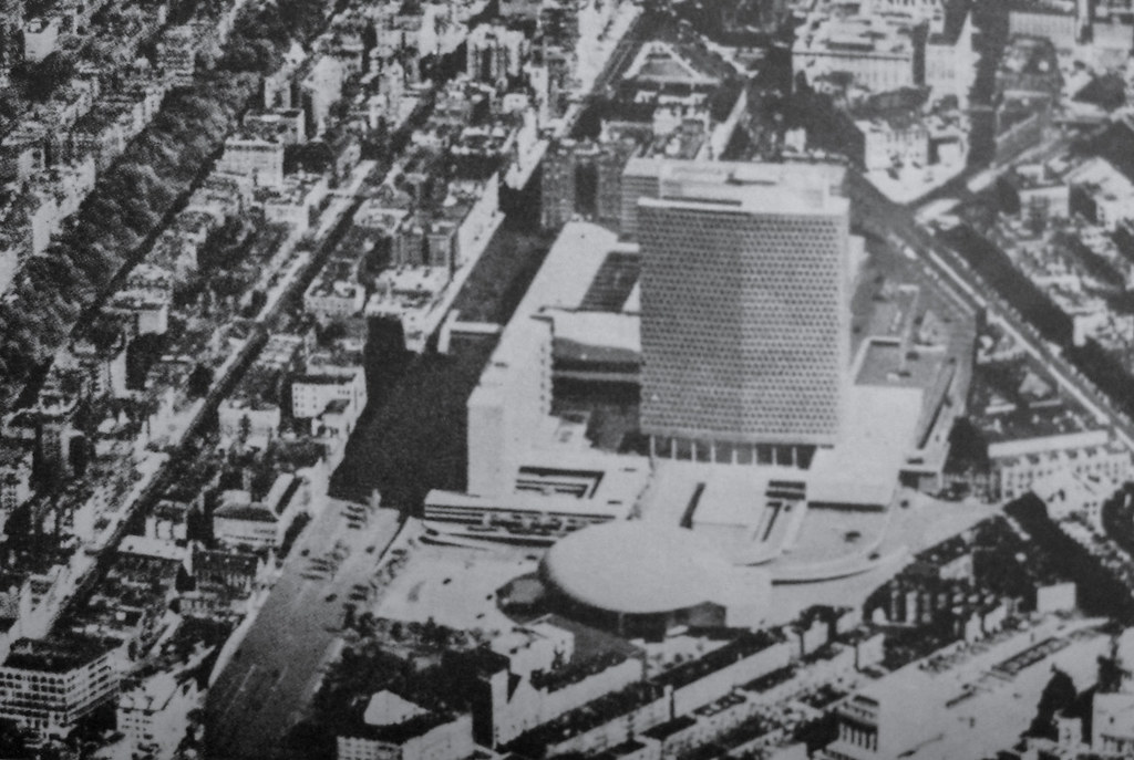
By 1985 a Master Plan had been completed, which is where the next several images come from:
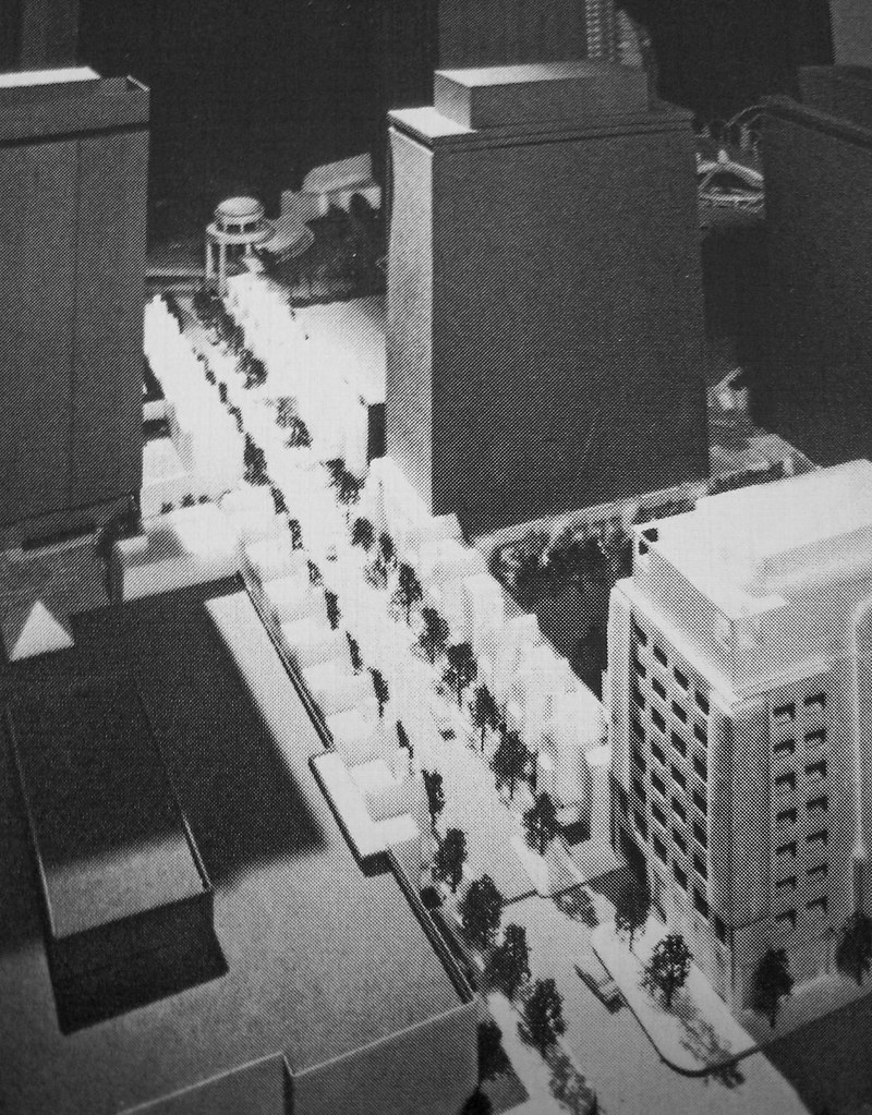
Perhaps the most intriguing idea from this plan: East Ring Road was to have townhouses built on them. The road would have been scaled down to "carriage" size, and other underutilized plaza/empty space would have created the rest of land needed for them:
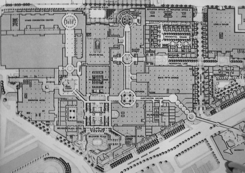
Also note that there is a "residential square" proposed off of East Ring Road:
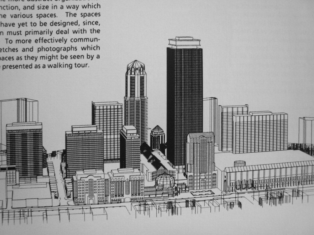
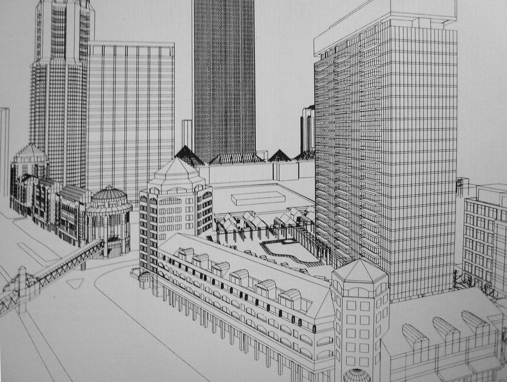
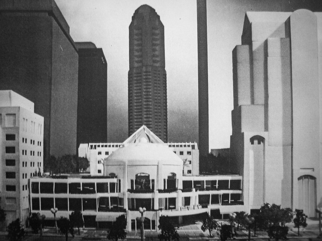
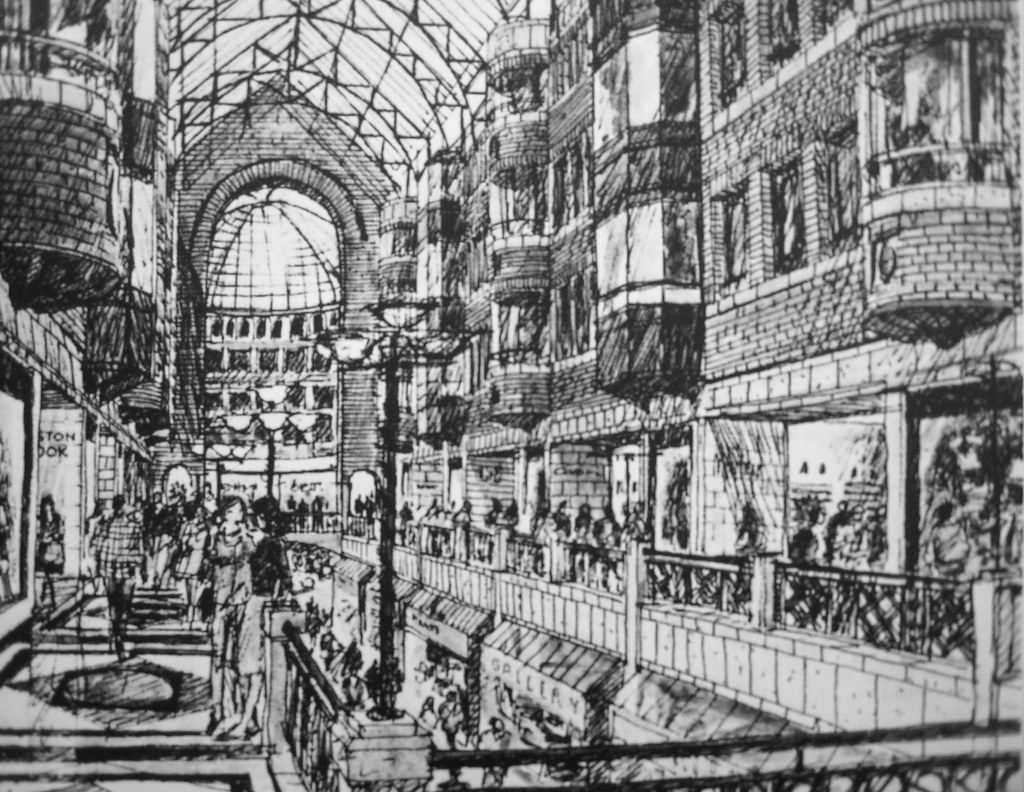
The MP proposed building up the main mall area a la Copley Place, although in place of the Drumpf-like brass and pink marble, this would have had a more typical Boston flavor to it:
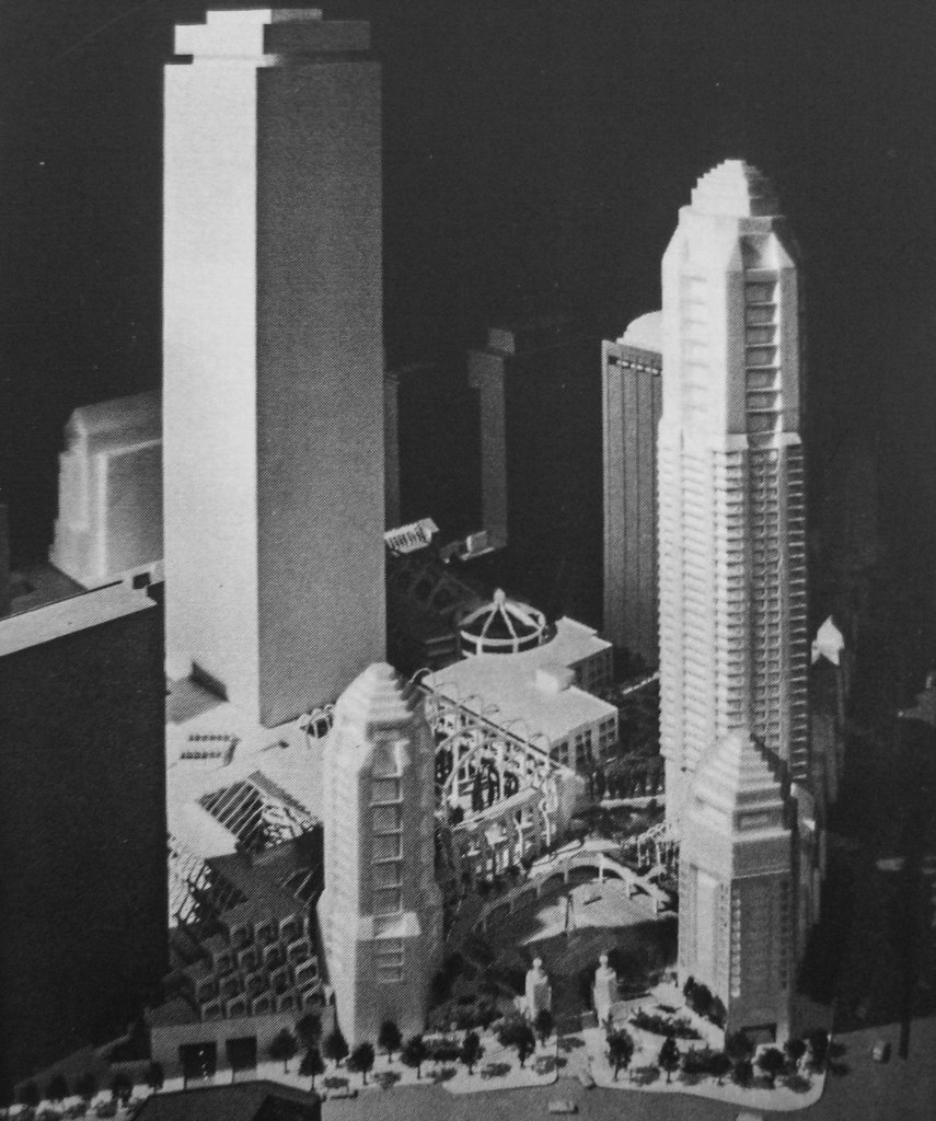
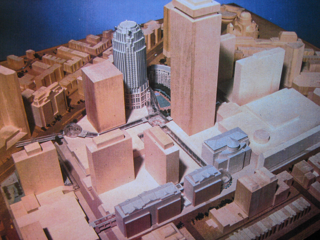
And then by 1989, two years after the so called PruPAC had been formed, the plans assumed the shape that they still have today:
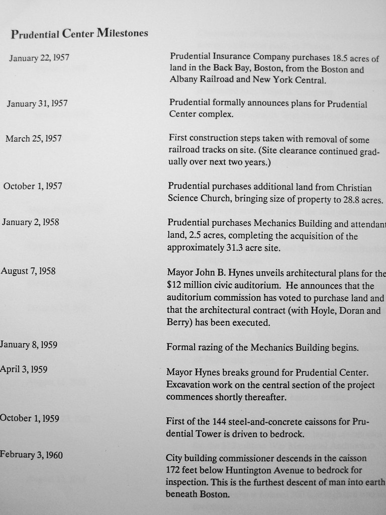
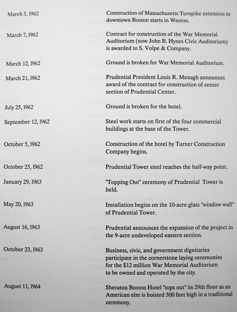
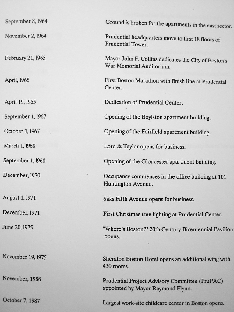
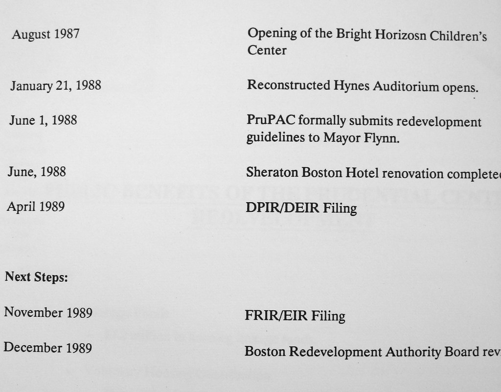
LASTLY, here is a timeline of "Prudential Center Milestones"
OK, that's it. Hope you enjoyed!
The earliest version of the Pru, taken from the cover of the "Taxi News Digest," October '54 edition:
1959, the Pru has assumed its basic final form, with many residential towers envisioned:
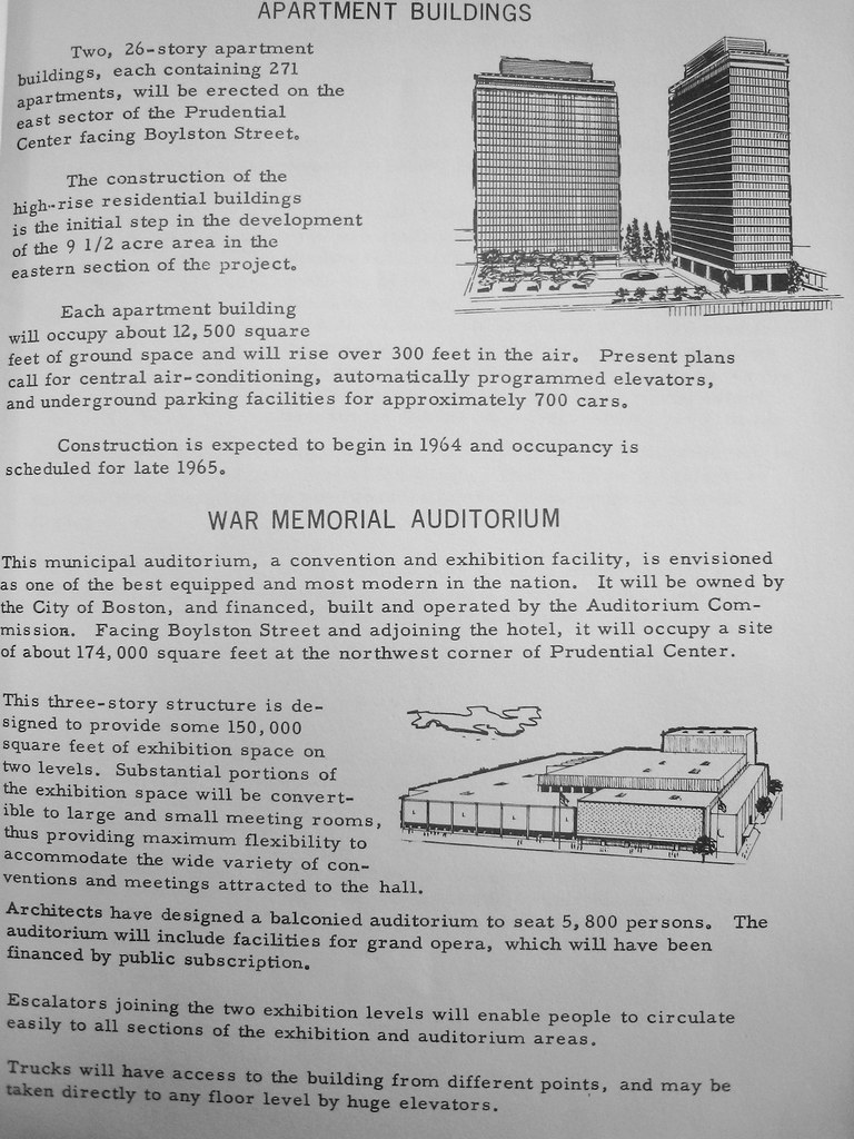
A couple years later, and the plan's been pared down to its first phase:
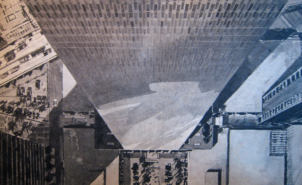
Auditorium under construction:
The barren plaza:
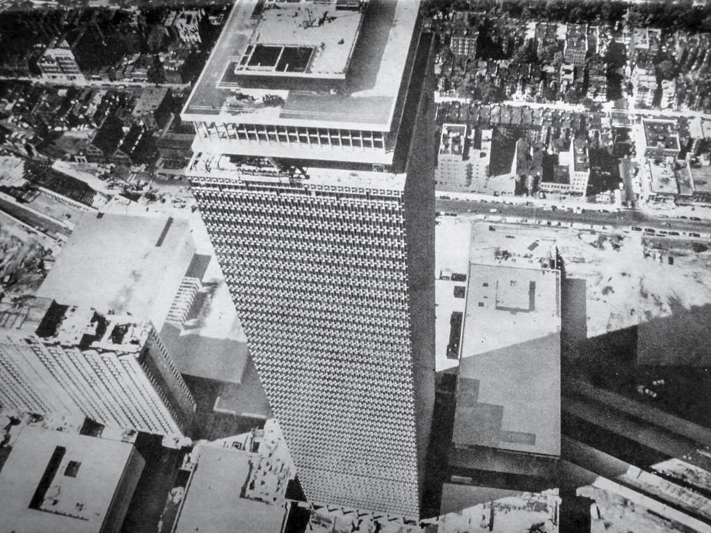
Circa 1968:
And the tenant directory from the same period:
Now let's fast forward to 1981. A firm is hired to start identifying ways to make better use of their space:
By 1985 a Master Plan had been completed, which is where the next several images come from:
Perhaps the most intriguing idea from this plan: East Ring Road was to have townhouses built on them. The road would have been scaled down to "carriage" size, and other underutilized plaza/empty space would have created the rest of land needed for them:
Also note that there is a "residential square" proposed off of East Ring Road:
The MP proposed building up the main mall area a la Copley Place, although in place of the Drumpf-like brass and pink marble, this would have had a more typical Boston flavor to it:
And then by 1989, two years after the so called PruPAC had been formed, the plans assumed the shape that they still have today:
LASTLY, here is a timeline of "Prudential Center Milestones"
OK, that's it. Hope you enjoyed!
Last edited: