I just want to post about how useless it is to have Logan Airport 3 miles away from Downtown yet it takes just as long as it would take a person to drive from SeaTac to Downtown Seattle or SFO to Downtown San Francisco.
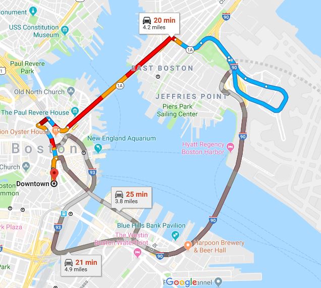 Logan Car
 by
Kent Xie, on Flickr
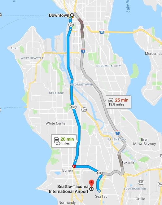 SeaTac Car
 by
Kent Xie, on Flickr
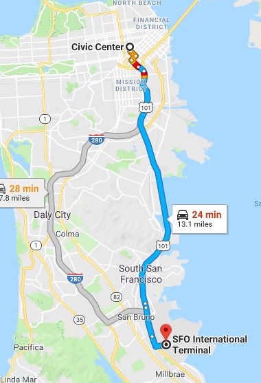 SFO Car
 by
Kent Xie, on Flickr
What's the point of having the airport so close again?
Because if it were as far as the others itd take over 45 mins.
The screenshot I took doesn't adjust but I did run the map with the timezone adjusted and the travel time was about 5 minutes longer and still shorter in terms of miles per minute.
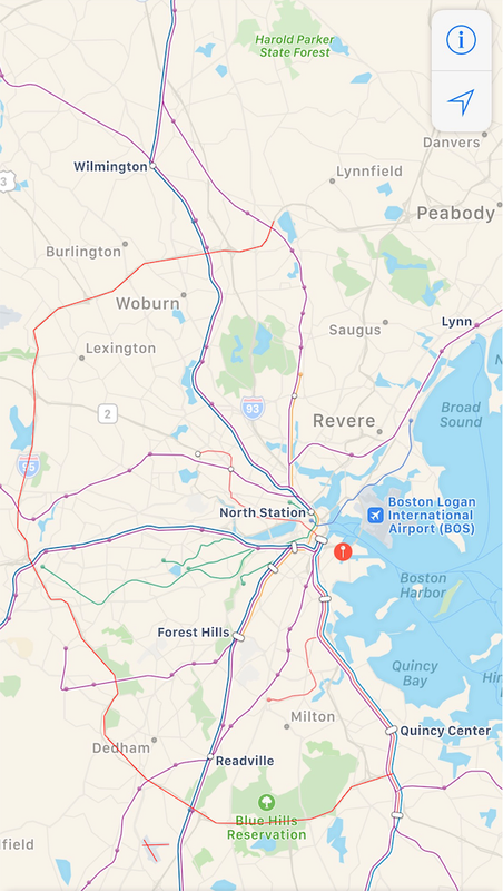
Part of this I assume is that having an airport outside the most congested areas in the city means that airport traffic does not contribute to downtown traffic (i.e. someone from a Seattle suburb going to Sea-Tac would not need to drive through downtown to reach the airport). Perhaps putting an airport right next to Downtown may not be the most efficient idea after all. Unfortunately the location of Logan, built on the most Eastern portion of the city means that all airport traffic West and South of Boston will have to funnel through Downtown.
Boston would do better having an airport west of the city so that none of the airport traffic coming from or going to the surrounding suburbs have to drive through the city to reach it.
Boston is a bit over 700 thousand people in 2019, the metro area is what 4.5 million people? The airport serves the region and metro area. All 4.5 million people plus even more from further out have to go through downtown Boston plus cross a harbor to get to the airport. Hanscom off of i95 would have made much more sense if that plan for relocation had went through. I95 is the major artery for the region, connect it with a subway line, done. Logan is really not that beneficial being where it is because of the massive choke point especially being on the other side of the harbor. Its probably too late now, but I think this was a massive oversight due to traffic and stymieing construction forever. East Boston also could have been connected with a bridge allowing pedestrian/bike access w/o Logan as well.
Tbh it could still be economically viable, Hanscom already exists it would just need expansion, but the value of that Logan Airport land would be multiple multiple billions in development. Logan is maxed for expansion which is a hinderance to the region, maybe this plan should be revived? It would allow brand new terminals which LAX, Laguardia, JFK, are all doing anyways.
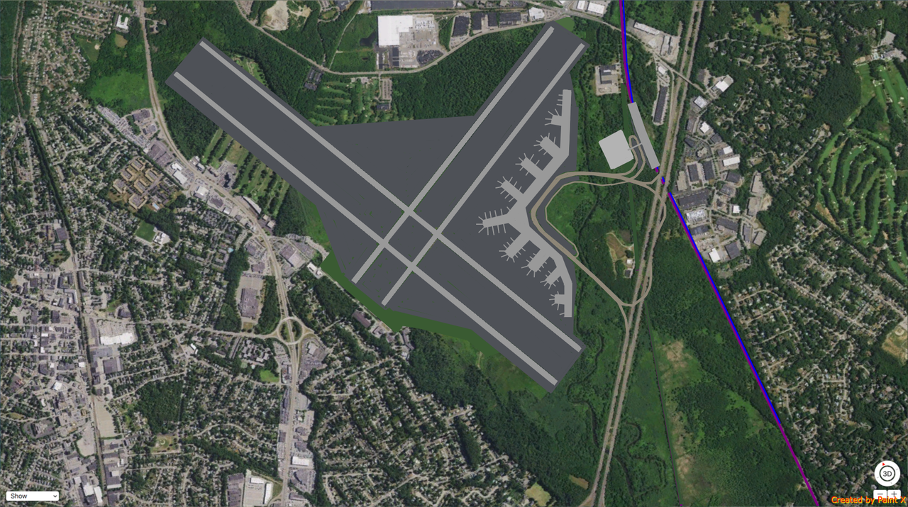
Norwood may be an ever better location, its also off of 95, more within the Boston area and has tonssss of room for expansion + no millitary base, and a commuter rail line that is just past a part that is already slated to be converted to orange. Plus part of rejection of the Hanscom expansion was outrage by the “rich people towns” over more overflights. Norwood already has 2 runways, with tons of room, Logan has 6, Londons Heathrow fits in more flights than Logan on its 2 runways.
https://marketurbanismreport.com/how-to-replace-bostons-logan-airport-pt-1/
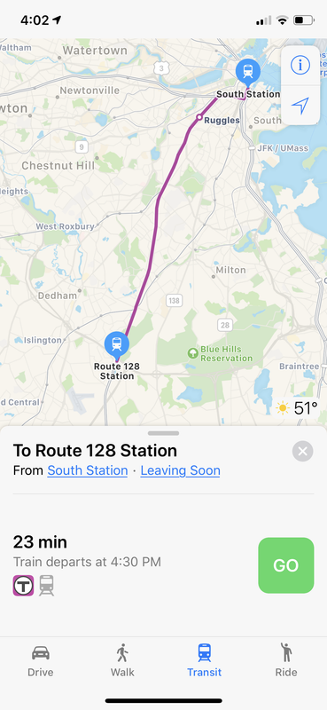
Heres an article which actually describes how the commuter rail is actually the best option for airport service. Plus especially with NSRL that gives the entire region access to the airport. Either way this would mean a direct connection from the airport to south station. Norwood has Amtrak AND Commuter rail, the more I look into this the more it looks like a no brainer. With many airports building brand new terminals, when that decision comes up for Boston I think relocation needs to be on the table as well. A replacement would have to be close to the city, but also serve the multi millions of the metro, I think metro west is the answer.
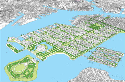
Look at the immense amount of housing, expansion area the city would have, all with 0 filling in the harbor. We could double the size of the city, ease airport congestion, huge influx of cash which could go towards transit, solve housing, height restrictions...etc. Relocation may be THE future of this city imo.
 https://marketurbanismreport.com/the-case-for-closing-bostons-logan-airport/
")