I went down a rabbit hole and found some interesting things under analysis, and sketched out some questionable solutions.
Let’s imagine a future world where:
- Green Line is extended to the Seaport, with LRT services running between Longwood/Back Bay, South Station, and the Seaport
- A third Ted Williams bore is not built, relegating cross-harbor services (e.g. Seaport <> Airport, and Seaport <> Chelsea) to segregated bus lanes in the existing tunnels
- The Piers Transitway is maxed out capacity-wise, and/or we don’t want the dedicated ROW LRT services mixing with the largely-but-not-totally-separated bus services
In this world, where do those Ted Williams bus services go once they reach the Seaport?
Previously, I’ve suggested funneling them into the Summer St bus corridor, and consolidating the various BRT routes running into Downtown & the Seaport under a single “brand” – either a “Navy Line”, or just the good ol’ Silver Line.
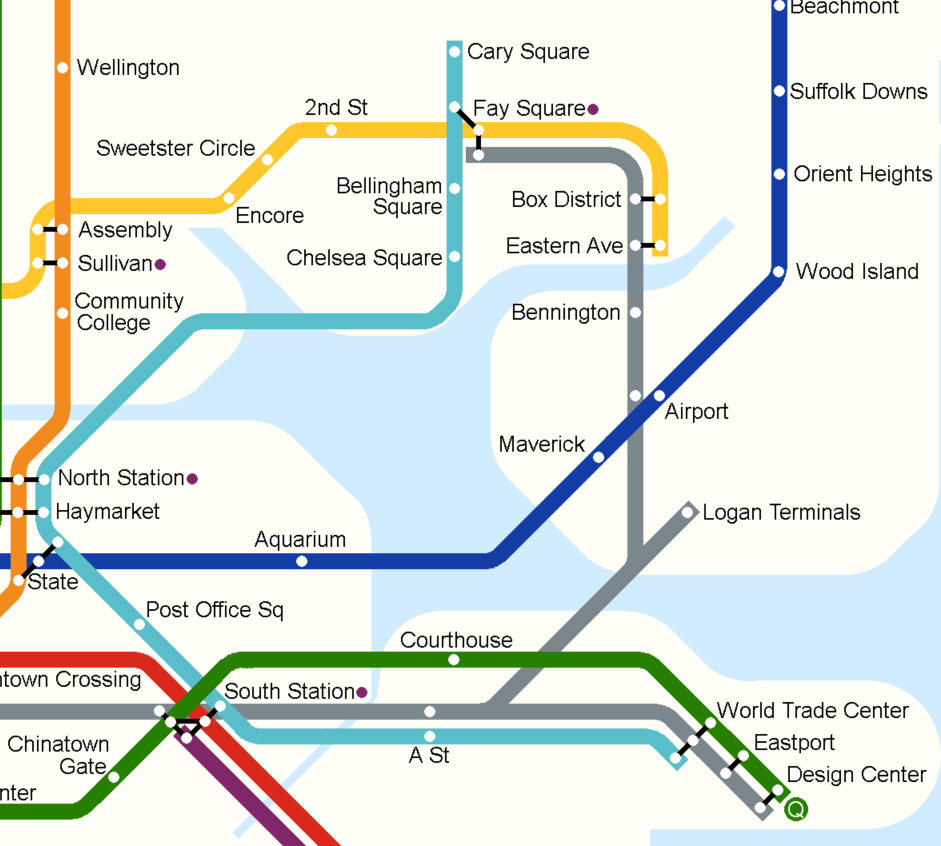
And that’s… probably fine. But when did I ever let “probably fine” stop me from fiddling? So, here’s an idea for creating a pair of BRT services for the Seaport, in addition to LRT in the Piers Transitway.
The “Navy Line” (or whatever we want to call it) remains the
Congress St/Summer St corridor, extended along the Tobin Bridge to Chelsea (supplemented by non-BRT feeder routes from the T7 in Charlestown and South Boston, the T111 to Woodlawn, and potentially the T116, if we can get reliability across the Tobin high enough). This route terminates around World Trade Center station.
The “Silver Line” is basically today’s Silver Line, but rerouted on to Congress St in the Seaport.
SL1 and SL3 services emerge on to Congress St directly from the highway, and bear left toward downtown. A stop just before A St provides access to Seaport jobs (see below), as well as transfer to SL2 for service to the far eastern section of the Seaport. After crossing the channel, these routes do a loop around the Federal Reserve building before heading back out.
Going outbound, SL1 and SL3 do a slightly roundabout jog to the south to pick up the on-ramp into the tunnel; SL2 service continues down Congress St, stopping outside the WTC stop before potentially continuing on to the Design Center branch, where they could interline with LRT service, though that’s probably overkill.
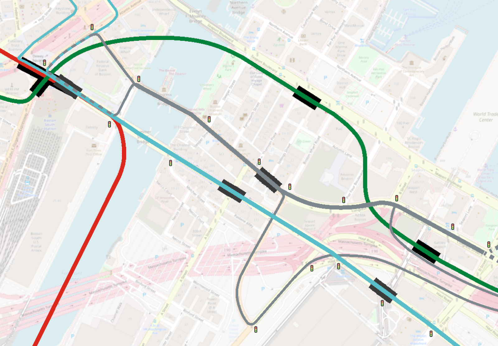
Why is this better than running along Summer St? Arguably, this alignment lets the cross-harbor services get to South Station as quickly as possible, while still providing some level of access to the Seaport. On the other hand, it’s not clear that the time-savings would be massive, and while I do think the A St stop location serves the Seaport reasonably well, it’s also definitely true that this alignment serves the Seaport less.
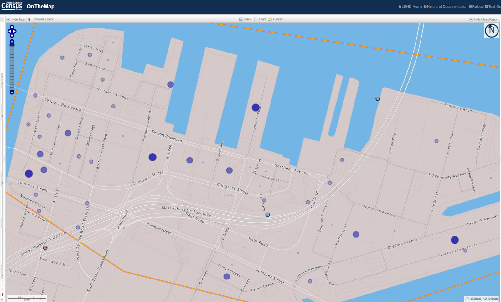
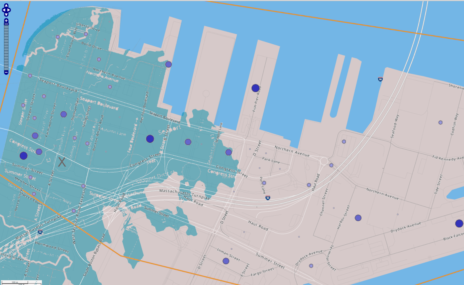
As for the question of stop location, here is the On-The-Map rendering of the Seaport (enhanced for legibility):
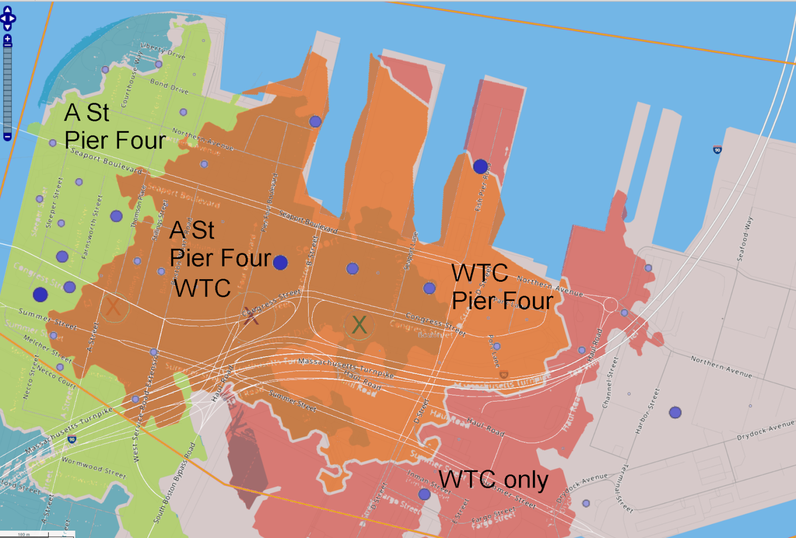
And here are the overlapping 10 minute walksheds of stops at A St, at Pier Four Boulevard, and in front of WTC station (note that the boundaries are not precise):
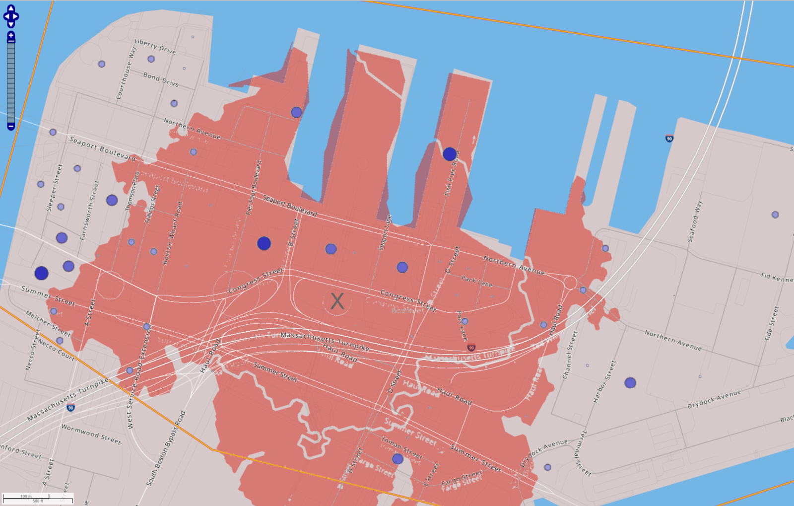
And for completeness, here is the A St walkshed on its own:
And WTC on its own:
Somewhat surprisingly, WTC doesn’t actually net you that many more jobs (I think) – you get the WTC itself, that office building on D St, and some smaller job centers out near Silver Line Way and Northern Avenue, but it’s not as big of a difference as I expected.
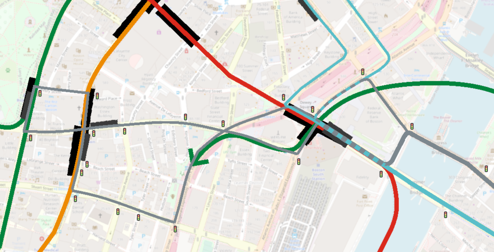
Separating out the “Silver Line” from the “Navy Line” raises another question: why stop at South Station?
Well, the reason to stop at South Station is that you then have to contend with x many more feet of street-running and y many more traffic lights.
I definitely wouldn’t want to run our new SL1 and SL3 services beyond South Station – their journeys are long enough already.
But an SL2 service, aided by bus lanes and TSP, connecting at Chinatown and Boylston (requiring Avery St to be reversed to one-way the other way), would provide a 2-seat-ride to the Seaport for Park St- and Government Center-terminating Green Lines services. The alignment below is about 4500 feet of street-running westbound and about 2500 feet eastbound.
(If you got aggressive with lane-taking on Essex and built a contraflow lane, you could shorten that westbound journey to be similar length to the eastbound.)
Anyway, this is in the Green Line Reconfiguration thread because it covers potential alternatives if the Green Line ends up consuming all slots in the Piers Transitway, and because this dubious SL2 service would provide a two-seat ride for Kenmore Division <> Seaport journeys, which – even with a transfer tunnel at Back Bay + Copley – still remains one of the annoying loose ends of my recent designs.
(Mostly I wanted to memorialize the analysis of Seaport jobs.)