I-695, Soutwst X-Way, Mystic Valley Prkway, S. End Bypass

One area that would have worked well is Route 2 running along what is currently the Fitchburg Commuter Rail from Alewife underneath Porter Square, beside Somerville Ave, below Union Square in Somerville and below McGrath Highway to near North Station. It would have taken a lot more traffic off West Cambridge and Somerville Streets and the Charles River which is where Route 2 presently dumps all the traffic. Route 2 probably wouldn't have been anymore disruptive than Route 9 is through Wellesley.

Hard to say for sure... That whole area certainly suffers from some of the worst traffic around. Not sense enough for legit public transit but way way way too congested to drive in. All those towns - Watertown, belmont, north cambridge, are all just horrifically impossible to get around in during rush hour...
 
One area that would have worked well is Route 2 running along what is currently the Fitchburg Commuter Rail from Alewife underneath Porter Square, beside Somerville Ave, below Union Square in Somerville and below McGrath Highway to near North Station. It would have taken a lot more traffic off West Cambridge and Somerville Streets and the Charles River which is where Route 2 presently dumps all the traffic. Route 2 probably wouldn't have been anymore disruptive than Route 9 is through Wellesley.

Definitely would have helped but at what cost? It would have created a wall between Cambridge and Somerville. Also as someone previously stated this was a state project, one that wasn't up for the 90/10 slip with the Feds. This might be why I've seen more concrete plans for the SEX+Inner Belt than these other highways.

I honestly think that the state should have extended Rt 2 to Mass Ave via the old freight cutoff (which is now the bike path between Alewife and Davis) and built a proper interchange at Rt 2/Alewife Brook Parkway, then widened Somerville Ave from Porter to McGrath Highway. You would have had an arterial street system that could have handled the traffic.

The thing that really saved Cambridge, oddly enough, from needing the Rt 2 extension is that the towns along Rt 2 and outside of Rt 128 in this quadrant are really wealthy and never saw the mass suburbanization that hit the South Shore after 93/Rt 3 opened. Had Concord and Lexington exploded with suburban sprawl after WW2 then traffic on Rt 2 would be a parking lot and the streets of Cambridge clogged with even more traffic.

Believe they studied both the Fitchburg Line and the Fitchburg Cutoff routings. It was a pick-your-poison either way. Either Porter and Union got obliterated, or Davis and East Somerville got obliterated.

I-290 was also supposed to continue east of 495 to meet 128 and 2. Bedroom communities fought that one tooth-and-nail, and it had so many problems with wetlands and reservoir crossings they couldn't even narrow down the recommended routings past a Top 3. And that one did survive on-paper for a couple years past the 1970 moratorium before they ultimately decided 128 just couldn't handle the traffic if nothing further were built inbound.

Top Two options were either crossing 128 at the Route 20 exit, laying waste to a portion of Waltham, and merging in with 2 in Lexington...or taking a northerly routing and merging in with 2 in Concord near Crosby's Corner.

They would've at least had an outside shot of pushing for more funding for 2 & 3 if another interstate-badged expressway got tied-in, but 290 had so many problems just getting constructed through the Worcester area that it overshot the timeframe to do any coordinated planning. So 2 was always going to be one the state had to carry the water on, and with the route options through Cambridge so awful any which way it was always the likeliest first cut.


Jeez...can you imagine how much traffic that thing would be carrying if 290 and 3 both merged into that 8-lane monster in Arlington? They'd have widened the damn thing with its own zipper lane 15 years ago and be talking some "managed lane" nonsense widening today if that all got built and every bedroom 'burb NW to Burlington and west to Marlborough got sprawled out to maximum unsustainability hell.
 
Hard to say for sure... That whole area certainly suffers from some of the worst traffic around. Not sense enough for legit public transit but way way way too congested to drive in. All those towns - Watertown, belmont, north cambridge, are all just horrifically impossible to get around in during rush hour...

Please, enough hyperbole. Everyone says crap like this "oh my town's traffic is THE WORST!!!11"

If it was so bad, nobody would go there. :p

But clearly they do.
 
Ya, I commute through North Cambridge and Belmont every day. I don't drive, but from what I see (walking/biking/on public transit) and hear from co-workers, the Route 2 interchange with route 3 and 16 at Alewife has traffic from 6:30-10:00 am, and from 2:00-8:00 pm. Most of the bad traffic is a ripple effect from that interchange (Route 2, Alewife Brook Parkway, etc).

My transit-pitch: stripe/build a bus lane on/adjacent to Route 2 from Exit 59 to Alewife. Build a park-and-ride near Exit 59 so that people can park further from Alewife and take the bus to Alewife, avoiding traffic, if they so choose.

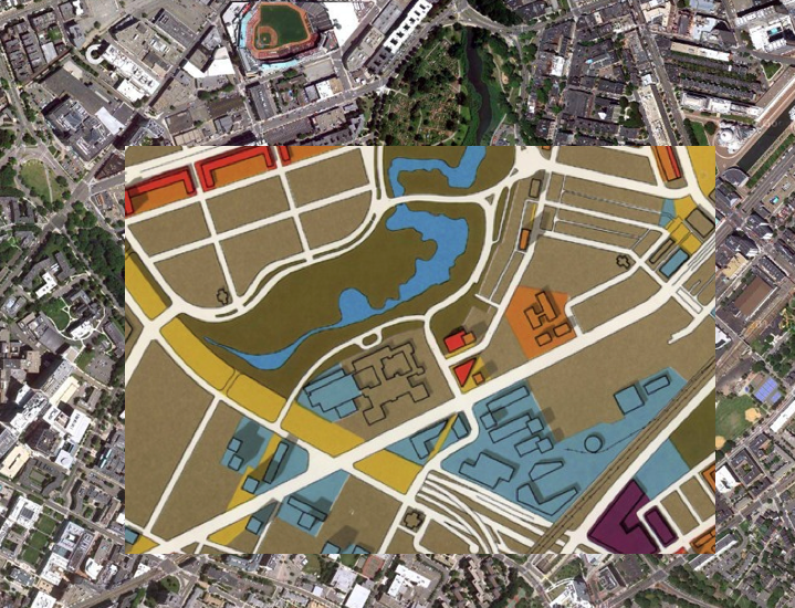
Nah. What they need to do is build that long sought-after Fitchburg Line station at 128 & 20 right by the Polaroid complex and 70 bus terminus to replace the Weston trio of stops. Then designate that an Indigo expansion route with once-every-20 service and tap-on/tap-off transfer to Red at Porter. That's what's going to be the ultimate load reliever for Alewife garage.


As for Alewife rotary they need to make a start on some basic improvements:

#1. Widen out the 16W-to-2W onramp and demolish the WB sidewalk over the bridge for more acceleration and merge room, so the second pair of traffic lights can be eliminated entirely with total free movement to 2W from Mass Ave. and only 1 light from 16E.

#2. Re-stripe 2 from the Lexington/Arlington line to Lake St. from 8 to 6 lanes. Trade in for wider left shoulder and a little bit more grass buffer on the sides. All of that is residual from when the highway was overbuilt for the canceled Routes 2 & 3 concurrency. And it worsens the traffic at the rotary when the lane-drop to 3 lanes and all the sorting has to happen on approach to Alewife. A re-stripe would make EB traffic sorting a lot more orderly.

#3. Zap the superfluous extra EB onramps around Route 60 and Lake St. There's four of them: one off the frontage road before 60, one right after 60, another one accessible only from Lake St. WB, and the 4th one at the proper Lake St. interchange and Acorn Park Dr. WTF? I would ditch the first and third ones entirely to clean out this whole portion where the Alewife traffic starts backing up. The EB frontage road right before the 60 light is too low-traffic for the queues to be a problem, so they're fine not having that first free-movement slip ramp. The re-striping and elimination of onramp #1 lets you do a longer accel lane on ramp #2, and elimination of really really superfluous and low-traffic ramp #3 allows for a longer decel lane on the Lake St. exit ramp. Which also helps clean up a little of the mash-down on final approach.

#4. Re-shape the Lake St. EB exit ramp. Longer decel lane because onramp #3 is gone, longer ramp with improved geometry. Stick a traffic light at the bottom of the ramp for movements straight onto Acorn Park Dr. Way better than making a high-speed sharp turn off the Alewife station ramp for those who live/work there. Sign this exit as Lake St. Arlington / Acorn Park Cambridge.

#5. Make Acorn Park Dr. a one-way on the Alewife side past the small parking lot so only permitted direction is onto the Alewife station ramp; all traffic TO Acorn Park gets funneled to the modified Lake St. exit in #4. Re-shape it into a hook ramp with short merge lane on the Alewife exit ramp. If wetlands doesn't allow for it, take the driveway to Discovery Park, turn that into the one-way hook ramp with short merge, and delete that end of Acorn Park Dr. entirely for more space on the bisected grassy parcel to put in additional buildings.

#6. Extend Cambridge Park Pl. (i.e. Alewife Station access road) through the Summer Shack parking lot--relocating the Church In Cambridge--for a new intersection aligned direct with Rindge Ave. Delete the Cambridge Park Dr. intersection. Exiting Alewife traffic now goes straight through the Cambridge Park Dr. light to the parkway, supporting a longer queue that doesn't freeze up trying to make 2 turns in a 2-block radius. Transit Police have to direct traffic there every rush hour at the station exit (including A.M. for the kiss-and-ride traffic) because that 2-light, 2 lefts movement is such a clusterfuck and so many drivers try to cheat making that left onto Cambridge Park Dr. Office buildings on Cambridge Park Dr. now requires a turn instead of going straight to the parkway...but that's far, far and away the lower-volume road so it's a much better setup to have prevailing traffic direction to/from the parkway be for the station. Parkway gets 1 light eliminated to shorten the queues both directions near the Mall and a much cleaner consolidated intersection: protected lefts all-directions, traffic-island free rights, straight access to/from Rindge (which really shouldn't take that bad a hit). And that is further helped by the shorter queues onto 2W from eliminating the second pair of lights in #1. Moreover, the 83 bus gets extended straight into Alewife station instead of fizzing out in the Russell Field parking lot.

#7. Build the Alewife-Mass Ave. busways that the T has wanted for ages. Ping more Alewife buses down those busways to loop at GLX Route 16 station, which will help take a load off the Red Line for folks who'd go downtown to transfer @ Park.


^^It's not the killshot that takes care of all the stupid curb cuts on EB right before Alewife or does the expensive flyover/flyunder onto WB from Alewife, but it's a substantial amount of low-cost improvement that solves the weaving problems from 60 to Alewife where 2E starts backing up, solves the Acorn Park Dr. access + egress problems, substantially improves the geometry on the station egress, substantially improves bus transit in the area, and whacks 2 sets of parkway lights whose mis-timings and mangled traffic flow are big contributors to the parkway backups heading all directions into the 2 rotary.

I'd implement all these before dealing with the years and years of planning required on the expensive fixes and the requisite tricky EIS'ing around the marsh wetlands.
 
Please, enough hyperbole. Everyone says crap like this "oh my town's traffic is THE WORST!!!11"

If it was so bad, nobody would go there. :p

But clearly they do.

Nope, my hometown is Brookline and I dont think that. One of the major problems with the towns north of the river is that they developed in such outrageously piecemeal fashion that there are too many closed-off neighborhoods such that getting across town is very limited to certain major roads, while everything else is a series of dead ends, railroads, hills, and streets that become one way the opposing direction. I stand by the fact that parts of Watertown but especially Belmont and most of western, northern and the fringes of eastern Cambridge are extremely difficult to get through. Certainly there are other areas as well, like Quincy... but I dont find most of Dorchester, Roxbury or Brookline comparably difficult to get through, even at rush hour.

In all of these areas, the sad thing about preservation of the nineteenth century low rise in all of these areas is that it limits the argument for good rail transit expansion. It's like, let's plan on making the area as dense as possible but not quite dense enough to justify a subway, but way too dense to make a bus or streetcar route effective!
 
One of the major problems with the towns north of the river is that they developed in such outrageously piecemeal fashion that there are too many closed-off neighborhoods such that getting across town is very limited to certain major roads, while everything else is a series of dead ends, railroads, hills, and streets that become one way the opposing direction.

That fact is true of just about all of the Boston regions that happened to develop as streetcar suburbs.
 

There's a lot more to the story than that. There were many crosstown streetcar routes through the southern parts of Boston and across Brookline, and in general since those areas were more heavily settled and earlier, there are more roads cutting across town in that vicinity. Some of them are very congested and follow their crosstown streetcar route history, but many of them are just old roads that slice through a neighborhood. With Belmont, you have the massive blob of residential neighborhood between Trapelo and Concord and there is no direct route through that. Throw in the barrier of the railroad (which again, has few ways across it, in contrast to older suburbs like Dorchester or JP where there are plenty of crossings).
 
There's a lot more to the story than that. There were many crosstown streetcar routes through the southern parts of Boston and across Brookline, and in general since those areas were more heavily settled and earlier, there are more roads cutting across town in that vicinity. Some of them are very congested and follow their crosstown streetcar route history, but many of them are just old roads that slice through a neighborhood. With Belmont, you have the massive blob of residential neighborhood between Trapelo and Concord and there is no direct route through that. Throw in the barrier of the railroad (which again, has few ways across it, in contrast to older suburbs like Dorchester or JP where there are plenty of crossings).

I would proposed the 72 route be extended into Watertown crossing the 73, 71, and 70/70A routes and then perhaps circling the Watertown Arsenal before returning northward.

The 74 from Harvard I would have continue down Pleasant Street, Belmont into the Trapelo Rd. area you spoke of and into the Waltham Common Via Belmont Center. Belmont would be a great suburb if you could reverse commute better into the Route 128 corridor via Waltham Common.
 
Let's keep this about canceled highways and the transit pitches in their exiting thread.
 
Nope, my hometown is Brookline and I dont think that. One of the major problems with the towns north of the river is that they developed in such outrageously piecemeal fashion that there are too many closed-off neighborhoods such that getting across town is very limited to certain major roads, while everything else is a series of dead ends, railroads, hills, and streets that become one way the opposing direction. I stand by the fact that parts of Watertown but especially Belmont and most of western, northern and the fringes of eastern Cambridge are extremely difficult to get through. Certainly there are other areas as well, like Quincy... but I dont find most of Dorchester, Roxbury or Brookline comparably difficult to get through, even at rush hour.

In all of these areas, the sad thing about preservation of the nineteenth century low rise in all of these areas is that it limits the argument for good rail transit expansion. It's like, let's plan on making the area as dense as possible but not quite dense enough to justify a subway, but way too dense to make a bus or streetcar route effective!

Cambridge and Somerville are perfectly navigable within their borders even at rush-hour if you know what you're doing. I can drive from Union to just about any other area square easily at rush hour (although I don't tend to drive between points in Cambridge/Somerville anyway). The hard points are getting OUT to the burbs or into into Boston. Even getting to the burbs is not difficult if you know alternate routes. I can get home to Somerville from work in Lexington, and drive back out there during rush hour for an evening event in maybe 5 or 10 additional minutes from my morning commute at 6:30 (before rush hour starts). The difference is I don't take Mass Ave, Alewife and Route 2. I go back routes through Medford and Arlington - never touching Route 16, and only touching 2A or Mass Ave well past Arlington Center. People are just slaves to their GPS and their routines, and very few people are willing to go exploring.
 
Cambridge and Somerville are perfectly navigable within their borders even at rush-hour if you know what you're doing. I can drive from Union to just about any other area square easily at rush hour (although I don't tend to drive between points in Cambridge/Somerville anyway). The hard points are getting OUT to the burbs or into into Boston. Even getting to the burbs is not difficult if you know alternate routes. I can get home to Somerville from work in Lexington, and drive back out there during rush hour for an evening event in maybe 5 or 10 additional minutes from my morning commute at 6:30 (before rush hour starts). The difference is I don't take Mass Ave, Alewife and Route 2. I go back routes through Medford and Arlington - never touching Route 16, and only touching 2A or Mass Ave well past Arlington Center. People are just slaves to their GPS and their routines, and very few people are willing to go exploring.

True to all of that. Im saying that cutting across vast swaths of Boston +/- Brookline is still easier than cutting across a comparable distance in Cambridge or Somerville to reach a neighboring town or city, particularly between two nodes.
 
After years of reading tidbits about how a young Mike Dukakis fought plans to build another Riverway on the Brookline side of the Muddy, I finally found a map showing a plan for that project. For those that are not aware, the plan, as I understand it, was to have a parkway replace Pond Ave, the end of Chestnut, and the west part of Perkins and then follow Parkman Drive to meet back up with the Arborway. I am pretty sure the reason there's that weird wide part of Perkins for no reason (right before it becomes Goddard) has something to do with that. Link here.
 
Funnily enough, Brook House is not incredibly dissimilar from this proposal.
 
After years of reading tidbits about how a young Mike Dukakis fought plans to build another Riverway on the Brookline side of the Muddy, I finally found a map showing a plan for that project. For those that are not aware, the plan, as I understand it, was to have a parkway replace Pond Ave, the end of Chestnut, and the west part of Perkins and then follow Parkman Drive to meet back up with the Arborway. I am pretty sure the reason there's that weird wide part of Perkins for no reason (right before it becomes Goddard) has something to do with that. Link here.

Here's a Boston Globe article from 3/25/69 with a map and a nod to Dukakis:
Linky
Would have marooned Olmsted Park and Leverett Pond inside giant rotaries surrounded by one-way routes, and taken the (formerly) lovely stone overpass over Huntington/Rte. 9... and crapped up the Emerald Necklace for good, imho.
 
Thinking about it, the way that 95N was cleared and dug before it was stopped and the orange and commuter rail lines were moved to the trench, it actually would have been extremely beneficial is the land for this had been cleared, then stopped by the community, and the inner ring was built in its place. That definitely would have been worth it and it would have filled back in over time. Actually, in my opinion, if they had done a cut n cover and put a surface road over top that would have been great, because Boston is plagued by all roads leading downtown and almost none cross the city sideways making traffic even worse than it could be. If only...


9fc16-pastedgraphic-4.png


b8bd1-pastedgraphic-7.png


696cf-pastedgraphic-6.png


96f86-pastedgraphic-5.png


76caf-pastedgraphic-8.png


da8ad-pastedgraphic-9.png


6cbf9-screen_shot_2011-10-30_at_1-13-18_am.png


2ca8b-screen_shot_2011-10-30_at_1-13-56_am.png


6a49c-screen_shot_2011-10-30_at_1-12-29_am.png
 
Last edited:
Jesus. That asphalt holocaust would've bulldozed literally 3 different apartments I lived in for a grand total of 12 years in this city. :(
icon_mad.gif
 
The Inner Belt looked good on maps, but, really, it would have ended up a traffic-clogged nightmare during rush hours just like every other highway in every large metro area of the US. Even worse, the Red Line to Alewife and the Orange Line SW corridor may not have been happened, as they were paid for with cancelled Expressway funds. So, we would have had a traffic-clogged version of Dallas.
 
After years of reading tidbits about how a young Mike Dukakis fought plans to build another Riverway on the Brookline side of the Muddy, I finally found a map showing a plan for that project. For those that are not aware, the plan, as I understand it, was to have a parkway replace Pond Ave, the end of Chestnut, and the west part of Perkins and then follow Parkman Drive to meet back up with the Arborway. I am pretty sure the reason there's that weird wide part of Perkins for no reason (right before it becomes Goddard) has something to do with that. Link here.

Does anyone have plans showing what Pond Ave looked like before they reduced it to one lane each direction? From what I can tell, it used to be a median separated parkway maybe 15 years ago? The bike and walking paths run along what used to be one side of the roadway.
 

Back
Top