I-695, Soutwst X-Way, Mystic Valley Prkway, S. End Bypass

And in addition, the northern section basically split off into its own area, which for some folks feels closer to Harvard Square than what's now called Allston Village.

That has precedent, for a couple hundred years Brighton was closer by road to Cambridge via the Great Bridge than Boston, which required going all the way to Roxbury. This map of the milestones (a 1919 interpretation of the area in 1700) shows what's now Barry's Corner as being the major intersection in the area.

Living north of the Pike myself - I go to Harvard for the T, bars and restaurants. It's pretty rare I go into Allston; I'm roughly equidistant to both, but getting to Harvard is a far easier by every mode but car.
 
Has anyone read this book??

Al Lupo, Frank Colcord and Edmund P. Fowler, "Rites of Way: The Politics of Transportation in Boston and the U.S. City," Little, Brown and Company
 
Rites of Way is quite good. IIRC, it was published in the aftermath of the anti-highway and anti-airport expansion movements so it is a little dated and not perhaps not the best source for historical perspective of these projects, but still a great contemporary account of the politics of the time.
 
I finally got around to looking up the 1966 "Basic Design Report Southwest Expressway" referenced in post #162 of this thread at the BPL. I was mainly looking at the proposed impacts on Jamaica Plain and Forest Hills, but took a bunch of cellphone shots of the four color plates, the plans for the Forest Hills cloverleaf and a few other tidbits I wanted a record of. My shots are by no means complete, but here they are:
Link to whole Flickr album

The Forest Hills clover leaf:
Boston Southwest Expressway plan 1966

Does anyone happen to know whether these plans prepared by Brown Professional Engineering Inc were the prefered ones of the time and the ones ultimately cancelled? I gather there were perhaps a few alternates or iterations considered in the mid-to-late 60s.
 
Wow thanks for the follow up man. You took much better/more pix than I did back in 2012! ;-)

I'm still just constantly shocked by how catastrophic this thing would have been. Every image is just total carnage.

Edit: CARnage
 
One of those things where if I'd taken my time I could have grabbed it all...

I still wonder which of these (or others) were the operative ones under consideration for the SW Xway at the end. Just a curiosity about the design process - were several firms commissioned to come up with something? Or were they evolutionary from each other? The '66 Brown Engineering one seems to have done test borings all through the corridor, so it was more than just spec... and: I wonder what happened to those paintings!
 
So the OL channeling and northern extension and RL extensions came out of the money that would have been used to fund the SW Expressway - but since the OL median line was already planned here (and to go all the way down the NEC, it seems), it would appear that there ought to have been a lot more money available (these highway projects were massive) than was needed to fund those rail extensions we got. What happened to the rest of the funds? Or maybe it wasn't all fully funded yet....
 
There is a part of me that is morbidly curious how the city would have been had this been built. I love the renderings of under the 95-695 interchange where there are parks and trees. I've seen parks under highways and in the heart of bombed out Dudley Sq it would have been a haven for gangs, drugs, and the homeless.
 
There is a part of me that is morbidly curious how the city would have been had this been built. I love the renderings of under the 95-695 interchange where there are parks and trees. I've seen parks under highways and in the heart of bombed out Dudley Sq it would have been a haven for gangs, drugs, and the homeless.

Yep. Renderings always represent the ideal.

If this project and the continued urban renewal had continued in Boston through the 70's and 80's we probably would not be talking right now since the city would be or less gone.
 
So the OL channeling and northern extension and RL extensions came out of the money that would have been used to fund the SW Expressway - but since the OL median line was already planned here (and to go all the way down the NEC, it seems), it would appear that there ought to have been a lot more money available (these highway projects were massive) than was needed to fund those rail extensions we got. What happened to the rest of the funds? Or maybe it wasn't all fully funded yet....

Federal fun bux. You had matching funds coming with everything that had an interstate route shield, and of course none of that is true with transit projects. So the pot got a lot smaller when the highway moratorium was passed and the state funding (in the go-go 70's no less!) had to carry the load. If any highways were first on the chopping block in that plan it was MA 2/US 3 which were primarily state-funded construction and weren't guaranteed the fed funding like all the other then- yet-to-be-built roads that were fully vetted members of the final Eisenhower Interstate Plan.


Also, keep in mind that the NEC SW Corridor, South Station renovation, and Back Bay rebuild were themselves rail project recipients of the diverted funding. Had the SW Expressway gone through the Fairmount Line would've absorbed all NEC traffic--on 2 tracks forever--with the NEC inbound of Readville and Needham Line abandoned. Back Bay would've become a Worcester Line-only stop downsized to 2 tracks, an Orange headhouse, and probably some depressing old-Yawkey -like bus shelter of a platform. South Station--by then fresh off its partial demolition with the preservation fight still underway to save the rest of the building from the wrecking ball--would've had its capacity downsized even more with the Cove side reduced to just 2 Worcester tracks, and probably would've become some sad AmShack of a station facility with fewer than 10 platforms.

By the time the rail corridor had been built you did have the first iteration of the High Speed Rail studies on the corridor and the ambitious (but sadly underfunded) 1980's NEC Improvements plan underway. So that was a substantial amount of funding diverted to transit there. The 80's South Station renovation and expansion, New Back Bay's spacious track capacity, Ruggles and Hyde Park stations, the rebuilt-from-ground-up Needham Line, all the mainline track capacity, all the modern high-density signaling into the terminal and future provisions for electrification. That was quite a bit of money, with the state having to bear disproportionate share...especially when the Carter and Reagan Admins. started gutting that high-speed program like a fish and Amtrak was closest it had ever been to extinction.


I can't even imagine how fucked we'd be if the Fairmount Line were Boston's only transit link to the rest of the Eastern Seaboard. Throw that one on the pile of every other unintended Urban Renewal consequence reducing Boston to 12 lanes of flyover country like a Kansas City on the Atlantic.
 
Federal fun bux. You had matching funds coming with everything that had an interstate route shield, and of course none of that is true with transit projects. So the pot got a lot smaller when the highway moratorium was passed and the state funding (in the go-go 70's no less!) had to carry the load. If any highways were first on the chopping block in that plan it was MA 2/US 3 which were primarily state-funded construction and weren't guaranteed the fed funding like all the other then- yet-to-be-built roads that were fully vetted members of the final Eisenhower Interstate Plan.


Also, keep in mind that the NEC SW Corridor, South Station renovation, and Back Bay rebuild were themselves rail project recipients of the diverted funding.

Interesting. Aside from the NEC, I think the SWC park also was paid for by this - though I doubt that cost much money, but the bike path is technically transit-related.


There is a part of me that is morbidly curious how the city would have been had this been built. I love the renderings of under the 95-695 interchange where there are parks and trees. I've seen parks under highways and in the heart of bombed out Dudley Sq it would have been a haven for gangs, drugs, and the homeless.

I keep waiting for the day when we have incredibly advanced simulation technology where you could basically put in enough data points to recreate all of Boston in the 60s in a SimCity-like program, then build the highways, press play, and take a look at what happens.
 
Interesting. Aside from the NEC, I think the SWC park also was paid for by this - though I doubt that cost much money, but the bike path is technically transit-related.

Yeah, and also consider that these post-moratorium allocation decisions were Fred Salvucci's doing. He was arguably a bigger booster of the NEC High-Speed Program than the feds themselves were once the grand studies and recommendations actually got in front of the Congresscritters and transit-hostile Prez. admins who had to cut the checks.

What we know today as the Acela was basically a watered-down, 20-years-late version of what the 1970's HSR plan drew up. And there was a furious spending spree of Corridor state-of-repair modernization in the early-80's using money appropriated in the short span between the change in political climate that went from gung-ho to hostile in an instant and more or less put the freeze on any additional spending until the '99 electrification. When Massachusetts had the opportunity to trade in the SW Corridor for an upgraded rail corridor, Salvucci basically paid forward the entire inside-128 contribution to the HSR program. And that's how we end up in the place we are today with the Boston-end infrastructure being able to absorb every bit of Amtrak's superduper 2040 HSR plan just on the provisions left by:

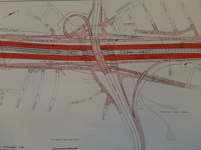
-- Untapped NEC track capacity between Forest Hills and Readville, which exists for a reason.
-- SSX, which they were thinking of way the hell back then.
-- Fairmount Line as load-balancer for local vs. longer-distance traffic, which they were thinking of back then.
-- Inland Route, which did exist in shitty/barely-usable form back then but had much the same upgrade concepts as they're thinking of pursuing today.
-- Orange Line swallowing Needham Line, which they were thinking of way the hell back then.
-- N-S Link, which of course had its provisions baked into Salvucci's Big Dig.


Compared to NYC, we are on easy street when it comes to meeting the requirements of the 2040 plan (N-S Link not being a requirement for D.C.-Boston, of course). The infrastructure footprint for it all is pre-built or pre-reserved and whatever isn't built (SSX, Track 4, etc.) just needs to be populated onto the template they left for it with the SW Corridor, SS, and BBY modernizations. And that's because guys like Salvucci saw the 1970's HSR plan, which was a bit more ambitious than the 1999 build ended up being, as a Phase I jumping-off point for the 2040 plan (or whatever year they had that pegged as happening). It seems so obvious now, but he was really really out on a limb 40 years ago using the power of his office to put down the full down payment on the NEC using mostly state money and highway funds traded-in at a loss. Nobody would be able to get away with bullying those resources around today for something with an intended 2050 payoff-on-investment. It simply doesn't happen anymore with political instant-gratification the rule.
 
Some of these renders show what would have been a modern looking highway, even by today's standards. Certainly something a lot better than what the Southeast Expressway currently is - a substandard highway that is responsible for carry traffic from route 3, 24 and 95 into Boston.
 
The SE X-way is relatively easy to fix. On the other hand, the SW X-way would have required the Inner Belt to function, and the combination of those two expressways would have destroyed much of Boston, Cambridge and east Somerville.
 
The SE X-way is relatively easy to fix. On the other hand, the SW X-way would have required the Inner Belt to function, and the combination of those two expressways would have destroyed much of Boston, Cambridge and east Somerville.

I don't doubt that the SW X-way would have been a bad thing. Just thinking about how would have been a more modern and efficient highway than what we currently have on the SE Expressway.
 
I don't doubt that the SW X-way would have been a bad thing. Just thinking about how would have been a more modern and efficient highway than what we currently have on the SE Expressway.

But the problem is that it needed the Inner Belt to move traffic effectively. Without it it would have just funneled MORE traffic through the old Central Artery than we see even today because of induced demand. I93 wouldn't be as terrible today if we had the SWX but the Central Artery would be completely fucked.

Alternatively had the SWX been built with no Inner Belt then all that traffic would have been dumped into the local roads of the South End (which was already going to happen as both Columbus and Tremont were going to be turned into one way arteries.) So say goodbye to your South End gentrification, as well say goodbye to your JP/Mission Hill gentrification too.

The mid-century tactic of building highways through poor neighborhoods had a one-two crippling effect: the routes were chosen through poor areas to keep land costs down and because the residents had the least political clout to stop it, then, when the highway was built the formerly poor areas became bombed out slums as anyone still there ran for the suburbs and took their property tax money with them hurting the city further.

Urban expressways were always supposed to be one part of the equation in terms of a transportation network. We in America just went bat shit crazy for them when the Feds started throwing 90 cents on the dollar to states which is why you have all these small cities with giant highway loops surrounding their old downtowns and no mass transit. How are those cities looking today? Not places anyone wants to live.
 
So the OL channeling and northern extension and RL extensions came out of the money that would have been used to fund the SW Expressway - but since the OL median line was already planned here (and to go all the way down the NEC, it seems), it would appear that there ought to have been a lot more money available (these highway projects were massive) than was needed to fund those rail extensions we got. What happened to the rest of the funds? Or maybe it wasn't all fully funded yet....

The Interstate system wasn't only- for moving people it was officially the "National System of Interstate and Defense Highways". It was also to allow the U.S. military to be deployed around the country more easily during W.W.II. Esp. military around Fresh Pond, Watertown Arsenal, Weymouth Base, Hanscom base, etc. The highway might have been disruptive for a while but just like the Big Dig disrupted a while people would have eventually just settled, or resettled around it. It probably would have led to more development north of Boston which hasn't really happened as much as south of Boston.
 
But the problem is that it needed the Inner Belt to move traffic effectively. Without it it would have just funneled MORE traffic through the old Central Artery than we see even today because of induced demand. I93 wouldn't be as terrible today if we had the SWX but the Central Artery would be completely fucked.

Alternatively had the SWX been built with no Inner Belt then all that traffic would have been dumped into the local roads of the South End (which was already going to happen as both Columbus and Tremont were going to be turned into one way arteries.) So say goodbye to your South End gentrification, as well say goodbye to your JP/Mission Hill gentrification too.

The mid-century tactic of building highways through poor neighborhoods had a one-two crippling effect: the routes were chosen through poor areas to keep land costs down and because the residents had the least political clout to stop it, then, when the highway was built the formerly poor areas became bombed out slums as anyone still there ran for the suburbs and took their property tax money with them hurting the city further.

Urban expressways were always supposed to be one part of the equation in terms of a transportation network. We in America just went bat shit crazy for them when the Feds started throwing 90 cents on the dollar to states which is why you have all these small cities with giant highway loops surrounding their old downtowns and no mass transit. How are those cities looking today? Not places anyone wants to live.

One area that would have worked well is Route 2 running along what is currently the Fitchburg Commuter Rail from Alewife underneath Porter Square, beside Somerville Ave, below Union Square in Somerville and below McGrath Highway to near North Station. It would have taken a lot more traffic off West Cambridge and Somerville Streets and the Charles River which is where Route 2 presently dumps all the traffic. Route 2 probably wouldn't have been anymore disruptive than Route 9 is through Wellesley.
 

Back
Top