BostontoLancaster
New member
- Joined
- Nov 26, 2012
- Messages
- 94
- Reaction score
- 0
So I've been a long time lurker on this forum, a displaced Bostonian living in Lancaster, PA, for the past five years (the first four attending college and this most recent one working and interning in the area). However, on Sunday I will be moving back to the Boston area to start a new job and will once again be plugged into the Boston development scene. As such, I hope to begin contributing more to the conversation.
Although I will never mistake Lancaster for Boston, Lancaster is a vibrant, energetic city that really has carved out a place in my heart. As I am not working this week, I have decided to really go on a detailed walking tour of this small, but ultra-livable city and snap a bunch of photos. Given this forum's enthusiasm for architecture and urban planning in general, I thought it might make for an interesting photo essay. I have split my walking tour into three parts: yesterday I walked around Franklin & Marshall College (my alma mater), the north side, and the East End; today I will spend my time snapping photos downtown; and tomorrow I plan to walk around the West Side. Given the size and number of photos, I will split the tour into three posts, starting with this one (the introduction, F&M, north side, and East End). I hope you enjoy and I look forward to contributing more to this forum! Also, I apologize for the not-so-terrific quality of my photos; all I have is my smartphone at my disposal.
NOTE: I figured it might be useful to include a map of Lancaster City: https://maps.google.com/maps?client...gl=us&ei=XtvvUYGiEo6w8QS314GYDw&ved=0CJoBELYD. For those who have never been there, this might serve as a way to generally orient yourself with the city should you choose to do so.
Before I begin, just a bit of background: Lancaster is about an hour and a half west of Philadelphia, 45 minutes southeast of Harrisburg, and four and a half hours east of Pittsburgh. It has approximately 60,000 residents living in an area of about 7.2 square miles, giving it a population density of ~8,000 people per square mile. It is the 8th largest city in the state. It is historically and culturally relevant: it is the home of late president James Buchanan, was the nation's capital for one day, has a bustling arts community, and is the historical and present heart of Amish country. Although Lancaster has not been immune to urban renewal over the course of time, its fabric is comprised primarily of stone and brick buildings between three and seven stories tall. There are some blights (as you will see), but much of this fabric remains intact. Over the past five to ten years, Lancaster has experienced something of a rejuvenation, which many other small to midsize cities (at least in PA) have failed to experience. It thrives on the money and tourism that pours in from Philadelphia, Baltimore, Washington, and, to a lesser extent, New York City and New England. It has leveraged its arts community and the Amish to its advantage. The primary economic engines in the city are the following: Franklin & Marshall College, Lancaster Regional Hospital, Lancaster General Health/Hospital, and tourism. I'll provide more details within the photo essay, but enough blabbing for now...on to the pictures!
Part 1: F&M, north side, East Side
1. Franklin & Marshall College
Below are photos of F&M's main campus. It's not a "city college" in the way BU is; as you'll notice, F&M has a defined campus that looks suburban. It sits on the very edge of the city (its campus practically is the city line). That being said, the College has been very active in rejuvenating the area surrounding it, which I will discuss in further detail throughout this series.
The College, which was born when Benjamin Franklin's Franklin College and Chief Justice John Marshall's Marshall College combined (Franklin had lots of money, but no students and Marshall had lots of students, but no money), used to be housed completely in Old Main:

Directly to Old Main's left is the Shadek-Fackenthal Library:

And just two more shots of F&M for the flavor. I have many more, but F&M's campus isn't really the point of this little photo essay:


2. Harrisburg Ave.
This area used to be a total blight, and although there is still much room for improvement, a slew of developments have begun to boost this area's image. Much of it used to be abandoned warehouses and mills, a train yard, and scrap heaps. Today, many of the abandoned buildings have been repurposed, the scrap heaps are gone, and the rail yard will soon be moved, freeing up acres of developable land for F&M, the hospitals, and the city. This is an ongoing process that will likely take another decade or so to complete. It's not perfect, but there is promise.
The biggest project on Harrisburg Ave. is College Row, which is widely regarded as part of the F&M campus, but is in fact owned by a third party. (F&M ordered and paid for its construction, but it didn't want to operate the facility.) The top five floors are student housing and the ground floor is all retail, which is almost completely occupied. These two buildings have eleven retail spaces, meaning there really aren't any large superblock retail spots, which is a huge plus. Immediately to the left are several more retail buildings, the College's gym, and a multipurpose athletic field. All these developments sit on former scrap heaps. I didn't snap a photo of the other buildings because, well, they kinda look like what you see here.

Immediately behind College Row sits the rail yard and a bunch of unused land. As of right now, a new rail yard is be constructed about a half-mile away. Once completed, these rails will be torn up and the city will reconnect the street grid. Once done, much of the lawn you see will become F&M's athletic fields and nursing facilities for city's hospitals. Another segment of the newly available land (not visible here) will be divvied up into 12 parcels for the city to sell off to private developers, hopefully reintegrating the part of the city that has been cut off thanks to the rail yard by creating a new, mixed-use area. Although a huge benefit to F&M and the city, it will be a shame to lose the old bridge (first picture).


Continuing down Harrisburg Ave., you start to see some developments that have been finished. One such example is Fenz, a trendy restaurant and bar that took over an old warehouse and salvaged what it could, in the process creating a really cool space. There is a series of stores in a more boring, modern, one-story extension coming out of its rear that isn't visible in this shot. To the right you can see old warehouses; those have been repurposed into student housing and office space (these are technically part of the West End, which I will address in the third part). Their preservation has created a far more interesting neighborhood than had F&M elected to bulldoze it all and start over.

Across the street from Fenz is the end of the railyard. This area is what will be chopped up into the 12 parcels for the city to sell off to private developers. This is also where much of the reknitting of the city's street grid will take place.

Even further up Harrisburg Ave. and closer to the city's downtown, more completed, successful development can be seen. Two prominent examples of projects that replaced derelict buildings or scrap yards are the YMCA (brand new construction, first picture) and the Lancaster ARTS Hotel (rehabbed mill building, second picture). The Lancaster ARTS is a terrific boutique hotel that also house John J. Jeffries, a phenomenal restaurant serving food that can only be obtained from the area farmers. This is a theme: restaurants in Lancaster tend to use local food whenever possible, which is smart, as it leverages the region's Amish heritage while also providing the freshest food you can find. More on the city's terrific collection of restaurants later on.


3. Lancaster's north side
For those of you looking at the map, I took a left on Prince Street, which is the western border of the city's downtown district.
Admittedly, Lancaster probably doesn't look like much of a city thus far. However, that will change, I promise. The north side of the city technically isn't a neighborhood name, but I am calling it that for the sake of organization. This area has seen some investment, but not as much as the downtown area and the western part of the city surrounding F&M. Even the East Side has received more attention than the northern part of the city. That is changing, however, with upgrades to the train station and some infrastructure improvements providing a long-term boost to the region in exchange for some short-term headaches.
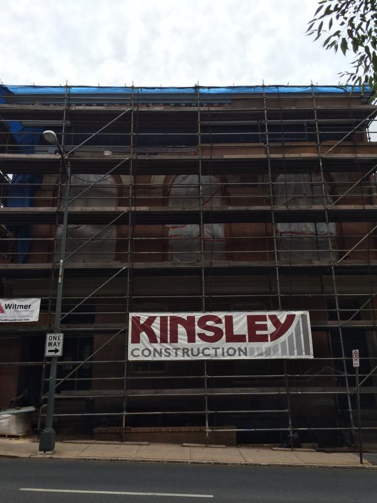
The north part of the city is populated by a lot of abandoned lots and warehouses. It won't stay that way for long, however. Here is an example of a warehouse that will be turned into lofts by 2015. There are at least three such projects going on in the immediate vicinity. Additional residents will undoubtedly provide a much needed jolt to this area. Unfortunately, I don't think any of the projects (done by RGS Associates) include much ground-floor retail. That being said, beggars can't be choosers, and the influx of residents will be a boon for the area.

A member of the semi-pro Independent baseball league, the Lancaster Barnstormers are a relatively new anchor for the city's northernmost section. They completed their new stadium only several years ago. As an urban design enthusiast, I feel the new stadium is a mixed bag. Yes, it replaced a scrap yard, so it is an improvement. However, thanks to its single-use as a baseball stadium, it livens the area only on game days. This area could have served as a gateway to a reinvigorated north end of the city. Instead, it only intermittently boosts the area's profile. When the Barnstormers aren't in town, the stadium deadens the immediate area, primarily thanks to blank walls along the street (second photo). The first picture is of the stadium's main entrance.


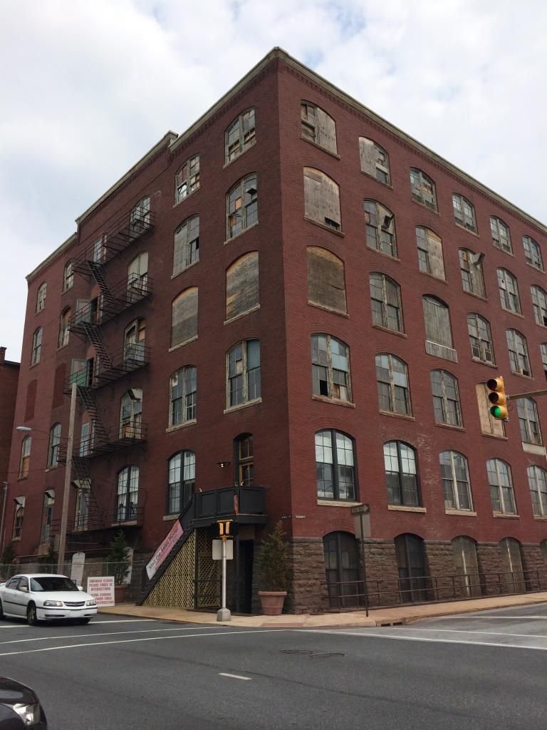
In my mind, this next photo showcases one of Lancaster's top five development opportunities. An old factory that currently has no use, the building could act as the cornerstone of an impressive development the could anchor the north side. The property it sits on occupies an entire city block, which obviously raises the worry of a superblock development. However, if done right, this could act as the anchor for the city's north side that the land currently occupied by the baseball stadium could have been. Nothing is currently eminent, but once the aforementioned loft projects are completed, there will be many more people living in the area, which will hopefully encourage someone to take a risk on this parcel.

The train station basically serves as the northernmost boundary of the city. Over the train tracks lies the suburbs. The exterior is nice for a small city; Amtrak and the city recently completed a refurbishment of its exterior (they are currently working on its interior). I wish it wasn't so set back from the curb, but all in all it will be a very handsome station once the interior is completed and it brings life to the north side of the city.

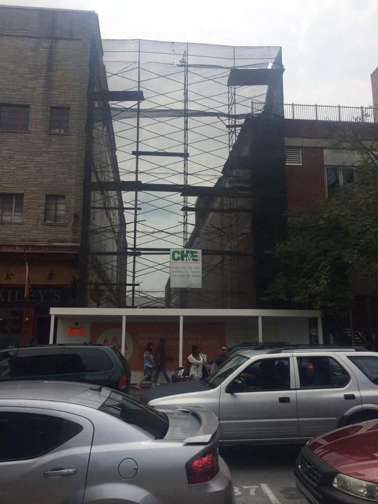
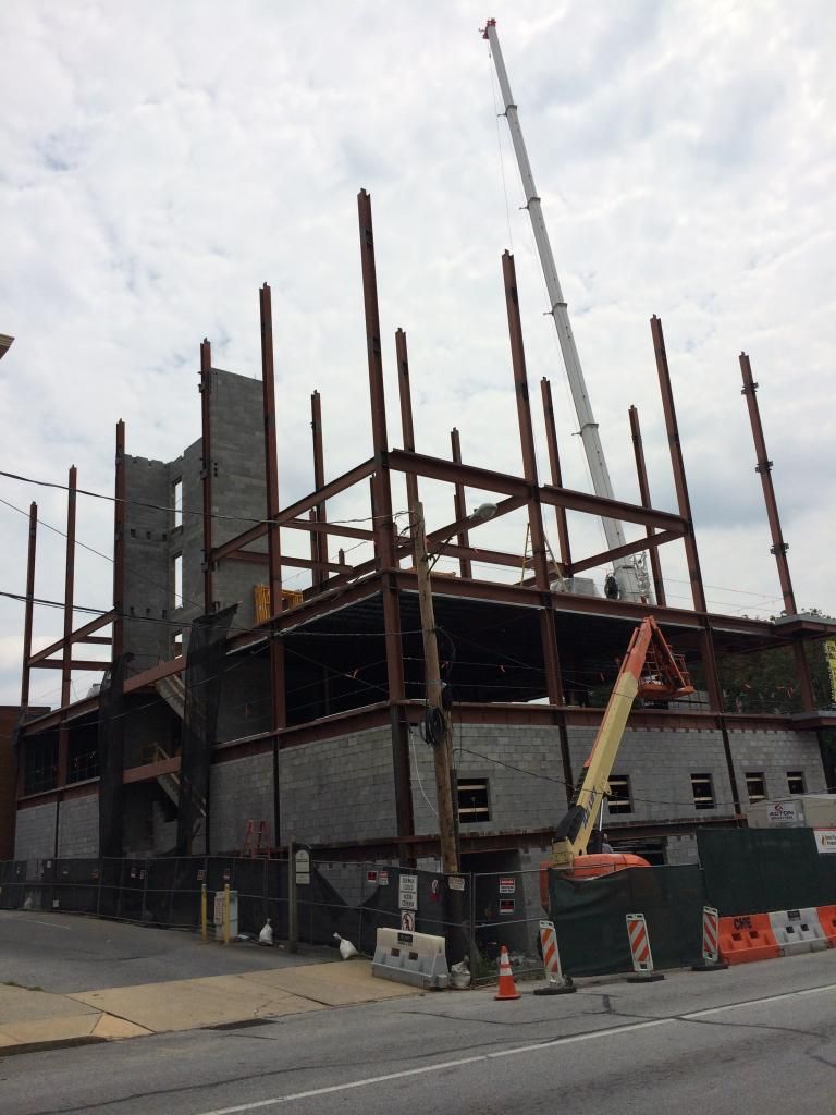
Just outside the station, the city and the state are working on the major infrastructure project I mentioned earlier. It's difficult to appreciate the significance of what's happening unless you live in Lancaster, but essentially the project will replace a crumbling bridge just east of the train station and it will improve the traffic patterns throughout much of the northern part of the city. For residents and business owners, it is a tremendous short term headache. However, once completed, it should benefit this part of the city immensely. There is a lot of underutilized land in the area where this work is going on (think used car sales lots, repair shops, etc.). I think the redevelopment of the area around the train station will take awhile; there are plenty of redevelopment opportunities in the city's northern section closer to the vibrant downtown and West End neighborhoods. That being said, if Lancaster can continue to build on its momentum, those opportunities will eventually be used up. Once that happens, these lots (a couple of which you can see in the construction pictures) could provide an interesting opportunity to reconnect a neighborhood.


For those following the map, I walked down McGovern Avenue (train station) and then took a right on Lime Street.
Lime Street is the easternmost border of the downtown district and marks the beginning of the East End, an actual neighborhood. The homes aren't the prettiest (the city's best residential districts are located in the West End area), but they are nothing to scoff at. Below are two photos of typical row homes (at least for the East End). Much of Lime Street is residential or office space; on the ground floors of some of these row houses, you can find law firms and architects galore.


The major tenant of Lancaster's north part of the city is Lancaster General Hospital, which is part of the Lancaster General Health network. This is the hospital that will be working with F&M on the redevelopment of the land freed up by the removal of the rail yard. (It makes sense: three F&M trustees are on LGH's Board of Directors.) Lancaster General occupies several city blocks (below is a picture of the main entrance). Although its downtown campus is by no means an architectural or urban planning masterpiece, Lancaster General has spent A LOT of money on Lancaster and brought several thousand jobs to the city, both of which would be irreplaceable should the city get picky and scare it off. Of course, what's there already would be nearly impossible to move, but the city wants LGH to focus on its downtown location (it has several campuses elsewhere that could certainly benefit from increased investment) and to bring additional functions to Lancaster instead of the suburbs.

4. East End
The East End has received more investment than the city's northernmost portion, although with the new lofts and infrastructure investments pouring into the north side, the East End is quickly losing ground. The issue with the East End has a couple issues holding it back from reaching the heights that the downtown district and the West End have achieved. One is that it lacks a dedicated tenant to anchor the neighborhood and draw money to it. The West End has F&M, the north side has the train station and LGH, and downtown has a bustling arts community and several tourist hot spots. The city has tried to create something like that here, but thus far it has failed to have the same impact. As a result, the East End is a gritty urban neighborhood (not necessarily a bad thing, as I am sure many members of this forum can appreciate) that is punctuated by several highlights. A total revitalization of the area is a long way off, and I am not sure where it would come from, as it doesn't have the vacant land or the easily renovated abandoned warehouses that the rest of the city had. It's mostly old row houses.
When you come across the Lancaster Cemetery, you know you've entered the East End. It's large and would offer the East End a lot of developable land were it available to be repurposed. Of course, that will never happen (nor should it). Many important people (to Lancaster, at least) are buried here and it is pretty, but I can't help but wonder what could be built using this land, which sits in the middle of an urban area.

Lancaster General Hospital's College of Nursing sits on the edge of the East End as well. I believe this is one of several functions the Hospital would like to move over to Harrisburg Avenue once the rail yard has been removed. What would take its place, I have no idea, but it is a nice building. (I apologize for the intense glare here.)

Getting off the East End's edge a bit, Urban Place is located on New Holland Pike and is the site of the greatest effort to reinvigorate the neighborhood. Old, abandoned warehouses were refurbished and turned into a mixed-use are with offices, civic space (the civic space is largely taken up by the city's science museum, the Science Factory), a hotel, and a restaurant. Overall, it's an interesting mixed-use development that looks good for what it is. Unfortunately, it could have been so much more had the original planners thought to include residences and more ground floor retail. Right now, it brings little life to the area outside of office hours and even then it can be sterile. It is certainly better than what was there, but it's an example of developers getting it about 60% right; had the buildings next to the street included ground-floor retail and even just one building been condos or apartments instead of more office space, I think this would have been than much more successful. The hotel is nearly always full, but since there is little to do in the immediate vicinity, its occupants head downtown or to the West End, so the East End sees relatively little benefit. The following the three pictures are all of Urban Place.


Across the street from Urban Place is this nondescript wooden building that looks much older than it is. Inside is my favorite East End bar. I don't make it over here all that much, but when I do, I tend to frequent this spot.

One thing Lancaster (and, in particular, the East End) has a lot of that I wish Boston would embrace more is colorful murals. They dot the landscape throughout the East End, the northern part of the city, and parts of the West End. I think murals add color and vibrancy to otherwise downtrodden areas, so I always stop to admire good murals that are tastefully done. This particular one is relatively new, covering the blank side wall of what is the headquarters of an Iraqi catering place. The food is excellent. For whatever reason, Lancaster has attracted a very diverse array of nationalities, which is reflected in its food. Without leaving the city, I can get really good Iraqi, Nepalese, Tibetan, Chinese, Vietnamese, Thai, Ethiopian, authentic Mexican, Colombian, Italian (the real kind), Haitian, Jamaican, and French cuisine. I know I'm forgetting several as well. Anyway, here's a photo of the mural I mentioned:

NOTE: I recognize I have been calling the neighborhood the East End and the mural says the East Side. It gets called both names in Lancaster. I have heard both names from locals. I just happened to learn that it is called the East End.
One really successful East End refurbishment is the Lancaster Brewing Company, one of two breweries the city has within its limits (the other is Iron Hill, which is a chain and is located in the College Row complex). It's a very cool place inside, with the tables located amidst all the tanks and equipment the brewery uses to make its beer. Iron Hill in College Row is generally considered to be the better of the two breweries (although they are predictably similar), but there's no question this has proven to be an excellent usage of a vacant factory that would have otherwise remained empty and rotting for years and the Lancaster Brewing Co. not decided it would be a cool place for a brewery/restaurant. The first picture is of the main entrance and the second picture is of its newly renovated outdoor patio on the opposite side. The outdoor section is surprisingly successful given its exposure to a busy intersection and it will improve even more once the brewery installs the public art display it had commissioned for the patio.


This next picture is of a small street closer to downtown from where I have been. For those looking at the map, I believe I was on East Walnut Street when I snapped this photo.

The last stop on my tour of the East End was Musser Park, which is the centerpiece of what is probably the prettiest and best put together part of Lancaster's East End. It occupies about two city blocks and is surrounded by three and four story brick and stone homes that are nearly as old as the city itself. The western half of the park is largely an open lawn (second photo) and is used to host festivals, markets, and other community events. I didn't get a chance to snap any photos of the really nice homes surrounding Musser Park because a flash storm popped up just as I was going through the area. It's not a tragedy, however, as it looks like much of the West End, which I have yet to post. For now, a couple photos of Musser Park will have to suffice:


On the easternmost edge of Musser Park is the Lancaster Art Museum. Not being a huge fan of art, I have never gone there, preferring to frequent the city's restaurants, bars, and other attractions. However, it is in a handsome building (the photo doesn't do it justice) and the people I know who have attended it have told me it's well worth a visit if you're interested in art. As long as you don't go in expecting it to be the MFA, it is a good way to spend a couple hours.

And that concludes Part 1 of 3. Today I will be walking around the downtown core of the city (easily its most vibrant, exciting part) and tomorrow I will be walking around the West End (a very pretty, but largely residential area). I will post my downtown photos and thoughts to this thread either tonight or tomorrow morning. What you saw today were easily the least impressive segments of Lancaster. If you can stand my mediocre photography and my long post, you'll certainly enjoy seeing the other two parts of this little series. I hope you enjoyed it!
Although I will never mistake Lancaster for Boston, Lancaster is a vibrant, energetic city that really has carved out a place in my heart. As I am not working this week, I have decided to really go on a detailed walking tour of this small, but ultra-livable city and snap a bunch of photos. Given this forum's enthusiasm for architecture and urban planning in general, I thought it might make for an interesting photo essay. I have split my walking tour into three parts: yesterday I walked around Franklin & Marshall College (my alma mater), the north side, and the East End; today I will spend my time snapping photos downtown; and tomorrow I plan to walk around the West Side. Given the size and number of photos, I will split the tour into three posts, starting with this one (the introduction, F&M, north side, and East End). I hope you enjoy and I look forward to contributing more to this forum! Also, I apologize for the not-so-terrific quality of my photos; all I have is my smartphone at my disposal.
NOTE: I figured it might be useful to include a map of Lancaster City: https://maps.google.com/maps?client...gl=us&ei=XtvvUYGiEo6w8QS314GYDw&ved=0CJoBELYD. For those who have never been there, this might serve as a way to generally orient yourself with the city should you choose to do so.
Before I begin, just a bit of background: Lancaster is about an hour and a half west of Philadelphia, 45 minutes southeast of Harrisburg, and four and a half hours east of Pittsburgh. It has approximately 60,000 residents living in an area of about 7.2 square miles, giving it a population density of ~8,000 people per square mile. It is the 8th largest city in the state. It is historically and culturally relevant: it is the home of late president James Buchanan, was the nation's capital for one day, has a bustling arts community, and is the historical and present heart of Amish country. Although Lancaster has not been immune to urban renewal over the course of time, its fabric is comprised primarily of stone and brick buildings between three and seven stories tall. There are some blights (as you will see), but much of this fabric remains intact. Over the past five to ten years, Lancaster has experienced something of a rejuvenation, which many other small to midsize cities (at least in PA) have failed to experience. It thrives on the money and tourism that pours in from Philadelphia, Baltimore, Washington, and, to a lesser extent, New York City and New England. It has leveraged its arts community and the Amish to its advantage. The primary economic engines in the city are the following: Franklin & Marshall College, Lancaster Regional Hospital, Lancaster General Health/Hospital, and tourism. I'll provide more details within the photo essay, but enough blabbing for now...on to the pictures!
Part 1: F&M, north side, East Side
1. Franklin & Marshall College
Below are photos of F&M's main campus. It's not a "city college" in the way BU is; as you'll notice, F&M has a defined campus that looks suburban. It sits on the very edge of the city (its campus practically is the city line). That being said, the College has been very active in rejuvenating the area surrounding it, which I will discuss in further detail throughout this series.
The College, which was born when Benjamin Franklin's Franklin College and Chief Justice John Marshall's Marshall College combined (Franklin had lots of money, but no students and Marshall had lots of students, but no money), used to be housed completely in Old Main:

Directly to Old Main's left is the Shadek-Fackenthal Library:

And just two more shots of F&M for the flavor. I have many more, but F&M's campus isn't really the point of this little photo essay:


2. Harrisburg Ave.
This area used to be a total blight, and although there is still much room for improvement, a slew of developments have begun to boost this area's image. Much of it used to be abandoned warehouses and mills, a train yard, and scrap heaps. Today, many of the abandoned buildings have been repurposed, the scrap heaps are gone, and the rail yard will soon be moved, freeing up acres of developable land for F&M, the hospitals, and the city. This is an ongoing process that will likely take another decade or so to complete. It's not perfect, but there is promise.
The biggest project on Harrisburg Ave. is College Row, which is widely regarded as part of the F&M campus, but is in fact owned by a third party. (F&M ordered and paid for its construction, but it didn't want to operate the facility.) The top five floors are student housing and the ground floor is all retail, which is almost completely occupied. These two buildings have eleven retail spaces, meaning there really aren't any large superblock retail spots, which is a huge plus. Immediately to the left are several more retail buildings, the College's gym, and a multipurpose athletic field. All these developments sit on former scrap heaps. I didn't snap a photo of the other buildings because, well, they kinda look like what you see here.

Immediately behind College Row sits the rail yard and a bunch of unused land. As of right now, a new rail yard is be constructed about a half-mile away. Once completed, these rails will be torn up and the city will reconnect the street grid. Once done, much of the lawn you see will become F&M's athletic fields and nursing facilities for city's hospitals. Another segment of the newly available land (not visible here) will be divvied up into 12 parcels for the city to sell off to private developers, hopefully reintegrating the part of the city that has been cut off thanks to the rail yard by creating a new, mixed-use area. Although a huge benefit to F&M and the city, it will be a shame to lose the old bridge (first picture).


Continuing down Harrisburg Ave., you start to see some developments that have been finished. One such example is Fenz, a trendy restaurant and bar that took over an old warehouse and salvaged what it could, in the process creating a really cool space. There is a series of stores in a more boring, modern, one-story extension coming out of its rear that isn't visible in this shot. To the right you can see old warehouses; those have been repurposed into student housing and office space (these are technically part of the West End, which I will address in the third part). Their preservation has created a far more interesting neighborhood than had F&M elected to bulldoze it all and start over.

Across the street from Fenz is the end of the railyard. This area is what will be chopped up into the 12 parcels for the city to sell off to private developers. This is also where much of the reknitting of the city's street grid will take place.

Even further up Harrisburg Ave. and closer to the city's downtown, more completed, successful development can be seen. Two prominent examples of projects that replaced derelict buildings or scrap yards are the YMCA (brand new construction, first picture) and the Lancaster ARTS Hotel (rehabbed mill building, second picture). The Lancaster ARTS is a terrific boutique hotel that also house John J. Jeffries, a phenomenal restaurant serving food that can only be obtained from the area farmers. This is a theme: restaurants in Lancaster tend to use local food whenever possible, which is smart, as it leverages the region's Amish heritage while also providing the freshest food you can find. More on the city's terrific collection of restaurants later on.


3. Lancaster's north side
For those of you looking at the map, I took a left on Prince Street, which is the western border of the city's downtown district.
Admittedly, Lancaster probably doesn't look like much of a city thus far. However, that will change, I promise. The north side of the city technically isn't a neighborhood name, but I am calling it that for the sake of organization. This area has seen some investment, but not as much as the downtown area and the western part of the city surrounding F&M. Even the East Side has received more attention than the northern part of the city. That is changing, however, with upgrades to the train station and some infrastructure improvements providing a long-term boost to the region in exchange for some short-term headaches.
The north part of the city is populated by a lot of abandoned lots and warehouses. It won't stay that way for long, however. Here is an example of a warehouse that will be turned into lofts by 2015. There are at least three such projects going on in the immediate vicinity. Additional residents will undoubtedly provide a much needed jolt to this area. Unfortunately, I don't think any of the projects (done by RGS Associates) include much ground-floor retail. That being said, beggars can't be choosers, and the influx of residents will be a boon for the area.

A member of the semi-pro Independent baseball league, the Lancaster Barnstormers are a relatively new anchor for the city's northernmost section. They completed their new stadium only several years ago. As an urban design enthusiast, I feel the new stadium is a mixed bag. Yes, it replaced a scrap yard, so it is an improvement. However, thanks to its single-use as a baseball stadium, it livens the area only on game days. This area could have served as a gateway to a reinvigorated north end of the city. Instead, it only intermittently boosts the area's profile. When the Barnstormers aren't in town, the stadium deadens the immediate area, primarily thanks to blank walls along the street (second photo). The first picture is of the stadium's main entrance.


In my mind, this next photo showcases one of Lancaster's top five development opportunities. An old factory that currently has no use, the building could act as the cornerstone of an impressive development the could anchor the north side. The property it sits on occupies an entire city block, which obviously raises the worry of a superblock development. However, if done right, this could act as the anchor for the city's north side that the land currently occupied by the baseball stadium could have been. Nothing is currently eminent, but once the aforementioned loft projects are completed, there will be many more people living in the area, which will hopefully encourage someone to take a risk on this parcel.

The train station basically serves as the northernmost boundary of the city. Over the train tracks lies the suburbs. The exterior is nice for a small city; Amtrak and the city recently completed a refurbishment of its exterior (they are currently working on its interior). I wish it wasn't so set back from the curb, but all in all it will be a very handsome station once the interior is completed and it brings life to the north side of the city.

Just outside the station, the city and the state are working on the major infrastructure project I mentioned earlier. It's difficult to appreciate the significance of what's happening unless you live in Lancaster, but essentially the project will replace a crumbling bridge just east of the train station and it will improve the traffic patterns throughout much of the northern part of the city. For residents and business owners, it is a tremendous short term headache. However, once completed, it should benefit this part of the city immensely. There is a lot of underutilized land in the area where this work is going on (think used car sales lots, repair shops, etc.). I think the redevelopment of the area around the train station will take awhile; there are plenty of redevelopment opportunities in the city's northern section closer to the vibrant downtown and West End neighborhoods. That being said, if Lancaster can continue to build on its momentum, those opportunities will eventually be used up. Once that happens, these lots (a couple of which you can see in the construction pictures) could provide an interesting opportunity to reconnect a neighborhood.


For those following the map, I walked down McGovern Avenue (train station) and then took a right on Lime Street.
Lime Street is the easternmost border of the downtown district and marks the beginning of the East End, an actual neighborhood. The homes aren't the prettiest (the city's best residential districts are located in the West End area), but they are nothing to scoff at. Below are two photos of typical row homes (at least for the East End). Much of Lime Street is residential or office space; on the ground floors of some of these row houses, you can find law firms and architects galore.


The major tenant of Lancaster's north part of the city is Lancaster General Hospital, which is part of the Lancaster General Health network. This is the hospital that will be working with F&M on the redevelopment of the land freed up by the removal of the rail yard. (It makes sense: three F&M trustees are on LGH's Board of Directors.) Lancaster General occupies several city blocks (below is a picture of the main entrance). Although its downtown campus is by no means an architectural or urban planning masterpiece, Lancaster General has spent A LOT of money on Lancaster and brought several thousand jobs to the city, both of which would be irreplaceable should the city get picky and scare it off. Of course, what's there already would be nearly impossible to move, but the city wants LGH to focus on its downtown location (it has several campuses elsewhere that could certainly benefit from increased investment) and to bring additional functions to Lancaster instead of the suburbs.

4. East End
The East End has received more investment than the city's northernmost portion, although with the new lofts and infrastructure investments pouring into the north side, the East End is quickly losing ground. The issue with the East End has a couple issues holding it back from reaching the heights that the downtown district and the West End have achieved. One is that it lacks a dedicated tenant to anchor the neighborhood and draw money to it. The West End has F&M, the north side has the train station and LGH, and downtown has a bustling arts community and several tourist hot spots. The city has tried to create something like that here, but thus far it has failed to have the same impact. As a result, the East End is a gritty urban neighborhood (not necessarily a bad thing, as I am sure many members of this forum can appreciate) that is punctuated by several highlights. A total revitalization of the area is a long way off, and I am not sure where it would come from, as it doesn't have the vacant land or the easily renovated abandoned warehouses that the rest of the city had. It's mostly old row houses.
When you come across the Lancaster Cemetery, you know you've entered the East End. It's large and would offer the East End a lot of developable land were it available to be repurposed. Of course, that will never happen (nor should it). Many important people (to Lancaster, at least) are buried here and it is pretty, but I can't help but wonder what could be built using this land, which sits in the middle of an urban area.

Lancaster General Hospital's College of Nursing sits on the edge of the East End as well. I believe this is one of several functions the Hospital would like to move over to Harrisburg Avenue once the rail yard has been removed. What would take its place, I have no idea, but it is a nice building. (I apologize for the intense glare here.)

Getting off the East End's edge a bit, Urban Place is located on New Holland Pike and is the site of the greatest effort to reinvigorate the neighborhood. Old, abandoned warehouses were refurbished and turned into a mixed-use are with offices, civic space (the civic space is largely taken up by the city's science museum, the Science Factory), a hotel, and a restaurant. Overall, it's an interesting mixed-use development that looks good for what it is. Unfortunately, it could have been so much more had the original planners thought to include residences and more ground floor retail. Right now, it brings little life to the area outside of office hours and even then it can be sterile. It is certainly better than what was there, but it's an example of developers getting it about 60% right; had the buildings next to the street included ground-floor retail and even just one building been condos or apartments instead of more office space, I think this would have been than much more successful. The hotel is nearly always full, but since there is little to do in the immediate vicinity, its occupants head downtown or to the West End, so the East End sees relatively little benefit. The following the three pictures are all of Urban Place.


Across the street from Urban Place is this nondescript wooden building that looks much older than it is. Inside is my favorite East End bar. I don't make it over here all that much, but when I do, I tend to frequent this spot.

One thing Lancaster (and, in particular, the East End) has a lot of that I wish Boston would embrace more is colorful murals. They dot the landscape throughout the East End, the northern part of the city, and parts of the West End. I think murals add color and vibrancy to otherwise downtrodden areas, so I always stop to admire good murals that are tastefully done. This particular one is relatively new, covering the blank side wall of what is the headquarters of an Iraqi catering place. The food is excellent. For whatever reason, Lancaster has attracted a very diverse array of nationalities, which is reflected in its food. Without leaving the city, I can get really good Iraqi, Nepalese, Tibetan, Chinese, Vietnamese, Thai, Ethiopian, authentic Mexican, Colombian, Italian (the real kind), Haitian, Jamaican, and French cuisine. I know I'm forgetting several as well. Anyway, here's a photo of the mural I mentioned:

NOTE: I recognize I have been calling the neighborhood the East End and the mural says the East Side. It gets called both names in Lancaster. I have heard both names from locals. I just happened to learn that it is called the East End.
One really successful East End refurbishment is the Lancaster Brewing Company, one of two breweries the city has within its limits (the other is Iron Hill, which is a chain and is located in the College Row complex). It's a very cool place inside, with the tables located amidst all the tanks and equipment the brewery uses to make its beer. Iron Hill in College Row is generally considered to be the better of the two breweries (although they are predictably similar), but there's no question this has proven to be an excellent usage of a vacant factory that would have otherwise remained empty and rotting for years and the Lancaster Brewing Co. not decided it would be a cool place for a brewery/restaurant. The first picture is of the main entrance and the second picture is of its newly renovated outdoor patio on the opposite side. The outdoor section is surprisingly successful given its exposure to a busy intersection and it will improve even more once the brewery installs the public art display it had commissioned for the patio.


This next picture is of a small street closer to downtown from where I have been. For those looking at the map, I believe I was on East Walnut Street when I snapped this photo.

The last stop on my tour of the East End was Musser Park, which is the centerpiece of what is probably the prettiest and best put together part of Lancaster's East End. It occupies about two city blocks and is surrounded by three and four story brick and stone homes that are nearly as old as the city itself. The western half of the park is largely an open lawn (second photo) and is used to host festivals, markets, and other community events. I didn't get a chance to snap any photos of the really nice homes surrounding Musser Park because a flash storm popped up just as I was going through the area. It's not a tragedy, however, as it looks like much of the West End, which I have yet to post. For now, a couple photos of Musser Park will have to suffice:


On the easternmost edge of Musser Park is the Lancaster Art Museum. Not being a huge fan of art, I have never gone there, preferring to frequent the city's restaurants, bars, and other attractions. However, it is in a handsome building (the photo doesn't do it justice) and the people I know who have attended it have told me it's well worth a visit if you're interested in art. As long as you don't go in expecting it to be the MFA, it is a good way to spend a couple hours.

And that concludes Part 1 of 3. Today I will be walking around the downtown core of the city (easily its most vibrant, exciting part) and tomorrow I will be walking around the West End (a very pretty, but largely residential area). I will post my downtown photos and thoughts to this thread either tonight or tomorrow morning. What you saw today were easily the least impressive segments of Lancaster. If you can stand my mediocre photography and my long post, you'll certainly enjoy seeing the other two parts of this little series. I hope you enjoyed it!


