Skip to bottom for bus transit forum-related talking point
There's a keyword repeated and that's traffic. Cars are geometrically incompatible with dense land use. Not to say that there's no place for private automobiles as they're a very useful transportation tool. That said, of this 66-served region that we're discussing, the only part that potentially has a genuine automobile access and capacity problem is Harvard-Allston crossing the Charles. Without that Eliot Bridge interchange taking up that entire area, it would be a good idea to have a bridge extending from Hawthorn so that not all traffic coming or going northeast from Allston is funneled across the existing Anderson Memorial. It still boils down in the end to too many cars all trying to go to finite-sized destinations and not enough alternative transportation modes to suit the travel corridor demand. The population and job market aren't stagnated, the travel demand will only continue to increase. A Malvern extension would only offer about a half mile of "relief" which just puts the same cars right back to Comm, Brighton, Cambridge Ave, etc. The working design alternatives also have I-90 exiting onto Malvern.
View attachment 45495
That's frankly not how scapegoating works. The vehicular congestion in the LMA is not coming from people driving from Allston/Brighton/Cambridge, there are not enough car users from these places with LMA jobs to cause that congestion, and they have decent transportation alternatives. Boston is an actual city where real people live, so it's as you say major center nodes pepper a region of dense old residential neighborhoods. This is the best way to build environments where as many people as possible can live close to work and amenities. Originally it was to be able to walk easily but then we invented an amazing thing called mass transportation that allowed more people to live in these same kinds of places but with greater regional access to more opportunities. Unfortunately, we built cars into the way we live, as infrastructure prioritized for cars is dangerous to people and makes getting around our dense human environment more difficult. Roads are good when they prioritize moving
people not cars. Highways have their place to move people and goods
between urban centers but not within them.
I'll reiterate that the best way to alleviate traffic along this travel corridor (which extends further north and west than Harvard Sq and Allston) is more and better fast, frequent, reliable mass transportation. Anything from a bus with dedicated lanes to a $22bil full-bore TBM tunneled subway would do more for traffic than any additional roads, road intersection removals, or road widening (unless that road is widened to fit dedicated transit).
Europe barely has any urban highways, and the places that do *cough* UK cities *cough* absolutely suck. Other places that realized they suck tore them down. What European cities do well is indeed their division of arterials, collectors, and local streets in terms of vehicular traffic management and in part safety. Europe also got flattened during a couple of wars right in time for the rise of the automobile making it easier to restart street layouts for the car. I'm not sure where you're getting no sidewalks and terrible for pedestrians from though. Yeah, Europe has roads that are bad offenders of car priority to the detriment of pedestrians but they are very limited, and like you say they'll have a robust transit system to facilitate the safe movement of people in this dangerous car-dominated world. Also, the UK, France, Italy, and Germany are known for being incredibly car-dependent outside of a select number of cities. Every city has room to grow and be better for people, some are farther along in that than others and that's where examples of success can be pulled from.
Being a better city for pedestrians aka people is a bad thing? Not that Boston is better than London or Paris, it's not. London slaps pedestrian crossings on main arterials too.
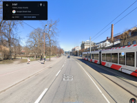
View attachment 45500As does Paris.
View attachment 45501
People cross roads wherever possible whenever they want everywhere in the world. If there's a clear desire for people to cross roads in between intersections that might mean there should be a safe crossing there. Other parts of Europe like the Netherlands also don't have antiquated signals that only work in a cycle. They have advanced sensors that can tell when pedestrians or bikes approach and switch car traffic to red to prioritize crossing. These lights also change the signal on a direction with less cars to prioritize one with more to keep traffic flowing better. What most of Europe gets right is that their city centers put moving people above moving cars which means prioritizing higher capacity and safer transportation infrastructure for walking, biking, and public transit.
Bus Talk:
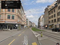
More of our main bus arterials should look like Columbus Ave. To make service more fast and reliable I think the MBTA should do a sort of Corridor ID like Amtrak where they indentify which roads have a lot of route overlap and passenger turnover on them and select which ones could be redesigned with center bus lanes within their current street width and rank priority on their funding and implementation based on those metrics. Harvard Ave is a more narrow road and the 66 is the only route serving it despite its high ridership so I'd think it'd end up down the priority list. But there's potential for a couple new routes to be created that could use the same infrastructure and add passenger capacity to the route. A Watertown Sq to Brookline Village or a potential Longwood bus hub via North Beacon and Harvard Ave is a potential addition as well as a theoretical West Station to Ruggles via Babcock-Harvard-LMA.
In terms of getting across the river, we have limited bridges so the T and the city should prioritize the few routes that run across them for the benefit of North-South people movement.