MBTA Buses & Infrastructure

3473388309_66a5b5e87e_k.jpg
My teenage years just called…
 
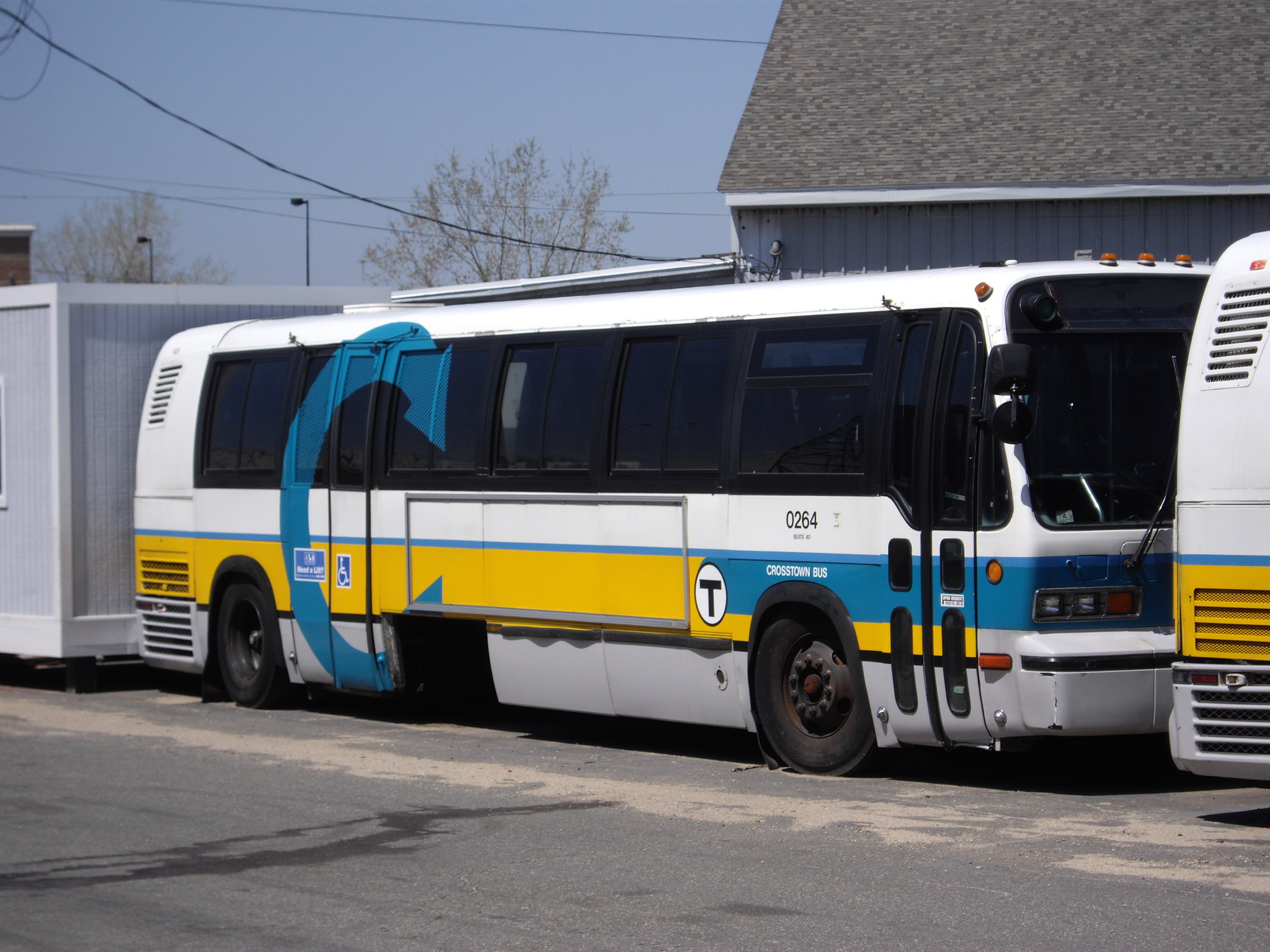
I wish I could give you a better source than “trust me bro” but from what I’ve been told and understand the “T” branding is being dropped. There will be a little clock showing 15 minutes on the bus stop signs, but the route numbers won’t be “T1”
That would be incredibly frustrating if true. We desperately need some effective branding (that are not as pretentious as a "Line") for these bus routes to indicate frequent, reliable service, so that riders feel confident in using them. I can't think of better ways to do so than putting the "T" in the routes' names.
I don't know if the "T" is useful for buses. What does the T mean even?

I would love for them to commit to it and brand everything as F for frequent or go full chaos and brand SL for all the frequent routes. SL1 and SL1 be damned!

Less tongue in cheek, they should consider something more than a clock graphic. That's not going to mean something to most riders and in fact maybe ripe for critique. "Tick-tock the bus isn't here" kind of critiques .
 
God mode pitch: Renumber the whole network so that high-frequency routes are multiples of 10.

Reasonable pitch: Keep the T prefix, or switch it to F for frequent, or K for key, or something! There's no way a casual transit user will remember that routes 1, 7, 39, 111, yada yada are all high-frequency.
 
On the question of "Should Silver Line branding be phased out?" Here are my thoughts:
  • As @Teban54 and @Smuttynose said, the Washington St Debacle has made many people (rightfully) skeptical of "Silver Line" projects, often seeing them as token gestures in lieu of actual improvements. For this reason, I think introducing any new SL routes, like the proposed SL6, would be a bad idea.
  • The existence of the Washington St routes also reflects negatively on the rest of the SL lines, even the good parts. A better solution would be to replace the SL4/5 with two routes: The T49X, a version of the existing SL4/5 with a couple extra stops eliminated, and the T49, making more local stops along Washington St than the existing SL services.
That would at least make the Silver Line (almost) all at least kinda-BRT. Some possibilities to go even further:
  • Replace SL1 with a revamped Logan Express, and potentially combine it with the Back Bay Logan Express service. SL1 is currently burdened with carrying local traffic from South Station to Seaport alongside airport travelers. Anyone who's ridden this route and been thoroughly smushed by luggage knows the pain this brings. This route would run on the surface to avoid being constrained by Transitway speeds.
  • Replace SL3 with a network of buses all using the Chelsea Busway. One of the big advantages of BRT is that it's really easy to branch it like crazy to give as many one seat rides as possible, but the Chelsea Busway completely ignores this benefit. What if instead of one SL3 route, there were multiple routes branching off to places like BUMC/Nubian, the Airport Terminals, Kendall, North Station, and Seaport/South Station?
  • Finally convert SL2 to light rail for faster, smoother rides through the Transitway and eventually connect it to the Green Line.
And then you could finally 'kill' the Silver Line and replace it with proper service that it has always deserved. (Although if the branding's reputation had improved enough by this point I suppose you could keep it for the SL2 conversion rail line.)
 
Replace SL1 with a revamped Logan Express, and potentially combine it with the Back Bay Logan Express service. SL1 is currently burdened with carrying local traffic from South Station to Seaport alongside airport travelers. Anyone who's ridden this route and been thoroughly smushed by luggage knows the pain this brings. This route would run on the surface to avoid being constrained by Transitway speeds.
Why not run the SL1 route directly South Station to Logan via the former HOV access to the Williams Tunnel, the same way the regional bus carriers do?
 
Why not run the SL1 route directly South Station to Logan via the former HOV access to the Williams Tunnel, the same way the regional bus carriers do?
That could work, although in general I think the preferred approach should be to spend the least amount of time possible on I90 and spend more time in dedicated bus lanes.
 
That could work, although in general I think the preferred approach should be to spend the least amount of time possible on I90 and spend more time in dedicated bus lanes.
I actually find the I-90 (formerly) HOV lanes to Logan and the dedicated HOV exit to South Station from Logan both work well.

The problem is the Williams Tunnel, which is always going to be the case.
 
I don't know if the "T" is useful for buses. What does the T mean even?

I would love for them to commit to it and brand everything as F for frequent or go full chaos and brand SL for all the frequent routes. SL1 and SL1 be damned!

Less tongue in cheek, they should consider something more than a clock graphic. That's not going to mean something to most riders and in fact maybe ripe for critique. "Tick-tock the bus isn't here" kind of critiques .
I admit, I did think that the "T" branding was cute... but also oddly reduplicative in a strange way. Imagine saying: The T's T12 bus is being extended to Providence next month. It's a little "too" cute, so in some ways I'm not surprised it would be phased out.
  • As @Teban54 and @Smuttynose said, the Washington St Debacle has made many people (rightfully) skeptical of "Silver Line" projects, often seeing them as token gestures in lieu of actual improvements. For this reason, I think introducing any new SL routes, like the proposed SL6, would be a bad idea.
  • The existence of the Washington St routes also reflects negatively on the rest of the SL lines, even the good parts. A better solution would be to replace the SL4/5 with two routes: The T49X, a version of the existing SL4/5 with a couple extra stops eliminated, and the T49, making more local stops along Washington St than the existing SL services.
I do agree that the Silver Line "brand" is now fundamentally flawed, but ironically I think SL3/SL3x have the strongest claim to the BRT mantle, and I think SL6 would also. And, regardless of what they call it, SL3x and SL6 would both include physical infrastructure improvements dedicated to transit. Is that sufficient to merit the "rapid transit" branding? No, but I do think it's reasonable to brand them with something different.

I also don't think SL4/5 will ever be "de-branded". They'd literally have to tear the line off of the map -- the headlines write themselves. There's no way the T looks at the PR storm that would prompt and sees it as worth the eventual rehabilitation of the Silver Line brand for use elsewhere in the system; rehabbing the brand just isn't worth the headache.
That would at least make the Silver Line (almost) all at least kinda-BRT. Some possibilities to go even further:
  • Replace SL1 with a revamped Logan Express, and potentially combine it with the Back Bay Logan Express service. SL1 is currently burdened with carrying local traffic from South Station to Seaport alongside airport travelers. Anyone who's ridden this route and been thoroughly smushed by luggage knows the pain this brings. This route would run on the surface to avoid being constrained by Transitway speeds.
Yep, agree with you here (as we've discussed before).
  • Replace SL3 with a network of buses all using the Chelsea Busway. One of the big advantages of BRT is that it's really easy to branch it like crazy to give as many one seat rides as possible, but the Chelsea Busway completely ignores this benefit. What if instead of one SL3 route, there were multiple routes branching off to places like BUMC/Nubian, the Airport Terminals, Kendall, North Station, and Seaport/South Station?
In principle I agree with you on this benefit and potential use. In practice, how would you actually draw this network? The Chelsea Busway seems like a small piece, and has the downside of skirting the actual core of Chelsea (ie. where people live).
  • Finally convert SL2 to light rail for faster, smoother rides through the Transitway and eventually connect it to the Green Line.
Obviously agree here.

In general, I think some sort of BRT is going to remain necessary if only to handle the leg of the journey that goes through the TWT. Potentially also for routes that would otherwise need to traverse the Tobin Bridge. Should those be rebranded away from being the Silver Line? Maybe? But they'll still have to be buses, either way, so I wonder how much difference the branding actually makes.
 
Devil's advocate regarding Silver Line branding north of the Mystic: Few Everett residents ride the SL4/5 on a regular basis or have knowledge of the "equal or better" promise. And the SL3 busway just over the border in Chelsea looks really snazzy compared to what they have on Broadway, especially if you don't ride it often enough to be aware of the Ted Williams morass at rush hour.

And even then, a cold :poop: sandwich (some dedicated ROW) is always going to be preferable to a warm, steaming bowl of the same ingredients (their current setup) if no one is organizing Everett residents to demand better service.
 
OK, so down-branding SL4/5 is politically unviable, and for good reason--there OUGHT to be rapid transit to Nubian, even if there isn't today. So what about upgrading them to proper BRT? At least south of the pike, just eyeballing the satellite view, it seems like there'd be room for a proper center-running busway on Washington St. Am I being too optimistic there?
 
OK, so down-branding SL4/5 is politically unviable, and for good reason--there OUGHT to be rapid transit to Nubian, even if there isn't today. So what about upgrading them to proper BRT? At least south of the pike, just eyeballing the satellite view, it seems like there'd be room for a proper center-running busway on Washington St. Am I being too optimistic there?

Until the day comes that an algorithm can be embedded in the AB software that allows this staggeringly informative documentary on the Silver Line's sociopolitical origins to be posted at periodic, sensible junctures, I will continue to happily post it manually.

Watch it and be educated!

(everyone out there in AB-land; not singling-out kdmc by any means!)


(EDIT: I see a "SORRY THIS CAN'T BE PLAYED warning comes up--but click on the link and you'll still be able to watch it, I just tried and it worked...)
 
As far as branding - I'm thinking of LA Metro with it's "Rapid" buses which use numbers beginning with 700. We have suburban routes that have 700 in their name, but, maybe we could do a step-down and go to the 600s? Like 1-->601?
 
Until the day comes that an algorithm can be embedded in the AB software that allows this staggeringly informative documentary on the Silver Line's sociopolitical origins to be posted at periodic, sensible junctures, I will continue to happily post it manually.
OK, that was a fantastic watch. You're right--that should be required watching for young folks like me before we start suggesting Silver Line changes :)

Takeaways:
  • There is room for a median busway and/or LRT through the South End *if* you remove a significant amount of parking and possibly many trees. That'd have been a no-go in the early 2000s, but maybe the climate has changed since then? (no pun intended)
  • You'd still need to deal with Chinatown, which is the biggest issue for SL4/5 reliability today.
  • Even if it were done with the best intentions ("no service change"), I'd bet that down-branding SL4/5 to a "T" bus would come across as extremely sus to Roxbury residents, given how MBTA has gaslighted them before.
  • Maybe it's best that SL4/5 stays Silver so that people can keep looking at it and saying "wow, weird, shouldn't that be Real BRT / LRT?"
 
OK, so down-branding SL4/5 is politically unviable, and for good reason--there OUGHT to be rapid transit to Nubian, even if there isn't today. So what about upgrading them to proper BRT? At least south of the pike, just eyeballing the satellite view, it seems like there'd be room for a proper center-running busway on Washington St. Am I being too optimistic there?
I think making the Washington St trunk line part of the SL4/5 center-running BRT would certainly be possible in the near-future.

Here's my thinking on why:
  1. Shift to center-running on adjacent corridors: BTD and the T seem very focused on delivering the second phase of Columbus Ave up to Ruggles Station (that would provide a continuous center-running corridor from the northern edge of Franklin Park to Ruggles - solid 2-mile corridor) followed by the Blue Hill Ave project. It's taken a long time but I think we're finally seeing a sea-change in planning and street design approach in Boston that embraces most of the on-street elements needed for BRT - aka, it's becoming increasingly a matter of time that there'll be an overhaul of Washington St sometime in the 5-10 year range, once other major projects are in the ground / in construction (other evidence of that is the Everett SL3 corridor that just got announced, and other projects like the proposed Western Ave transitway, Rutherford Ave, etc.).
  2. Not a priority politically (but also becoming less of a political hot potato with every passing year): Politically, it's been 20+ years since the Washington St Silver Line bus lanes were installed, and I think there's a lot of hurt feelings that the project didn't end up with light rail (can't recommend that "Equal or Better" documentary @DBM posted above enough! That and the WGBH Big Dig podcast are two of the best multimedia projects documenting Boston's planning history IMHO). I don't hear many (or any) local or influential individuals or orgs asking for a BRT upgrade on Washington St, which means it's not gonna be a political priority for anyone in power to go out on a limb to push for it. There's been a generation since the Silver Line was planned, so eventually those hurt feelings will be less strong (not saying they're going away or can't be resurrected), but it'll take a re-framing of the corridor to justify re-configuring it / re-investing it at some point.
  3. Changes on the corridor: since the SL was launched in the early 00's, the old New York Streets area has built out dramatically, same for the lower part of the Harrison-Albany corridor area. We're seeing the final part of that come together with that last part of that come together with the parcels by Berkeley St being developed now. There're also T service changes on the horizon - SL4/5 would be formally combined into one service under the Bus Network Redesign plan. Just pointing out one point included in that summary table linked previously: "Combine Route SL4 & SL5 for better legibility, reliability, and opportunity for iconic stops in downtown section of route." That tells me that the T would eventually like to take another look the SL here to design better stops and bus lanes for Downtown Crossing and South Station, which could open up considerations for the rest of the corridor. You can see Boston being willing to do that if there're investments expanded along the entirety of the corridor (not just benefitting downtown). That could get the ball rolling on more serious planning / design conversations for the Washington St corridor in the next 5 years.
 
As far as branding - I'm thinking of LA Metro with it's "Rapid" buses which use numbers beginning with 700. We have suburban routes that have 700 in their name, but, maybe we could do a step-down and go to the 600s? Like 1-->601?
I thought about this idea and I like it; the only problem is that a number of our Rapid/Frequent/T routes have three digits. We may be able to drop the one digit without too much impact? Or otherwise simply renumber them?
  • T101 -> 601 or 611
  • T109 -> 619
  • T104 -> 614
  • T110 -> 610
  • T111 -> 611
  • T116 -> 616
Huh, that's actually not as bad as I expected. T101 and T111 conflict, and T101 would likely conflict with the T1. That should be solvable enough.

Of course, if we wanted to all out, we could ditch the existing numbers entirely, and renumber based on terminal (or "core" station), like:
  • 60x - true crosstown (the proposed T1, T12, T66, maybe T47)
  • 61x - downtown (T7, T111, SL4/5)
  • 62x - Ruggles
  • 63x - LMA
  • 64x - Back Bay (T8, T9, T39)
  • 65x - Central or Kendall (T70, T101)
  • 66x - Harvard (T71, T73, T77)
  • 67x - Airport or Maverick (T116, T104)
  • 68x - Forest Hills (T31, T32)
Or, base it on the rapid transit line they feed into closest to downtown, numbers increasing as the feeder stations move farther from downtown:
  • 60x - downtown and true crosstown
  • 61x and 62x - southside Orange Line
  • 63x - south side Green Line (including T8, T9, T39)
  • 64x - northside Red Line
  • 65x - northside Blue Line
So, for example, the 63x series would be:
  • 631 (proposed T9, City Point <> Copley)
  • 632 (todays T8, JFK/UMass <> Copley)
  • 633 (proposed T39, Forest Hills <> Copley) (yes, I know it's actually Back Bay, hush)
  • 634 (proposed T28, Mattapan <> Kenmore) (could also go in the 61x series)
  • 635 (proposed T58, Watertown <> Kenmore)
I dunno what to do with the T16 or T96, but I think this would otherwise cover everything?

Okay, now to get on with the rest of my morning...
 
OK, that was a fantastic watch. You're right--that should be required watching for young folks like me before we start suggesting Silver Line changes :)

Takeaways:
  • There is room for a median busway and/or LRT through the South End *if* you remove a significant amount of parking and possibly many trees. That'd have been a no-go in the early 2000s, but maybe the climate has changed since then? (no pun intended)
  • You'd still need to deal with Chinatown, which is the biggest issue for SL4/5 reliability today.
  • Even if it were done with the best intentions ("no service change"), I'd bet that down-branding SL4/5 to a "T" bus would come across as extremely sus to Roxbury residents, given how MBTA has gaslighted them before.
  • Maybe it's best that SL4/5 stays Silver so that people can keep looking at it and saying "wow, weird, shouldn't that be Real BRT / LRT?"
I think making the Washington St trunk line part of the SL4/5 center-running BRT would certainly be possible in the near-future.

Here's my thinking on why:
  1. Shift to center-running on adjacent corridors: BTD and the T seem very focused on delivering the second phase of Columbus Ave up to Ruggles Station (that would provide a continuous center-running corridor from the northern edge of Franklin Park to Ruggles - solid 2-mile corridor) followed by the Blue Hill Ave project. It's taken a long time but I think we're finally seeing a sea-change in planning and street design approach in Boston that embraces most of the on-street elements needed for BRT - aka, it's becoming increasingly a matter of time that there'll be an overhaul of Washington St sometime in the 5-10 year range, once other major projects are in the ground / in construction (other evidence of that is the Everett SL3 corridor that just got announced, and other projects like the proposed Western Ave transitway, Rutherford Ave, etc.).
  2. Not a priority politically (but also becoming less of a political hot potato with every passing year): Politically, it's been 20+ years since the Washington St Silver Line bus lanes were installed, and I think there's a lot of hurt feelings that the project didn't end up with light rail (can't recommend that "Equal or Better" documentary @DBM posted above enough! That and the WGBH Big Dig podcast are two of the best multimedia projects documenting Boston's planning history IMHO). I don't hear many (or any) local or influential individuals or orgs asking for a BRT upgrade on Washington St, which means it's not gonna be a political priority for anyone in power to go out on a limb to push for it. There's been a generation since the Silver Line was planned, so eventually those hurt feelings will be less strong (not saying they're going away or can't be resurrected), but it'll take a re-framing of the corridor to justify re-configuring it / re-investing it at some point.
  3. Changes on the corridor: since the SL was launched in the early 00's, the old New York Streets area has built out dramatically, same for the lower part of the Harrison-Albany corridor area. We're seeing the final part of that come together with that last part of that come together with the parcels by Berkeley St being developed now. There're also T service changes on the horizon - SL4/5 would be formally combined into one service under the Bus Network Redesign plan. Just pointing out one point included in that summary table linked previously: "Combine Route SL4 & SL5 for better legibility, reliability, and opportunity for iconic stops in downtown section of route." That tells me that the T would eventually like to take another look the SL here to design better stops and bus lanes for Downtown Crossing and South Station, which could open up considerations for the rest of the corridor. You can see Boston being willing to do that if there're investments expanded along the entirety of the corridor (not just benefitting downtown). That could get the ball rolling on more serious planning / design conversations for the Washington St corridor in the next 5 years.
Obligatory plug: a core tension is any Washington St transit plan is the dual purposes trying to be served. As I explain here, an "F Line to Nubian" isn't actually sufficient, because the purpose of the El was to provide express service to downtown for Dorchester & Mattapan residents transferring from buses and streetcars. Local service in the South End has always been provided by surface transit, whether streetcar or bus. Northampton and Dover stations definitely played their part, don't get me wrong, but there's a reason all of the Dorchester bus routes continue to run to the Orange Line even once the Silver Line opened.

This is why @Teban54 and I favor a grade-separated "heavy metro light rail" (think Los Angeles) route that travels along I-93, where an el would be much less disruptive:

1711022349890.png


And I think the question of speedy service directly from Nubian is not a trivial one from an equity perspective. Both in the 1970s and now, Mass Ave creates a dividing line between a white/Asian/somewhat diverse South End and a large swath of majority black and Hispanic neighborhoods stretching to the edge of the city.

1711022648509.png

https://sites.google.com/a/bostonpublicschools.org/desegregation/home/resources

1711022665929.png

https://www.boston.gov/sites/defaul...3/go_boston_2030_-_3_boston_today_spreads.pdf

To be clear, I'm all in favor of center-running bus lanes on Washington St if it can be done in a way that is helpful to the community.

But at the end of the day, I don't think improvements to surface transit on Washington St will substantially address one of the core harms caused by the closure of the El: for Dorchester + Mattapan riders transferring from buses, closing down the El and forcing the extra jog to Ruggles significantly increased travel time -- equivalent to picking up the transfer station Nubian Square and relocating it as far south as Forest Hills.
 
This is why @Teban54 and I favor a grade-separated "heavy metro light rail" (think Los Angeles)
But I have to step in here and say that this completely ignores mode choice. If you're linking into the GL system, you need low-floor vehicles, which are not and can never be 'heavy metro' due to their more limited capacity stemming from the fact you need to put all the wheels and guts under the floor somewhere. This is why LA uses high-floor LRVs, not low-floor trams. It also ignores the fact that you can have surface running light rail that is quite fast. Again in LA, parts of the A Line have an average speed of 28 miles per hour. Granted, the stop spacing is very high, more like 2 miles than the 2000ft that makes sense on Washington St, but I think it's definitely possible to at least get closer to the ~15mph average speed you need to match the El's travel time than you think it is. Parts of the C branch, with no signal priority and a bajillion intersections, already have average speeds around 10mph. (On Washington St this would look like 11 minute travel times vs ~7 to match the El.)

And arguably an even bigger issue, this completely ignores the fact that if we're concerned about getting people from Dorchester and Mattapan into downtown as quickly as possible, the Fairmount Line is right there, right now. With today's diesel trains it can still get riders from Mattapan to South Station much faster than any bus+light rail combo ever could. (~22 mins vs a fairly optimistic 35 mins)
 
I agree with your overall philosophy here @TheRatmeister, so I don't want to come across as combative, but I do want to drill in to some of these points more specifically:
If you're linking into the GL system, you need low-floor vehicles, which are not and can never be 'heavy metro' due to their more limited capacity stemming from the fact you need to put all the wheels and guts under the floor somewhere. This is why LA uses high-floor LRVs, not low-floor trams.
There are more characteristics of heavy metro than just outright capacity. But either way, a grade-separated, limited-stop service is going to be higher capacity overall than an intersection-traversing surface-stop-spacing service (assuming same vehicles) due to the shorter travel times.

I've been trying to find data to support your claim about high-floor vs low-floor capacity, and I must be looking in the wrong places -- can you help me out?

And as for low-floor vs high floor itself -- MUNI Metro uses converting cars that can serve both low and high platforms, and LA's A Line itself demonstrates that street-running segments can, eventually, be run with high-floor trains.
It also ignores the fact that you can have surface running light rail that is quite fast. Again in LA, parts of the A Line have an average speed of 28 miles per hour. Granted, the stop spacing is very high, more like 2 miles than the 2000ft that makes sense on Washington St, but I think it's definitely possible to at least get closer to the ~15mph average speed you need to match the El's travel time than you think it is.
Does the A Line do 28 mph in its street-running segments, or along its dedicated ROW? Average speed of 28 miles per hour means that the typical running speed has to be something extremely high like 40mph, which is never going to be appropriate for a city street like Washington. (Unless you actually mean "28 mph when running"?)

The long stop spacing is part of my point: if you are making stops every 2,000 feet, the service is gonna be slower. And reducing the number of stops reduces the benefit to South End residents, who will need to be onboard for this infrastructure to be built. Running via I-93 allows you to reduce the number of stops.
Parts of the C branch, with no signal priority and a bajillion intersections, already have average speeds around 10mph. (On Washington St this would look like 11 minute travel times vs ~7 to match the El.)
Maybe I used different data in my analysis, but as far as I can tell, the Central Subway itself between Kenmore and Park barely reaches 10 mph. Can you provide more detail on where and how the C reaches 10 mph?

At the end of the day, to match the El's travel times with a surface branch, you would need to run something like the Orange Line at street-level. I don't see that happening, unless you install quad-gates and always give the light rail the priority when crossing through intersections. (And I don't think that's feasible.)
And arguably an even bigger issue, this completely ignores the fact that if we're concerned about getting people from Dorchester and Mattapan into downtown as quickly as possible, the Fairmount Line is right there, right now. With today's diesel trains it can still get riders from Mattapan to South Station much faster than any bus+light rail combo ever could. (~22 mins vs a fairly optimistic 35 mins)
Yeah, this is a reasonable question and a larger debate that has been hashed out elsewhere on the board. But if Fairmount is sufficient, then significant upgrades to Washington shouldn't be necessary at all?

EDIT: I should be clear: if you can convince me that a surface LRT line on Washington St would achieve what I’m describing, I’ll be thrilled. I would love to be proven wrong. I’m just articulating the ways I’m not yet convinced.
 
Last edited:
But I have to step in here and say that this completely ignores mode choice. If you're linking into the GL system, you need low-floor vehicles, which are not and can never be 'heavy metro' due to their more limited capacity stemming from the fact you need to put all the wheels and guts under the floor somewhere. This is why LA uses high-floor LRVs, not low-floor trams. It also ignores the fact that you can have surface running light rail that is quite fast. Again in LA, parts of the A Line have an average speed of 28 miles per hour. Granted, the stop spacing is very high, more like 2 miles than the 2000ft that makes sense on Washington St, but I think it's definitely possible to at least get closer to the ~15mph average speed you need to match the El's travel time than you think it is. Parts of the C branch, with no signal priority and a bajillion intersections, already have average speeds around 10mph. (On Washington St this would look like 11 minute travel times vs ~7 to match the El.)
While high floor vs. low floor certainly do impact capacity, I agree with @Riverside that it's only part of what makes fast (and reliable) service. A grade-separated route running low-floor LRVs, with 1-2 intermediate stops, will obviously be much faster than an LRV route with 5-7 intermediate stops and another 12 or so "stops" disguised as intersections (majority of which are not eliminable due to heavy pedestrian traffic, unlike LA). Simple as that. Using low floor vehicles absolutely does not preclude being faster than a C-branch streetcar.

Parts of the C branch, with no signal priority and a bajillion intersections, already have average speeds around 10mph. (On Washington St this would look like 11 minute travel times vs ~7 to match the El.)
Does the A Line do 28 mph in its street-running segments, or along its dedicated ROW? Average speed of 28 miles per hour means that the typical running speed has to be something extremely high like 40mph, which is never going to be appropriate for a city street like Washington. (Unless you actually mean "28 mph when running"?)
In April 2018, the C branch ran average speeds of only 8.3 mph on the surface-running segment:
1711032026558.png


Meanwhile, the D branch -- which uses low floor LRVs -- runs 20.7 mph:
(I also checked Brookline Hills to Fenway, which has closer stop spacing, but the result is similar.)
1711032368587.png


Given that even the tunneled segments on GL only run 10-11.5 mph (see below), I find it highly improbable that a surface-running C branch can run as fast as that.

B branch: 7.3 mph (this is before Amory and Babcock consolidation)
1711032419989.png


E branch, full route to Northeastern: 6.7 mph
1711032461663.png


E branch, dedicated ROW segment: 8.3 mph
1711032541395.png


Trunk, Copley to Park: 11.6 mph
1711032784539.png


Trunk, Kenmore to North Station: 9.9 mph
1711032824886.png


I find it interesting how Kenmore-NS runs even slower than Copley-Park, despite less congestion on the extended tunnel segments. (Edit: On another look, it appears that the slowdown had more to do with Park-NS, and to a lesser extent, possibly at Kenmore itself.)
GLX obviously doesn't have 2018 data, so I used April 2023 when there were no known slow zones yet.
Medford branch (to Lechmere): 19.7 mph
1711034452445.png
 
Last edited:
Does the A Line do 28 mph in its street-running segments, or along its dedicated ROW? Average speed of 28 miles per hour means that the typical running speed has to be something extremely high like 40mph, which is never going to be appropriate for a city street like Washington. (Unless you actually mean "28 mph when running"?)
It's the segment around Watts/Compton where in (Mainly) runs in the median. My understanding is that since it has crossing gates it basically has ultimately signal priority at all intersections, which is how it accomplishes the very high running speeds necessary.
I've been trying to find data to support your claim about high-floor vs low-floor capacity, and I must be looking in the wrong places -- can you help me out?
Looking at Seattle's Link LRVs, their crush capacity is around 192 pax per car, with a car length of 95ft. These are arranged into 4 car sets for a total train length of 380 ft and a total capacity of 768 pax. By contrast, the class 555 LRVs due to enter service on the Tyne and Wear Metro can hold about 600 pax per train, with a train length of around 200ft. So per foot of train length, these high floor LRVs can hold around 50% more people.

To actually see this difference though you need to use an all longitudinal seating configuration, which is possible on high floor vehicles but not on low floor vehicles. (At least, not without big capacity compromises like you can see here.) If a transverse seating configuration is used, there is very little difference.
Maybe I used different data in my analysis, but as far as I can tell, the Central Subway itself between Kenmore and Park barely reaches 10 mph. Can you provide more detail on where and how the C reaches 10 mph?
Outbound between Coolidge Corner and Washington Sq. The ~2000 ft stretch with no intersections definitely helps, but it's also held back enough by making 3 stops in that section as well as having a couple bonus foot crossings, so I think it balances out.
But if Fairmount is sufficient, then significant upgrades to Washington shouldn't be necessary at all?
As we have established, SL4/5 and the Washington St Corridor are important for two groups of riders: Dorchester/Mattapan transfers, and Washington St locals. The former would see a quicker journey downtown by using the Fairmount Line if it actually had <10 minute headways. But this solution does nothing for the former group. SL4/5 buses are already very crowded even with insanely tight headways that are under 3 minutes at some peak times, so more capacity is badly needed here. Even low-floor trams would represent a major capacity improvement, even single type 10s would roughly double the number of pax per train. Depending on how Boylston and Park St are used, you could maybe even convert some platforms to run high-floor trains, which as stated previously would be even better for capacity. (Although for an almost entirely street running route with high stop density I'm not sure it's worth the trade off of more expensive, less accessible stops and platforms.) Yes, for the people along Washington St, it might not be quite as fast as the El was. (~10 mins vs ~8 mins, but it would also have more local stops than the El did, likely resulting in faster travel times for some people compared to the El. I would argue pretty strongly that this service could and should be considered "Equal or Better." In fact, if we're only concerned about travel times and not capacity, you could even get most of the benefit with median bus lanes and the existing buses and not change anything else. (Although the loop at DTX/South Station gets a little messy on the surface, light rail can terminate at Park St which is also better for transfers.)
 
Last edited:

Back
Top