Millennium Tower (Filene's) | 426 Washington Street | Downtown

Status
Not open for further replies.
They could be accounting for CSC, which should be somewhere in the 700's

Though if they're taking into account other future/likely buildings, this would be number 5? CSC and Copley are bigger?
 
I guess it has been decided that Boston is red at the bottom, white in the middle, and blue up top. Kinda patriotic.

it is amazing how well this describes boston architecture and even more so that I never noticed that before. so true
 
I still think this was a missed opportunity to rebuild the DTX station.

True that! At least partially. Imagine if the basement levels of the building were a grid of small retail outlets. Essentially creating a transit-accessible mall of some sort? Lot of potential there. Can keep out of the elements and everything while having the convenience of being downtown and right on the same level as the MBTA.
 
That's not State. The Franklin/Shoppers Park headhouse leads down to the OL Oak Grove platform in DTX.

On that note, and OT - anyone know where to find a good map of the Park / DTX / State underground labyrinth?
 
True that! At least partially. Imagine if the basement levels of the building were a grid of small retail outlets. Essentially creating a transit-accessible mall of some sort? Lot of potential there. Can keep out of the elements and everything while having the convenience of being downtown and right on the same level as the MBTA.

Sounds like Tokyo. this could either be a really good or really bad idea depending on how it would be implemented. I personally would like to see it tried.
 
On that note, and OT - anyone know where to find a good map of the Park / DTX / State underground labyrinth?

Zoom into DTX on Google Maps on your Android phone. The T stations are all mapped (like they do with shopping malls and such). The labyrinth is fascinating. I used it to find the up-only escalator next to the deli in 101 Arch on Hawley St.
 
Zoom into DTX on Google Maps on your Android phone. The T stations are all mapped (like they do with shopping malls and such). The labyrinth is fascinating. I used it to find the up-only escalator next to the deli in 101 Arch on Hawley St.

that is awesome i never knew that was a thing
 
Zoom into DTX on Google Maps on your Android phone. The T stations are all mapped (like they do with shopping malls and such). The labyrinth is fascinating. I used it to find the up-only escalator next to the deli in 101 Arch on Hawley St.

Sort of really crappy, though. Hmm. Would be an awesome project to do in SketchUp! I don't have the time nor expertise for that, though. :(
 
That's not State. The Franklin/Shoppers Park headhouse leads down to the OL Oak Grove platform in DTX.

Data -- yes that's the unfortunate non part of this mega project

Perfect opportunity to do part of the project to interconnect Orange at DTX to Orange at State -- that would enable a Pedestrian direct walking interconnection from:

1) Green to Red (Park)
2) Green to Orange (Park; Winter St Concourse to DTX)
3) Green to Blue (Park; Winter St Concourse to DTX; Washington St. Concourse to State)
4) Red to Orange (DTX)
5) Red to Green (Park)
6) Red to Blue (DTX; Washington St. Concourse to State)
7) Orange to Red (DTX)
8) Orange to Blue (Washington St. Concourse to State)
9) Orange to Green (Winter St Concourse to Park)
10) Blue to Orange (State)
11) Blue to Red (State; Washington St. Concourse to DTX)
12) Blue to Green (State; Washington St. Concourse to DTX; Winter St Concourse to Park)

Eventually as part of the Govt Center rebuild I'd connect from Blue [Govt Cent] to Blue or Orange @[State]

This network would allow a much more robust system allowing for the shutdown of anyone of the Big 4 stations for maintenance or emergency without losing the core of the system

It would also generate enough foot traffic to have a Montreal or European-like underground shopping concourse inside the Charley Zone --- I'd call it the "Hub" and put it under Shoppers' Park corner of Franklin and Washington

Too Bad that its not happening now -- But there will be another chance when the old Wolworth's complex {Marshals today} gets redone in the next 20 years or so
 
that is awesome i never knew that was a thing

True story: I can't drive anywhere near Roxbury Crossing with google maps up without my phone insisting that I'm on the platform level. How it thinks I, doing 20 something mph there is beyond me.

Sorry, what were we talking about?
 
Sort of really crappy, though. Hmm. Would be an awesome project to do in SketchUp! I don't have the time nor expertise for that, though. :(

Urb -- I've a long standing challenge to the membership:

Greatest Distance that can be traveled in Boston on foot under a roof, within a pedestrian tunnel, or in a "gerbil tube" with out encountering weather including use of the T [actual travel distance on the T vehicle not included] and all publicly accessible:

My candidate is Lobby of Sheraton Boston to Lobby of Hyat Regency Downtown via:
several possible arcades of the Pru complex to Copley Place
to tunnel under under Dartmouth Street
to Orange Line Platform at Back Bay Station
via Orange Line to DTX
DTX Orange Line Platform to concourse
to Macy's
within Macy's to hidden entrance to Lafayette Corporate Center Parking Garage
within Lafayette Corporate Center Tunnel to Elevator
to level of Entrance to Hyatt Hotel
via corridor to Hotel Lobby
 
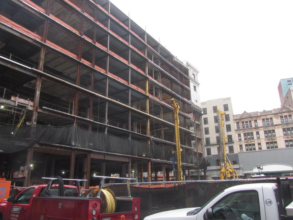
Pretty sure the 2 yellow things in the 2nd and 3rd pics are piledrivers. Does this mean we should be expecting the crane shortly?


Those yellow machines look more like drilling rigs. Perhaps a pre-cursor to piledrivers. Pile drivers are much larger. I had 2 piledrivers going nutso for 2 months next to my building in NYC - it was awful.
 
Those yellow machines look more like drilling rigs. Perhaps a pre-cursor to piledrivers. Pile drivers are much larger. I had 2 piledrivers going nutso for 2 months next to my building in NYC - it was awful.

Yes, looks like drilling from my office window. No piles yet. But TONS of activity in and around the hole where the tower is going.
 
Yes, looks like drilling from my office window. No piles yet. But TONS of activity in and around the hole where the tower is going.

Based on two recent projects - Millennium Place and Avalon Exeter - aren't the drills more indicative of a caisson-based foundation, rather than a pile-based foundation?
 
When I walked by on Friday it looked like they were installing precast concrete cylinders in a vertical alignment. Looked almost like sewer pipe. I figured it was a big boy version of a sonotube.
 
Operation closest to the Burnham appeared to be soil mixing, which is why they also had the gyp cement silo and frac tank there. Operation along Washington St looks to be start of a seacant pile wall.

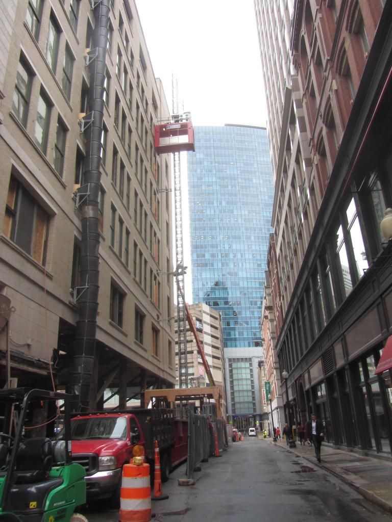
Burnham is showing some progress, looks like upper floors are poured out and a material hoist installed on Hawley Street
 
Based on two recent projects - Millennium Place and Avalon Exeter - aren't the drills more indicative of a caisson-based foundation, rather than a pile-based foundation?

Yes, definitely. The foundation will likely be caissons based on the drilling equipment now on site. Semass' observation also supports this. I went back and checked the section in the NPC to see if the base was shown, but they didn't model the foundation - just a 55-story tower floating in the earth...
 
Yes, definitely. The foundation will likely be caissons based on the drilling equipment now on site. Semass' observation also supports this. I went back and checked the section in the NPC to see if the base was shown, but they didn't model the foundation - just a 55-story tower floating in the earth...

Data -- I thought that a few pages back someone mentioned drilled shafts for the foundation substructure with a slab and then the tower basement
 
Status
Not open for further replies.

Back
Top