It doesn't preclude, but it does make reconnection tougher because all trajectories pass uncomfortably close to it. So the siting was indeed a brainfart...just not a fatal one.
It does block the path of the old elevated line torn down in 1983 that ran curbside-adjacent along Elizabeth St. into old Providence Station, but so much else has changed with the whole area and the whole track layout for the move to the underground bunker station that the Viaduct trajectory wouldn't be the means of reconnection today. Memorial Blvd. was built on top of what used to be the old elevated platform berths for Old Union Station. To reconnect you'd probably incline-down out the tunnel portal instead of
incline-up, take a close pass behind 10 Washington Place, and diagonal under the canals onto the footprint of Memorial Dr. underneath the wedge plaza on the south-facing side of One Citizens. You're on-trajectory under Memorial.
The dilemma then becomes the station itself, as the 1980's bunker is well-offset from where trajectories would merge. However, it isn't the most enticing station in the world in current state, and there are fairly inexpensive relocation options. If you made a new primary headhouse underneath Providence Place and spit platforms out the west side of the air rights cover-over underneath the I-95 spaghetti ramps you'd be able to trade what's currently very poor land usage for a new union station that's much closer to where the old one was than the current bunker, with an attractively straighter alignment. Amtrak on the East Side trajectory can be on the lower level, crossing under the canal to slot underneath the current tracks as they pass under Providence Place. The resulting station would look much like North Station with the ramps zooming overhead way in back and the waiting room inside a renovated portion of Mall. Cheap cosmetic cover-over possibilities can make the tracks under the highway slightly better-presented (it's crap-zero land use anyway), and the lower-level tunnel would sprout up at flying junction a few feet west of 95 on a much more tangent trajectory than anything that interfaces the fugly curve through the current bunker.
As long as you can come up with a *semi* change in vision for Providence Place now being a primary headhouse and waiting room, none of this is all that hard to pull off and is probably a large improvement over the current bunker with headhouse underwhelmingly offset from primary foot traffic. 10 Washington and One Citizens are close shaves with building mitigation...but nothing a 2-track tunnel extension couldn't handle. And everything else like Memorial Blvd. and the very artificially reshaped canals is mid-1980's cleanroom from the demo/rebuild of the rail alignment with no environmental blockers to underpinning with tunnel and zero messy utility relocations.
--------------------------------
The main reason for pause, other than cost, is "Why?" The actual Amtrak time savings for using the straighter East Junction alignment for a little more 165 MPH territory isn't large. In part because the slow zone is confined to only Pawtucket with the Attleboro Cutoff at the state line being existing 125 MPH. Alon Levy modeled it and it really didn't project big enough to be worth doing. While Pawtucket has some congestion, it's nothing like what Amtrak encounters in Greater Boston so the traffic separation here does little.
Rather, the value proposition for reconnecting the tunnel probably has much more to do with
commuter rail service increases than Amtrak. Providence Line RUR and RIDOT Intrastate's overlapping Woonsocket-Providence + Providence-Westerly patterns with sparser outer ends and denser midsection Pawtucket to Davisville or Wickford are game-changers for mode shares. But if Amtrak were able to vacate to the east side such that it was just passenger trains and P&W freights on the old alignment, you would be able to infill true Urban Rail station density inside the I-295 belt and basically layer a South Attleboro-T.F. Green "Fairmount Line" worth of service stopping every half-mile. Think infills at Roosevelt Ave. at the state line + Central Falls plugging the South Attleboro-Pawtucket gap, Mt. Hope and Smith Hill spanning Pawtucket-(relocated) Providence. Then the much-needed Olneyville infill spanning Providence and Cranston. Boston RUR service skip-stops South Attleboro-Pawtucket-Providence-T.F. Green as usual, while the hyper-locals rapid transitize through the infills.
With a scenario like that where you're densifying the local stops and making it such that Providence Line long-hauls are the new expresses...
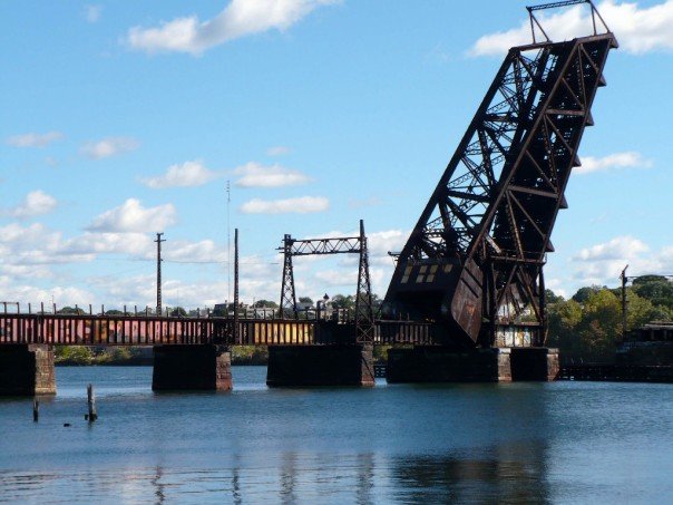
THEN it makes sense to boot Amtrak through the tunnel to kick on the afterburners. Because they will then need a super-super express set of tracks if the T is taking the existing expresses. In that case an angled trajectory out of the east portal running along the riverbank to Waterman Ave. with new fixed-bridge crossing pointing northwest ramps up the speed way more than the old drawbridge's right-angle wye and they can very quickly ramp up to 125-165 MPH.
^^That's^^ very different from what NEC FUTURE studied. They were only considering Amtrak needs in isolation, not commuter rail needs as a driver. In real terms Amtrak's needs are not so huge that it can get this alt alignment built by its own gravity. But saturate commuter rail traffic instead with quasi rapid-transit layering???...that's a very different story.