Quabbin & MWRA Water & Sewer

Re: Water

The MWRA has clear numbers on what is a sustainable draw from the Quabbin and the whole system. 300 million gallons per day. And we are at around 230 million gallons per day.

How'd we (you?) get to 230? 230 would be a freakish +15% YOY vs what the MWRA site says (Where most swings are single-digit % and the bigger moves are downward):
http://www.mwra.state.ma.us/04water/html/wsupdate.htm
2017 195.40 mgd/avg
2016 208.01 mgd/avg
2015 206.57 mgd/avg
2014 200.85 mgd/avg
2013 202.80 mgd/avg
2012 194.70 mgd/avg
2011 196.60 mgd/avg
2010 204.30mgd/avg
2009 194.30 mgd/avg
2008 205.60 mgd/avg
2007 219.90 mgd/avg

In the 1980s we were drawing 65% MORE; 330mgd/avg...10% above "sustainable"... for a sustained period of time:
1980-2014-wateruse-800.jpg


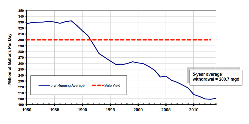
Here's what we did to drop that (in the face of rising metro population)
  • Vigorous leak detection and repair efforts on MWRA and community pipes
  • Retrofitting 370,000 homes with low-flow plumbing devices
  • A Water Management Program for area businesses, municipal buildings and nonprofit organizations
  • Extensive public information and school education programs
  • A change in the state plumbing code requiring new toilets to be 1.6 gallon per flush
  • Meter improvements that helped track and analyze community water use
  • New water-efficient technology that has created reductions in residential use
  • Water pipeline replacement and rehabilitation projects throughout the MWRA and community systems.

Basically, technology leaves us a whole 'nother round of such conservation improvements, which can be "built" through a combination of plumbing codes and price hikes:

  • California style 1.28 gallon per flush toilets
  • Hot water recirculation (no more "running the tap")
  • Greywater irrigation & drip irrigation
  • Municipal (distribution pipe) leak fixing
  • rolling change to Water Sense appliances

Municipal water supply is *way down* on my "big ticket" list of priorities compared to sea level rise, smart electric grid, & ground transportation. We know how to manage water and we have a proven track record of doing it (and Californians to act as guinea pigs in whatever that next round of consumption-reduction technologies is going to be)
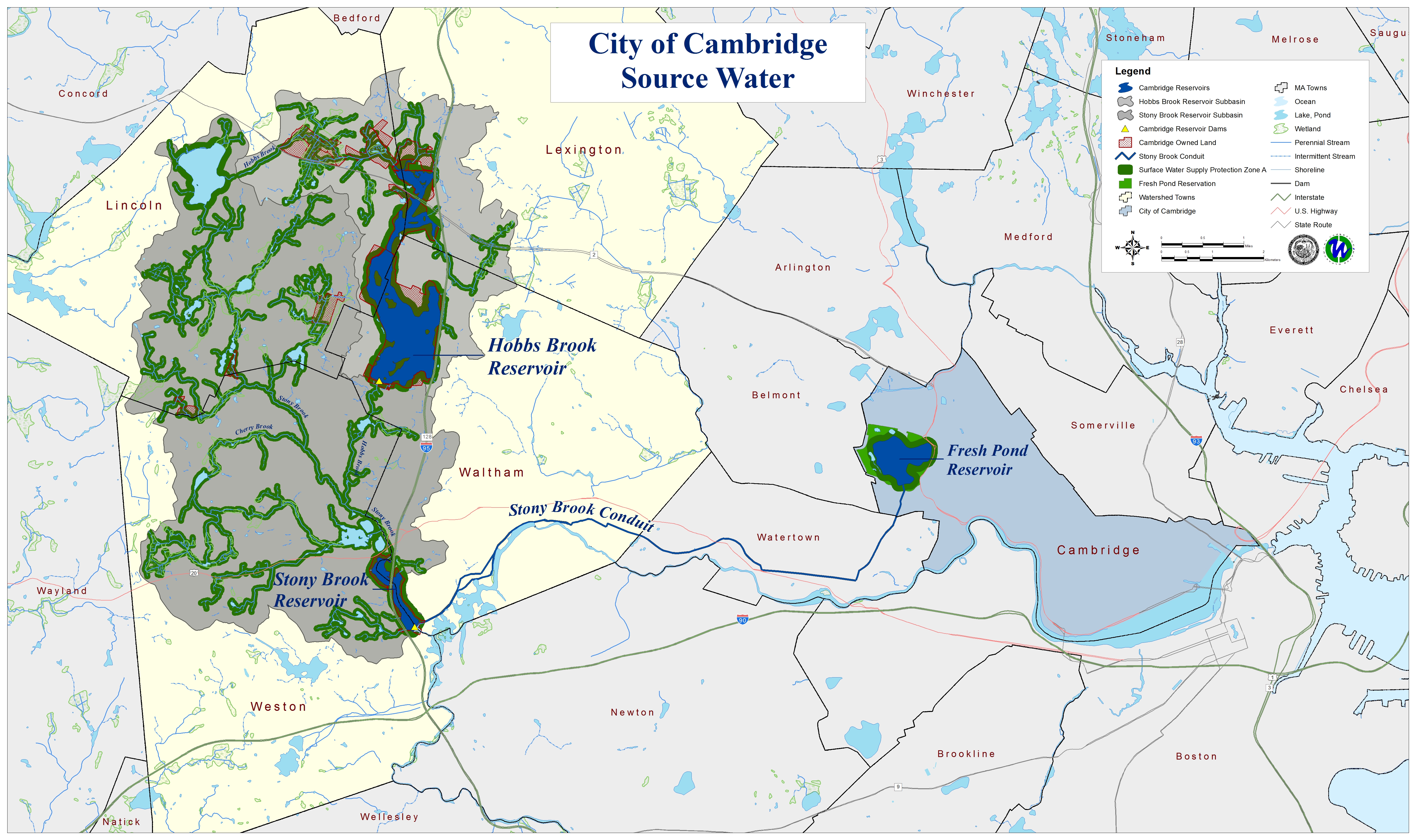
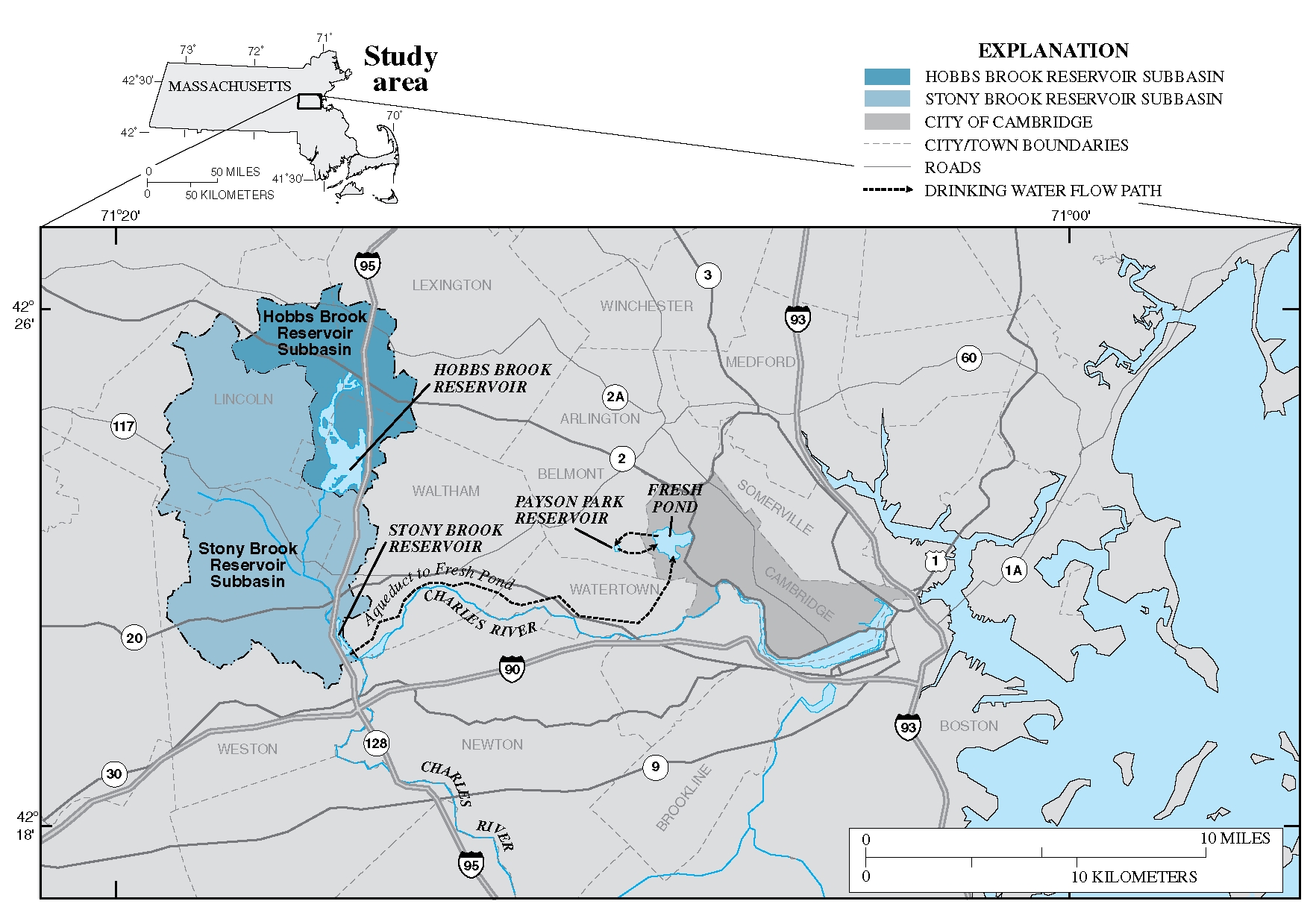
 
Last edited:
I am enough of an infrastructure geek that I read the MWRA annual letter they send on a town-by-town basis, and I remember the bad old days in Boston, Brookline when they usually reported too much lead (before getting better at pH) and too much fecal coliform (before building the goose-proof tanks).

And good for them that they remember the big blow-out in Weston 10 years ago (which created a crisis at what should have been their moment of triumph in opening the second aquaduct)

What stood out to me this year was their work on redundancy
  • "We recently completed a second pipe to the north in Stoneham, Reading, and Woburn, providing service to six communities" (anyone know where this is? It'd make sense that it might tie to the somewhat older new tank behind the former Adventist hospital on the Stoneham-Melrose line?)
  • Wachusett Aquaduct Pumping Station in Marlboro which now provides a second way to get water to the treatment plant
  • We are also nearing the completion of a redundant pipeline south of Boston
  • Design is underway on the upgrade of Weston Aquaduct Main 3 in Weston, Waltham, Belmont, Arlington, and Medford
  • And planning for two new tunnels north and south of Boston that will provide redundance for the region
Scanning around the MWRA site is definitely a trip back to the dawn of HTML 4. I didn't find the "one diagram with all the pipes" Anyone find one?
 
Good stuff, MWRA.

This is as good a time as any to remind people to NOT dump cooking oil down the drain and to NOT flush any products down the toilet that won't hydro-degrade. That includes tissues and baby wipes.

The fatbergs are real.
 
Also somewhat related, Mass & most of New England as a whole is "Abnormally Dry" on the drought monitor (map valid as of 6/18/20).

Further reading available HERE

drought NE 2020.png
 
Incidentally, Is this an aqueduct that appears as a nearly-straight line that hugs the Lexington-Waltham town line, and interrupts most property lines between the Hobbs Brook Reservoir (City of Cambridge) and Beaver Brook North? It seems to create a bunch of parcels 40 feet wide.

Better: MassGIS view of the "what's with the last 40 feet?"

If it turns out to be an interurban RR, I'll move this someplace else. I suppose it might just be an artifact of the town-line drawing process?

2017_59x35_SourceWatershedPrint_sm.jpg


As "plat interrupter" it doesn't quite make it all the way to the Payson Park Reservoir, but maybe because the "inner burbs" (Belmont) had mostly been laid out at the time that Cambridge reached out to build their reservoir and its aqueduct? Or maybe Cambridge *thought* they'd build an aqueduct?

(Id assume it takes a path through Beaver Brook park and somehow gets to Payson Park, even if it can't be seen in the property lines)

Straight-Line-ROW-purple.png


It is strangely straight considering that it seems not to be an electric ROW. It also seems to be about where you'd expect it to be (but isn't) in Cambridge's map of its water supply:
1998_USGS_StudyAreaLandscape.jpg
 
Last edited:
Sorry, I'm not sure what you're seeing there. The only thing I see around the Lexington-Waltham line on that first map... is the municipal boundary. Is there a screenshot missing?
 
Is that not just a rendering of the town boundary? I'm definitely misunderstanding something.
 
Is that not just a rendering of the town boundary? I'm definitely misunderstanding something.
It isn't just rendering. Consider how there are a series of 40' wide parcels created on the Waltham side of the Lex-Wal line:
From left to right:
249, 0, 69, 3
How did there come to be a continuos property line exactly 40' parallel to and south of the town line? To me that says "ROW was created"
Or that some primordial pair of landowners thought the town line was 40' south of where it was ultimately laid down.
MassGIS.PNG
 
I interpreted it as property lines that intersect the town line, rather than a separate parcel. Like take parcel 24 in the image above. That parcel straddles the town line. The portion south of the line is part of Waltham's tax base, while the larger portion to the north is part of Lexington's. But again, I may be missing something here.
 
How did there come to be a parcel line 40' south of the town line, essentially for the entire length of the town line?
 
How did there come to be a parcel line 40' south of the town line, essentially for the entire length of the town line?

It looks like the lots follow an old stone wall. My guess would be a farmer in the 1800s thought he was building his wall along the town line, but oops.

"but oops" explains a lot of property/town/country line anomalies.
 

Attachments

  • LCC 22262B.JPG
    LCC 22262B.JPG
    140.5 KB · Views: 209
It looks like the lots follow an old stone wall. My guess would be a farmer in the 1800s thought he was building his wall along the town line, but oops.
"but oops" explains a lot of property/town/country line anomalies.
Or that Lexington and Waltham were agreeing that the stone wall was the boundary but later found out that they had surveyed/agreed a line 40' north of the stone wall they thought they were using.

QUESTION NOW: if this isn't a water thing, what thread should the last 8 posts go in?
 
If you turn on the Aqueducts layer (under Infrastructure), no aqueduct appears. On the other hand, it doesn't appear to show any aqueducts leading from the Cambridge Reservoir.
 
Looks like the MWRA is planning on removing a dam on the Quinapoxet River for environmental reasons.

Oakdale1.jpg


About this Project:

The Quinapoxet Dam is an earthen embankment and stone masonry horseshoe dam that spans the Quinapoxet River from bank to bank. The dam is owned by the Commonwealth of Massachusetts and is under the care and control of the DCR Division of Water Supply Protection, which is funded by the MWRA.

The Quinapoxet Dam was built in 1905 when the Wachusett Reservoir was constructed as part of an effort to straighten and widen the riverbed to drop sediment before entering the reservoir. The dam was also originally intended to prevent upcutting and erosion of the river channel.

Overview:
The Quinapoxet Dam is in need of repair and will continue to require maintenance and regulatory inspection into the future. When the reservoir was created, the dam had been completed as part of the lower river channel widening and collectively served to mitigate sediment impact on the reservoir. However, this riverine system has stabilized over the last 115 years. MWRA has modified the reservoir elevation to a stable operating band to eliminate highs and lows in elevation. MWRA also has a sophisticated real-time water quality monitoring system in place. Additionally, removal of obsolete dams are finding favor in the environmental community for the substantial benefits that result.

Project Page on MWRA Website
 
Looks like the MWRA is planning on removing a dam on the Quinapoxet River for environmental reasons.


Project Page on MWRA Website
Funny, I read the press blurb and came away with the idea the DCR is removing the dam to avoid maintenance and repair costs on the 100+ year old dam. Oh and there might also be a positive environmental outcome.
 
Funny, I read the press blurb and came away with the idea the DCR is removing the dam to avoid maintenance and repair costs on the 100+ year old dam. Oh and there might also be a positive environmental outcome.
On the project website, restoration of a salmon fishery is highlighted.
MWRA understands the potential environment benefit associated with reproducing a cold-water fishery (i.e., restoring a salmon population formerly impacted by creation of the dam). This project is a priority and consistent with the goals of the Executive Office of Energy and Environmental Affairs (EEA), Department of Fish and Game (DFG), environmental groups and sport fishing associations.
 
Big diameter pipe going in at 200 Boston Ave Medford (Tufts outbuildings on the Som/Med line)

is this water or sewer?

992786EF-54DB-4840-8D44-4636CA694968.jpeg
 
I think that’s part of the WASM rehabilitation they’re doing during the next few winters.
 

Back
Top