South Station Tower | South Station Air Rights | Downtown

> The original 759’ would have made this the downtown jewel

I vaguely recall (emphasis on vaguely) looking at a graph with the height limits imposed by the FAA and believe that this tower is situated right on the edge of one of the zones that doesn't exceed 700 ft. I'm sure that FAA map is buried somewhere in one of these threads but don't have time to hunt for it.
Google Logan Airspace Map.
 
The actual answer is that Logan should be moved onto a partial landfill island in the Harbor which would become a portion of Boston's floodwall system. The area of land currently occupied by Logan would be turned into forest and marshland.
 
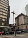
Tower crane looks great.
Photo from Tuesday morning.
 

Attachments

  • FFDFC6CE-21D1-4A8B-8D52-21AC682681FB.jpeg
    FFDFC6CE-21D1-4A8B-8D52-21AC682681FB.jpeg
    1.8 MB · Views: 152
I still wanna know what the deal is with the one random balcony on the left side that sticks out. Almost feels like thats the one you are supposed to throw yourself off if the economy tanks too heavily.
That balcony may very well be a vantage point for snipers protecting the building in an emergency (so I've been told). I believe you'll see some slits on the ground floor as well, facing the plaza, and probably around each side of the building.
 
I’m going to guess it’s a balcony attached to the Fed board room.
 
All of that land is fill and at 0' elevation. Nobody should be living there in a world of rising tides, with or without a flood barrier.
Off-topic for this thread but what you're saying is a common misconception. Logan's tarmac is really not at a significant flood risk, despite its location by the harbor. Logan has a lower storm surge flood risk, for example, than most of the East Boston neighborhoods around it, all of the Seaport, all of the South End, all of the Bulfinch Triangle, all of the Sullivan Square area, much of Downtown, etc.

You can see this easily in the Climate Ready Boston Maps. If you turn on layers for "Stormwater Flooding: Near-term" (green below) and "10% Annual Coastal Flood Risk: 2070s" (blue below), for example, Logan is totally clean while much of the City is very much not:
1651790825928.png


Even if you dial up the risk to "1% Annual Coastal Flood Risk: 2070s" you still see a lot of clean land at Logan, although floodwaters do start to encroach. But again, plenty of established residential neighborhoods are in significantly worse shape than Logan under this 100-year storm scenario 50 years into the future. When you also figure in that Logan land is also much better suited for resiliency improvements than existing neighborhoods are due to Logan's blank canvas nature, it makes it even more relatively resilient for the future.
1651790988844.png


I don't want to take this thread further off the rails, but this comes up all the time on aB and when making assumptions about the projected impacts of future climate change it's important to stick to the facts. Just because Logan feels like it will be flooded, that doesn't mean it will be.
 
Last edited:
Neither Massport nor the Commonwealth 'own' Boston harbor. The Federal government does, because the waters of Boston Harbor are considered waters of the United States. Logan airport is 2400 acres, and the Federal government is not going to permit filling an equivalent area in Boston harbor for a new airport.

Two decades ago, San Francisco wanted to expand its airport runways by filling in part of the Bay. As an offset, the city proposed to create 29,000 acres of new coastal wetlands. Didn't happen.
San Francisco Airport officials have proposed an airport runway expansion that has a novel tradeoff for environmentalists. In exchange for filling up to 1,400 acres of San Francisco Bay for new runways, the airport proposes to restore 29,000 acres of bay wetlands that are located east and south of the airport.

As it is, Logan is not included in a list of 12 major U.S. airports most at risk from a rise in sea levels.
https://www.climatecentral.org/news...e-increasing-threat-from-sea-level-rise-16126[/quote]
 
Off-topic for this thread but what you're saying is a common misconception. Logan's tarmac is really not at a significant flood risk, despite its location by the harbor...

A very important distinction indeed. Though, it's also not quite fair for a message to the general public to be "Logan isn't affected," because much of the connective infrastructure (harbor tunnels, roadways, blue line, silver line, trucking routes) is affected. So the Logan ecosystem still needs protection, just not the tarmac.
 
The actual answer is that Logan should be moved onto a partial landfill island in the Harbor which would become a portion of Boston's floodwall system. The area of land currently occupied by Logan would be turned into forest and marshland.

I know this is unlikely to ever happen but any ballpark guesstimates how much this would cost? Tens of billions? More?
 
A very important distinction indeed. Though, it's also not quite fair for a message to the general public to be "Logan isn't affected," because much of the connective infrastructure (harbor tunnels, roadways, blue line, silver line, trucking routes) is affected. So the Logan ecosystem still needs protection, just not the tarmac.

Exactly. Logan has no practical value as a vital transportation hub if Route 1A is continously being inundated by rising seas. Technically of course its true that the tarmac would be at a relative remove, but how would that matter for 99% of the populace if one of the most vital transportation links to it is being chronically submerged?
 
I know this is unlikely to ever happen but any ballpark guesstimates how much this would cost? Tens of billions? More?
Fill in Quincy Bay, only area big enough. 2400 acres x average 45 feet of fill = $$$$$$$$$$$$$$$$
 
Fill in Quincy Bay, only area big enough. 2400 acres x average 45 feet of fill = $$$$$$$$$$$$$$$$
I would tend towards believing that VTOL aircraft could become the dominant form of air transport sometimes around when the sea becomes a real problem. While wild speculation, a smaller footprint airport/spaceport could be built around Long Island while also being the control center for any system of lockes protecting the harbor. But derail I do, as this conversation belongs in the Boston 2100 thread.
 
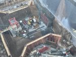
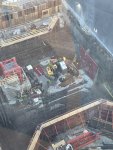
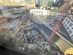
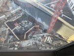
I got some photos from directly above yesterday. I’m sure some of you will enjoy these.
 

Attachments

  • 25B7520A-F5DD-43EE-BCD6-637175396EB5.jpeg
    25B7520A-F5DD-43EE-BCD6-637175396EB5.jpeg
    1.9 MB · Views: 472
  • 241BC1F8-6546-4848-BDC8-214C240C0646.jpeg
    241BC1F8-6546-4848-BDC8-214C240C0646.jpeg
    2.2 MB · Views: 479
  • EC8832D5-917D-421F-B083-9C8006B69A82.jpeg
    EC8832D5-917D-421F-B083-9C8006B69A82.jpeg
    2.2 MB · Views: 471
  • C384DFCD-A52F-4226-BC5A-C3A675EE6716.jpeg
    C384DFCD-A52F-4226-BC5A-C3A675EE6716.jpeg
    1.8 MB · Views: 457
I got some photos from directly above yesterday. I’m sure some of you will enjoy these.
Riding along the W 4th bridge this morning, the first tower crane was continuing the process of building the second. It looks less apparent by these pictures, but the second crane base being built appeared remarkably wider than the first; might have been the angle/ positioning
 
Riding along the W 4th bridge this morning, the first tower crane was continuing the process of building the second. It looks less apparent by these pictures, but the second crane base being built appeared remarkably wider than the first; might have been the angle/ positioning

Totally possible. See the Parcel 12 build, the Boylston St crane is considerably heftier.
 

Back
Top