You are using an out of date browser. It may not display this or other websites correctly.
You should upgrade or use an alternative browser.
You should upgrade or use an alternative browser.
Aerials
- Thread starter Mike
- Start date
BeyondRevenue
Active Member
- Joined
- Mar 13, 2020
- Messages
- 553
- Reaction score
- 1,157
Transit Oriented Development..... The MBTA needs it forever because.... Problematic... also can't happen because... Even though there's a ton of demand.... So that's why.The Sullivan Square area between I-93 and the Mystic River is so in need of redevelopment/densification. It looks like the Seaport area did 30 years ago; a sea of parking lots.
Charlie_mta
Senior Member
- Joined
- Jul 15, 2006
- Messages
- 5,150
- Reaction score
- 7,778
Rutherford Ave needs to be reconfigured, which is languishing due to lack of leadership, and along with it, the T station at Sullivan Square needs to be redeveloped, Apparently the highway underpass will remain, but even with that, a street grid, including the T station area, can be reestablished and development of buildings proceed. As for funding, the Feds are poised to enact a large infrastructure bill. Rutherford Ave, along with the Red-Blue connector, should be high on the list for receiving infrastructure funds from that bill.Transit Oriented Development..... The MBTA needs it forever because.... Problematic... also can't happen because... Even though there's a ton of demand.... So that's why.
 IMG_2698
 IMG_2699
 IMG_2707
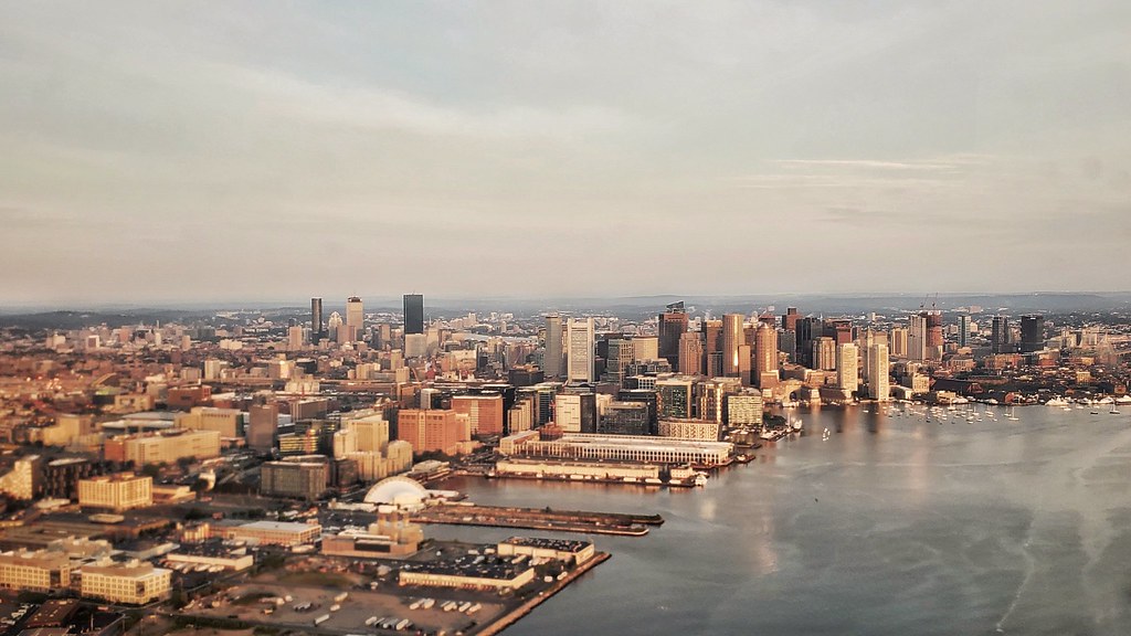 Boston at takeoff by Ryan Knapp, on Flickr
Charlie_mta
Senior Member
- Joined
- Jul 15, 2006
- Messages
- 5,150
- Reaction score
- 7,778
From that vantage point, Boston looks a lot like Chicago.
Equilibria
Senior Member
- Joined
- May 6, 2007
- Messages
- 7,229
- Reaction score
- 8,759
It is always great to see the state house from the back.
Always nice to have the reminder that it's mostly orange
") .
.stick n move
Superstar
- Joined
- Oct 14, 2009
- Messages
- 13,482
- Reaction score
- 24,533
Amazing
Charlie_mta
Senior Member
- Joined
- Jul 15, 2006
- Messages
- 5,150
- Reaction score
- 7,778
^ That photo really shows how incredibly far Boston has come in the last 40 years. The old elevated highways and transit lines, the huge parking lots in old railroad yards, and the half torn-down blighted industrial areas are all gone. Amazing transformation. Everett, Sullivan Square, and Lynn are up next for an upgrade.
A few older ones, then a newer one.

This one is less than 10 years old!


This one is less than 10 years old!
This next one looks very familiar...
Now compare it to the render.
kz1000ps
Senior Member
- Joined
- May 28, 2006
- Messages
- 9,186
- Reaction score
- 13,713
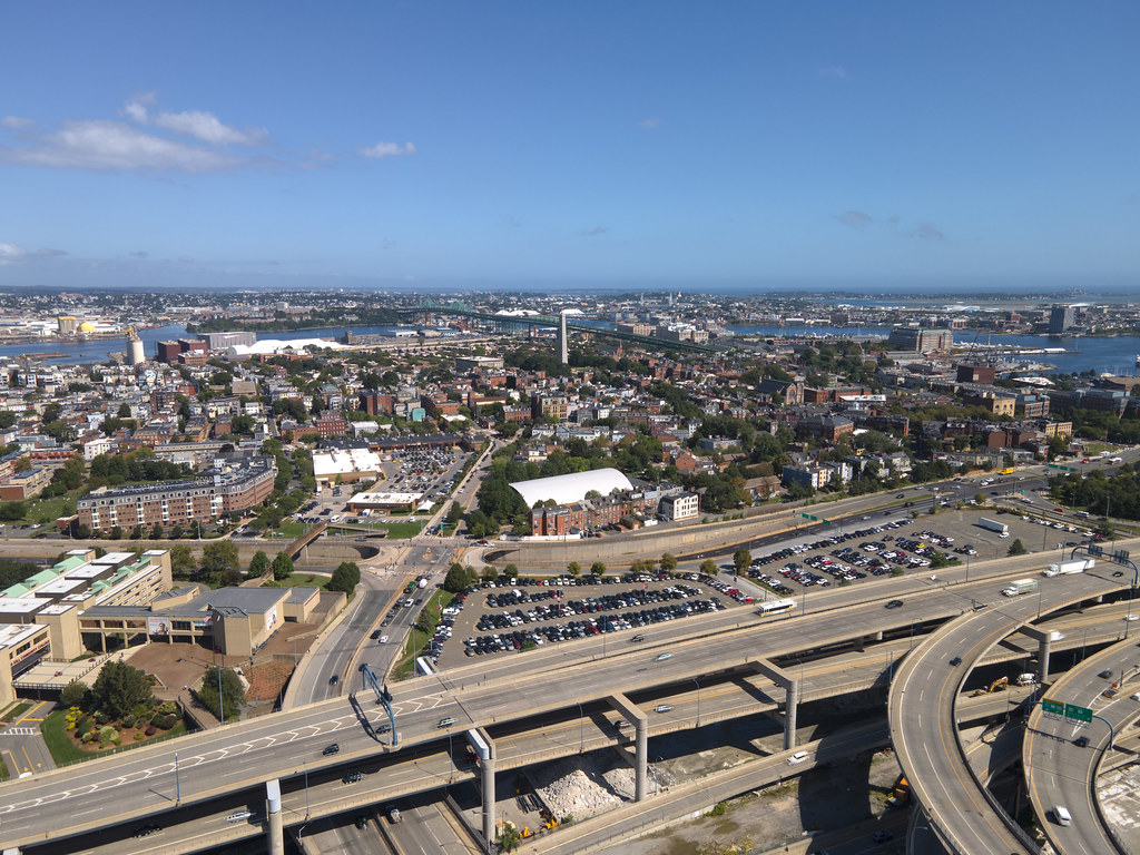
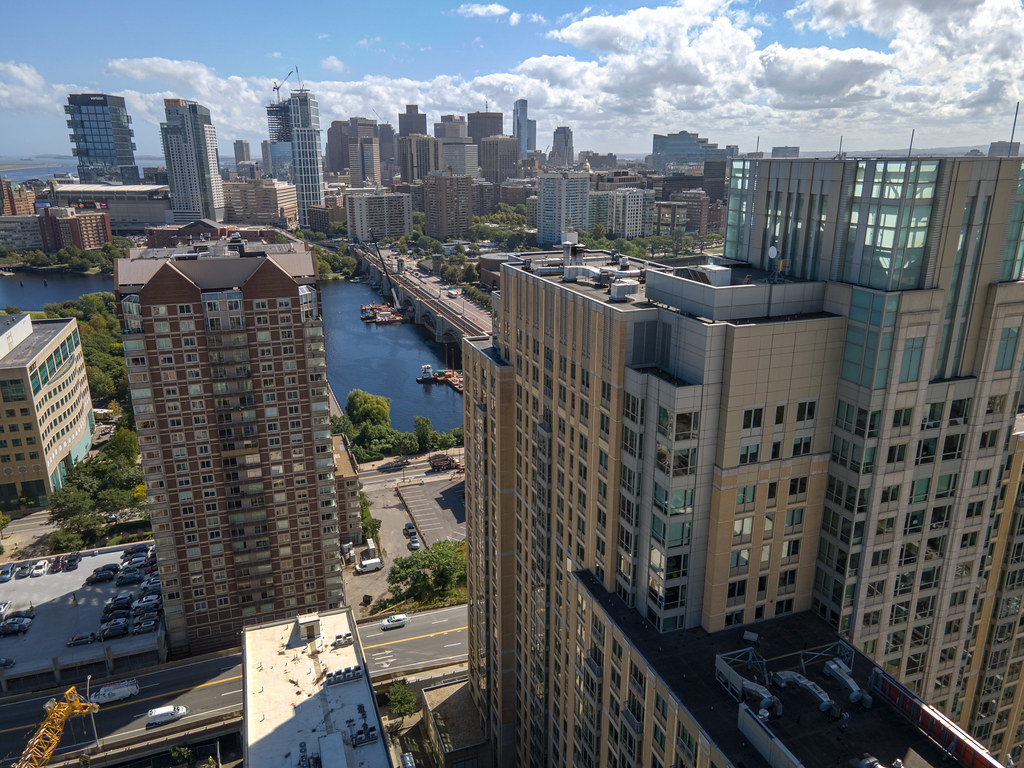
Sooooo I had to get a drone for my new job, and today was the first time I tried it out in a properly dense area


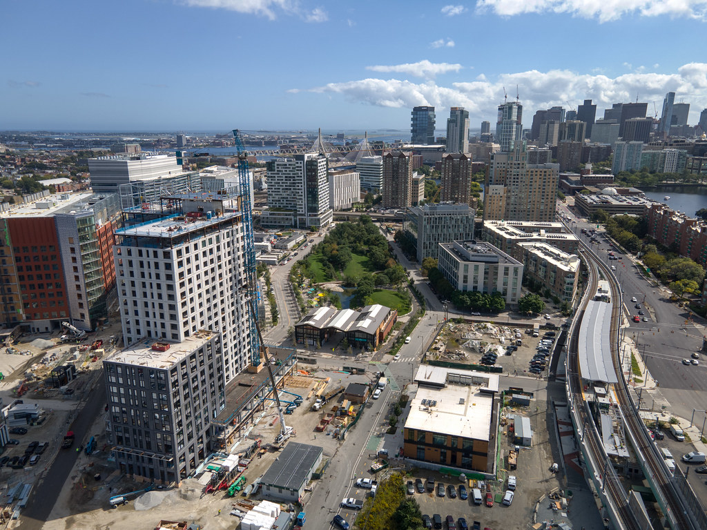

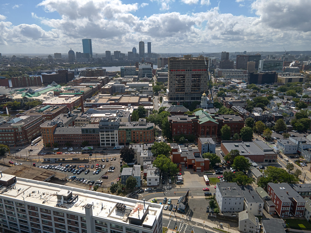
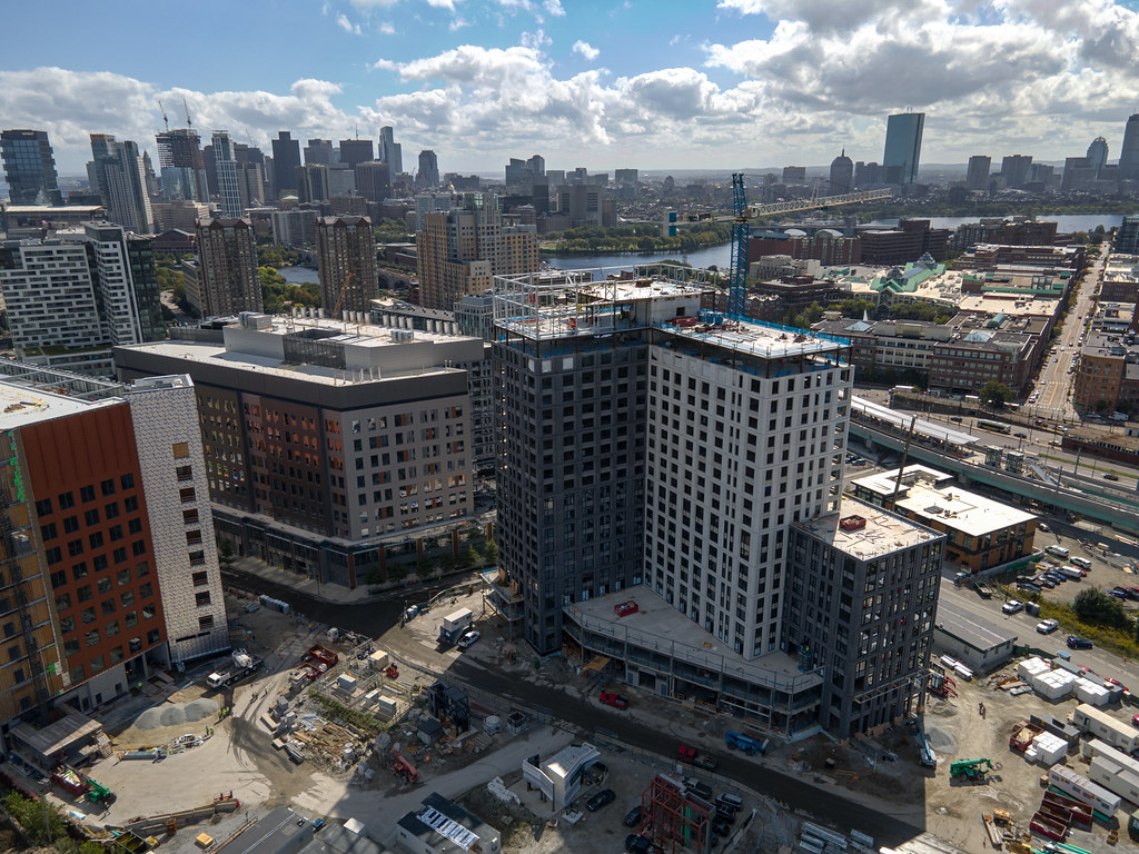
For those who have next to no familiarity with these things, they are NOT toys and they are HIGHLY regulated by the FAA with all sorts of airspace restrictions and limitations. In highly restricted areas (like Winthrop or where I live in Bedford, a mile and a half from Hanscom) the propellers won't even start turning because its GPS will always get picked up if it's turned on.
So showing up here I had no idea if I'd even be able to get it off the ground, let alone take 30 or whatever shots I ended up getting. But the good news is it was all clear, and an architect from the firm Jacobs Architecture (designed parcels JK and EF) saw what I was doing and asked me to email him some shots! So who knows, maybe I just wormed my way into some commercial/architectural photography work
Lastly, in this specific location I had a height limit of 120 meters or 393.7 feet, and I think there was an invisible wall over the MBTA maintenance facility because I couldn't venture over it at all.
OH AND this thing cost $1000 and has no zoom. Why no zoom??


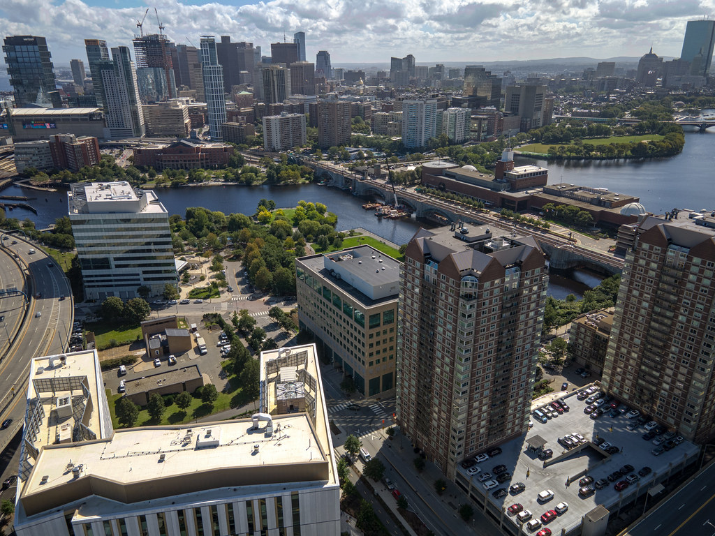
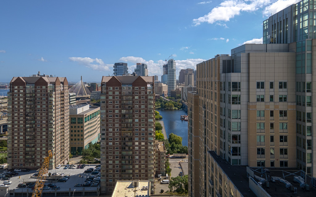

I've always liked the North Point apartment tower. Any nods to art deco will steal my heart every single time ¯\_(ツ)_/¯
For those who have next to no familiarity with these things, they are NOT toys and they are HIGHLY regulated by the FAA with all sorts of airspace restrictions and limitations. In highly restricted areas (like Winthrop or where I live in Bedford, a mile and a half from Hanscom) the propellers won't even start turning because its GPS will always get picked up if it's turned on.
So showing up here I had no idea if I'd even be able to get it off the ground, let alone take 30 or whatever shots I ended up getting. But the good news is it was all clear, and an architect from the firm Jacobs Architecture (designed parcels JK and EF) saw what I was doing and asked me to email him some shots! So who knows, maybe I just wormed my way into some commercial/architectural photography work
Lastly, in this specific location I had a height limit of 120 meters or 393.7 feet, and I think there was an invisible wall over the MBTA maintenance facility because I couldn't venture over it at all.
OH AND this thing cost $1000 and has no zoom. Why no zoom??
I've always liked the North Point apartment tower. Any nods to art deco will steal my heart every single time ¯\_(ツ)_/¯
- Joined
- May 25, 2006
- Messages
- 7,064
- Reaction score
- 1,990
It has zoom. You just need to fly it closer!
It has zoom. You just need to fly it closer!
Or post it bigger!