Biking in Boston

a new station runs about $50,000,

I think Boston made a great move last year when the BPDA mandated all new permitted developments must include funding for and space for a Bluebikes station though, once we see those projects finishing up then density is going to go up quickly.
they are more than that now. starts at $75K for new developments and goes up from there.
also, BTD has had this stipulation for new developments since 2011. the BPDA change last year changed the cost structure (from $50K to $75K plus) and required that space be provided on site for the location of the station. As construction is coming to an end, BTD then still decides IF they want the station on site where it was designed for BPDA permitting or whether there is another nearby location that is better.
 
Encouraging bicyclists in the ped zone, which a station at Wash & Summer would do, would be terrible, reckless policy--over the years I've seen demented and careless bike couriers go flying down Winter/Summer, and nearly clip pedestrians to catastrophic effect.

Preventing bikes in one of the only car free areas of the city is a terrible policy and needs to be changed. These issues could be resolved simply by bike lanes and a clear ROW for bikers while leaving the rest for pedestrians. Having spent a lot of time in this part of the city since I was a kid, bikes are far less of a threat to pedestrians in this area than the delivery vans or cops using it as a shortcut. Pedestrian zones should include facilities and infrastructure for bicycles.

You can even see in that google maps street view of the sign which you linked that a bike lane runs right up to the area then simply ends. This makes no sense for an area that could be extremely safe to ride with just some basic facilities (unprotected lanes would be more than enough on a generally car free street). To me that sign signals a much deeper problem in terms of the way we think about infrastructure and traveling car free.

A Blue Bikes kiosk at 65 Franklin St.--400 feet from the DTX Orange Line portal at Millennium Tower. Another at Tremont & Hamilton--550 feet from the DTX station portal at Summer & Wash. And another kiosk at Tremont & West--450 feet from the Orange Line DTX entrance on Temple Pl. Really, that trio isn't already convenient enough?!?

The closest one of these is two full blocks away from the station, you also seem to be using distance as the crow flies not that someone would actually walk
(and rounding solidly down at that). In a dense downtown area if you cannot see the stop when you come out from underground it is too far away. If you need to get 5-7 blocks away and you have to walk 2-4 to get on a bike you are going to skip it. This is pretty basic to making a last mile trip actually work.
 
Last edited:
Preventing bikes in one of the only car free areas of the city is a terrible policy and needs to be changed. These issues could be resolved simply by bike lanes and a clear ROW for bikers while leaving the rest for pedestrians. Having spent a lot of time in this part of the city since I was a kid, bikes are far less of a threat to pedestrians in this area than the delivery vans or cops using it as a shortcut. Pedestrian zones should include facilities and infrastructure for bicycles.

You can even see in that google maps street view of the sign which you linked that a bike lane runs right up to the area then simply ends. This makes no sense for an area that could be extremely safe to ride with just some basic facilities (unprotected lanes would be more than enough on a generally car free street). To me that sign signals a much deeper problem in terms of the way we think about infrastructure and traveling car free.


The closest one of these is two full blocks away from the station, you also seem to be using distance as the crow flies not that someone would actually walk
(and rounding solidly down at that). In a dense downtown area if you cannot see the stop when you come out from underground it is too far away. If you need to get 5-7 blocks away and you have to walk 2-4 to get on a bike you are going to skip it. This is pretty basic to making a last mile trip actually work.


100% agreed (importance of adding bike lanes in DTX ped zone)--so long as they're of the quality that the Europeans have been doing for decades--grade separated/protected for all other users, etc. I have a general sense that Boston is finally doing something about safeguarding its bike lanes by adding pylons, etc. But I suspect we're still a ways from being on par with the Europeans. The fact that for years Boston would slap a line of paint down and say, "here, that's a bike lane," does not inspire confidence but hope springs eternal that such a grossly cynical/lazy mentality has been progressively eroded.

As for the measurements: I just re-measured again using Google Maps.

--From the Orange Line DTX portal at MTower to the Blue Bikes station at Franklin & Arch is exactly 400 feet, heading up Franklin.
--From the Blue Bikes station at 120 Tremont (assuming the user doesn't know about the Orpheum/Corner Mall cut-through) is 775 feet to the DTX entry at Summer/Wash, via Tremont then down Winter.
--From the Blue Bikes station at 147 Tremont, up Tremont, down Temple Pl., to the DTX Orange Line portal on Temple is 570 feet.

Each of those is under a 3-minute walk for an able-bodied adult that averages 3 mph walking. But I respect you like to employ a more stringent criteria for what constitutes convenience....
 
How easy does choosing your exit feel to you at DTX? At least unlike chinatown it does have a cross under but that is time walking underground and at rush hour it can be super crowded. Getting to that one exit that is close from the direction you are coming from is not guaranteed (nor is it easy if you don't know your way around).

This is one of the core stations of the whole MBTA network it should have its own blue bikes station and I find it rather odd how adamantly against it you are. Needless opposition to expanding transit access only helps preserve the car as the "only option."

I am also all for more "European style" bike lanes. One thing I have see there is a cycle track through pedestrian areas. This street is already mostly free of cars and as such they don't really need those same protections (which are necessary on car full streets and should be built out extensively). All they need is a clear ROW and a signal/buffer that instructs/encourages pedestrians to stay out of the lane (in Berlin thats often just a change of paving materials).
 
Last edited:
How easy does choosing your exit feel to you at DTX? At least unlike chinatown it does have a cross under but that is time walking underground and at rush hour it can be super crowded. Getting to that one exit that is close from the direction you are coming from is not guaranteed (nor is it easy if you don't know your way around).

This is one of the core stations of the whole MBTA network it should have its own blue bikes station and I find it rather odd how adamantly against it you are. Needless opposition to expanding transit access only helps preserve the car as the "only option."

I am also all for more "European style" bike lanes. One thing I have see there is a cycle track through pedestrian areas. This street is already mostly free of cars and as such they don't really need those same protections (which are necessary on car full streets and should be built out extensively). All they need is a clear ROW and a signal/buffer that instructs/encourages pedestrians to stay out of the lane (in Berlin thats often just a change of paving materials).

I am not remotely opposed to a Blue Bikes station being sited somewhere at the convergence of Washington/Summer/Winter; you misinterpret my prior comment.

I would NOT want to see it happen before BTD installed those "European style" (or per your reference, should I say "Berlin style"?) bike lanes, such that pedestrians in the DTX ped zone are 100% protected from cyclists. And that might not happen for a long time. Until such infrastructure upgrades do take place, I stand by my initial statement that it would be reckless and careless of pedestrians' safety to allow for a Blue Bikes installation there. If that's not point-blank obvious then I don't know what is.

Finally, though I'm not opposed, it strikes me that adding an additional one, when there are already 3 Blue Bikes stations within a 3-minute walk of all DTX subway station portals, would be rather redundant/superfluous. But again, you and I have different criteria, so be it!
 
Maybe I'm late to the party on this one, but I was biking to Coolidge Corner on Friday and I passed through the reconstructed area of Route 9 / Washington St for the first time since the new separated bike lanes have opened. The light cycle at the intersection of Route 9 and Pearl St had a bike signal that seemed to never turn green, even as I waited from one pedestrian cycle to the next. I eventually just went on a pedestrian signal. Was I missing something?
 
Maybe I'm late to the party on this one, but I was biking to Coolidge Corner on Friday and I passed through the reconstructed area of Route 9 / Washington St for the first time since the new separated bike lanes have opened. The light cycle at the intersection of Route 9 and Pearl St had a bike signal that seemed to never turn green, even as I waited from one pedestrian cycle to the next. I eventually just went on a pedestrian signal. Was I missing something?

nope. I bike through there often and they clearly never turned on some of the bike signals. Been stuck on red forever. So close!
 
Maybe I'm late to the party on this one, but I was biking to Coolidge Corner on Friday and I passed through the reconstructed area of Route 9 / Washington St for the first time since the new separated bike lanes have opened. The light cycle at the intersection of Route 9 and Pearl St had a bike signal that seemed to never turn green, even as I waited from one pedestrian cycle to the next. I eventually just went on a pedestrian signal. Was I missing something?

Hm.... corner of Route 9 and Pearl Street, you say? Just steps from NETA, now wouldn't that be?!? Clearly Brookline and NETA are colluding in an incredibly diabolical conspiracy to get bicyclists to take a quick detour, as they're stalled at the malfunctioning light, to purchase some *muscle relaxants* at NETA right there!

[remember: millions of conspiracy-addled Americans actually think like this these days. the horror, the horror.]
 
I am not remotely opposed to a Blue Bikes station being sited somewhere at the convergence of Washington/Summer/Winter; you misinterpret my prior comment.

I would NOT want to see it happen before BTD installed those "European style" (or per your reference, should I say "Berlin style"?) bike lanes, such that pedestrians in the DTX ped zone are 100% protected from cyclists. And that might not happen for a long time. Until such infrastructure upgrades do take place, I stand by my initial statement that it would be reckless and careless of pedestrians' safety to allow for a Blue Bikes installation there. If that's not point-blank obvious then I don't know what is.

Finally, though I'm not opposed, it strikes me that adding an additional one, when there are already 3 Blue Bikes stations within a 3-minute walk of all DTX subway station portals, would be rather redundant/superfluous. But again, you and I have different criteria, so be it!

I stand by my statement that this is absurd. Bikes are not the primary danger to pedestrians in this city and expanding facilities for bicyclists actually expands pedestrian safety too. You have a backwards way of looking at transit safety and demonize some of the safest means of travel over far more dangerous means. If you are truly concerned abut pedestrian safety to the point of supporting banning bikes, cars should be banned from the city (starting with the downtown core or areas with most concentrated pedestrian fatalities, which highly overlap anyway). Banning bikes only preserves the ubiquitousness of the means of travel that is actually dangerous to pedestrians.

As you can see by looking at a map, this is a hole. And it is a hole right in the center of downtown, and right on top of one of only 6 stations in the network serviced by 2 lines (one of only two served by three lines if you include the pedestrian link to Park st.) A station being conceivably close (but not visible) to one exit is not accessibility in a dense downtown neighborhood. You have not acknowledged that getting to the one vaguely convenient exit, which still is two blocks away, requires walking time underground for anyone coming from the north and your first measurements were absolutely as the crow flies and not as someone would walk. So, you can deny it as a hole, but it is not really about differing criteria as it is about you not really being honest about it and framing things that are demonstrably not as accessible as you frame them to be as "good enough. This is a great attitude if you want to change nothing and preserve business as usual, but not if you want to actually look at the reality in the face or, even better, try to change it.

Also to the People saying just transfer to a nearby station to get on a bike, the point is you should not have to do that from one of the the core stations in the network. All of these things add travel time and make it a lot less likely people will actually even get on the bike. The way you all seem to casually demand that anyone who doesn't drive must go out of their way to be able to do it says a lot about your priorities for transit and frankly they have no place in the 21st century city. These ideas are outdated enough as suburban planning policy. You should be able to get everywhere in the city without a car, that means you should be able to bike everywhere (especially the downtown core), that means you should be able to easily access car free alternatives from central (and secondary and tertiary) locations, that means "there is already a station vaguely nearby" is not good enough, that means a pedestrian area should not be a hole in the bike network, that means the bike network should be connected to itself and and integrated with other means of transportation. That anyone defends these policies, which should be incredibly easy to change and which obviously demand it by simple observation, and especially that people will be dishonest to do so, is truly disappointing. All it is a defense of the status quo for its own sake.
 

Attachments

  • Screen Shot 2021-09-07 at 9.51.47 AM.png
    Screen Shot 2021-09-07 at 9.51.47 AM.png
    1.1 MB · Views: 120
Last edited:
Also lets actually take pedestrian safety seriously and look at a map of where pedestrians and bicyclists are killed (by cars and trucks) in this city. It is clearly nonsense that bikes are the threat to pedestrians. I have addressed this already and you simply repeat it but take a look at what actually kills and injures pedestrians in this city: https://storymaps.arcgis.com/stories/583e2036be0b4a359be5efe0a6c33f25

I think it is especially interesting to look at the deaths along the shared use paths such as the south west corridor. Literally all of the deaths are caused by motor vehicles at intersections (and killing both pedestrians and bikers). There is not a single instance I can find of a bike killing someone. What this should be evidence for is that shared spaces between bikes and pedestrians are not dangerous, what is dangerous (to both of them) is having to leave those dedicated pedestrian areas and interact with cars, something that banning bikes from the pedestrian area downtown does force upon bicyclists. You are using a fundamental misunderstanding (deliberate or foolish it doesn't really matter) of safety to advocate against safety for bicyclists. Seeing as there are a ring of bike and pedestrian deaths around the area in question but none inside of it as far as I can tell this feels like compelling reason to expand bike access as a matter of safety, and makes your use of the rhetoric of safety to advocate for the status quo actively irresponsible.
 
Last edited:
I bike through DTX fairly often. It's not clear to me whether I'm allowed to do so, but what has always been very clear to me is that it's safer than the parallel, with car routes. As for pedestrian safety, I adjust my speed for conditions, just as I do on any other shared use path.
 
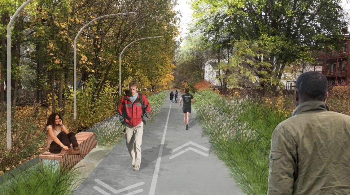
Any reason why the decking over the red line between Fields Corner and Ashmont couldn't become a bike path? I couldn't find a mention of this ROW in existing threads.
1631720056558.png
 
Any reason why the decking over the red line between Fields Corner and Ashmont couldn't become a bike path? I couldn't find a mention of this ROW in existing threads.
View attachment 16781
This "DotGreenway" is a thing:
 
Cambridge is installing a separated buffered bike lane, in addition to a inbound bus lane, from the Arlington line/Alewife Brook Pkwy to Dudley street as part of it's cycling safety ordinance thing to separate all bike lanes on Mass Ave. (Don't know if this is more a bus thing or bike thing, but as it's refered to as a cycling ordinance project, here it is) To do so, they're nuking one general travel lane and all street parking on that section, moving it and loading zones to side streets.
Screenshot_20211010-152525_Acrobat for Samsung.jpg

Lefts onto Cameron will become a Jersey style jug handle using Cedar and a two wayed section of Harvey.
Screenshot_20211010-155231_Acrobat for Samsung.jpg

In general, I like the project. As someone who lives just off Mass Ave on one of those side streets that will get meters in this section, (and has a car) I'm prone to some NIMBYism since theres zero off street parking, anywhere and it's consistently fully occupied already.

Hopefully, from Dudley in, the bike lane becomes a parking protected one; further in towards Porter it's dense enough with commercial that I don't think the businesses can survive without it, and from Dudley in there's extant separate bike lane with parking instead of the shared lane paint.

 
Last edited:
An interesting article that addresses how the issue of bike-pedestrian crashes (which has come up several times in the thread) is overhyped despite both declining (due to improving bike and pedestrian infrastructure) and being dwarfed by incidents involving motor vehicles and pedestrians.
 
Last edited:
As both a bike and bus rider, I'd also prefer bus/bike lanes on the bridge. Functionally, such lanes are better for heavily trafficked bike routes, because they allow for safe passing of slower bikes (not available currently on this bridge). The only concern I'd have is that it's kind of a long span, and might be challenging to mix the two modes without the buses stopping to pick up passengers. These lanes work well when the buses have frequent stops, not sure if they are as effective otherwise.
 
... The only concern I'd have is that it's kind of a long span, and might be challenging to mix the two modes without the buses stopping to pick up passengers. These lanes work well when the buses have frequent stops, not sure if they are as effective otherwise.
I share this concern. The Bus Bike lanes around me (e.g. inbound/downhill on Broadway, Winter Hill, Somerville) works really well because (1) going downhill, bikes can go basically the same speed as the buses and (2) about 4 stops ensure that just when a bus might be about to "run down" a cyclist, it has to pull off. (Uphill, the bike lane is "bus lane protected" so the bus can pass)

The flat, unbroken span the length of the Harvard Bridge (that's its name right? I still prefer Smoot) means that IF they had a bus-bike lane, the bus (going a mere 20mph) is near-always going to "run down" a bike (going 12mph) and wont be able to do the 25mph which'd otherwise be doable if the bus were operating start-stop (and in which the bus would average a nice 12mph ish speed)
 
Apparently the actual plan includes queue jumps at the lights, and that the second lane (where present) is a bus/right turn only lane. But that's not clear whatsoever from the petition website.
 

Back
Top