Commonwealth Avenue Improvement Project

They need two egress points for each station platform and they don't want to build mid block crosswalks. That's all.

Personally I think they should build mid block crosswalks anyway because the blocks are too long.

But that's an argument I have yet to win with the auto-centric engineers.
 
Last edited:
They need two egress points for each station platform and they don't want to build mid block crosswalks. That's all.

Personally I think they should build mid block crosswalks anyway because the blocks are too long.

But that's an argument I have yet to win with the auto-centric engineers.

And you won't win it, even with that attitude.

"The blocks are too long."

For whom, exactly? Pedestrians? They have to walk the same length regardless. For cars? Same argument.

All a midblock crossing does is add additional cost and additional potential for accidents for little to no return. It'll cost more money for a new pedestrian signal, which then has to be coordinated with the rest of the lights along the corridor and yadad, yada yada... the same arguments I made earlier in this thread.

But then again, I'm a car-centric engineer. I mean, why should I ever design stuff that accommodates everyone while putting an emphasis on the greatest number of affected people using Comm. Ave. as a numbered US route that acts as an arterial collector running parallel with a limited access toll road in a major urban location?
 
Are there numbers available on this? There are an awful lot of pedestrians and transit riders that use Comm Ave.

Yes, there are. The BU Transportation Master Plan did the study in 2012 and found that Green Line riders are the heaviest user of the corridor, followed by automobiles, and closely by pedestrians. Then there's the 57 bus, the BU shuttle, bikes, etc.

Here's a summary:

In the peak hour, car-based travel represents about 30% of the corridor usage, non-car-based travel about 70%. The MBTA accounts for 35% of the total. Physically active modes about 33.5%.

The confusion that North Shore has comes from the assumption that cars dominate Comm Ave like they do many other streets in other places. That's simply not true here, and it's not true in many parts of urban Boston.

Crosswalks have the dual benefit of making life easier for pedestrians while also reducing vehicular speeds to manageable levels (when designed properly). That reduces the frequency and severity of vehicular crashes when they do occur. Crosswalks also enhance urban vitality, which is why retail districts often feature very closely spaced crosswalks. The Boston Complete Streets guidelines call for crosswalks every 300 to 350 feet (IIRC). The current ones on Comm Ave are about 750 ft apart on average.

Comm Ave (in scope of Phase 2A) did not used to be a vital urban district -- it was the "auto mile" and used to be completely dominated by cars. That is no longer true, and has not been true for a long time. But the street design is leftover from the old days. Part of this reconstruction effort is reconciling the changes in character that have occurred since the "auto mile" heyday.
 
And you won't win it, even with that attitude.

"The blocks are too long."

For whom, exactly? Pedestrians? They have to walk the same length regardless.

This is clearly false, and encourages crossing at places without cross-walks (which is fine, but cars seem to get pissed off about it).
 
And you won't win it, even with that attitude.

"The blocks are too long."

For whom, exactly? Pedestrians? They have to walk the same length regardless.

It's time for topology with your professor, The EGE.

Let's say you're at BU (one of the highest pedestrian concentrations in the city). From Kenmore Square, the east campus block lengths heading west are 820, 760, 300, 420, and 720 feet between the crosswalks on each end.

To get from Mugar Library to the EPIC machine shops, it's 300 feet as the crow flies or 350 if there was a midblock crossing. But there isn't, so either route around the block is over 900 feet long. 550 extra feet of walking.

To get from Sargent to COM, it's 400 feet directly... or 1000 with the current street setup. 600 extra feet.

But because those two short blocks are the result of a midblock crossing, you never end up walking more than 300 feet more than the crow flies.

And as an extreme example of why very long blocks are bad for pedestrians, imagine you live at the corner of Buswell and Arundel in South Campus. It's 300 feet as the crow flies to your class in the Sociology building, a distance that would at most double if there were a pedestrian bridge to Hinsdale Street. But, under the current setup, you walk a minimum of 1800 feet to get to class. That's a quarter mile detour because of long blocks with no crossings.

But don't worry, it's the same length regardless.
 
Yes, there are. The BU Transportation Master Plan did the study in 2012 and found that Green Line riders are the heaviest user of the corridor, followed by automobiles, and closely by pedestrians. Then there's the 57 bus, the BU shuttle, bikes, etc.

Here's a summary:

In the peak hour, car-based travel represents about 30% of the corridor usage, non-car-based travel about 70%. The MBTA accounts for 35% of the total. Physically active modes about 33.5%.

The confusion that North Shore has comes from the assumption that cars dominate Comm Ave like they do many other streets in other places. That's simply not true here, and it's not true in many parts of urban Boston.

Crosswalks have the dual benefit of making life easier for pedestrians while also reducing vehicular speeds to manageable levels (when designed properly). That reduces the frequency and severity of vehicular crashes when they do occur. Crosswalks also enhance urban vitality, which is why retail districts often feature very closely spaced crosswalks. The Boston Complete Streets guidelines call for crosswalks every 300 to 350 feet (IIRC). The current ones on Comm Ave are about 750 ft apart on average.

Comm Ave (in scope of Phase 2A) did not used to be a vital urban district -- it was the "auto mile" and used to be completely dominated by cars. That is no longer true, and has not been true for a long time. But the street design is leftover from the old days. Part of this reconstruction effort is reconciling the changes in character that have occurred since the "auto mile" heyday.

I've read the BU Master Plan. It is clear that traffic volumes are trending downwards, and have been for some time, but they are still high, given the urban location is discussion.

At the same, you keep separating out cars versus buses in all of your arguments. Either buses use the travel lanes or they don't. Which one is it?

And the Master Plan clearly indicates that accommodating increasing volumes of both pedestrian and bicycle volumes are a key element in the design, as part of an overall attempt to further decrease traffic volumes.

The University has factored in their growth rates as much as they could forecast (enrollment numbers, additional employees, future development) and is clearly dovetailing with the state as far as coming up with a master plan that benefits both parties in the long term.

It clearly identifies that the vast majority of Comm. Ave. has sufficiently wide sidewalks along the entire length of the corridor. Areas where there are current pinch points or traffic islands of insufficient storage area are identified for upgrades for pedestrian safety.

There is an overall reduction of 35 metered parking spots for the sake of expanding crosswalk access points, sidewalk widths and dedicated turn lanes for traffic at a couple of intersections.

I could go on and on mentioning what the Master Plan outlines, but the gist of it is pretty clear: Pedestrians and Bikes are a significant point of focus.

Now, a couple of caveats:

1) It's a conceptual Master Plan. It's not definitive, especially since it's been commissioned by a private entity and not a state agency.

2) Little to no mention of improving midblock access.

Look, I understand the concern about extended lengths between crosswalks. But this particular area is a bit of a special circumstance. The Green Line is an obstruction, plain and simple. It complicates everything. And while it's easy to see a break across the tracks, it has to be ADA compliant as well. And any proposed crossing has to be signalized because of the volumes of pedestrians and vehicles involved.
 
Glad to hear that you've had a chance to take a look at the BU Transportation Master Plan. It's a very interesting document. And yes, it's true that traffic levels are also declining, something that I neglected to point out earlier.

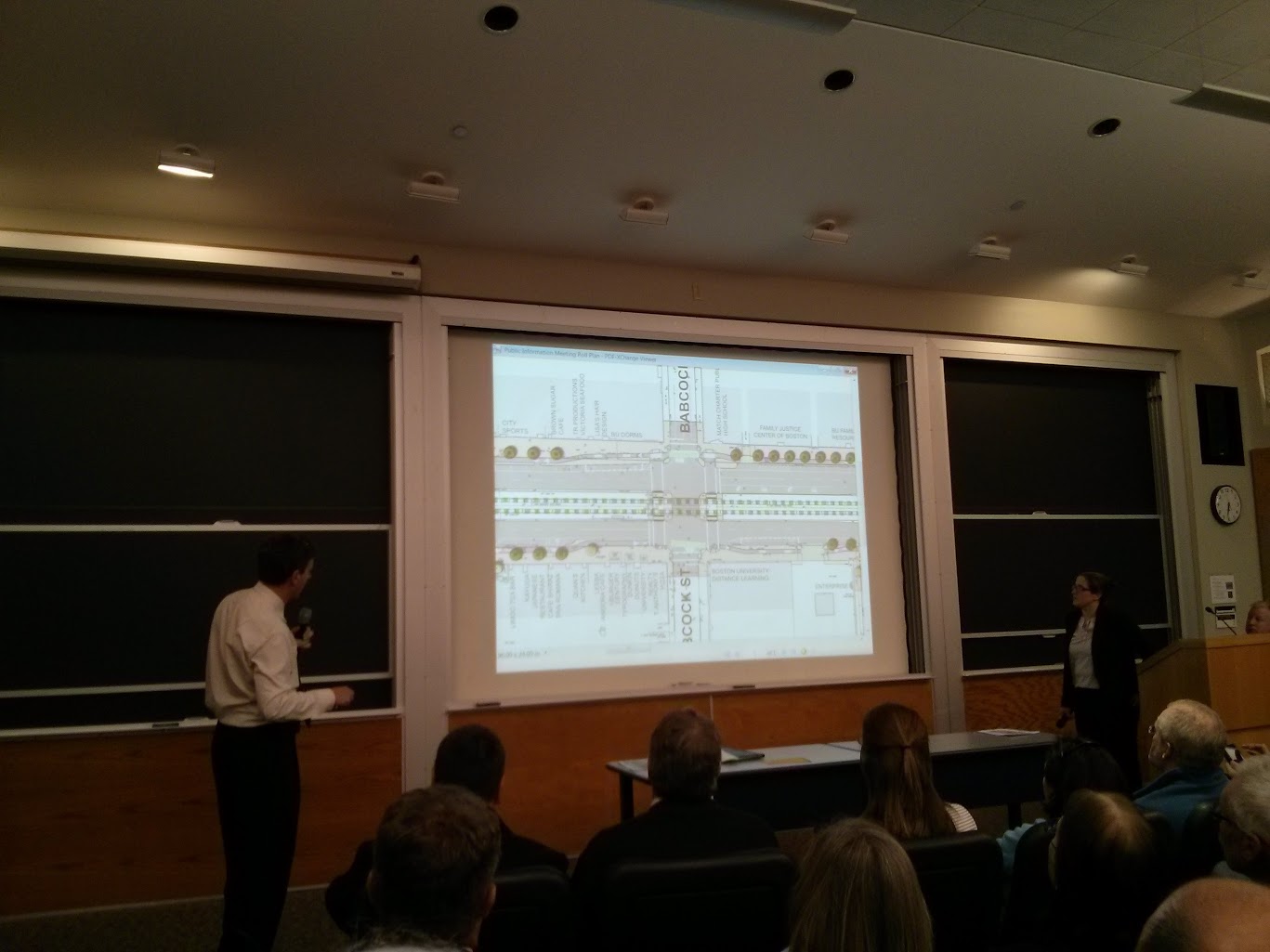
What's curious about the BU Transportation Master Plan is that its findings and philosophy is not reflected in the Comm Ave Phase 2A 25% Design that was supposedly funded by BU. It's possible that the Master Plan and the 25% Design were not coordinated -- I believe that the Master Plan was published after the 25% Design was originally proposed, in fact.

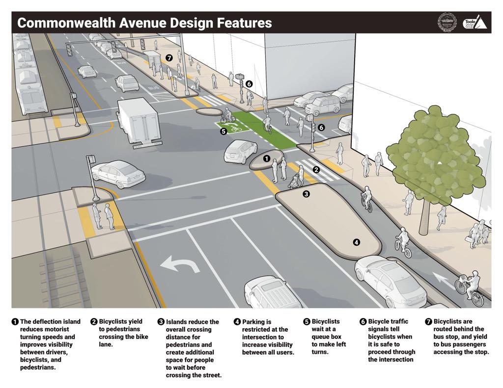
The Phase 2A 25% Design seems to reflect thinking circa-2008 or so, where the biggest perceived problem with Comm Ave was aesthetics and the solution was the creation of those street planting zones that you see between Kenmore and the BU Bridge. It fixes up some long-standing problems with the intersections (lack of dedicated left turn lanes) and adds a bunch of trees. Bike lanes were tossed in as an update. Sidewalks were narrowed to fit in the changes, but "enough" was left over, or so they thought.

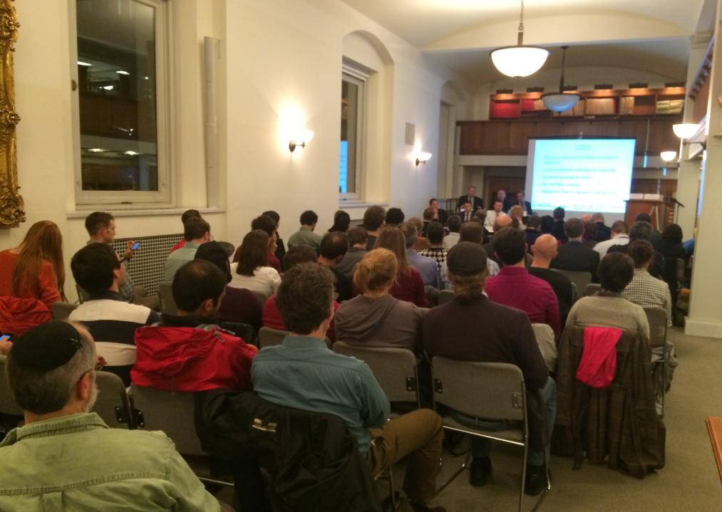
A lot of thinking has changed in the last few years, especially on the part of the city. Last year I attended the release of the Boston Complete Streets guidelines and then-Commissioner Tinlin stood up and said (paraphrasing): "5 years ago there is no way I would ever be doing anything like this, and now it seems inevitable."

So I appreciate that the BU Transportation Master Plan calls for fixing a lot of the remaining pedestrian issues along the corridor. However, Phase 2A 25% (and 75%) Design does not meet that calling, in my view, and in the view of many other people I have spoken with. And, both known Phase 2A designs fall far, far short of where bicycle facility planning should be in 2014. And neither incorporates the MBTA's long-awaited plans for station consolidation.

Regarding mid-block crossing, I know that the BU Transportation Master Plan does not really deal with it, which I believe is a failing of the plan. Most of the impetus for mid-block crossing is coming not from BU, but from the surrounding neighborhood. For example, I know that there will be a sizable contingent of local residents interested in a Naples Road crosswalk because of the presence of the supermarket.

I'm aware of the engineering issues surrounding the addition of crosswalks, but I think that they can be considered case-by-case and resolved. The Green Line is not an obstacle: that claim is rather absurd, actually, since streetcars have successfully mixed with people ever since the systems were invented in the 19th century, and continue to do so today in many places around the world. It's only relatively recently that certain people in Boston have come to fear the train, probably because they mistakenly associate it in their minds with heavy commuter rail trains that are indeed dangerous.

Furthermore, there is a de facto crossing of the Green Line at Naples Road already, and it has existed since the beginning. Hundreds of people (maybe more) use it every day -- just come and watch sometime. It's abundantly clear that there is no actual safety problem here with crossing the tracks (except for, of course, accessibility). The real danger comes from speeding motor vehicles, not from the Green Line trains. Therefore the engineering will need to focus on making the crosswalk safe by calming the street, and figuring out how to put in safe, accessible crosswalk ramps.

At the same, you keep separating out cars versus buses in all of your arguments. Either buses use the travel lanes or they don't. Which one is it?

Buses travel in a different manner than private cars, typically. The 57 bus averages about 10 mph in this stretch, stopping every couple blocks. Top speed is not so relevant: what really matters is how easy or hard it is for the bus to stop and board/alight passengers. The 57 bus received station consolidation in 2013 due to the key bus improvement project, which was a great help. Now it needs curb extensions so that stopping and starting time is minimized, and so that boarding and alighting onto a proper curb is made easiest. Furthermore, it is Complete Streets policy for every bus stop to be adjacent to a crosswalk: but some of the new bus stops have been moved away from existing crosswalks and could benefit from new, mid-block crosswalks.

The engineering of the bus stops in Phase 2A, and associated mid-block crosswalks, requires consideration of all the elements of the street together. For example, if an off-street cycle-track option is selected for the bicycle facilities, then the curb extensions for the bus stop should be planned in conjunction with the cycle-track in order to assure that the bus passengers have plenty of room to be clear of the cycle-track. This kind of design is quite common with sidewalk-level cycle-tracks in other places, but it needs coordination between different agencies in order to make it work here -- coordination that should be normal and commonplace, but sadly sometimes is not.
 
The MBTA just tweeted this pic from the meeting:
MBTA ‏@MBTA 51 seconds ago
A good turnout for tonight's public meeting on proposed improvements for the #MBTA #GreenLine 's B branch.

B0q1Ek8IIAA8do7.jpg:large
 
Apologies for the crap quality. They've promised to post the plans online, we'll see.

IMG_20150324_183151.jpg


IMG_20150324_183255.jpg


IMG_20150324_183837.jpg


IMG_20150324_184131.jpg
 
Protected bike lane & bus boarding islands!! This looks like Europe!!

From Twitter:
https://twitter.com/tooledesign/status/580506848916344833
CA5f4yHWYAE0GHH.jpg:large

Wow. This will instantly be the best biking corridor in the city. Mass Ave - the entire length from Arlington to Dorchester - should get the same treatment. Ditto Huntington Ave, Washington Street, Boylston Street (can a two-way cycle track be accommodated on a one-way street?), Dot Ave, Melnea Cass, and Warren/BHA - to name just a few!
 
Hopefully this is a sign of things to come. Protected lanes, pedestrian islands, even that little extra bit to make sure cars slow down. Amazing stuff.
 
it's too bad that parking has to be lost here since those spots (at least the ones by the dunkin, ems, other shops there) do support hose businesses and i am certainly not a rabidly antiparking person. BUT this stretch is dangerous, highway-esque and there thousands of college kids. annnnd this is overall just an awesome idea, progressive, visionary etc. if there is any area to start, it is quite definitely here. flaherty reveals himself to be just another irish south boston provincial. fuck 'em.
 
Does anyone know why the trolley reservation is 14' off center? Obviously it would be insanely expensive to shift them north, but it does make non-automotive projects harder.
 
Parking has to be lost anyway because

  • MBTA reservation must be widened for accessibility
  • Poor sight-lines must be fixed -- existing parking spots block view of pedestrians and cause danger
  • BU wants a left-turn lane onto Agganis -- that knocks a whole block of parking right out

I would say at least half, maybe more, of the parking spot loss is caused by things completely unrelated to bikes.

Also, I personally canvassed many businesses on Comm Ave, and nobody was particularly upset at all by the implication of lost parking. Some were totally thrilled by the idea of a protected bike lane.
 
Perhaps they can move the meters to East Broadway.

Or to Brighton Ave and Harvard Ave and the public lot behind Harvard Ave. The fact that parking in most of Allston Village is FREE is outrageous. That area needs to have turnover because of all the businesses. It does have 2 hour parking for much of the day, but that is very difficult to enforce.
 

Back
Top