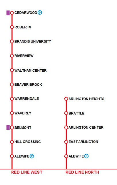
Crazy Transit Pitches

The DMU's advantage would have been to simply drop DMU stops on the Fitchburg and Lowell Lines *exactly* where the GLX stops are going. Huge cost advantage, but the problem would have been that *everyone* would be forced to change at North Station.

Are their elements of that plan that are salvageable? DMU 128-NS via Fitchburg would still be a substantial net benefit, especially if the MBTA is able to jam directional 3 tph into NS. If GLX-Porter pops up, you've got a nexus for the Arlington bus riders and northeast-originating CR DMU riders with access to their choice of flank route, red or green and transfer access to NS and SS.

Service overlap with North Station, yes, so it might have to run Porter-NS sans stops, but I'd still wager Belmonters could be persuaded with something new and sleek and Waltham could certainly use a frequency befitting the local conditions.
 
Would it be possible to reroute the red line into the silver line tunnel into the seaport and then under wetter the bypass road or D street to rejoin the current RoW? Potential stops could include courthouse, a stop on summer street, and then a relocated Broadway station.

I know that this would destroy the busses to Logan and other points but I think it could be worth it to being heavy rail transit to the seaport.

Building such a link would be a total boondoggle. It's Green or bust with the Seaport.
 
Would it be possible to reroute the red line into the silver line tunnel into the seaport and then under wetter the bypass road or D street to rejoin the current RoW? Potential stops could include courthouse, a stop on summer street, and then a relocated Broadway station.

I know that this would destroy the busses to Logan and other points but I think it could be worth it to being heavy rail transit to the seaport.

FWIW in my experience the buses to/from Logan are typically packed.

And it is often nearly impossible to board at Terminal E.
 
FWIW in my experience the buses to/from Logan are typically packed.

And it is often nearly impossible to board at Terminal E.

I don't understand why 1) buses don't have a dedicated ROW around the airport and 2) there's no way for buses to make both clock-wise and counter-clockwise loops. Imagine a bi-directional busway at Logan? I guess the problem is untangling the mass of ramps and roads that have been inserted over the years. But we probably wouldn't have to be talking about parking improvements if we could efficiently move mass numbers of people in buses.
 
I don't understand why 1) buses don't have a dedicated ROW around the airport and 2) there's no way for buses to make both clock-wise and counter-clockwise loops. Imagine a bi-directional busway at Logan? I guess the problem is untangling the mass of ramps and roads that have been inserted over the years. But we probably wouldn't have to be talking about parking improvements if we could efficiently move mass numbers of people in buses.

Insert this crazy pitch.

t7miQrd.jpg


The new outfield gates would be domestic gates and would connect to a new terminal somewhere between the current B and C terminals. The current A and E terminals would remain, as would half of C, which would share a common security checkpoint with all the new gates.

The 4/22 runways would be lost, as would the 9/27 runway, but 33L/15R would be expanded to a full length, and a third parallel runway added beyond that. New runways 6L/24R and 6R/24L would be added beyond the outfield gates and would swallow up Snake Island. I didn't fill in the land around the new runways but you get the picture.
 
Saw some people tweeting about how much it would cost to electrify the T, and was curious how much a roll out in preparation for NSRL would cost. Whereas a lot of other figures have been including things like Fitchburg and the Old Colony lines in their electrification plans, I only went for the lines that would set up an easier NSRL build with minimal portals. Working based on the 2014 blue book and the assumption that it would cost around $3 million per route mile, I came up with this spreadsheet real quick.

While we get the rest of the portals online we'll have a great electric base for only $500 million. Scrapping the South Coast shit-show and getting the NSRL in motion are critical to getting this done, otherwise there's really no need or available funding.

Not sure if I subconciously did so, but the north lines and south lines are pretty close ridership wise in this plan. Especially true with all the potential infills and Danvers Branch on the Eastern Route.
mbtaElectrify-page-001.jpg

mbtaElectrify-page-002.jpg
 
Last edited:
Insert this crazy pitch.

t7miQrd.jpg


The new outfield gates would be domestic gates and would connect to a new terminal somewhere between the current B and C terminals. The current A and E terminals would remain, as would half of C, which would share a common security checkpoint with all the new gates.

The 4/22 runways would be lost, as would the 9/27 runway, but 33L/15R would be expanded to a full length, and a third parallel runway added beyond that. New runways 6L/24R and 6R/24L would be added beyond the outfield gates and would swallow up Snake Island. I didn't fill in the land around the new runways but you get the picture.

Me likey, but I'm not sure all the extra runways are necessary.
 
Posting my Logan Relocation Pitch without ASAP's train line
CthKYT4.png
 
Me likey, but I'm not sure all the extra runways are necessary.

On second thought, maybe the two cross-runways would be unnecessary. When I drew that up yesterday, I was thinking that since this has the potential to vastly increase Logan's capacity, I would hate for the lack of runways to be its limiting factor. And then I figured, "since space is at a relative premium, why not just claim it all now?"
 
So do we need to move GLX over to this thread now?
<Sigh> I see your point, but instead I'd say that the struggle to get the GLX done sadly bumps all other schemes elsewhere about 5 years further into the future. Every pitch everywhere just got a little crazier.

The crazy/not-crazy threshold still passes through the middle of the North South Rail Link, but nobody can say on exactly which side of 2-track to 4 track or 3 portal to 4 portals the line falls. (and South Coast rail, whether crazy or not, is a real thing.)

Meanwhile I'd say BRT/Bus/Station Infill tweaks being "Reasonable", and GLX still safe in its own thread. And almost anything involving more than 1/4mile of tunnels or results in a cool map goes here. :-(
 
Somewhat off-topic question (preferably for some of our more knowledgeable aviation enthusiasts), but is it possible that advances in aviation technology could reduce the amount of space needed for runways at Logan?

It's pretty hard to predict what exactly we'll end up with on a several decades timescale.

Elon Musk has talked about the possibility of a vertical takeoff and landing electric jet if we can figure out how to get double the energy density batteries currently have; if that works out, runway requirements might become vastly smaller.

Virgin Galactic has been hinting at the long term possibility of suborbital flights between cities with an airplane carrying the rocket ship to high altitude. I haven't seen anything clearly explaining whether that configuration with two vehicles that then detach has the potential to reduce runway requirements.

And even just more evolution along the lines of the Dreamliner could bring about some small changes in runway requirements.
 
Maybe it would be something like

YL1 - Wonderland <---> Wellington
YL2 - Wellington <---> Alewife
YL3 - Alewife <---> Watertown

And maybe run alternative longer routes (i.e. Wonderland <--> Alewife) during peak and more regular ones during off hours (when headway's are longer and can accommodate such a long route)

110 already exists as the Wonderland to Wellington route, and it only takes about a half hour during rush hour in mixed traffic.

I've been thinking that extending 110 to Davis Square via Mystic Valley Parkway, Harvard St, and College Ave would make a lot of sense. Widening the shoulder on Mystic Valley Parkway enough that the shoulder could be shared between busway and breakdown lane functionality might make sense.
 
NSRL probably wouldn't work for that because it isn't outright replacing the surface terminals. It doesn't have that much capacity because its incredible steepness keeps even the most nimble of EMU's running slow single-file through each of the 2 NB, 2 SB tracks of the Link and the underground junctions. With less overall throughput and slower trip if Central Station gets built and takes any significant chunk of the schedule. The Link definitely blows the lid of capacity on every mainline because the terminal capacity is the ultimate limiter to how close you can pack the trains anywhere fanning out. So northside and southside each having a Terminal A and Terminal B option is where all the gains happen. NEC, B&A, Old Colony, Eastern Route, NH Main, Midland (Fairmount/Franklin), Fitchburg Main: all of them can have service density shooting to the moon if the start of the northside or southside terminal districts and great mash-together of all lines gives each of them 2 routes to divvy up and manage the mash-up. The only lines still limited by non-terminal track capacity are: the outside-128 branches still governed in part by their parent mainlines' track capacity (though the branch service density shoots through the moon too), the partially single-track inner Western Route, and perennial NEC odd-man-out Needham. The latter two in a NSRL universe probably (at long last) being expunged from commuter rail entirely and converted to Orange Line extensions so there's no also-rans dragging up the rear of the supersized CR system and depriving some dense inside-128 destinations of the frequent service everyone else gets to enjoy. It's most definitely not a substitute for rapid transit; if anything it majorly heightens the urgency to finish the ambitious 1945 expansion plan.


So it's not a SEPTA thing where the surface terminals are being 1:1 swapped for a thru-running tunnel. You'll have 2 final terminal approaches--each with finite capacity--to choose from. And if you want to wring the tippy-toppiest capacity out of each mainline to scale to each and every demand profile--inside-128, 128-to-495, past-495, regional intercity, and Amtrak/long-haul--you're still going to be bullseyeing the fattest targets and not throwing the kitchen sink's worth of niche services down the tunnels, through the North Station drawbridges, and through Cove interlocking. Indigo operations, most definitely...super-small xMU's or railbus thingies, no. If anything those Indigo trains are going to be swelling well beyond married-pair or married-triplet single xMU's and start running as 2- or 3-car lash-ups most hours of the day with Blue/Orange-approximate seating capacity. Slots are still too valuable to waste on a railbus.

You might not even have to limit yourself to 2 downtown terminals: Old Colony Lines might be able to get the options of existing South Station Surface Platforms, or NSRL, or Track 61, or West Station.
 
Brattle to Hobbs Ct. This is where there's likely to be the most trouble with residential abutters on both sides of the ROW. So if you have to go back under, inclining down before Brattle St. is the place to do it. Raise the roadway under the low-clearance rail bridge to its original level during the cut-and-cover job, replace the rail overpass with a new taller footbridge and run the trail over that moved back onto its current alignment.

1000 ft. of tunneling, or tricky negotiation on mitigation around abutters. Make this your first tunneling concession if you hit a blocker.

The deal to offer Brattle St area residents should be that they can either have:

Red Line in tunnel, no station in walking distance

or

Above ground station near Brattle St

Any evidence that the latter wouldn't be better for their property values?
 

Back
Top