Crazy Transit Pitches

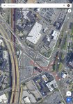
I always thought that was an operational issue. To turn the buses around, they need to go down Washington St all the way to Elm St, then come back via Boston Providence Hwy (at least that was the case when I took it). Too much dead mileage.

The bus redesign does have a 34 extension to Legacy Place.
I would take your word over mine; I never took it. Looking at weekly ridership data, it doesn't seem like there was a noticeable ridership difference.

If buses came back via Boston Providence Hwy, what stops were served inbound? (not that there are really better ways to turn buses around)
 
I would take your word over mine; I never took it. Looking at weekly ridership data, it doesn't seem like there was a noticeable ridership difference.

If buses came back via Boston Providence Hwy, what stops were served inbound? (not that there are really better ways to turn buses around)
The inbound trip starts at Washington St @ High St. Buses go via Boston Providence Hwy, High St, Washington St to pick up passengers, then back to the roundabout.
 
I've been spending too much time crayoning the SW Urban Ring lately, so instead of continuing with my efforts, I'll ask some motivating questions that someone will hopefully be able to answer or give insights.

1. How important is a continuous SW Urban Ring, as a one-seat ride from Ruggles to at least BU or Kenmore?

Most proposals of northside Urban Ring and a Harvard branch assume that passengers from the north (Chelsea, Sullivan, Grand Junction, Harvard) are primarily traveling to LMA, and maybe BU. However, points further south seem to be rarely considered, and rarely show up on proposals as a continuous stretch (possibly due to feasibility).

Setting aside feasibility concerns, my question is about demand from points east of LMA to points north of it. I imagine such travel patterns typically start at Ruggles (Regional Rail or OL South) or Nubian (buses), and want to go past LMA to destinations like: BU, West Station, Harvard, MIT & Kendall (via GJ). You may also have residents from Cambridge, Allston and Brookline trying to reach Ruggles for RR or OL.

However, I'm not sure how much demand there is, especially whether that's enough to justify the engineering difficulties for continuous service, or slower speed due to zigzagging, transfers or mode change.

2. If northside and southside Urban Ring services are split, where's the most logical split point?

This question is applicable regardless of whether southside UR is operated as LRT or BRT, though that decision may in turn affect the answer.

My thoughts:
  • Split at Kenmore: Most feasible from both sides, even if the south can be implemented as LRT (e.g. via Brookline Village, a cross-Longwood subway, or street-running). However, the location is not ideal for riders, especially those from the north who will need to transfer to LMA (though just an in-station transfer to the Highland Branch even in the worst case). Also, northside LRT need to run all the way to Park St due to lack of a Kenmore loop, unless some creative infrastructure is built there. This may also be too inefficient for cross-SW-Urban-Ring travel patterns (Ruggles to BU) highlighted in Question 1, depending on the southside route.
  • Split at BU: Even more feasible for northside LRT (don't need to run to Park if you build turnback tracks at Commonwealth subway), but connecting with southside service becomes a problem. Transfers to LMA service is also potentially much worse depending on southside UR implementation.
  • Split at LMA: Ideal location demand-wise, especially if the answer to Question 1 is "not very important". However, an OSR LRT from BU bridge to LMA is an engineering challenge. You also need a terminal somewhere that can be reached by both northside and southside services, or you risk not having them connected. If you can't place it within LMA or have an efficient cross-LMA route, it's not too different from the following option.
  • Split at Brookline Village: A more feasible version of "Split at LMA", easily allows southside to be fully LRT if applicable, and allows both sides to still have access to LMA via Longwood station on Highland and stations on Huntington. However, an OSR LRT from BU to Brookline Village is still an engineering challenge. This is also very inefficient for cross-SW-Urban-Ring travel patterns (Ruggles to BU) highlighted in Question 1, as they need to zigzag through Brookline Village and still not get an OSR. Options like the T47 or transferring via downtown may become faster.

3. How worthy is a station directly within the heart of LMA?

Having direct service to somewhere near Brookline Ave sounds amazing, but seems like that will require either BRT, which itself may not be a guarantee if you can't find enough bus lanes; or expensive tunneling, especially if you run it under Longwood Ave or Francis St, which may technically be feasible but so expensive to the point where F-Line is strongly against it. Brookline Ave is wide enough for a subway and/or bidirectional bus lanes, but it's in the wrong orientation.

I really don't like the walk from Longwood and Longwood Medical Area stations to the hospitals, but I wonder if that's what we'll have to settle on. Alternatively, I wonder if the benefits of a subway through LMA will ever be enough to justify its cost.
 
Last edited:
2. If northside and southside Urban Ring services are split, where's the most logical split point

Hopefully this is a small, helpful nudge: overlapping service. You are asking about where the two halves should meet, but are only considering points, rather than segments. For example, the northern half could have a southern terminus at Ruggles and the southern half could have a northern terminus at Lechmere.

I’m not proposing those termini, in particular, but rather overlapping service, in general.

EDITED TO ADD: You could also have overlapping service by adding a third “half.” You could have a northern half and a southern half (meeting at Kenmore for example), and then a middle half (between Lechmere and Ruggles, for example).
 
Last edited:
3. How worthy is a station directly within the heart of LMA?

Having direct service to somewhere near Brookline Ave sounds amazing, but seems like that will require either BRT, which itself may not be a guarantee if you can't find enough bus lanes; or expensive tunneling, especially if you run it under Longwood Ave or Francis St, which may technically be feasible but so expensive to the point where F-Line is strongly against it. Brookline Ave is wide enough for a subway and/or bidirectional bus lanes, but it's in the wrong orientation.

I really don't like the walk from Longwood and Longwood Medical Area stations to the hospitals, but I wonder if that's what we'll have to settle on. Alternatively, I wonder if the benefits of a subway through LMA will ever be enough to justify its cost.

Any useful D-E connector is going to involve a lot of tunneling. Longwood is about 3/4 mile, Francis about 1/2 mile. (Both assuming an E tunnel as far as Brigham Circle, which is necessary for any kind of high frequency.) Brookline Village is only about 1/4 mile... except that you either have to tunnel the extra 1/2 mile to Brigham Circle under Huntington, or portal up just to run on the surface for a while and portal down again.

So if you're building a D-E connector - and you really have to (along with the Back Bay-Bay Village subway) if you want to add any additional Green Line branches - you might as well built it on an alignment that gets a station directly in one of your biggest employment areas. If you actually want to get significant mode shift in a place like the LMA, telling people "you have to walk ten minutes to/from a surface stop, and if you going to downtown you have to gamble which will be faster" is not going to do it.

In my crayon map, that LMA station has direct service to:
  • Riverside via Newton
  • Needham via Newton
  • Ruggles
  • Harvard via BU and Beacon Park
  • Chelsea via Kendall, Sullivan, and Everett
  • Seaport via Back Bay and South Station
  • Porter via Back Bay, Downtown, Lechmere, and Union Square OR Route 16 via Back Bay, Downtown, Lechmere, and Tufts
1673035852398.png
 
I really don't like the walk from Longwood and Longwood Medical Area stations to the hospitals, but I wonder if that's what we'll have to settle on. Alternatively, I wonder if the benefits of a subway through LMA will ever be enough to justify its cost.

Is it really that bad? Google Maps says it's 0.3 mi from D and 0.4 from E to Brookline Avenue.
 
Any useful D-E connector is going to involve a lot of tunneling. Longwood is about 3/4 mile, Francis about 1/2 mile. (Both assuming an E tunnel as far as Brigham Circle, which is necessary for any kind of high frequency.) Brookline Village is only about 1/4 mile... except that you either have to tunnel the extra 1/2 mile to Brigham Circle under Huntington, or portal up just to run on the surface for a while and portal down again.

So if you're building a D-E connector - and you really have to (along with the Back Bay-Bay Village subway) if you want to add any additional Green Line branches - you might as well built it on an alignment that gets a station directly in one of your biggest employment areas. If you actually want to get significant mode shift in a place like the LMA, telling people "you have to walk ten minutes to/from a surface stop, and if you going to downtown you have to gamble which will be faster" is not going to do it.

In my crayon map, that LMA station has direct service to:
  • Riverside via Newton
  • Needham via Newton
  • Ruggles
  • Harvard via BU and Beacon Park
  • Chelsea via Kendall, Sullivan, and Everett
  • Seaport via Back Bay and South Station
  • Porter via Back Bay, Downtown, Lechmere, and Union Square OR Route 16 via Back Bay, Downtown, Lechmere, and Tufts
View attachment 32721
This is very cool. I think most of the conventional Urban Ring and/or GL reconfiguration proposals assume a D-E connector via Brookline VIllage and Huntington, and maybe have a separate Urban Ring tunnel or dedicated surface lanes through LMA.

Combining UR-thru-LMA and D-E connector is an idea I haven't seen before, and it massively improves the utility and potential of the subway. If we ignore engineering difficulties, looks like that's the way to go - shorter tunneling than Brookline Village connector, while providing much much greater benefit.
  • (Before this, I was actually concerned the D-E connector may not place high on a priority list in practice, especially when it requires a subway. "Increasing capacity on the Green Line" doesn't sound too exciting, even though we on this forum know it's absolutely needed.)
I'm a bit worried about engineering and cost, though. While a Brookline Village subway should be easy to build, a Longwood Ave or Francis St subway will likely have substantial costs due to building mitigation (and flood mitigation at the western end). That's why F-Line seems to be totally against it in 2015:
The boondoggles. . .
-- Plowing across Brookline or BU. Any way it's a >$4B megaproject with disastrous impacts to tall buildings, incredibly difficult EIS'ing in the Muddy River floodplain, and the same exact monied interests that stopped I-695 dead.

-- Going down any 2-lane streets with close-abutting tall buildings. Longwood Ave., Francis St...impossible. Blandford Mall...doubleplus impossible.

No...just, no. A billion dollars per 900 ft. of tunneling is a project concept that's self-immolating. If these are the hangups between doing it at all and not doing it at all...then just don't do it at all.
Riverside mapped out the widths of Longwood Ave and Francis St a few weeks ago. Note that the westernmost portion of Francis St (not labeled) looks even narrower and likely infeasible. I guess you can do stacked tracks and platforms on Longwood Ave if needed, but it will still be expensive, though hopefully less so than Essex St for SL Phase III.

However, I'm now cautiously optimistic that such a tunnel will bring enough benefits to be worth the cost, especially with all the connections you listed. Like I said somewhere recently... If we only have the means to build one expensive subway, this will be it.

Is it really that bad? Google Maps says it's 0.3 mi from D and 0.4 from E to Brookline Avenue.
I think The EGE's reply answered your question:
If you actually want to get significant mode shift in a place like the LMA, telling people "you have to walk ten minutes to/from a surface stop, and if you going to downtown you have to gamble which will be faster" is not going to do it.
 
Hopefully this is a small, helpful nudge: overlapping service. You are asking about where the two halves should meet, but are only considering points, rather than segments. For example, the northern half could have a southern terminus at Ruggles and the southern half could have a northern terminus at Lechmere.

I’m not proposing those termini, in particular, but rather overlapping service, in general.

EDITED TO ADD: You could also have overlapping service by adding a third “half.” You could have a northern half and a southern half (meeting at Kenmore for example), and then a middle half (between Lechmere and Ruggles, for example).
I guess there are two different viewpoints that I didn't make clear with my initial question: Operations and engineering.

My question was more intended to be from an engineering perspective. We know that
  • Northside beyond BU is almost certainly LRT (though with some overlapping with BRT/SL3 from Chelsea to Airport)
  • Southside beyond Ruggles likely prefers BRT more, but street-running LRT with dedicated ROW is also possible. If you really want (and have lots of money), you can build a subway and share it with the GL Nubian branch, as The EGE, Riverside and I discussed before.
  • LRT feasibilities from the north:
    • To BU or Kenmore: Easy
    • To "LMA boundary" or Brookline Village: Requires some BU-bridge-to-D connection, either surface or subway
    • To Huntington, OL and beyond: Requires either cross-LMA route (surface or subway), or zigzagging via Brookline Village
  • BRT feasibilities from the south (starting from Ruggles or Roxbury Crossing):
    • To "LMA boundary" or Huntington: Easy (assuming bus lanes)
    • To Brookline Village: Easy
    • To Kenmore or Longwood station: Requires bus lanes through LMA. Brookline Ave is doable, Longwood Ave and/or Francis St require some more thinking.
    • To BU: In addition to above, also requires some ROW to BU (but easier than LRT), plus a terminal there
    • To Grand Junction and beyond: Likely impractical
  • LRT feasibilities from the south:
    • To "LMA boundary" or Huntington: Easy
    • To Brookline Village: Easy
    • To Kenmore or Longwood station: Requires either cross-LMA route (surface or subway), or zigzagging via Brookline Village
    • To BU and beyond: In addition to above, also requires some BU-bridge-to-D connection
  • If you opt for the most expensive option of a cross-LMA subway, might as well make the southside also LRT, even if street-running to Seaport
  • The only ways to make a continuous ROW are either cross-LMA LRT route, or zigzagging via Brookline Village
So the original question becomes picking a split point (and the southside mode) that maximizes the benefits minus costs. I'm now favoring a cross-LMA subway more than when I posted the question, but other alternatives are still worth considering.

Without a continuous ROW, the only reasonable "overlapping service" from an engineering perspective is something like: Northside to Brookline Village, and southside BRT to LMA or Kenmore (mayyybe BU if demand is strong). Which itself isn't a bad proposal, I suppose, and may end up being the most cost-effective.

---------------------------------------

From an operational perspective: Any services that overlap more than the one I mentioned in the paragraph above will likely require a continuous ROW. But even assuming there is one, it is probably still worth considering running LRT services in segments, and not a single Airport-Seaport train, due to reliability concerns.

I'll keep this part short, but here are some patterns you may run:
  • Chelsea - LMA, Seaport - Kendall
  • Chelsea - Ruggles, Seaport - Kenmore or BU
  • Chelsea - LMA, Seaport - LMA or Kenmore, Nubian - Kendall or Sullivan
Note that you can't really turn trains around at Lechmere, though Sullivan may be doable depending on GL design there.
 
I think The EGE's reply answered your question

That's a fair point. The LMA does a lot to encourage employees to take public transit, offering shuttles and the like. That might be more because the parking garages are a big money maker for them though.
 
If you actually want to get significant mode shift in a place like the LMA, telling people "you have to walk ten minutes to/from a surface stop, and if you going to downtown you have to gamble which will be faster" is not going to do it.
This was thought-provoking for me. I'm not sure I would've put mode shift as my top priority when thinking about transit for Longwood -- I've seen reliability and travel time improvements (and, partially as a byproduct of those, capacity improvements) as the primary drivers.

This got me wondering -- what is the mode split for commuters to Longwood? In searching for that, I came across a recent whitepaper from the Longwood Collective: A Case Study in Robust Transportation Demand Management (TDM) Confronting Access Limitations at the Nation’s Pre-Eminent Medical, Academic, and Cultural Center: Mode Shift in Boston's Longwood Medical and Academic Area: Where Are We Now And What Comes Next? Lots of interesting information in here, including things like the effectiveness of different incentive programs to encourage mode shift, as well as, yes indeed, a breakdown of commute mode:

1673102412699.png


(The report doesn't emphasize the downsides of the 5-10 minute walks for commuters, though they may have been avoiding the topic because, unlike the other problems they draw attention to, there are limited short-term fixes for the walks.)

The report laments that the Public Transit share seems to cap out at about 50%. I share their lament, but I think it's worth putting that number in context. According to Go Boston 2030's Boston Today document, this is in fact a better transit share than overall among Boston residents' commutes (page 3):

1673102882804.png


And according to the MPO's Destination 2040 report, Longwood's is in fact a better transit share even than journeys to Downtown + the Seaport ("the Boston Business District"):

1673103049941.png


(The report grants that the auto share is likely increased overall due to the reduced transit access to Seaport compared to Downtown. If anyone knows about mode split data specifically for Downtown, I'd love to see it.)

According to OnTheMap, 23.5% of Longwood commuters originate in counties other than Suffolk, Middlesex, or Norfolk. Even if we exclude Worcester, Bristol, and Providence counties (given reasonable commuter rail access, and assuming most of those Bristol commuters are coming from the Attleboro area), that's still 17.4%, potentially accounting for as much as half of those auto commuters:

1673103430624.png


My points:

1) Auto mode share remains significant everywhere
2) Some evidence points to Longwood being further along in mode shift than the region overall
3) The numbers suggest that Longwood's auto share comes in large part from suburban/exurban commuters, including a significant share from the North Side where commuter rail fares weaker against driving than it does on the South Side

~~~

So, while I want to be clear that I absolutely love the idea of a subway through Longwood, I'm not convinced that the 5-10 minute walk is what is holding back the mode shift. If we want to tackle that 30% of "Drive Alone" commuters, I'd look at
  • Faster, more frequent, more long-running regional rail
  • Faster and more reliable connections to Longwood from:
    • North Station
    • South Station
    • Ruggles
    • Lansdowne
  • Which could take the form of
    • GLT and OLT to improve reliability and frequencies
    • Huntington subway to improve travel times
    • Back Bay-Seaport subway to provide two-seat journeys Old Colony Regional Rail <> Longwood
    • Dedicated bus lanes from Ruggles and from Lansdowne
    • Subway between LMA and Ruggles
    • North South Rail Link with through-running from Northside Lines through Ruggles and Lansdowne
I really want D-to-E-via-Longwood to be a slam dunk -- high-cost-high-reward. But for the moment, it seems like we can get a huge swath of the benefit for much more modest expense. (I'm working on a loose cost estimates post for the Green Line Reconfiguration thread, and I think there are stronger and more transformative uses for $4 billion -- not that I'm taking F-Line's off-the-cuff estimate as gospel, just that in general there are a number of other projects this would compete with.)

~~~

Finally, I'll just toss these out there for comparison.

First, a walkshed map (of 5 min and 10 min walks) from the current LMA and Brigham Circle stops and an infill at "Riverway Village" that provides better access than the current Longwood stop, with the OnTheCensus employment center locations superimposed -- a large swath is covered by the 5-min walksheds, and 10-min walksheds cover it entirely:

1673107999100.png


(It's very janky -- superimposing screenshots in Paint.NET.)

And second, a 5-min walkshed map of the Financial District; there is a gap between Broad St and Otis St, but while a Post Office Sq subway stop would be cool, we never see it as a pressing need:

1673107865149.png
 
The report laments that the Public Transit share seems to cap out at about 50%. I share their lament, but I think it's worth putting that number in context. According to Go Boston 2030's Boston Today document, this is in fact a better transit share than overall among Boston residents' commutes (page 3):

View attachment 32734
In addition to the downtown mode share data, I wonder if the 34.0% average is also dragged down by jobs outside the urban core, such as Waltham, Burlington, etc. Of course, I don't have any data to support the hypothesis or see how much of a contribution these jobs have.

And according to the MPO's Destination 2040 report, Longwood's is in fact a better transit share even than journeys to Downtown + the Seaport ("the Boston Business District"):

View attachment 32735

(The report grants that the auto share is likely increased overall due to the reduced transit access to Seaport compared to Downtown. If anyone knows about mode split data specifically for Downtown, I'd love to see it.)
Ironically, I think the fact that much of the Financial District doesn't have any rapid transit station within 10 minutes (as you pointed out below) may have contributed to that. If that's indeed the reason, it would point to even greater importance of bringing stations closer to jobs.

(I'm working on a loose cost estimates post for the Green Line Reconfiguration thread
Great, another post to look forward to :)

And second, a 5-min walkshed map of the Financial District; there is a gap between Broad St and Otis St, but while a Post Office Sq subway stop would be cool, we never see it as a pressing need:

View attachment 32739
I think that's more because of feasibility than demand though. Unlike LMA which still has potential for more rapid transit service, much of downtown is pretty much set in stone. An NSRL station directly within the Financial District is probably unrealistic (though some clever ways to placing South Station Under exits will help with the walkshed significantly, and so does an intermediate State-Aquarium station). Other than NSRL, practically there's no hope of another rapid transit line or amendment of an existing line to serve this area, as it's even harder to tunnel under these streets than in LMA.

Also, the downtown transitway for the T7 and others will significantly improve access to this area. Thanks to your reminder, now I actually believe such service may see more demand originating from these jobs itself than we imagined, perhaps used as a last-mile shuttle from subway stations, in addition to NS-SS and Seaport demands.

--------------------

Question for all: When the original Urban Ring proposals were studied (which IIRC had a cross-Brookline tunnel and a cross-LMA tunnel), were there detailed stats of ridership projections and breakdowns?
 
Is it really that bad? Google Maps says it's 0.3 mi from D and 0.4 from E to Brookline Avenue.
It's not that bad if you are somebody who has already bought in to transit. But if we want to convert new riders, who might not have the best access to their starting point, convenience to end point is a big deal.
 
It's not that bad if you are somebody who has already bought in to transit. But if we want to convert new riders, who might not have the best access to their starting point, convenience to end point is a big deal.

It’s not bad but for older folks or people with more limited mobility/disabilities getting to and from the D is uphill both ways the long way, and involves a set of stairs the short way. Said short way is unlit and pitch black after dark. It also involves crossing Brookline and Riverway and waiting for fairly lengthy light cycles. Going to the E is pretty easy and you can take a bus where convenient.
 
Converting Sullivan Square underpass to BRT-ROW
Something I have thought of, I’m not sure if it has already been discussed. I think this is borderline reasonable with the current SL extension and Sullivan Sq. Redesign plans. Why not use the Sullivan Square underpass as a BRT ROW? It could be extended to the turnaround loop with cut+cover while the Sullivan Square parcels begin construction. The station stub could either stay fully underground or ramp up to the current busway.
 

Attachments

  • A0CF627B-6418-4078-8440-C51E8E8E9925.jpeg
    A0CF627B-6418-4078-8440-C51E8E8E9925.jpeg
    4.9 MB · Views: 111
Converting Sullivan Square underpass to BRT-ROW
Something I have thought of, I’m not sure if it has already been discussed. I think this is borderline reasonable with the current SL extension and Sullivan Sq. Redesign plans. Why not use the Sullivan Square underpass as a BRT ROW? It could be extended to the turnaround loop with cut+cover while the Sullivan Square parcels begin construction. The station stub could either stay fully underground or ramp up to the current busway.
If this were to be done, only two lanes of the 4 lane underpass would be needed. Using only two lanes would free up space for ped/bike trails alongside Rutherford Ave where the 4 lane underpass currently surfaces.
 
There's really a case to be made to develop an underground bus way in Sullivan Sq, similar to Harvard Sq, to allow for more efficient operations between the Alford St bridge, the bus garage, Sullivan Sq station, and different connecting service corridors (via Cambridge St / Washington St to Union Sq, Maffa Way / Broadway to Winter Hill, Main St or Rutherford Ave to the rest of Charlestown, etc.).
 
In addition to the downtown mode share data, I wonder if the 34.0% average is also dragged down by jobs outside the urban core, such as Waltham, Burlington, etc. Of course, I don't have any data to support the hypothesis or see how much of a contribution these jobs have.


Ironically, I think the fact that much of the Financial District doesn't have any rapid transit station within 10 minutes (as you pointed out below) may have contributed to that. If that's indeed the reason, it would point to even greater importance of bringing stations closer to jobs.


Great, another post to look forward to :)


I think that's more because of feasibility than demand though. Unlike LMA which still has potential for more rapid transit service, much of downtown is pretty much set in stone. An NSRL station directly within the Financial District is probably unrealistic (though some clever ways to placing South Station Under exits will help with the walkshed significantly, and so does an intermediate State-Aquarium station). Other than NSRL, practically there's no hope of another rapid transit line or amendment of an existing line to serve this area, as it's even harder to tunnel under these streets than in LMA.

Also, the downtown transitway for the T7 and others will significantly improve access to this area. Thanks to your reminder, now I actually believe such service may see more demand originating from these jobs itself than we imagined, perhaps used as a last-mile shuttle from subway stations, in addition to NS-SS and Seaport demands.

--------------------

Question for all: When the original Urban Ring proposals were studied (which IIRC had a cross-Brookline tunnel and a cross-LMA tunnel), were there detailed stats of ridership projections and breakdowns?
Wasn’t the green line provisioned for a Post Office Sq routing?
 
Wasn’t the green line provisioned for a Post Office Sq routing?
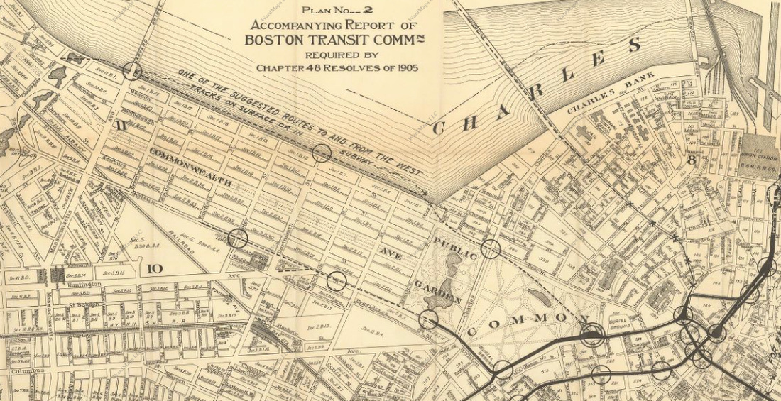
There was a 1913 proposal to extend the subway from Boylston Station under Boylston and Kingston streets to Post Office Square. Seems this would run into the same issues of the often discussed Silver Line connection via Boylston and Essex, narrow right-of-way, lots of underground hazards and old foundations that are very close to the tunnel.
1673876118976.png

 
So you've finally built your light rail line on Track 61 and you make it to the Seaport (and boy are you tired from laying down all those railroad ties and stringing up all those wires) -- it looks like the end is in sight, and then you round the bend at Summer St to find...

1674424719251.png


...a four-lane surface road, at-grade on-ramps and off-ramps, underground on-ramps and off-ramps, a parking garage, and an elevated street blocking your way from reaching the subway station at World Trade Center. Woe is you -- how will you ever finish this thing?

Answer: by going up and stealing some street from delivery trucks, and by knocking down the existing wall of the station to sneak a BRT platform under a parking garage.

Full details (at excruciating length and with a sadly less jocular tone) in my latest blog post, but I'll share the pretty diagrams here:

1674424958136.png


Overall diagram ^

Below, a crazy station design meant to maintain partial vehicle access to WTC Ave:

1674425017362.png


And a mildly saner alternative that just uses a GLX-style center platform:

1674425041547.png


~~~

Sometimes I spend waaaaaay too long thinking about a problem that does not exist, will likely never exist, and yet which holds my attention until I manage to exhaust myself into the delusion that I've "really thought it all the way through." This was actually a major impetus behind starting my blog -- even when I didn't post them here at ArchBoston, I was basically writing these essays/analyses anyway for fun, so I figured I might as well post them somewhere.

This is a classic example. Even here, none of us (I think) are major devotees of using Track 61 for Urban Ring LRT. I'd throw it on my crayon maps and leave the connection near World Trade Center vague and call it a day. But it kept nagging at me. The current Silver Line station and a surface stop on Summer St are so close and yet not quiiiiiite there.

So when I recently had the chance to spend some time in this exact corner of the Seaport, there was no hope: I was going to be chewing on this problem until I thought I had an answer. Now, as it turned out, this process did actually yield some interesting insights (below), but, to be clear, that's an unintentional benefit -- I was doing this because it was fun.

Interesting insights:
  • Track 61 is actually not very good for reaching the Seaport by rail, like, at all. Unless you are willing to go to extraordinary expense to dig under the Pike, or thread something through on some sort of elevated track, you end up being blocked by the "highway canyon", away from the core of the Seaport
  • The Seaport has strong east-west corridors on Summer St and the Piers Transitway and is narrow enough as a neighborhood that it's hard to find a logical north-south "crosstown" corridor
  • LRT vs BRT has a significant impact here: unless you are willing to go to extraordinary expense to build LRT under the Harbor to Logan, LRT to the Seaport would need to be justified on its own merits and would not be able to build as full of a ridership coalition as BRT. (To me, this makes it hard to justify running an LRT route on the Track 61 ROW, which is justifiable in a full[er] Ring service because of its speedier access to Logan and Chelsea, but otherwise avoids a lot of nearby destinations.)
  • If Downtown <> Logan BRT service were rerouted to Summer St (e.g. if Transitway is maxed out on LRT), you can use the existing Congress St surface stop for westbound service (as done today), and it looks like you actually could open up a wall on the southern side of the World Trade Center station to add an eastbound platform that would require almost no diversion from the speediest Summer St -> Logan route; this would enable easy transfers from Seaport LRT service to Logan BRT service
    • This seems worth considering even without an LRT Urban Ring
 
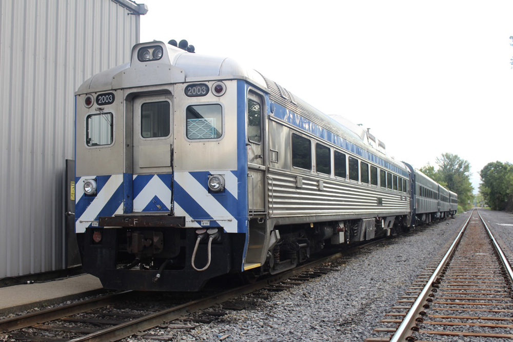
So apparently way up there in Maine they're going to launch a new train, from Brunswick to Rockland using a RDC set from the 1950s - for just $3m and no studies.

Most passenger rail startups consume cash by beginning with a ridership study, but that isn’t happening here. As Midcoast Rail's Smith puts it, “We can just run the damn service and see if it works!”

Evidently there's 14 of these RDCs sitting up in Vermont, so if you apply the quoted philosophy, where in the greater Boston area would you run these just because there's track in reasonable condition? (Ignoring the niceties of trackage rights, assuming you could sweet talk the freight RRs to operate them under contract, station siting, using mobile lifts for accessibility... etc, etc, etc - which is why I chose crazy vs reasonable pitches)

Personally, I'd take Providence-Worcester, nh Capitol corridor, and Pittsfield-Springfield- I'd say the Northern Tier, but I honestly doubt that PAS maintained track would be anything approaching brisk. Maybe a seasonal leaf peepers train?
 
Last edited:

Back
Top