Teban54
Senior Member
- Joined
- Nov 13, 2021
- Messages
- 1,142
- Reaction score
- 2,856
I've been spending too much time crayoning the SW Urban Ring lately, so instead of continuing with my efforts, I'll ask some motivating questions that someone will hopefully be able to answer or give insights.
1. How important is a continuous SW Urban Ring, as a one-seat ride from Ruggles to at least BU or Kenmore?
Most proposals of northside Urban Ring and a Harvard branch assume that passengers from the north (Chelsea, Sullivan, Grand Junction, Harvard) are primarily traveling to LMA, and maybe BU. However, points further south seem to be rarely considered, and rarely show up on proposals as a continuous stretch (possibly due to feasibility).
Setting aside feasibility concerns, my question is about demand from points east of LMA to points north of it. I imagine such travel patterns typically start at Ruggles (Regional Rail or OL South) or Nubian (buses), and want to go past LMA to destinations like: BU, West Station, Harvard, MIT & Kendall (via GJ). You may also have residents from Cambridge, Allston and Brookline trying to reach Ruggles for RR or OL.
However, I'm not sure how much demand there is, especially whether that's enough to justify the engineering difficulties for continuous service, or slower speed due to zigzagging, transfers or mode change.
2. If northside and southside Urban Ring services are split, where's the most logical split point?
This question is applicable regardless of whether southside UR is operated as LRT or BRT, though that decision may in turn affect the answer.
My thoughts:
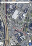
3. How worthy is a station directly within the heart of LMA?
Having direct service to somewhere near Brookline Ave sounds amazing, but seems like that will require either BRT, which itself may not be a guarantee if you can't find enough bus lanes; or expensive tunneling, especially if you run it under Longwood Ave or Francis St, which may technically be feasible but so expensive to the point where F-Line is strongly against it. Brookline Ave is wide enough for a subway and/or bidirectional bus lanes, but it's in the wrong orientation.
I really don't like the walk from Longwood and Longwood Medical Area stations to the hospitals, but I wonder if that's what we'll have to settle on. Alternatively, I wonder if the benefits of a subway through LMA will ever be enough to justify its cost.
1. How important is a continuous SW Urban Ring, as a one-seat ride from Ruggles to at least BU or Kenmore?
Most proposals of northside Urban Ring and a Harvard branch assume that passengers from the north (Chelsea, Sullivan, Grand Junction, Harvard) are primarily traveling to LMA, and maybe BU. However, points further south seem to be rarely considered, and rarely show up on proposals as a continuous stretch (possibly due to feasibility).
Setting aside feasibility concerns, my question is about demand from points east of LMA to points north of it. I imagine such travel patterns typically start at Ruggles (Regional Rail or OL South) or Nubian (buses), and want to go past LMA to destinations like: BU, West Station, Harvard, MIT & Kendall (via GJ). You may also have residents from Cambridge, Allston and Brookline trying to reach Ruggles for RR or OL.
However, I'm not sure how much demand there is, especially whether that's enough to justify the engineering difficulties for continuous service, or slower speed due to zigzagging, transfers or mode change.
2. If northside and southside Urban Ring services are split, where's the most logical split point?
This question is applicable regardless of whether southside UR is operated as LRT or BRT, though that decision may in turn affect the answer.
My thoughts:
- Split at Kenmore: Most feasible from both sides, even if the south can be implemented as LRT (e.g. via Brookline Village, a cross-Longwood subway, or street-running). However, the location is not ideal for riders, especially those from the north who will need to transfer to LMA (though just an in-station transfer to the Highland Branch even in the worst case). Also, northside LRT need to run all the way to Park St due to lack of a Kenmore loop, unless some creative infrastructure is built there. This may also be too inefficient for cross-SW-Urban-Ring travel patterns (Ruggles to BU) highlighted in Question 1, depending on the southside route.
- Split at BU: Even more feasible for northside LRT (don't need to run to Park if you build turnback tracks at Commonwealth subway), but connecting with southside service becomes a problem. Transfers to LMA service is also potentially much worse depending on southside UR implementation.
- Split at LMA: Ideal location demand-wise, especially if the answer to Question 1 is "not very important". However, an OSR LRT from BU bridge to LMA is an engineering challenge. You also need a terminal somewhere that can be reached by both northside and southside services, or you risk not having them connected. If you can't place it within LMA or have an efficient cross-LMA route, it's not too different from the following option.
- Split at Brookline Village: A more feasible version of "Split at LMA", easily allows southside to be fully LRT if applicable, and allows both sides to still have access to LMA via Longwood station on Highland and stations on Huntington. However, an OSR LRT from BU to Brookline Village is still an engineering challenge. This is also very inefficient for cross-SW-Urban-Ring travel patterns (Ruggles to BU) highlighted in Question 1, as they need to zigzag through Brookline Village and still not get an OSR. Options like the T47 or transferring via downtown may become faster.
3. How worthy is a station directly within the heart of LMA?
Having direct service to somewhere near Brookline Ave sounds amazing, but seems like that will require either BRT, which itself may not be a guarantee if you can't find enough bus lanes; or expensive tunneling, especially if you run it under Longwood Ave or Francis St, which may technically be feasible but so expensive to the point where F-Line is strongly against it. Brookline Ave is wide enough for a subway and/or bidirectional bus lanes, but it's in the wrong orientation.
I really don't like the walk from Longwood and Longwood Medical Area stations to the hospitals, but I wonder if that's what we'll have to settle on. Alternatively, I wonder if the benefits of a subway through LMA will ever be enough to justify its cost.
Last edited:
")