- Joined
- Jan 22, 2012
- Messages
- 5,078
- Reaction score
- 1,662
Still pushing to rip the power plant out by the roots for Olympic Park, I see? ")
Still pushing to rip the power plant out by the roots for Olympic Park, I see?
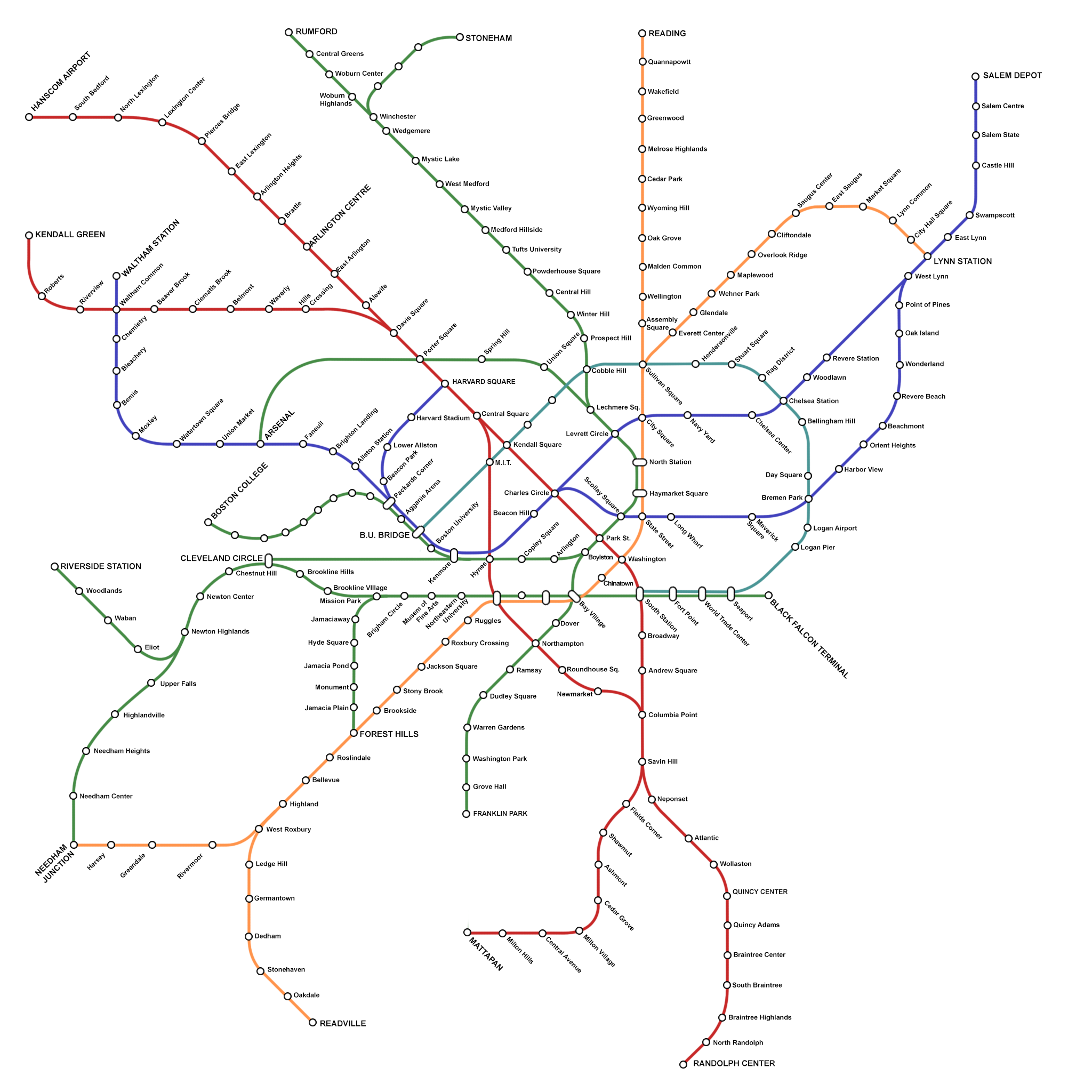
I would love to see the blue line resemble something like this, at least to Kenmore, it definitely needs to be longer. Also like the F-line, reactivating the A and the E to arborway and just in general the whole thing. I want the T to look like this yesterday. Throw in some kind of urban ring and Boston would be in good shape.

For the generations of tomorrow.

1. Perhaps it would be best to draw combined lines like 1/2/3 and 6/7 as distinct lines since the routes separate and join at different points? Right now you can't tell whether the 1/2/3 takes the downtown route or Mass Ave subway, or which of the 6/7 goes through Chelsea or East Boston.
*sigh* the dangers of copy/pasting.2. There's a typo in all of the stations on the E line with Jamaica in the name.
I'd argue that the Charles River is really important for your map Dave (and every map of Boston really). I understand that you might not have considered it yet as you are working out the diagrammatic representation, but now is the time to start planning it in before you get too comfortable with the way you have laid things out. The current map right now as drawn is very confusing, even as a diagram since there are no geographical landmarks/landforms for orientation.

What's the routing on the 6 between Brighton and Watertown? That seems to me to be one of the more speculative leaps here...
I second the idea of highlighting parks, and I'd also argue for highlighting beaches as well.
I don't think he's following an abandoned ROW there across the Charles... maybe there was a crossing I don't know about? Dave?